ArxivLens
R
Researcher

Rongkun Zhu

5 papers on arXiv

5 arXiv Papers
1 Total Publications
Profile

Academic Profile

Name Rongkun Zhu
Total Papers 1
Scholar Profile View on Semantic Scholar
Metrics

Statistics

5 arXiv Papers
1 Total Publications
Publications

Papers on arXiv

Thumbnail for Real-Time Localization and Bimodal Point Pattern Analysis of Palms Using
  UAV Imagery
arXiv
Real-Time Localization and Bimodal Point Pattern Analysis of Palms Using UAV Imagery

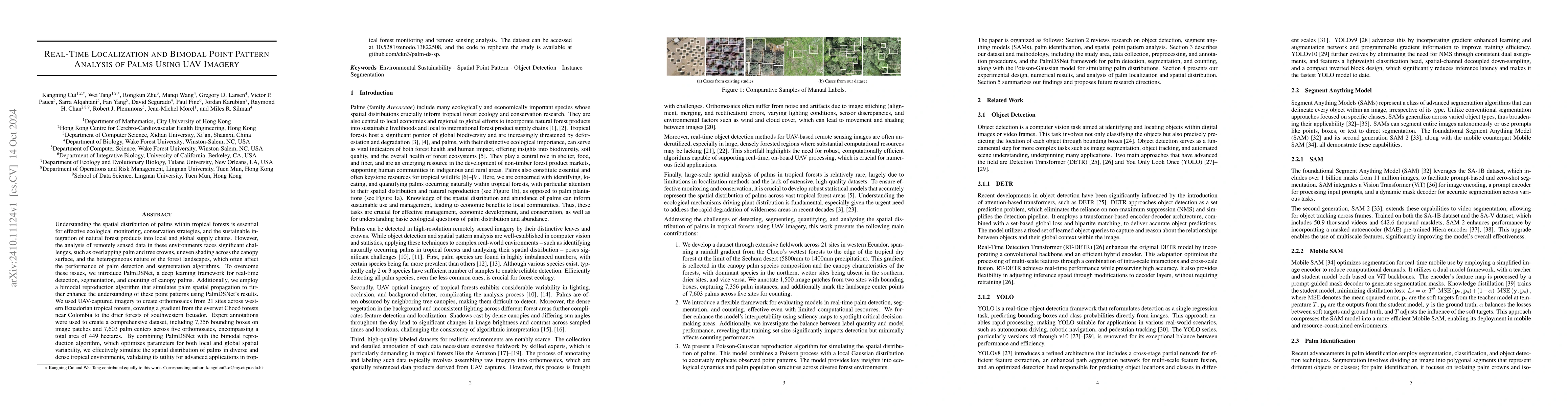
Understanding the spatial distribution of palms within tropical forests is essential for effective ecological monitoring, conservation strategies, and the sustainable integration of natural forest pro...

Thumbnail for Detection and Geographic Localization of Natural Objects in the Wild: A
  Case Study on Palms
arXiv
Detection and Geographic Localization of Natural Objects in the Wild: A Case Study on Palms

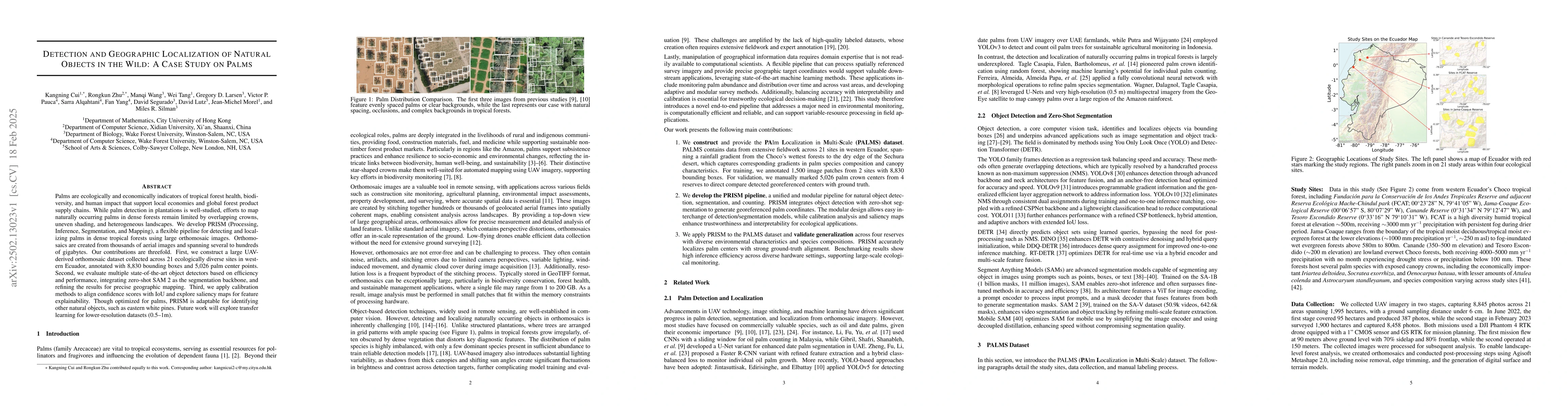
Palms are ecologically and economically indicators of tropical forest health, biodiversity, and human impact that support local economies and global forest product supply chains. While palm detection ...

Thumbnail for U2-BENCH: Benchmarking Large Vision-Language Models on Ultrasound
  Understanding
arXiv
U2-BENCH: Benchmarking Large Vision-Language Models on Ultrasound Understanding

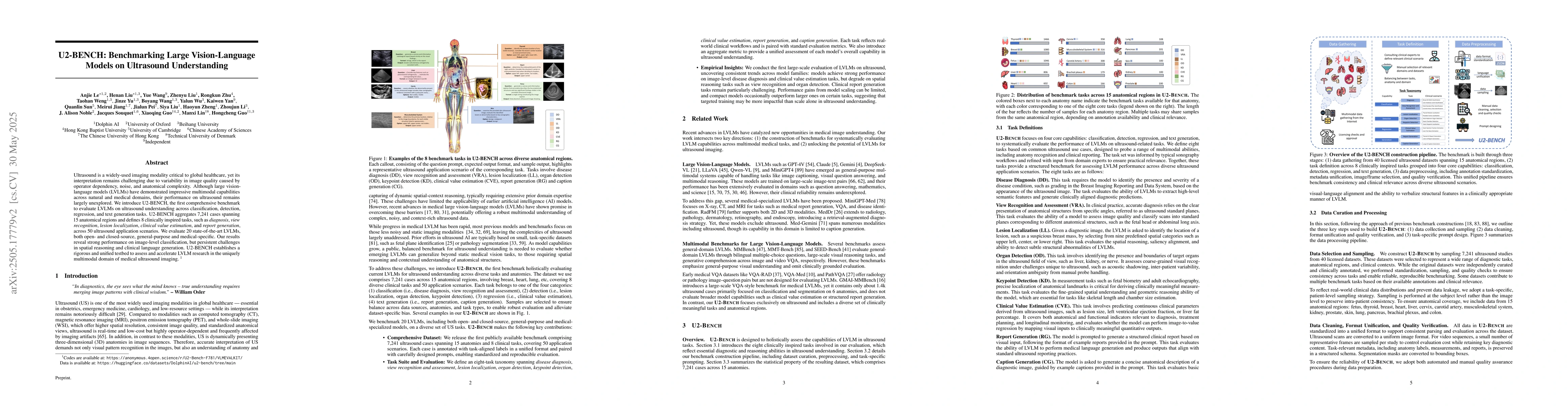
Ultrasound is a widely-used imaging modality critical to global healthcare, yet its interpretation remains challenging due to its varying image quality on operators, noises, and anatomical structures....

Thumbnail for From Orthomosaics to Raw UAV Imagery: Enhancing Palm Detection and
  Crown-Center Localization
arXiv
From Orthomosaics to Raw UAV Imagery: Enhancing Palm Detection and Crown-Center Localization

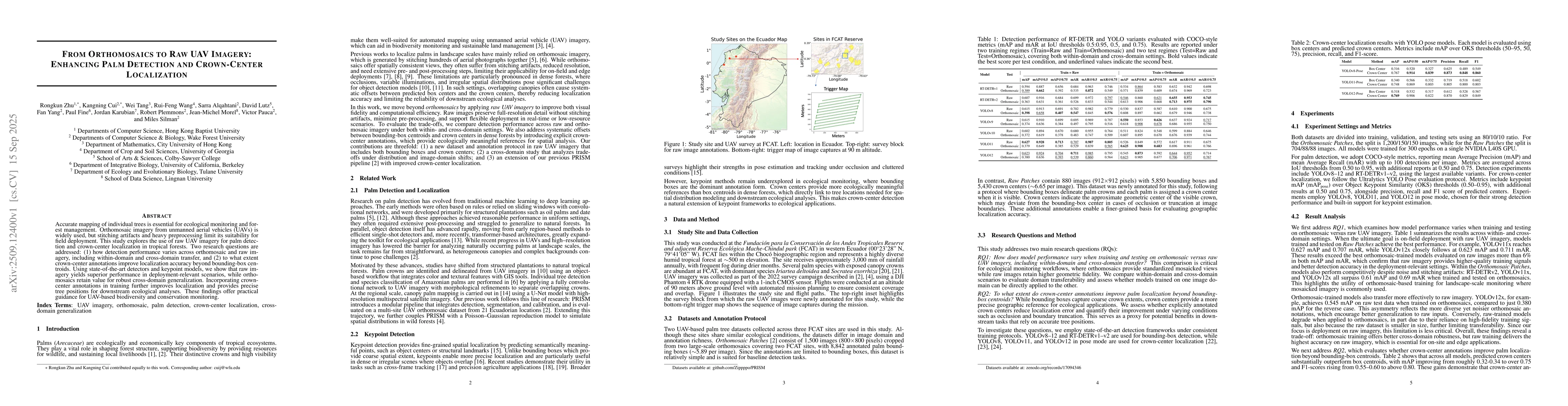
Accurate mapping of individual trees is essential for ecological monitoring and forest management. Orthomosaic imagery from unmanned aerial vehicles (UAVs) is widely used, but stitching artifacts and ...

Thumbnail for AwakeForest: An Interactive Geospatial Platform for Large-Scale Forest Imagery
arXiv
AwakeForest: An Interactive Geospatial Platform for Large-Scale Forest Imagery

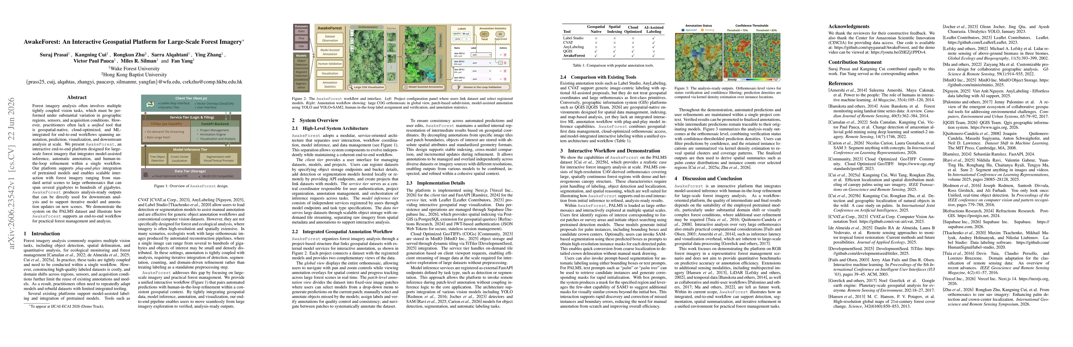
Forest imagery analysis often involves multiple tightly coupled vision tasks, which must be performed under substantial variation in geographic regions, sensors, and acquisition conditions. However, p...

This website uses cookies to ensure you get the best experience. Learn more