Academic Profile
Statistics
Similar Authors
Papers on arXiv
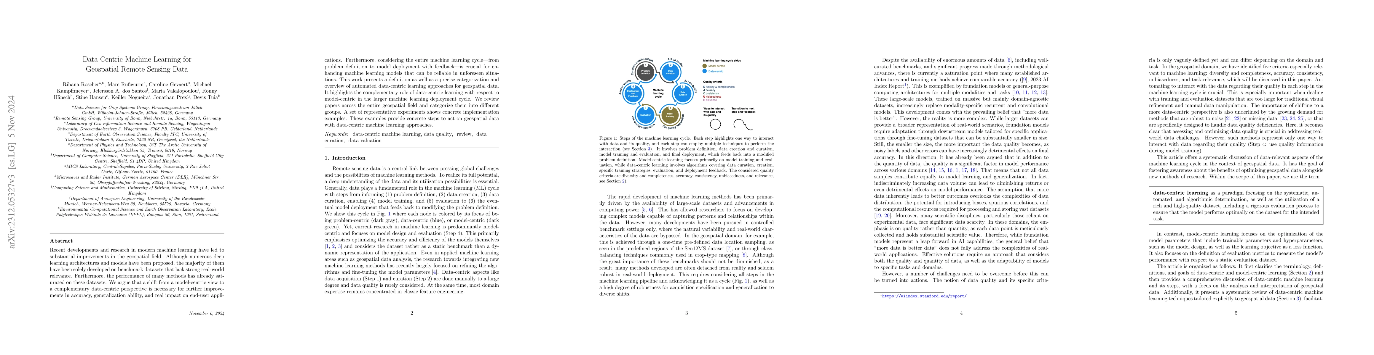
Recent developments and research in modern machine learning have led to substantial improvements in the geospatial field. Although numerous deep learning architectures and models have been proposed,...
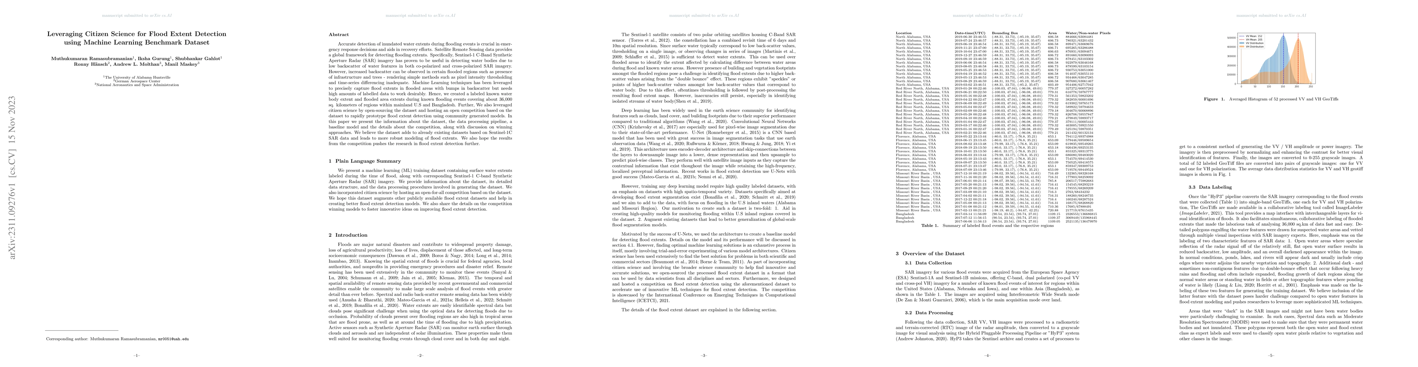
Accurate detection of inundated water extents during flooding events is crucial in emergency response decisions and aids in recovery efforts. Satellite Remote Sensing data provides a global framewor...
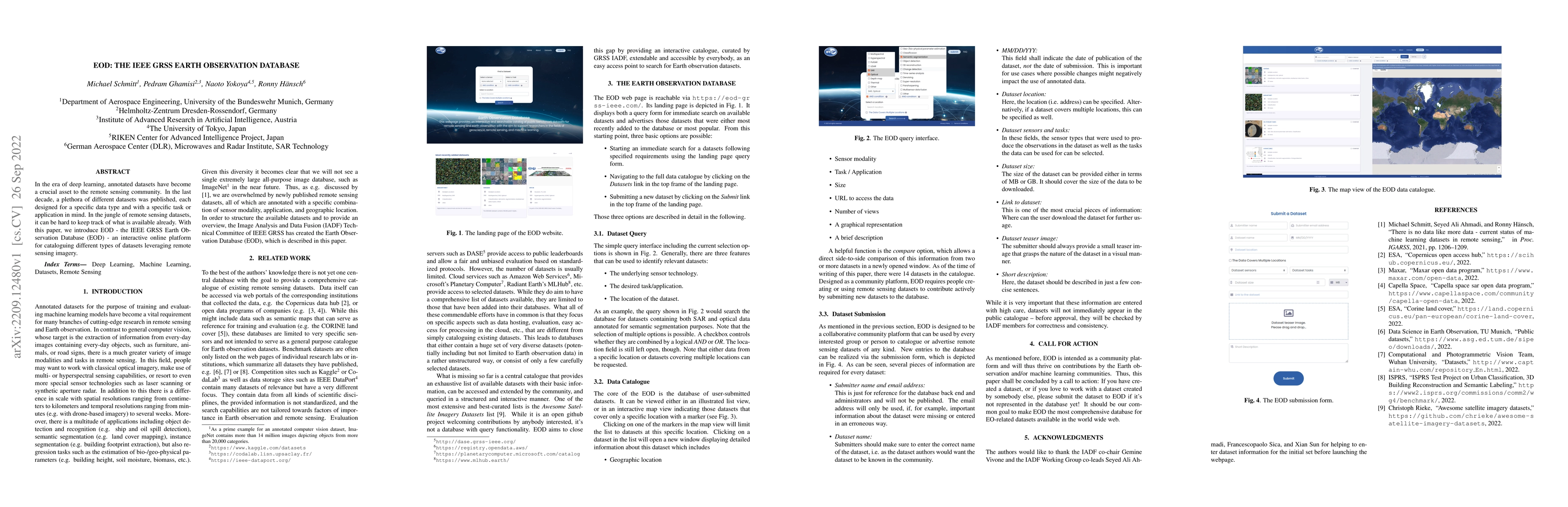
In the era of deep learning, annotated datasets have become a crucial asset to the remote sensing community. In the last decade, a plethora of different datasets was published, each designed for a s...
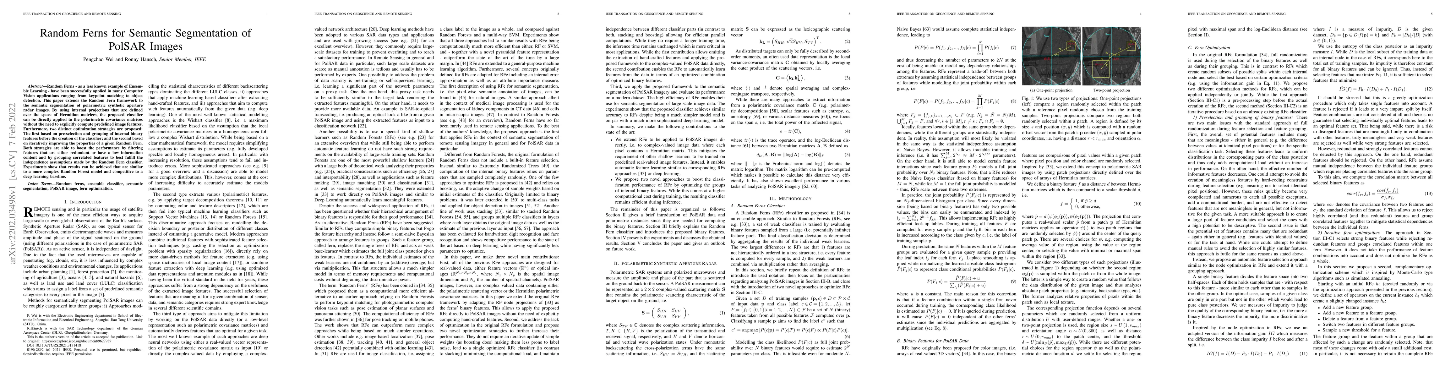
Random Ferns -- as a less known example of Ensemble Learning -- have been successfully applied in many Computer Vision applications ranging from keypoint matching to object detection. This paper ext...
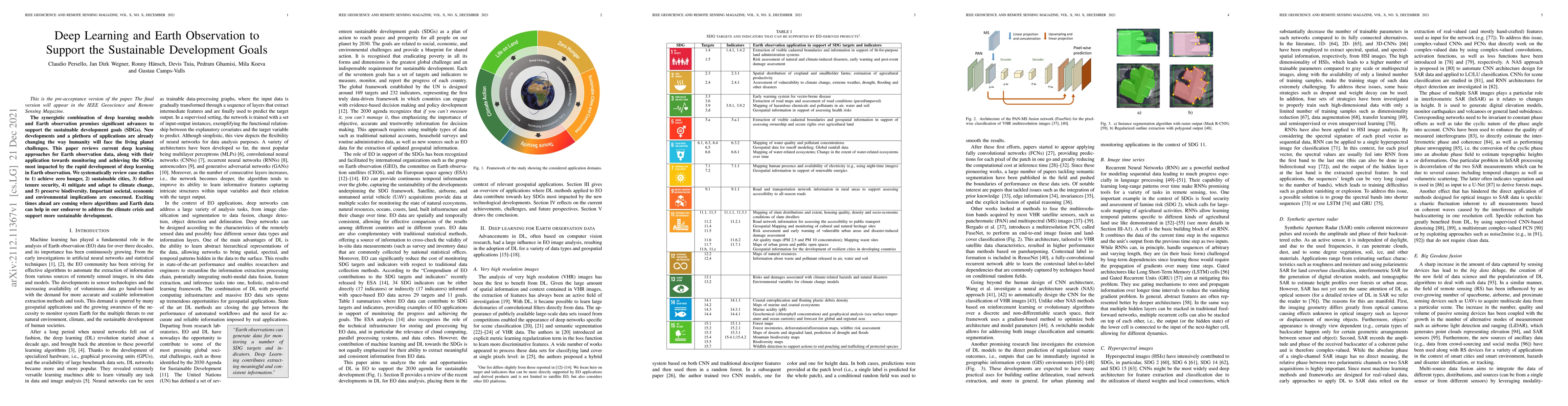
The synergistic combination of deep learning models and Earth observation promises significant advances to support the sustainable development goals (SDGs). New developments and a plethora of applic...
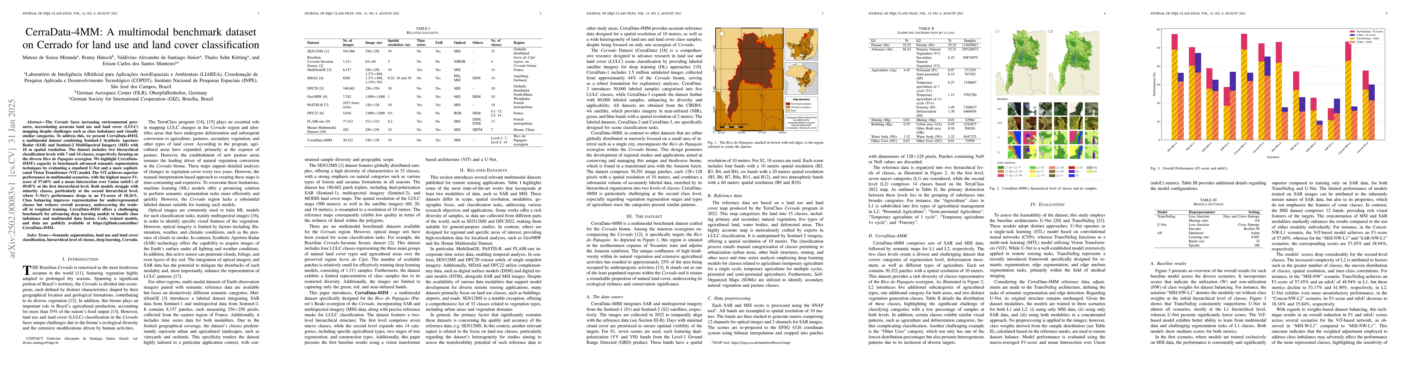
The Cerrado faces increasing environmental pressures, necessitating accurate land use and land cover (LULC) mapping despite challenges such as class imbalance and visually similar categories. To addre...
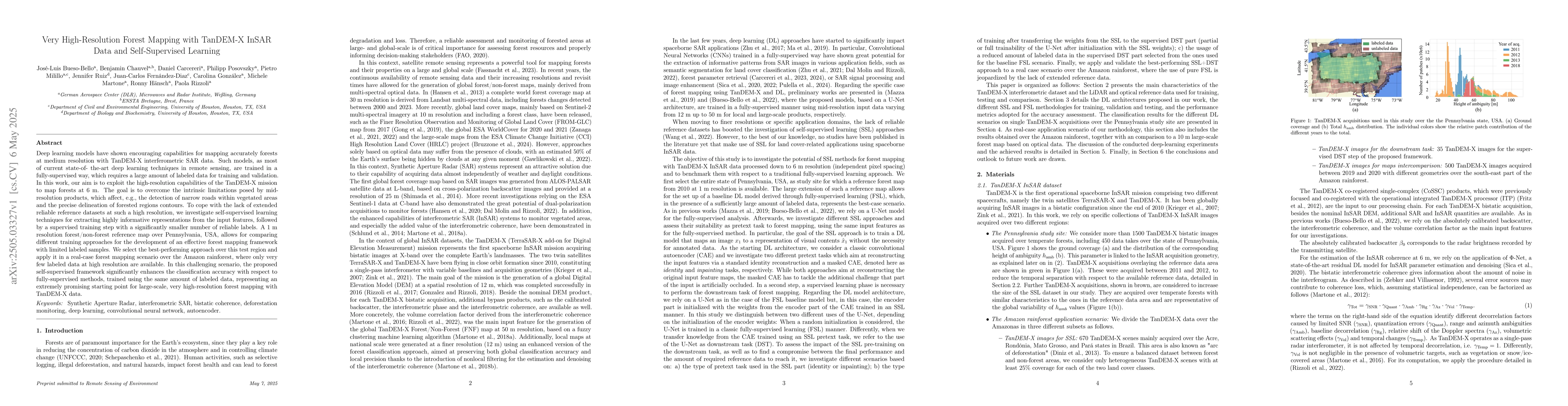
Deep learning models have shown encouraging capabilities for mapping accurately forests at medium resolution with TanDEM-X interferometric SAR data. Such models, as most of current state-of-the-art de...
The increasing accessibility of remotely sensed data and the potential of such data to inform large-scale decision-making has driven the development of deep learning models for many Earth Observation ...
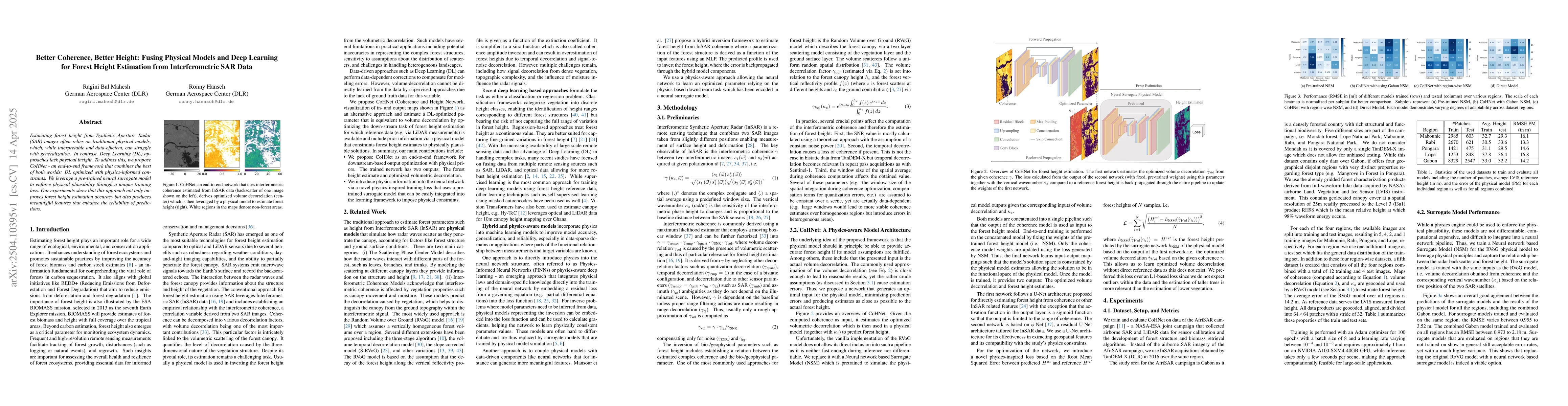
Estimating forest height from Synthetic Aperture Radar (SAR) images often relies on traditional physical models, which, while interpretable and data-efficient, can struggle with generalization. In con...
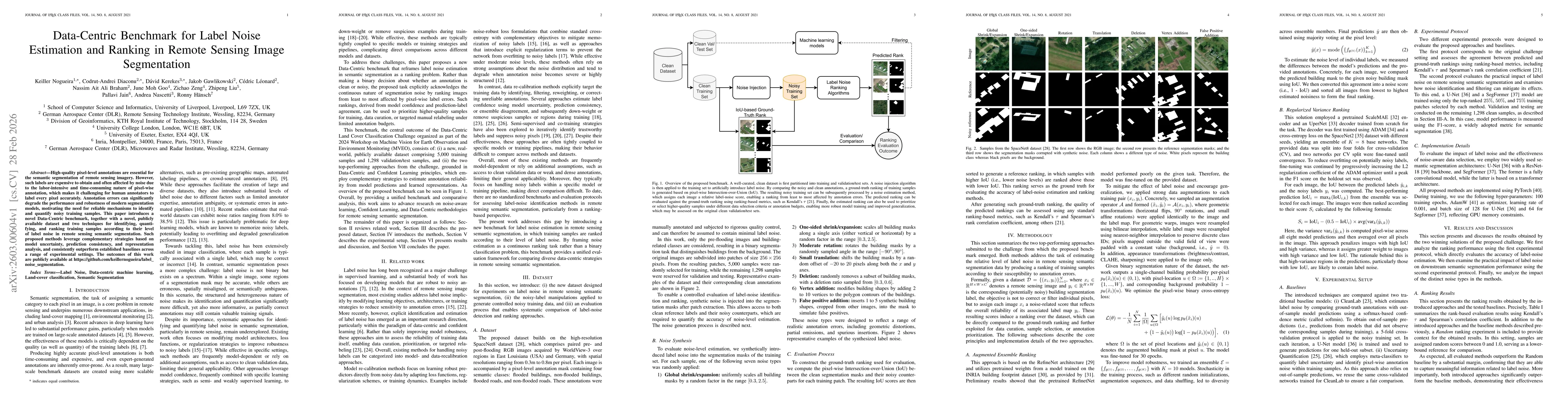
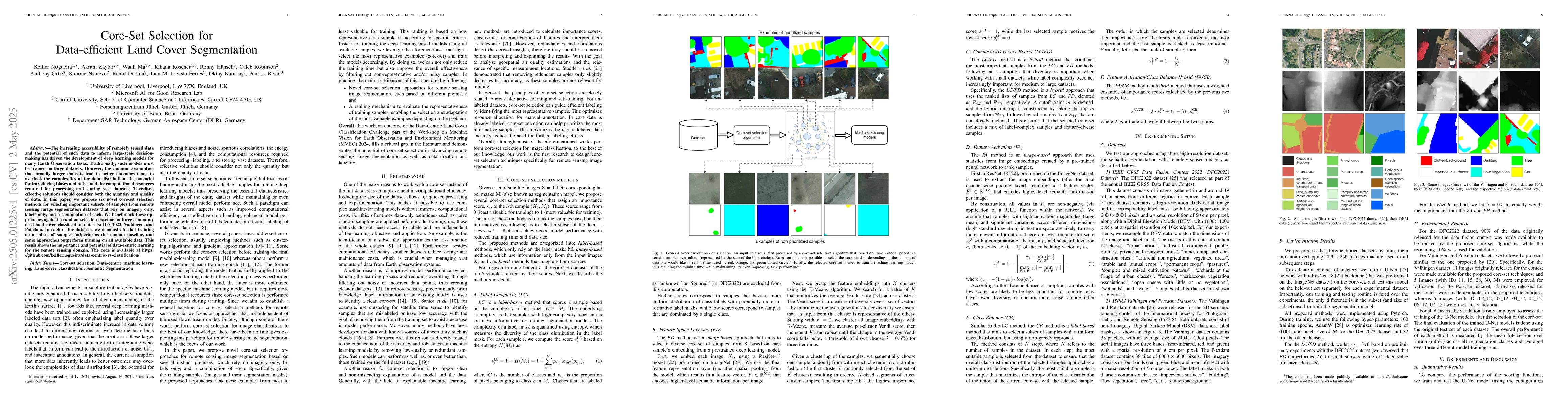
High-quality pixel-level annotations are essential for the semantic segmentation of remote sensing imagery. However, such labels are expensive to obtain and often affected by noise due to the labor-in...