Academic Profile
Statistics
Similar Authors
Papers on arXiv
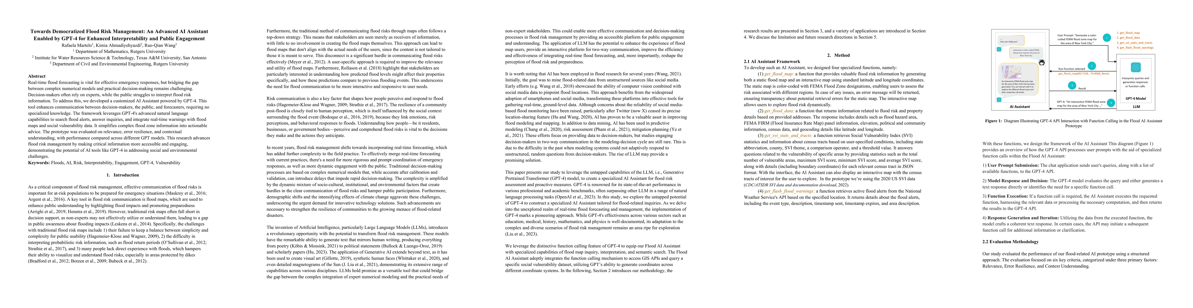
Real-time flood forecasting plays a crucial role in enabling timely and effective emergency responses. However, a significant challenge lies in bridging the gap between complex numerical flood model...

Real-time forecasting is important to the society. It uses continuous data streams to update forecasts for sustained accuracy. But the data source is vulnerable to attacks or accidents and the dynam...
Satellite altimetry, which measures water level with global coverage and high resolution, provides an unprecedented opportunity for a wide and refined understanding of the changing tides in the coas...
Urban flooding is becoming a common and devastating hazard to cause life loss and economic damage. Monitoring and understanding urban flooding in the local scale is a challenging task due to the com...
In the last decades, the development of smartphones, drones, aerial patrols, and digital cameras enabled high-quality photographs available to large populations and, thus, provides an opportunity to...
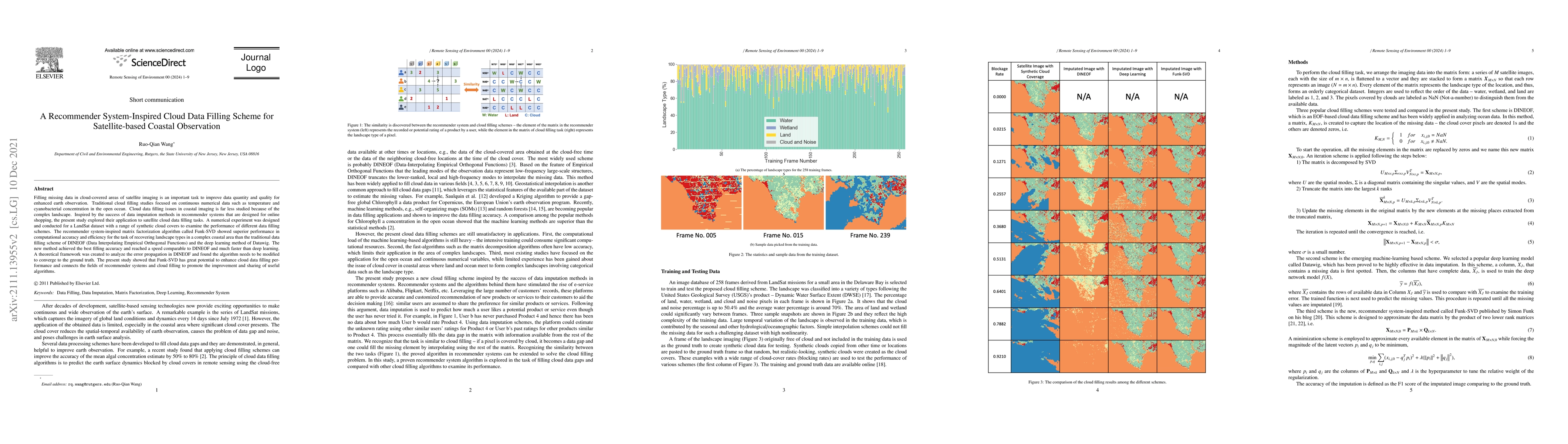
Filling missing data in cloud-covered areas of satellite imaging is an important task to improve data quantity and quality for enhanced earth observation. Traditional cloud filling studies focused o...
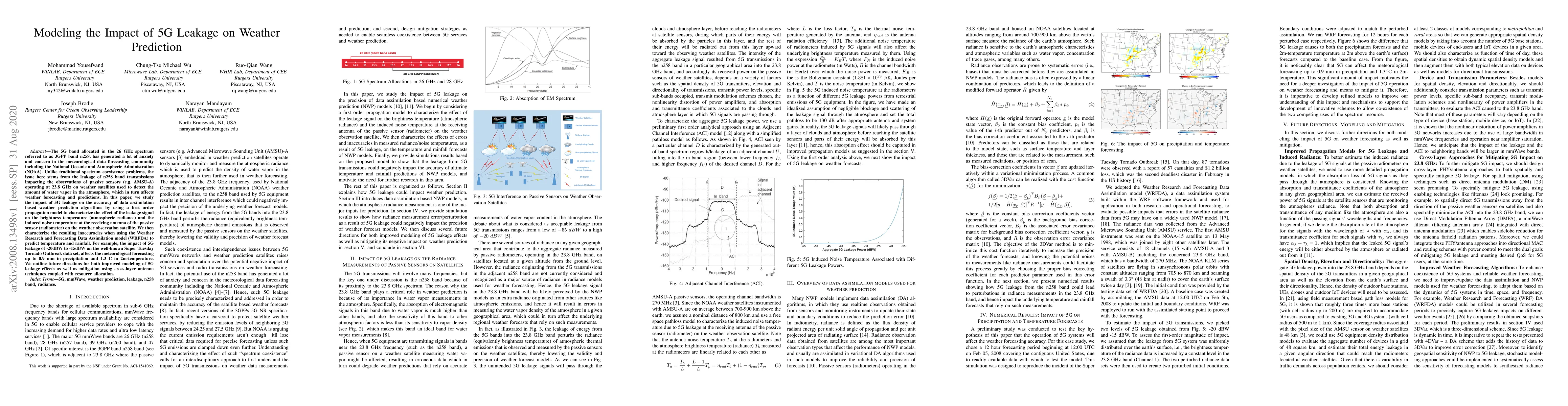
The 5G band allocated in the 26 GHz spectrum referred to as 3GPP band n258, has generated a lot of anxiety and concern in the meteorological data forecasting community including the National Oceanic...
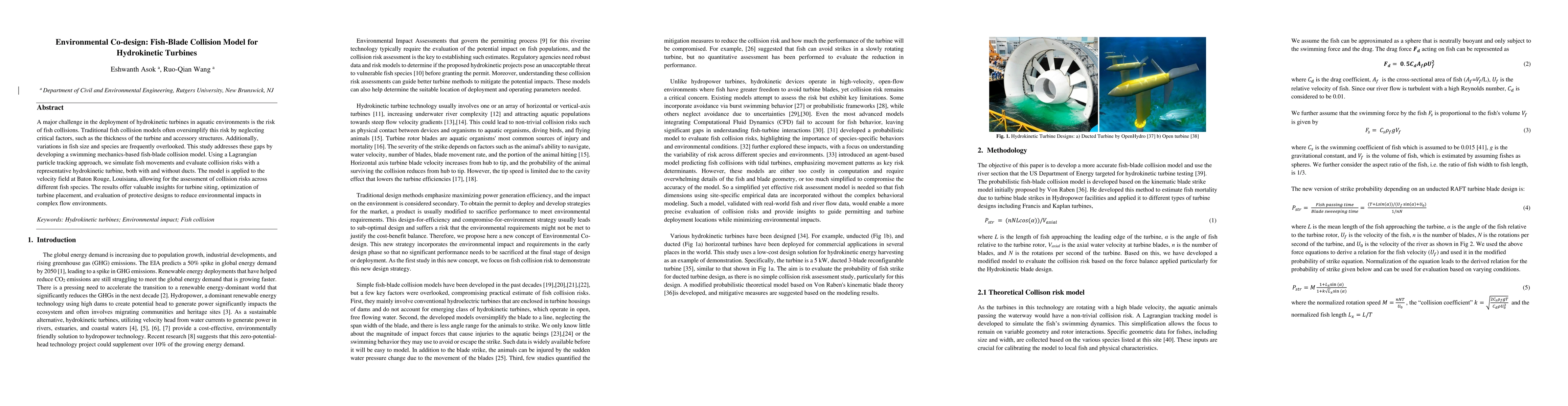
A major challenge in the deployment of hydrokinetic turbines in aquatic environments is the risk of fish collisions. Traditional fish collision models often oversimplify this risk by neglecting critic...