Academic Profile
Statistics
Similar Authors
Papers on arXiv
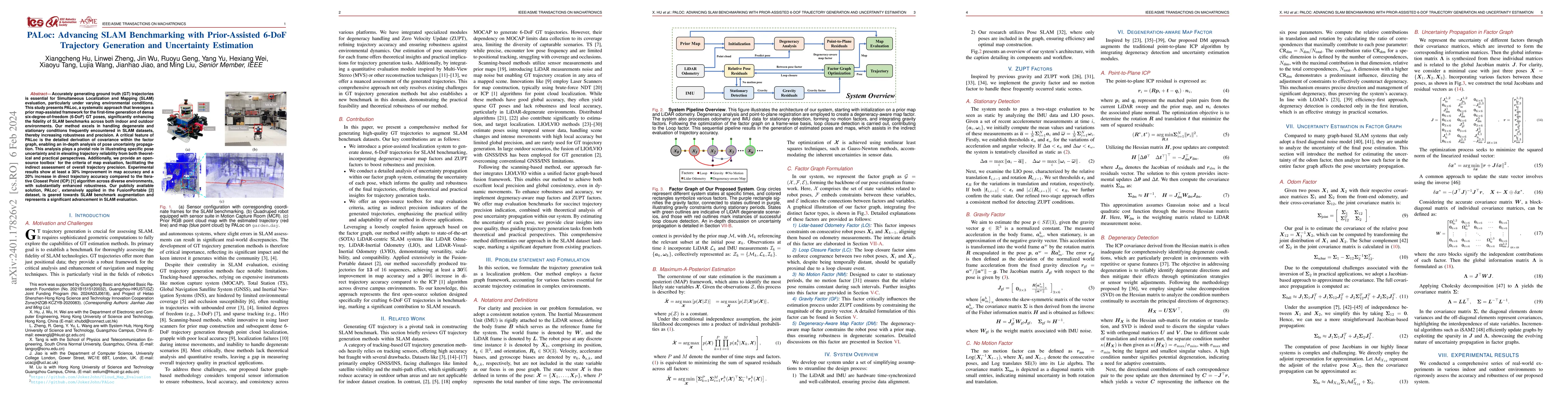
Accurately generating ground truth (GT) trajectories is essential for Simultaneous Localization and Mapping (SLAM) evaluation, particularly under varying environmental conditions. This study introdu...
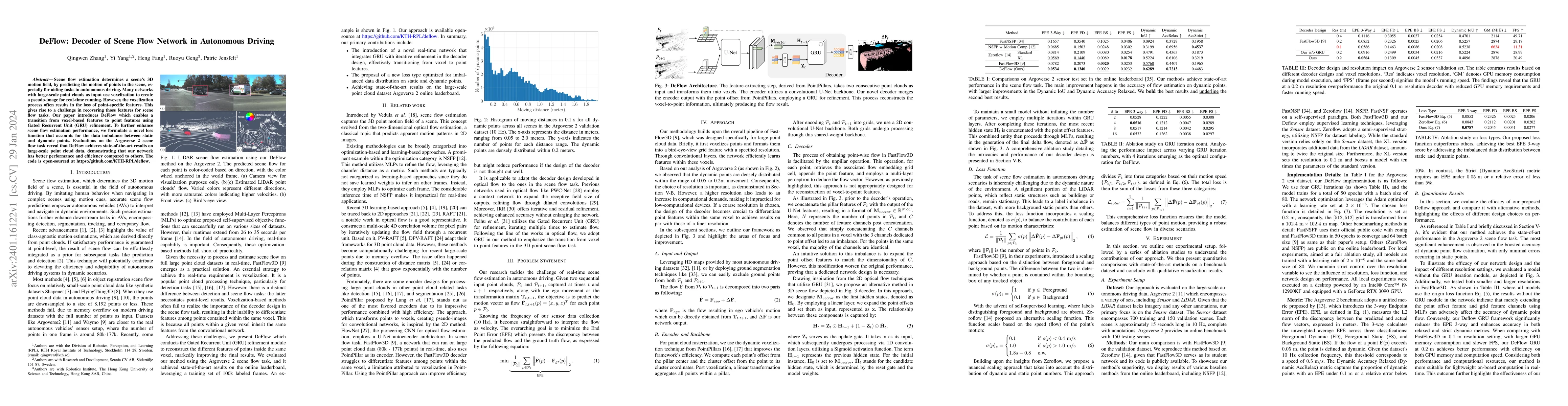
Scene flow estimation determines a scene's 3D motion field, by predicting the motion of points in the scene, especially for aiding tasks in autonomous driving. Many networks with large-scale point c...
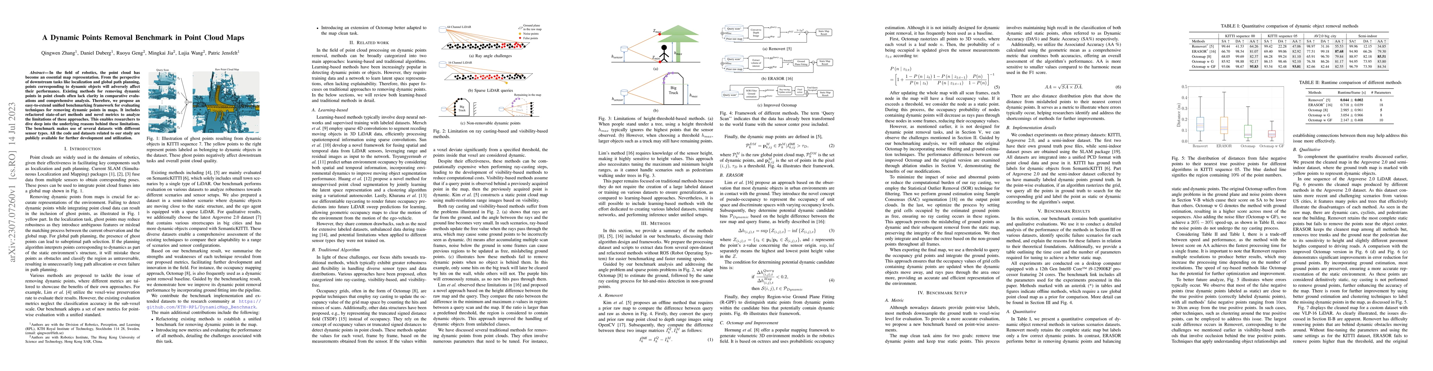
In the field of robotics, the point cloud has become an essential map representation. From the perspective of downstream tasks like localization and global path planning, points corresponding to dyn...
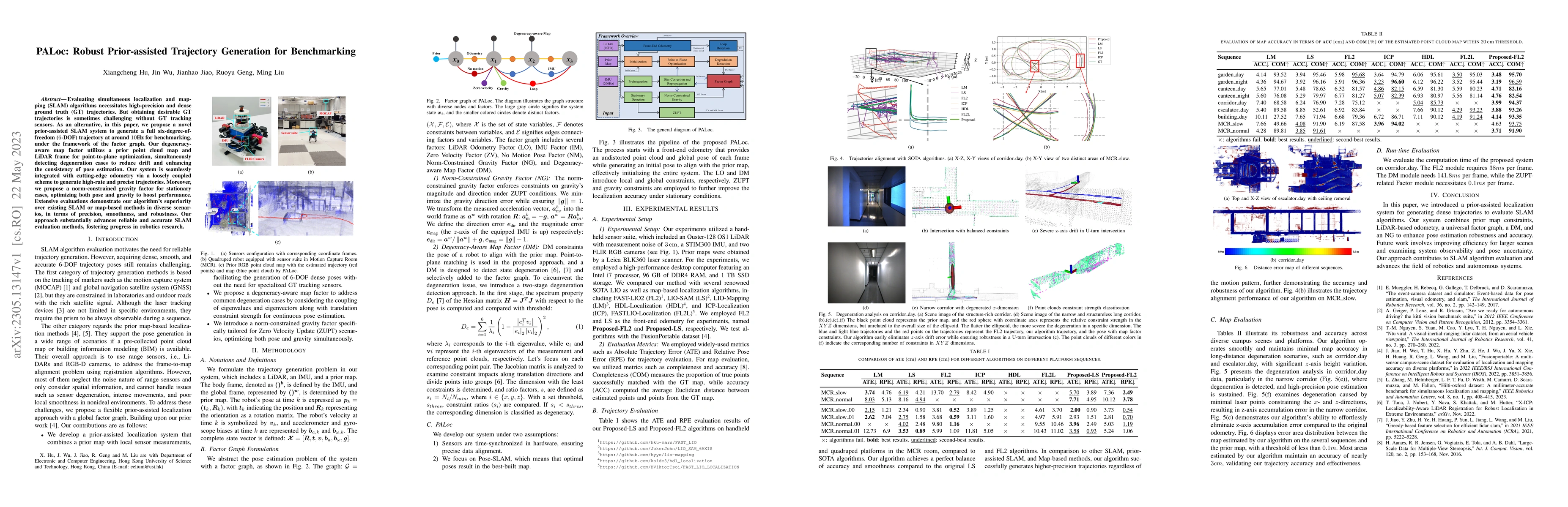
Evaluating simultaneous localization and mapping (SLAM) algorithms necessitates high-precision and dense ground truth (GT) trajectories. But obtaining desirable GT trajectories is sometimes challeng...
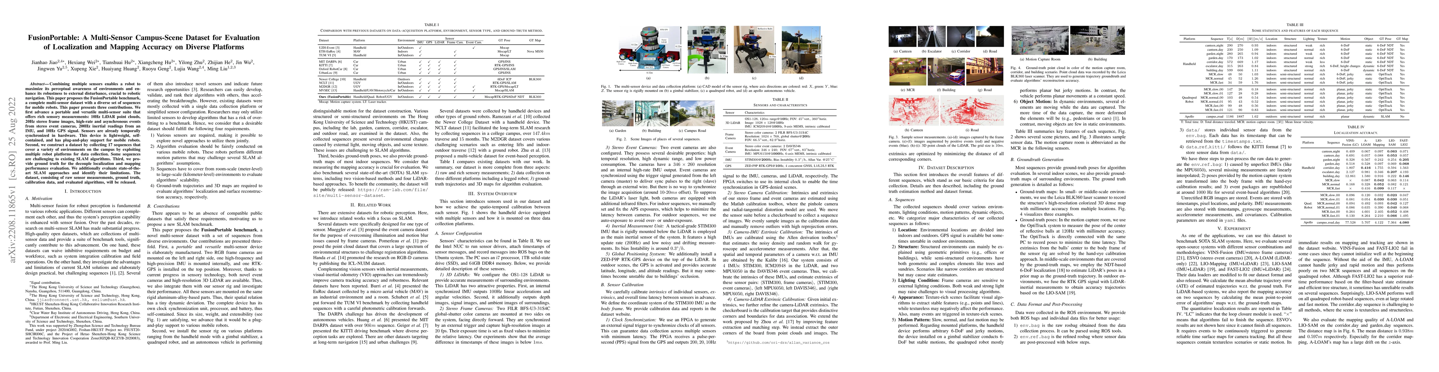
Combining multiple sensors enables a robot to maximize its perceptual awareness of environments and enhance its robustness to external disturbance, crucial to robotic navigation. This paper proposes...
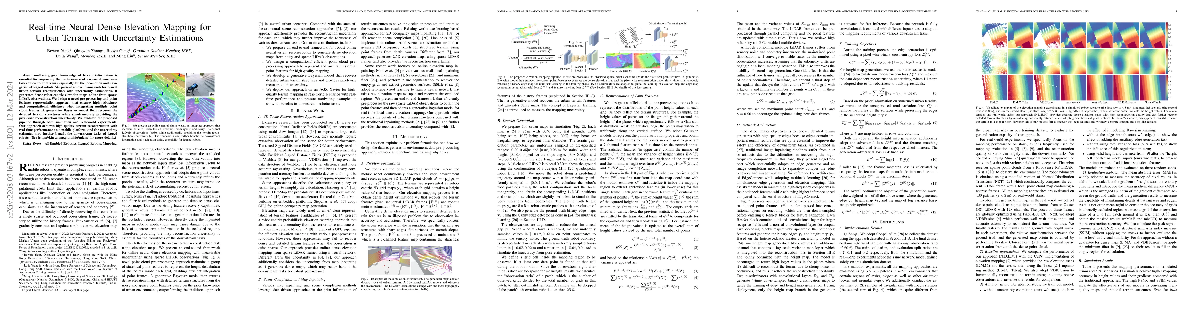
Having good knowledge of terrain information is essential for improving the performance of various downstream tasks on complex terrains, especially for the locomotion and navigation of legged robots...
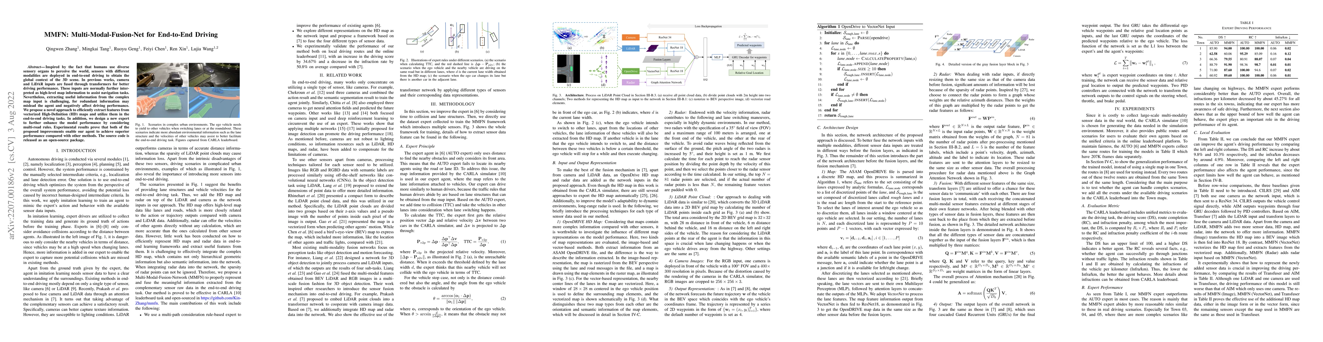
Inspired by the fact that humans use diverse sensory organs to perceive the world, sensors with different modalities are deployed in end-to-end driving to obtain the global context of the 3D scene. ...
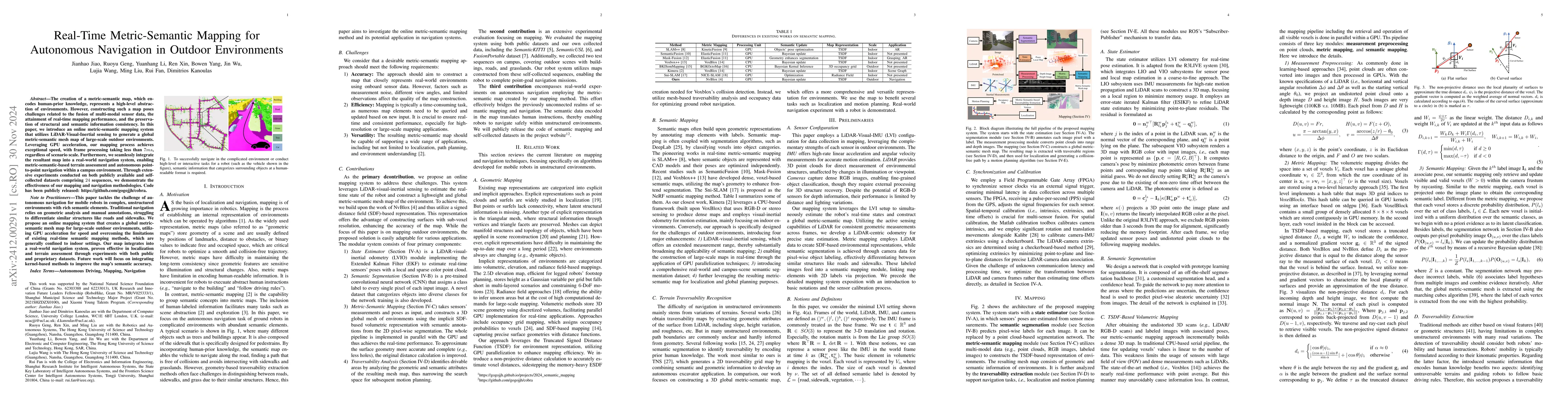
The creation of a metric-semantic map, which encodes human-prior knowledge, represents a high-level abstraction of environments. However, constructing such a map poses challenges related to the fusion...
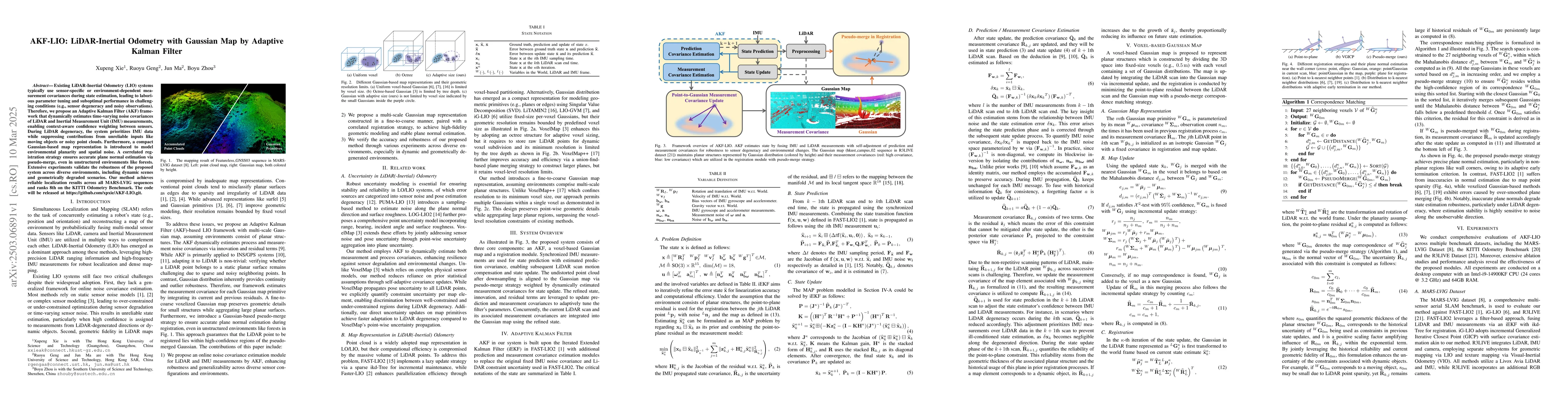
Existing LiDAR-Inertial Odometry (LIO) systems typically use sensor-specific or environment-dependent measurement covariances during state estimation, leading to laborious parameter tuning and subopti...
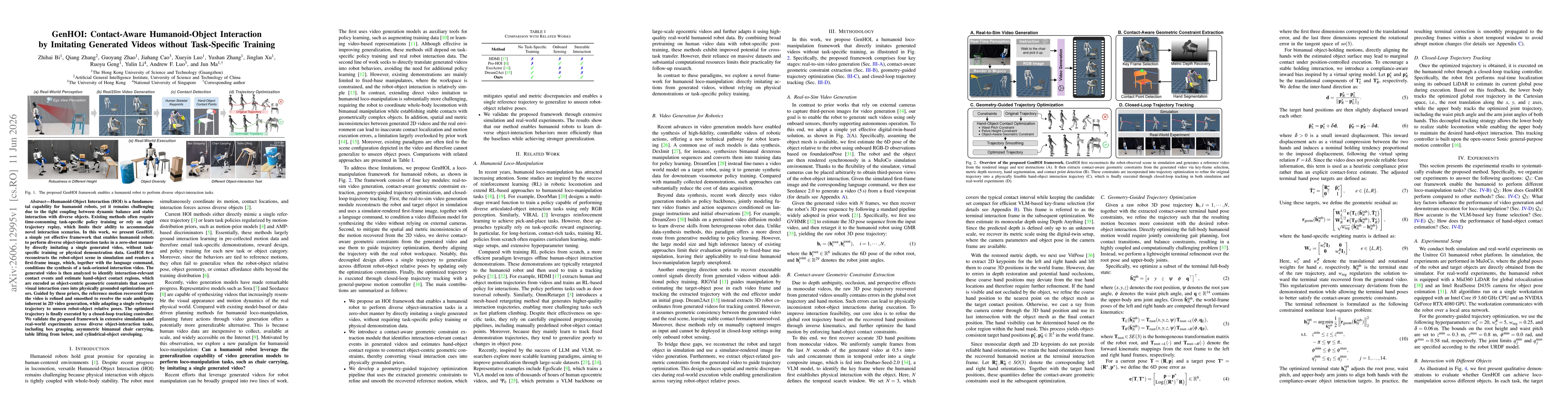
Humanoid-Object Interaction (HOI) is a fundamental capability for humanoid robots, yet it remains challenging due to the tight coupling between dynamic balance and stable interaction with diverse obje...