Academic Profile
Statistics
Similar Authors
Papers on arXiv
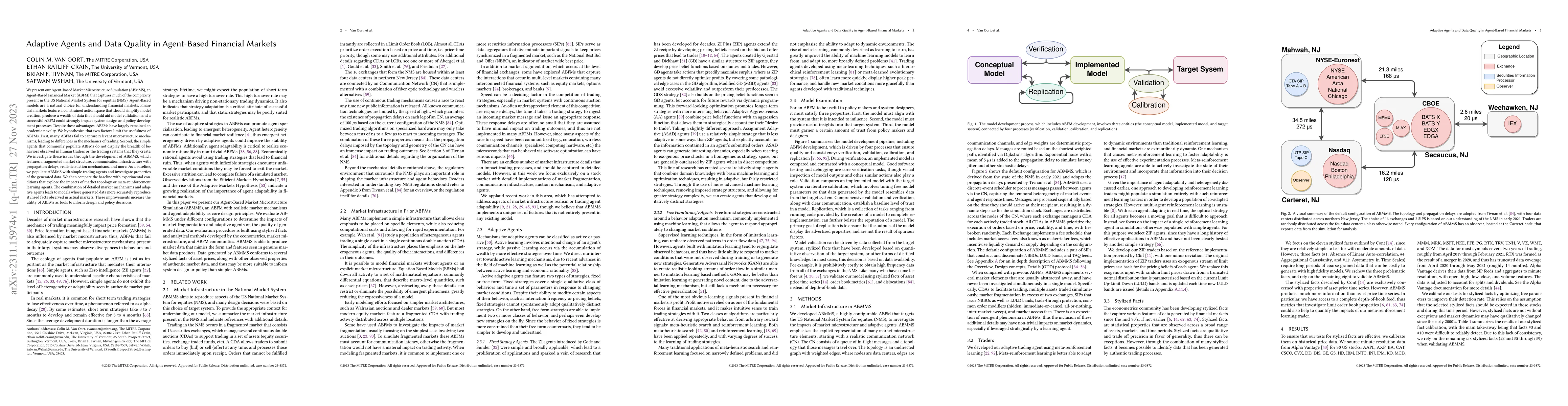
We present our Agent-Based Market Microstructure Simulation (ABMMS), an Agent-Based Financial Market (ABFM) that captures much of the complexity present in the US National Market System for equities...
Cross-View Geo-Localization (CVGL) estimates the location of a ground image by matching it to a geo-tagged aerial image in a database. Recent works achieve outstanding progress on CVGL benchmarks. H...
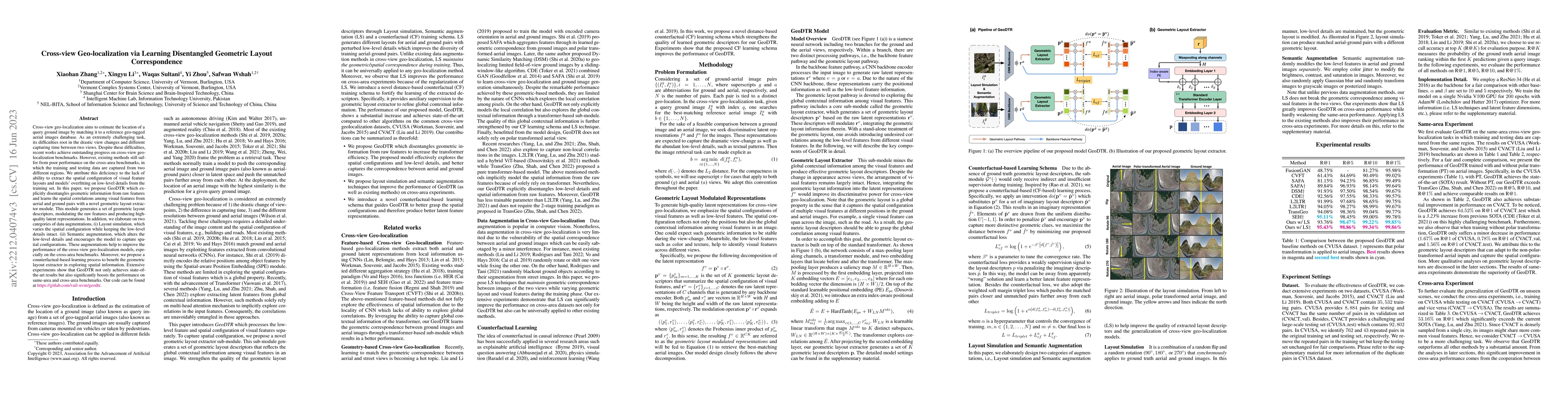
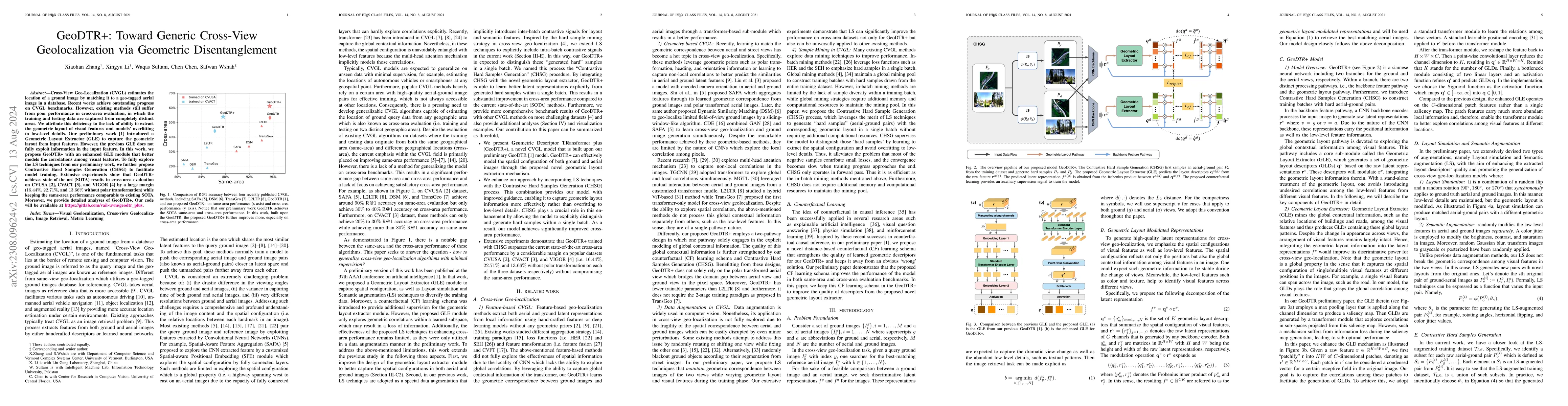
Cross-view geo-localization aims to estimate the location of a query ground image by matching it to a reference geo-tagged aerial images database. As an extremely challenging task, its difficulties ...
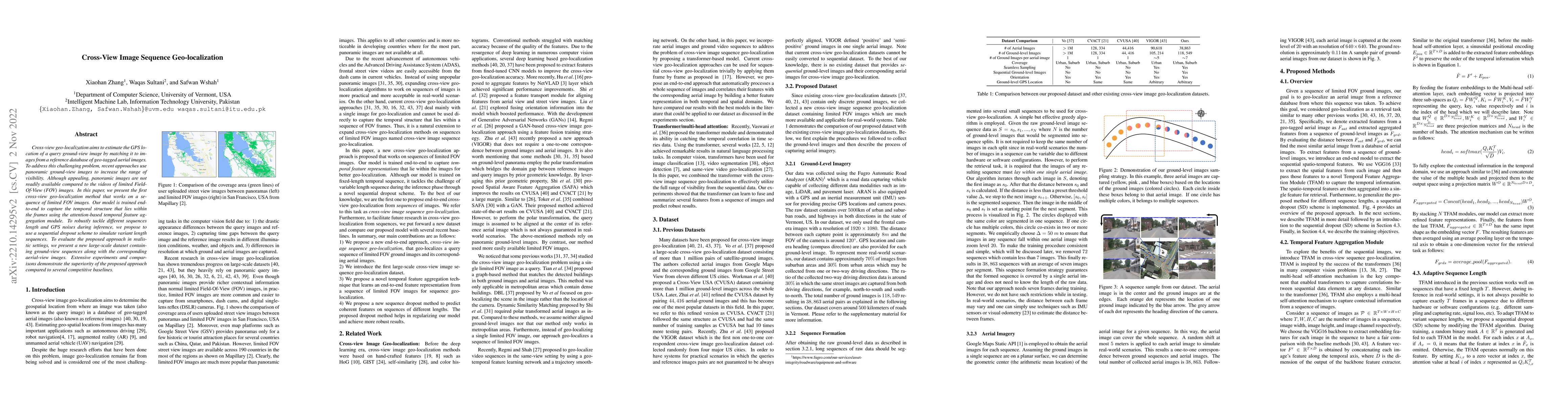
Cross-view geo-localization aims to estimate the GPS location of a query ground-view image by matching it to images from a reference database of geo-tagged aerial images. To address this challenging...
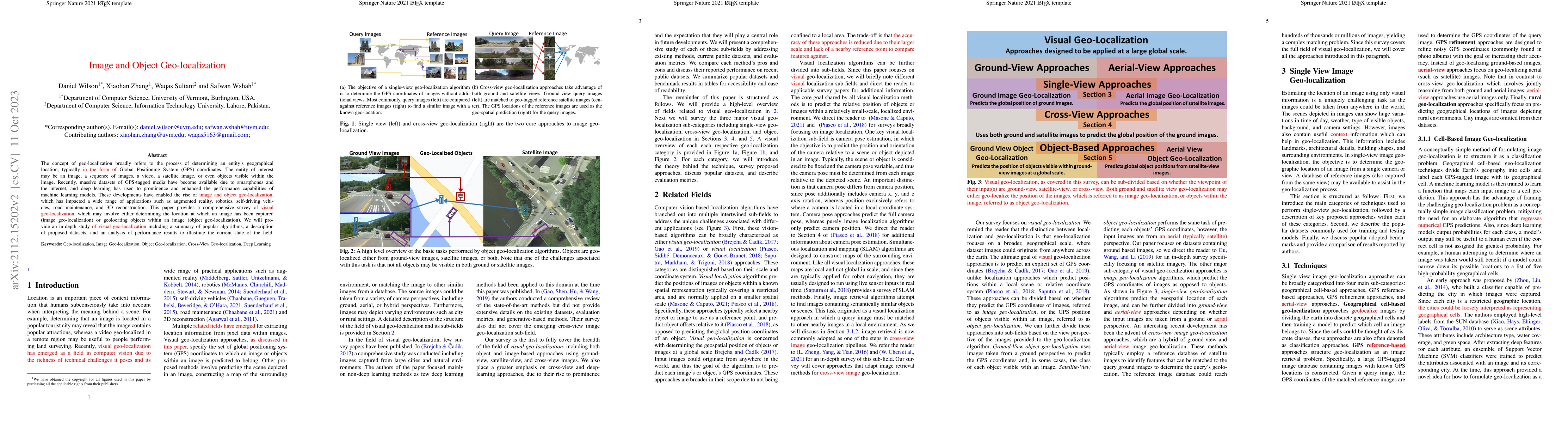
The concept of geo-localization refers to the process of determining where on earth some `entity' is located, typically using Global Positioning System (GPS) coordinates. The entity of interest may ...
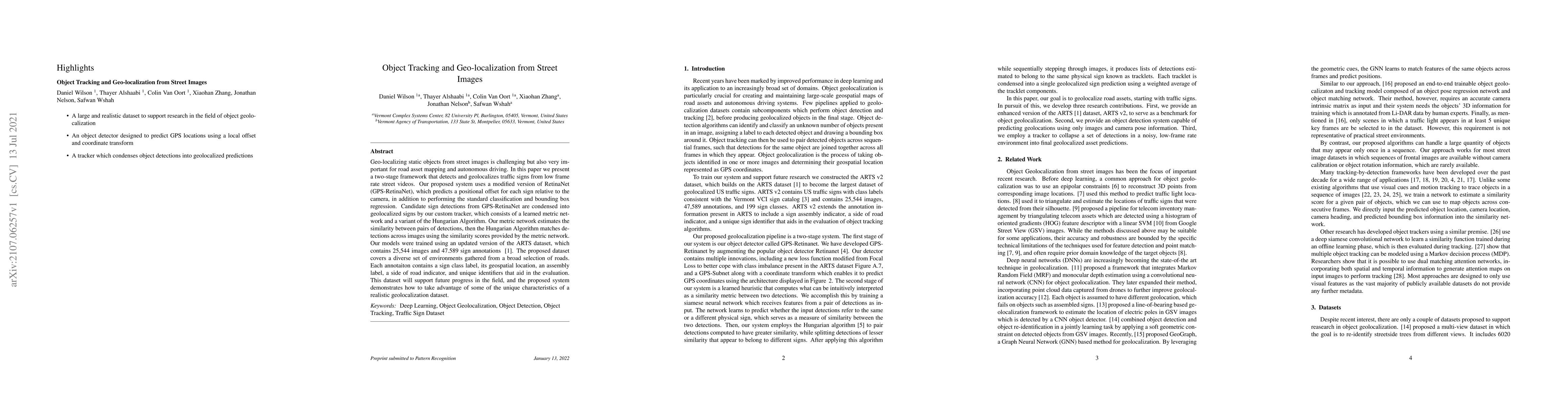
Geo-localizing static objects from street images is challenging but also very important for road asset mapping and autonomous driving. In this paper we present a two-stage framework that detects and...
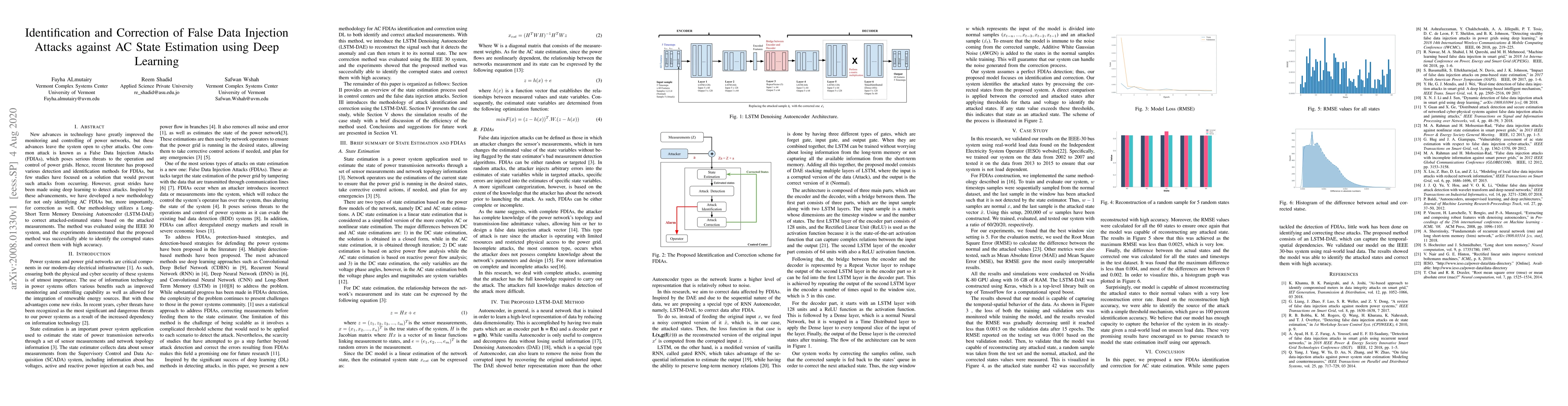
recent literature has proposed various detection and identification methods for FDIAs, but few studies have focused on a solution that would prevent such attacks from occurring. However, great strid...
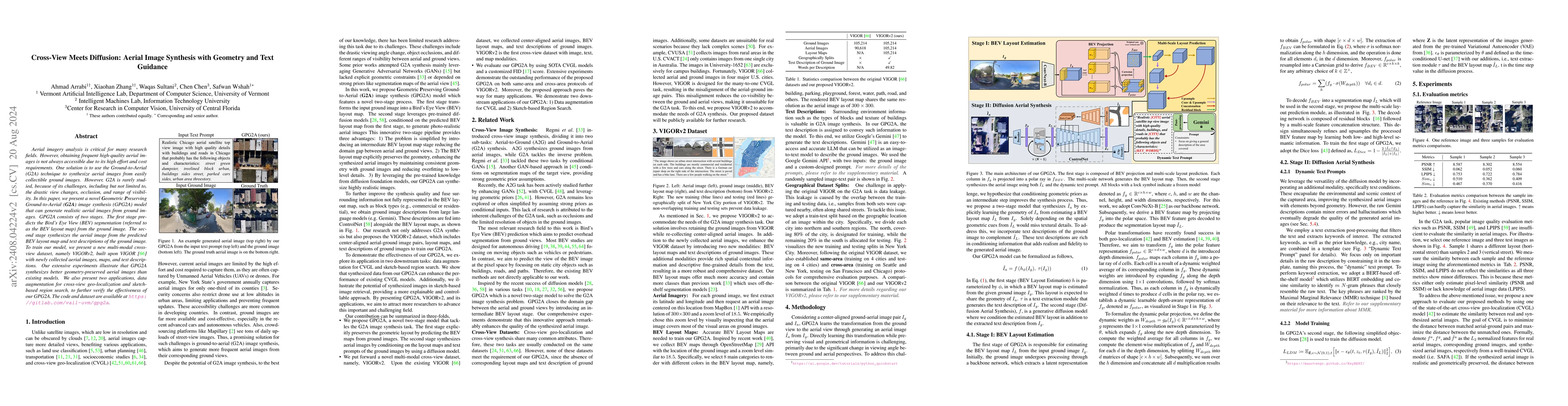
Aerial imagery analysis is critical for many research fields. However, obtaining frequent high-quality aerial images is not always accessible due to its high effort and cost requirements. One solution...
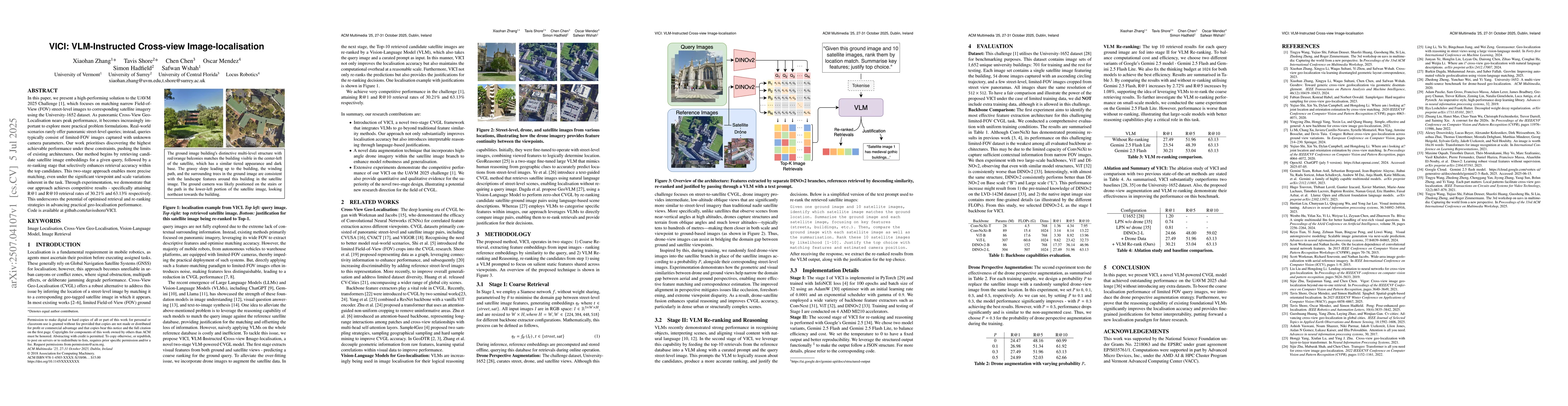
In this paper, we present a high-performing solution to the UAVM 2025 Challenge, which focuses on matching narrow FOV street-level images to corresponding satellite imagery using the University-1652 d...
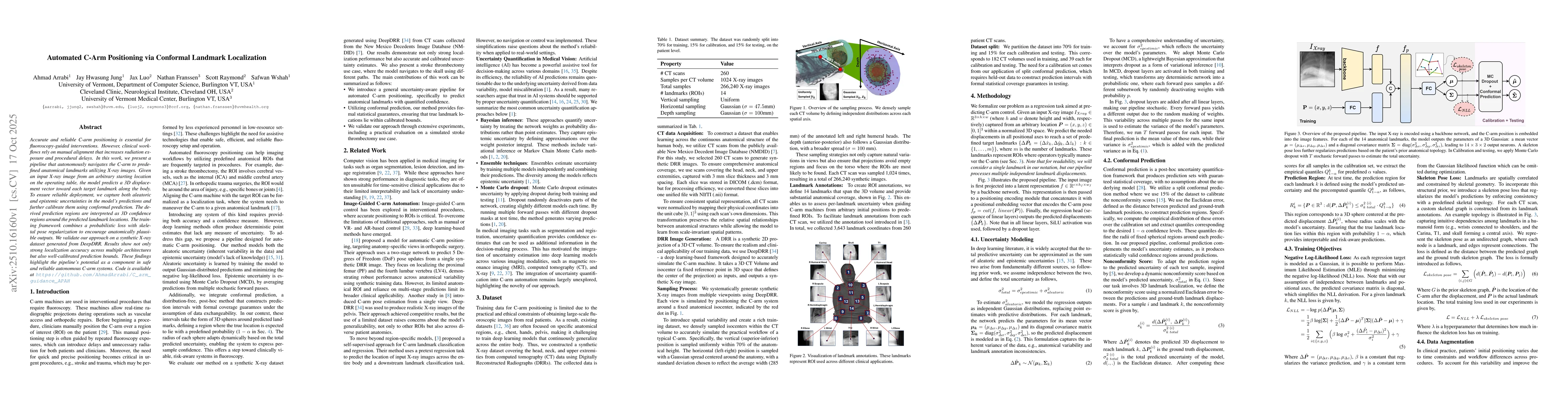
Accurate and reliable C-arm positioning is essential for fluoroscopy-guided interventions. However, clinical workflows rely on manual alignment that increases radiation exposure and procedural delays....
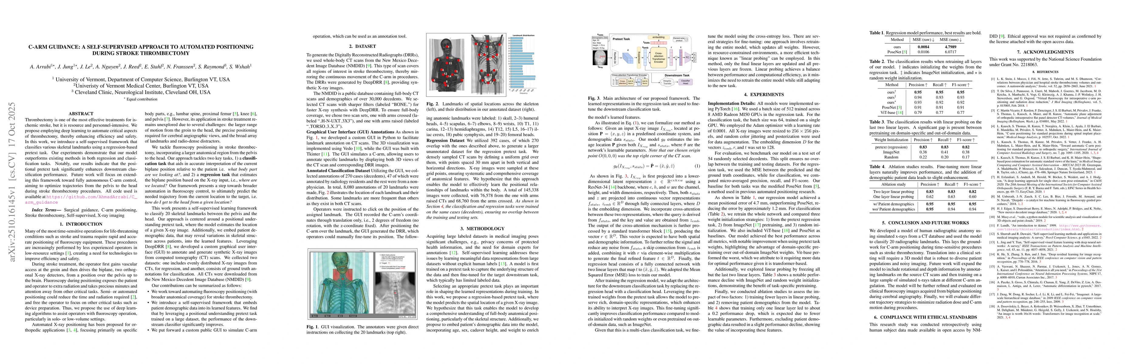
Thrombectomy is one of the most effective treatments for ischemic stroke, but it is resource and personnel-intensive. We propose employing deep learning to automate critical aspects of thrombectomy, t...
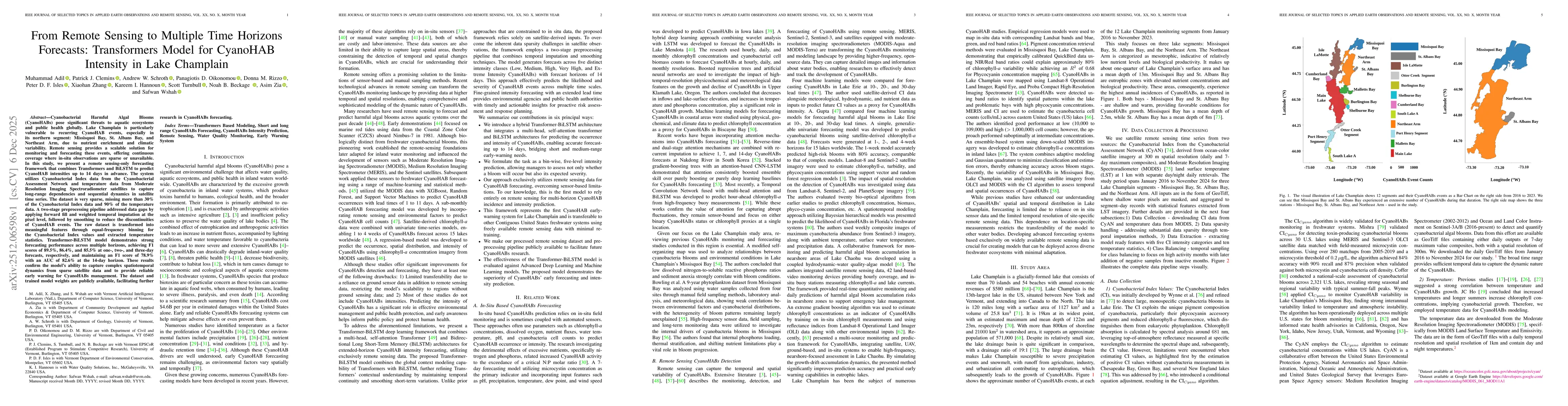
Cyanobacterial Harmful Algal Blooms (CyanoHABs) pose significant threats to aquatic ecosystems and public health globally. Lake Champlain is particularly vulnerable to recurring CyanoHAB events, espec...
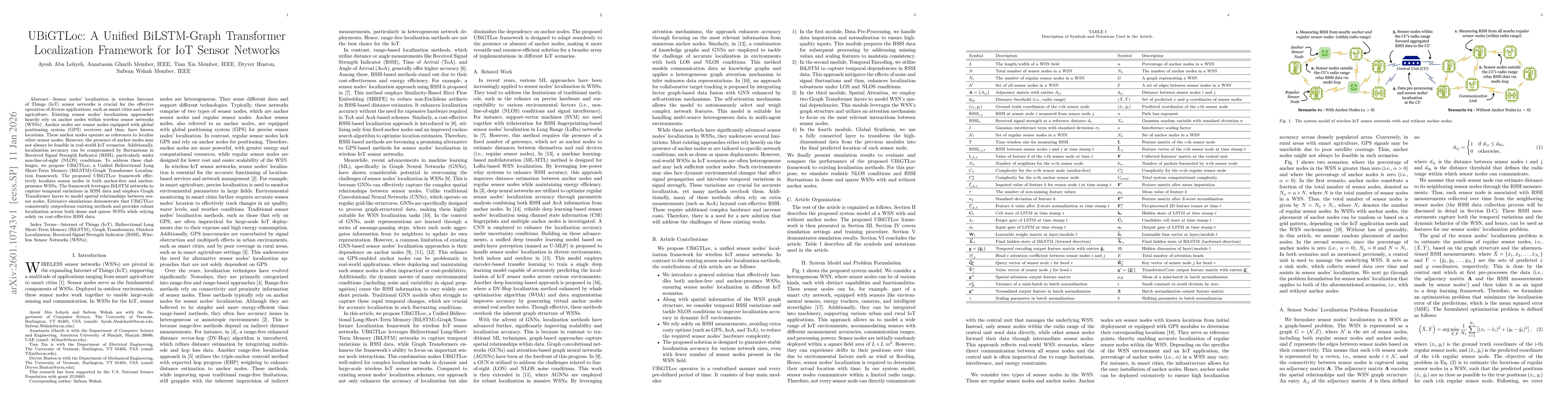
Sensor nodes localization in wireless Internet of Things (IoT) sensor networks is crucial for the effective operation of diverse applications, such as smart cities and smart agriculture. Existing sens...
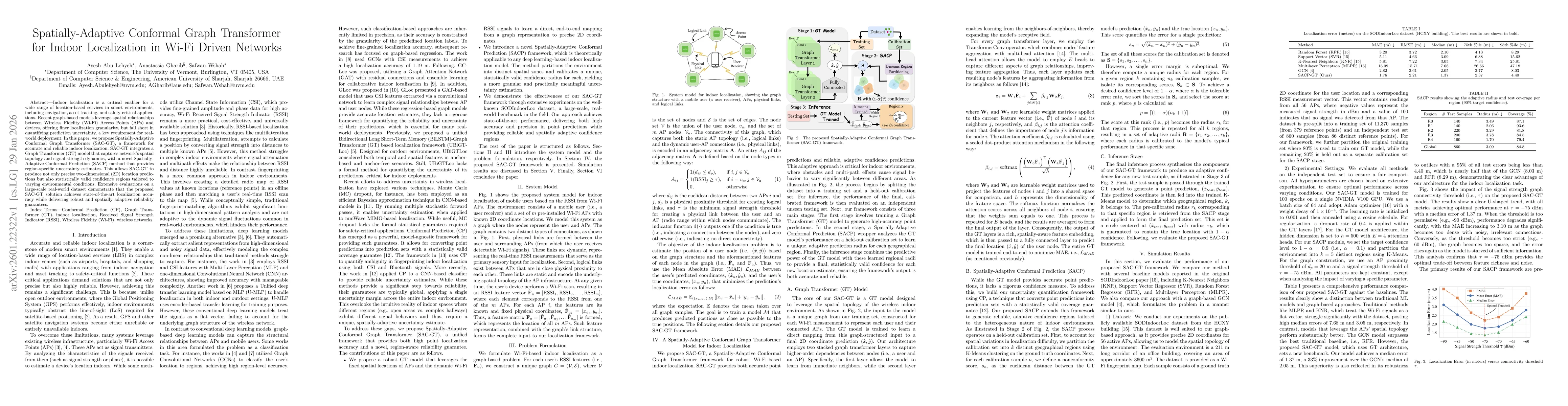
Indoor localization is a critical enabler for a wide range of location-based services in smart environments, including navigation, asset tracking, and safety-critical applications. Recent graph-based ...
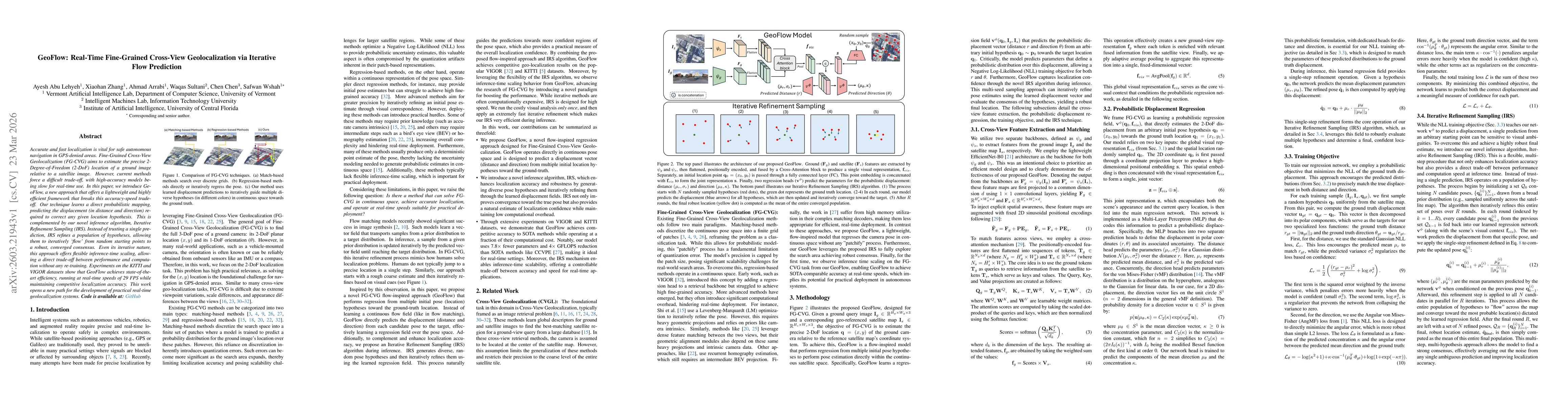
Accurate and fast localization is vital for safe autonomous navigation in GPS-denied areas. Fine-Grained Cross-View Geolocalization (FG-CVG) aims to estimate the precise 2-Degree-of-Freedom (2-DoF) lo...
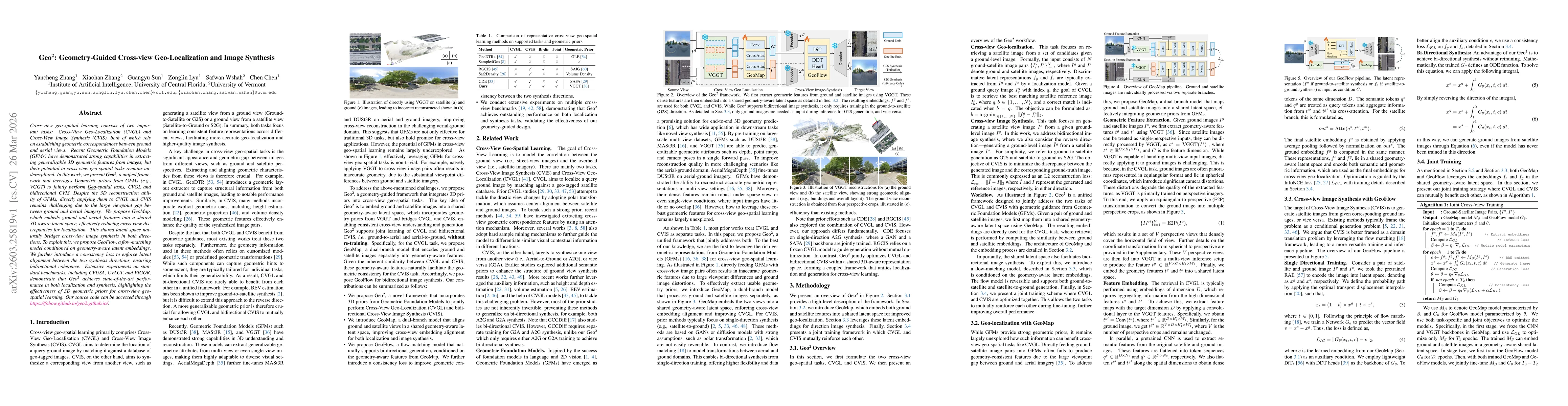
Cross-view geo-spatial learning consists of two important tasks: Cross-View Geo-Localization (CVGL) and Cross-View Image Synthesis (CVIS), both of which rely on establishing geometric correspondences ...
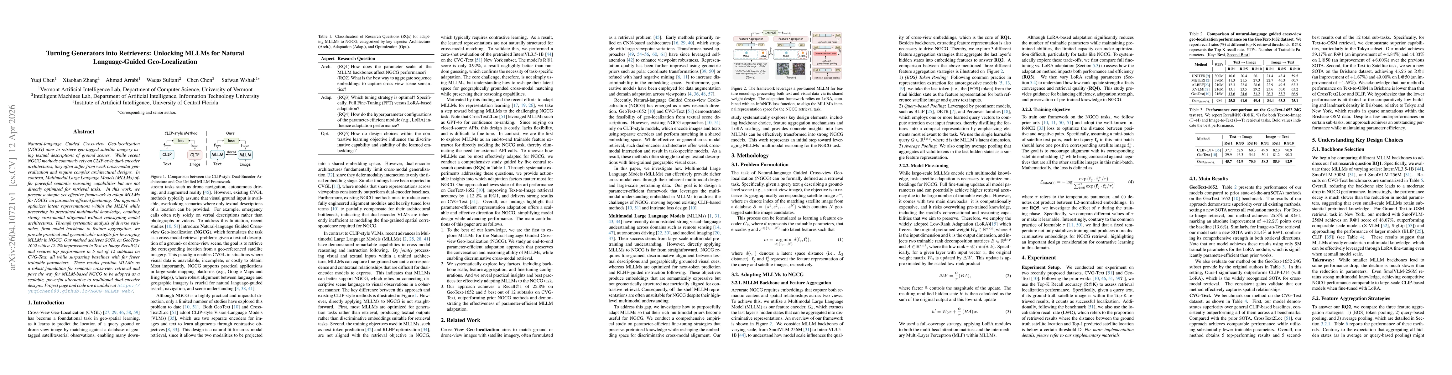
Natural-language Guided Cross-view Geo-localization (NGCG) aims to retrieve geo-tagged satellite imagery using textual descriptions of ground scenes. While recent NGCG methods commonly rely on CLIP-st...
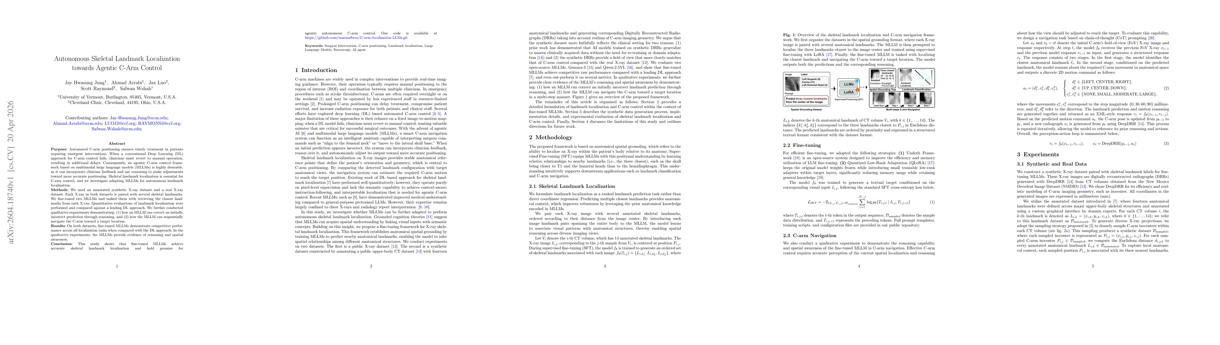
Purpose: Automated C-arm positioning ensures timely treatment in patients requiring emergent interventions. When a conventional Deep Learning (DL) approach for C-arm control fails, clinicians must rev...
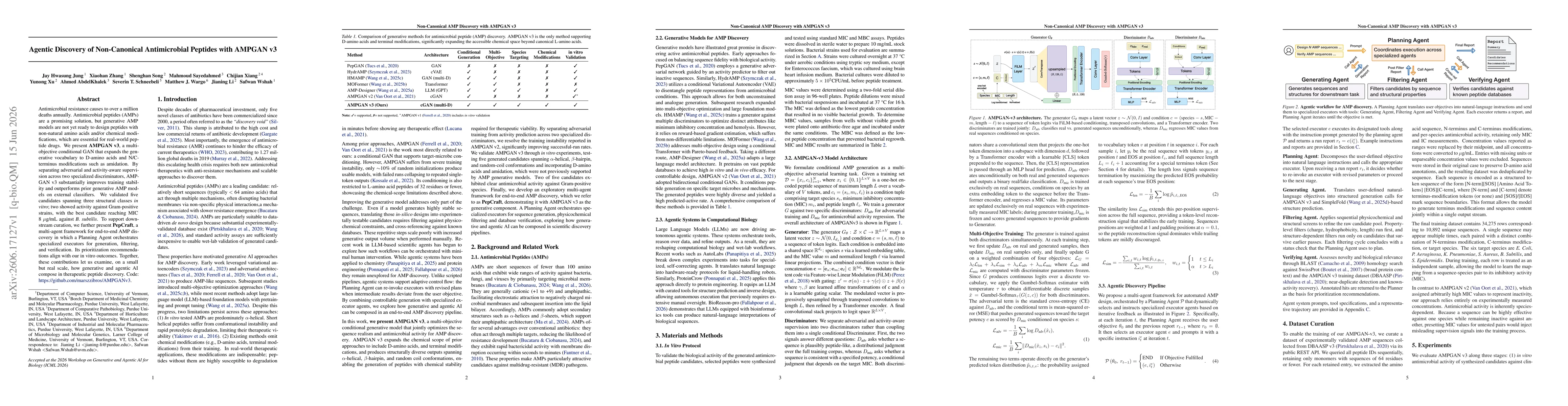
Antimicrobial resistance causes to over a million deaths annually. Antimicrobial peptides (AMPs) are a promising solution, but generative AMP models are not yet ready to design peptides with non-natur...