Academic Profile
Statistics
Similar Authors
Papers on arXiv
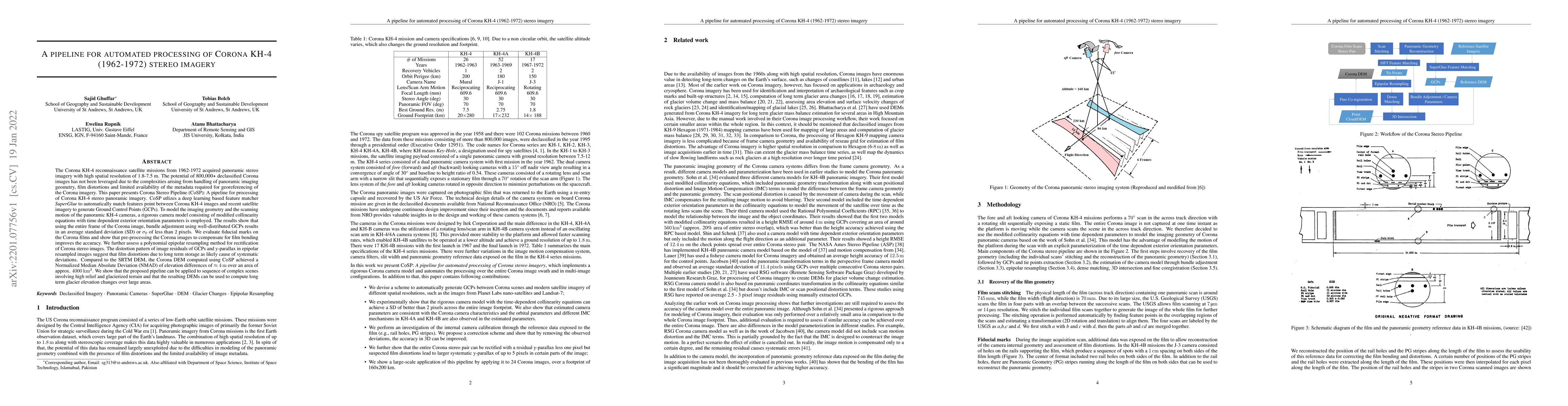
The Corona KH-4 reconnaissance satellite missions from 1962-1972 acquired panoramic stereo imagery with high spatial resolution of 1.8-7.5 m. The potential of 800,000+ declassified Corona images has...
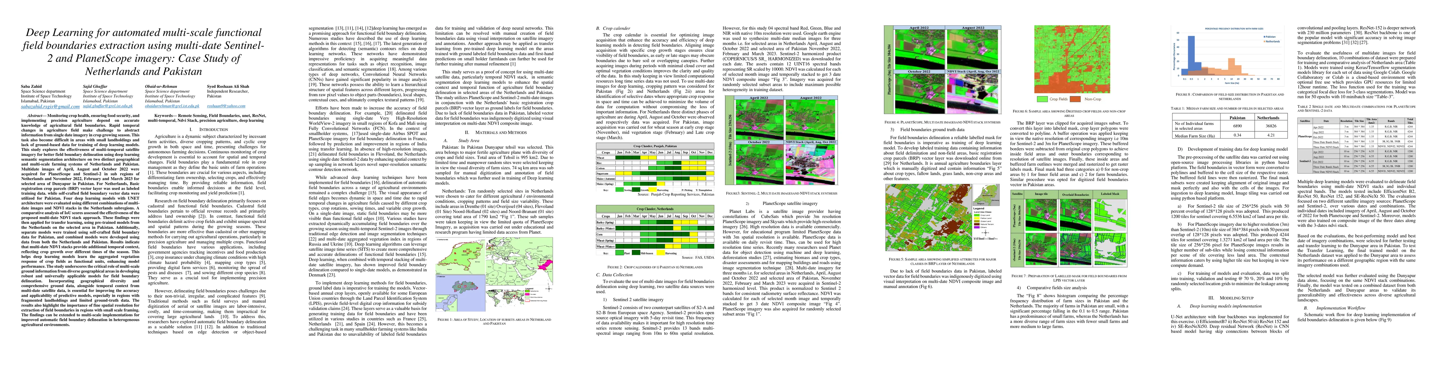
This study explores the effectiveness of multi-temporal satellite imagery for better functional field boundary delineation using deep learning semantic segmentation architecture on two distinct geogra...
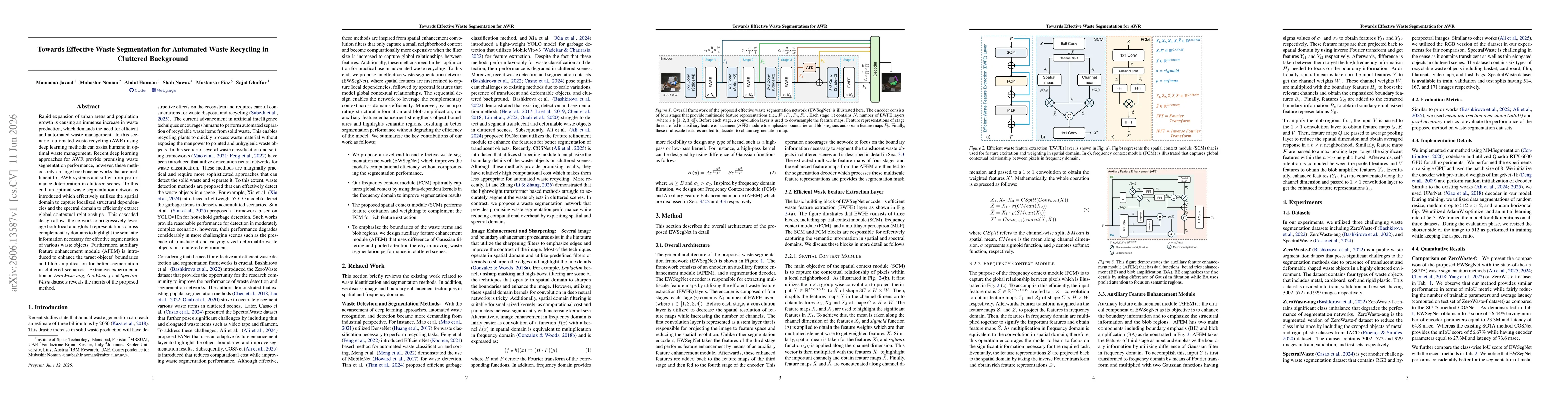
Rapid expansion of urban areas and population growth is causing an immense increase in waste production, which demands the need for efficient and automated waste management. In this scenario, automate...