2
arXiv Papers
3
Total Publications
Profile
Academic Profile
Metrics
Statistics
2
arXiv Papers
3
Total Publications
Network
Similar Authors
Publications
Papers on arXiv
arXiv
Multi-Region Transfer Learning for Segmentation of Crop Field Boundaries
in Satellite Images with Limited Labels
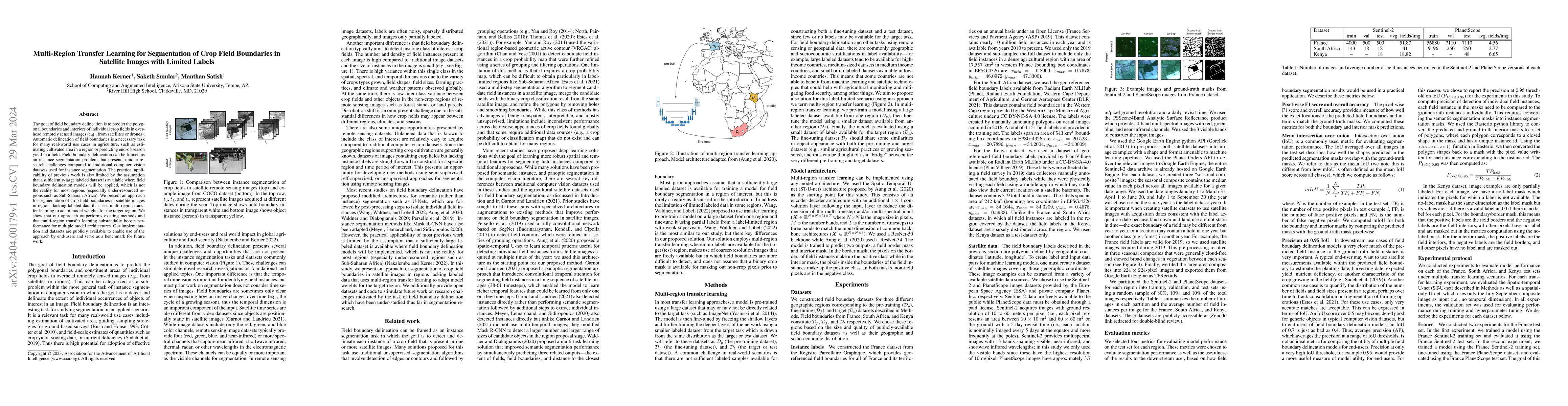
The goal of field boundary delineation is to predict the polygonal boundaries and interiors of individual crop fields in overhead remotely sensed images (e.g., from satellites or drones). Automatic ...
arXiv
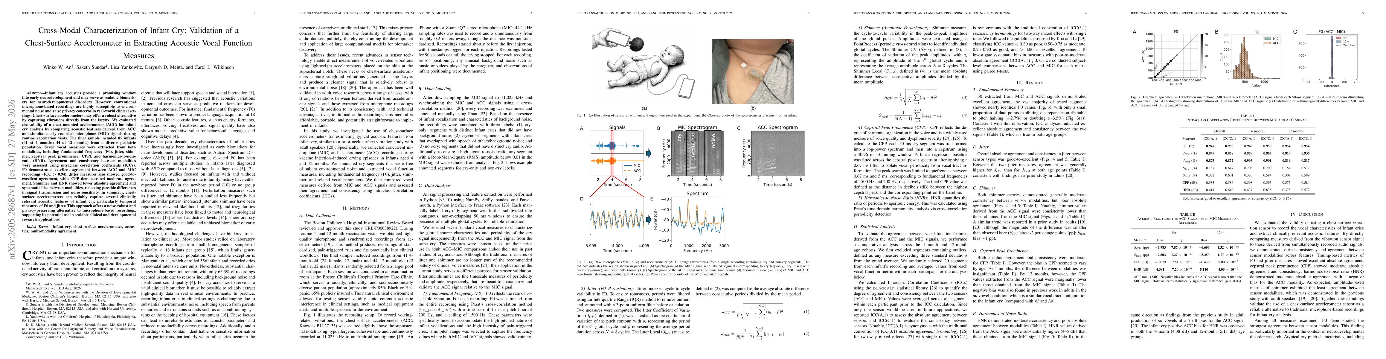
Cross-modal characterization of infant cry: validation of a chest-surface accelerometer in extracting acoustic vocal function measures
Background: Infant cry acoustics provide a promising window into early neurodevelopment and may serve as scalable biomarkers for neurodevelopmental disorders. However, conventional microphone-based re...