2
arXiv Papers
5
Total Publications
Profile
Academic Profile
Metrics
Statistics
2
arXiv Papers
5
Total Publications
Publications
Papers on arXiv
arXiv
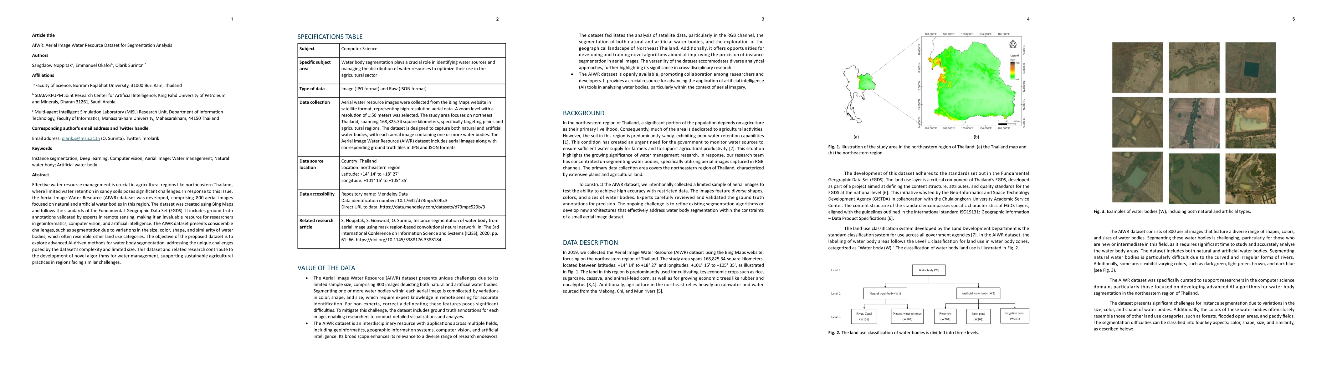
AIWR: Aerial Image Water Resource Dataset for Segmentation Analysis
Effective water resource management is crucial in agricultural regions like northeastern Thailand, where limited water retention in sandy soils poses significant challenges. In response to this issue,...
arXiv
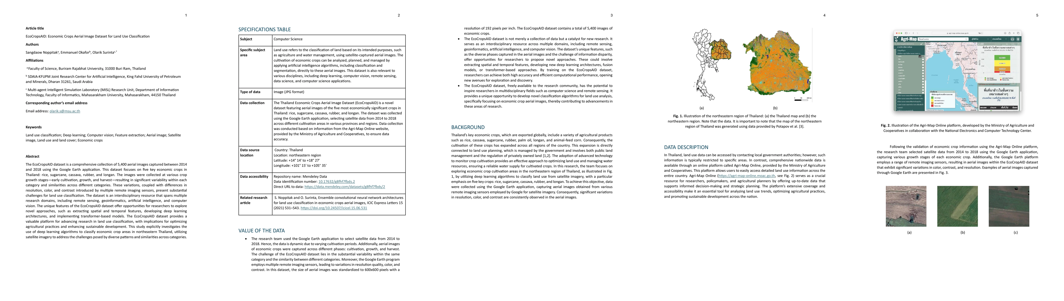
EcoCropsAID: Economic Crops Aerial Image Dataset for Land Use
Classification
The EcoCropsAID dataset is a comprehensive collection of 5,400 aerial images captured between 2014 and 2018 using the Google Earth application. This dataset focuses on five key economic crops in Thail...