Academic Profile
Statistics
Similar Authors
Papers on arXiv
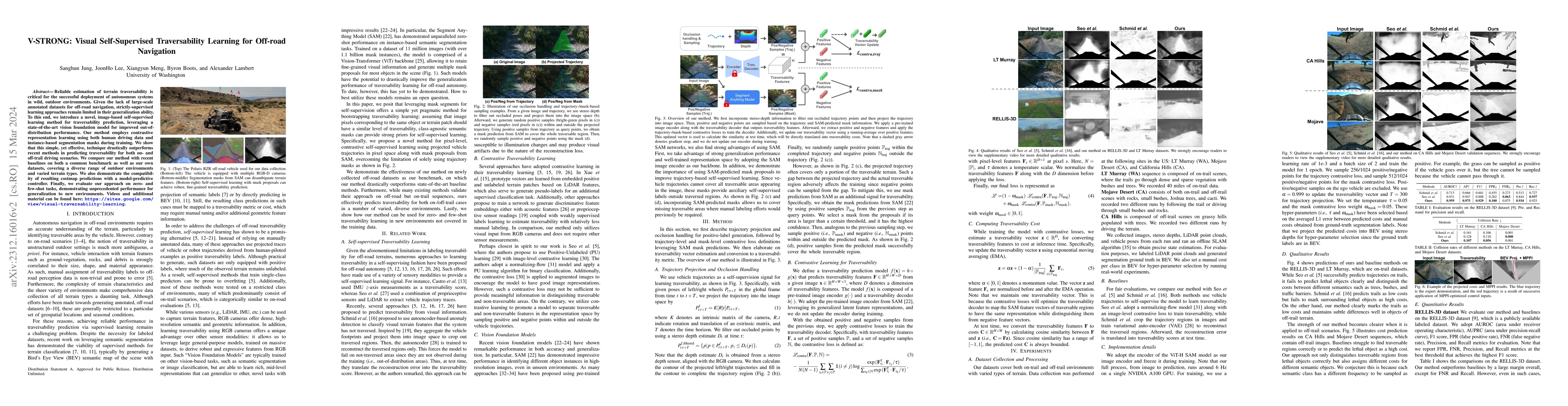
Reliable estimation of terrain traversability is critical for the successful deployment of autonomous systems in wild, outdoor environments. Given the lack of large-scale annotated datasets for off-...
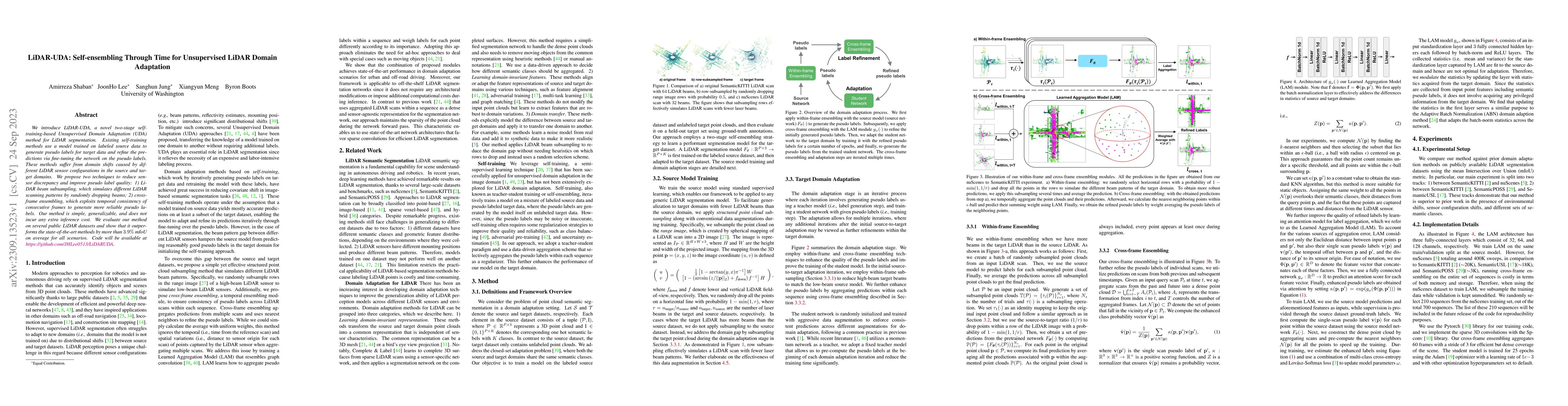
We introduce LiDAR-UDA, a novel two-stage self-training-based Unsupervised Domain Adaptation (UDA) method for LiDAR segmentation. Existing self-training methods use a model trained on labeled source...
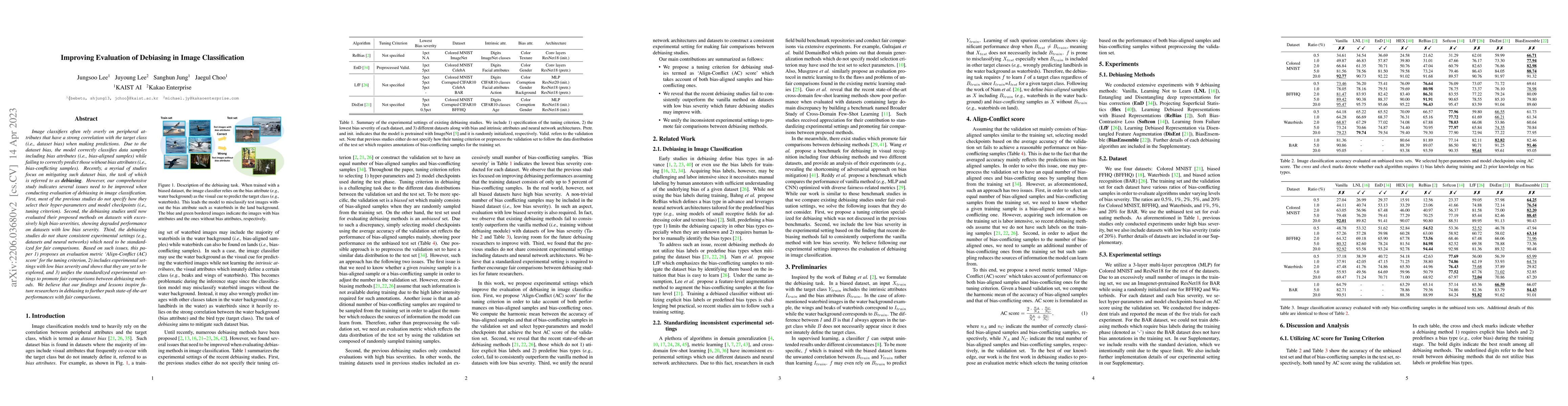
Image classifiers often rely overly on peripheral attributes that have a strong correlation with the target class (i.e., dataset bias) when making predictions. Due to the dataset bias, the model cor...
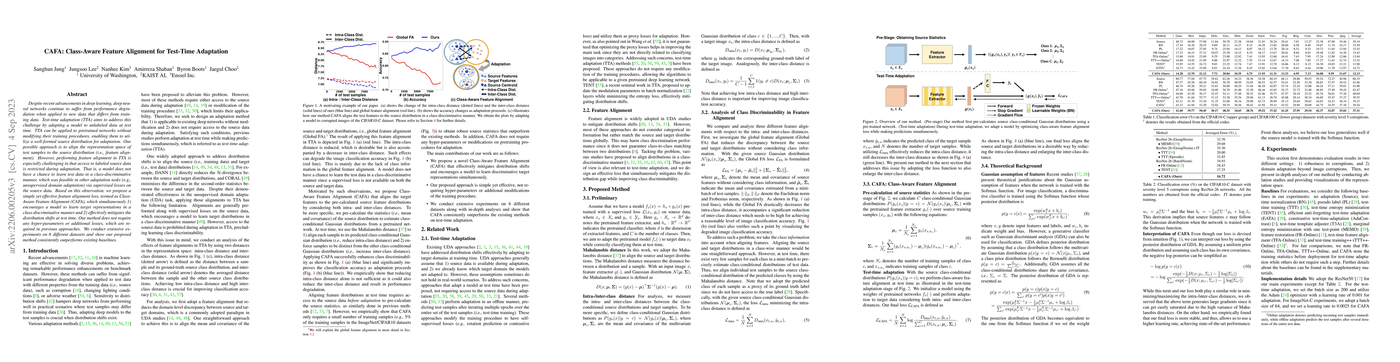
Despite recent advancements in deep learning, deep neural networks continue to suffer from performance degradation when applied to new data that differs from training data. Test-time adaptation (TTA...
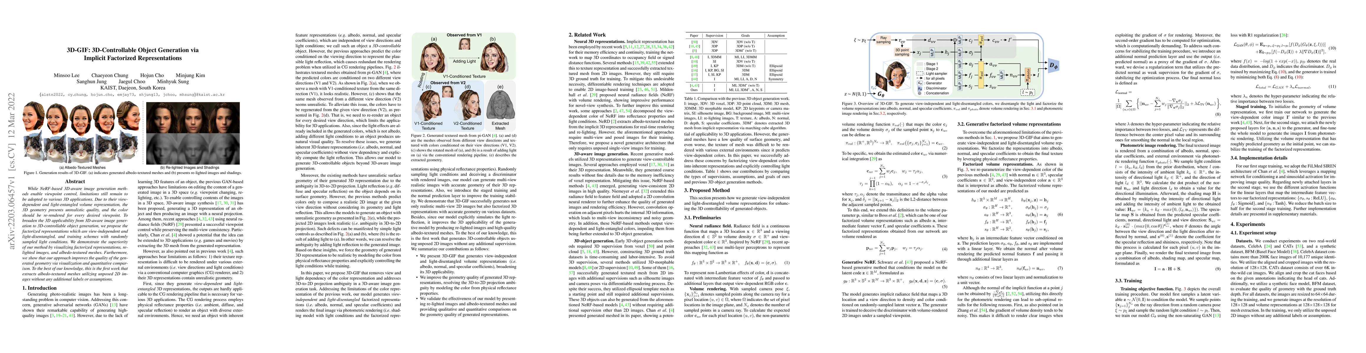
While NeRF-based 3D-aware image generation methods enable viewpoint control, limitations still remain to be adopted to various 3D applications. Due to their view-dependent and light-entangled volume...
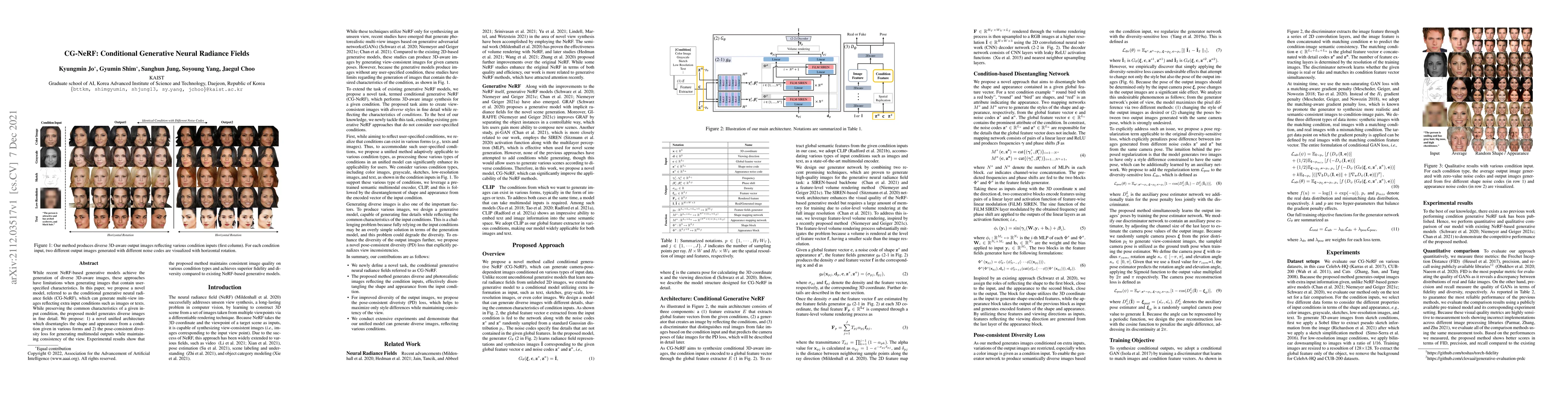
While recent NeRF-based generative models achieve the generation of diverse 3D-aware images, these approaches have limitations when generating images that contain user-specified characteristics. In ...
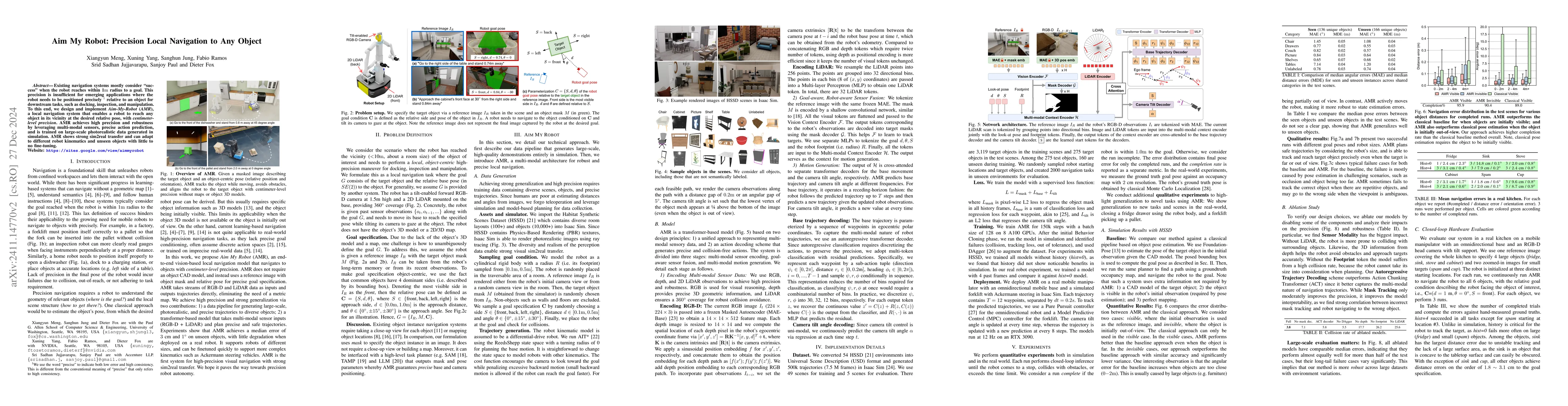
Existing navigation systems mostly consider "success" when the robot reaches within 1m radius to a goal. This precision is insufficient for emerging applications where the robot needs to be positioned...
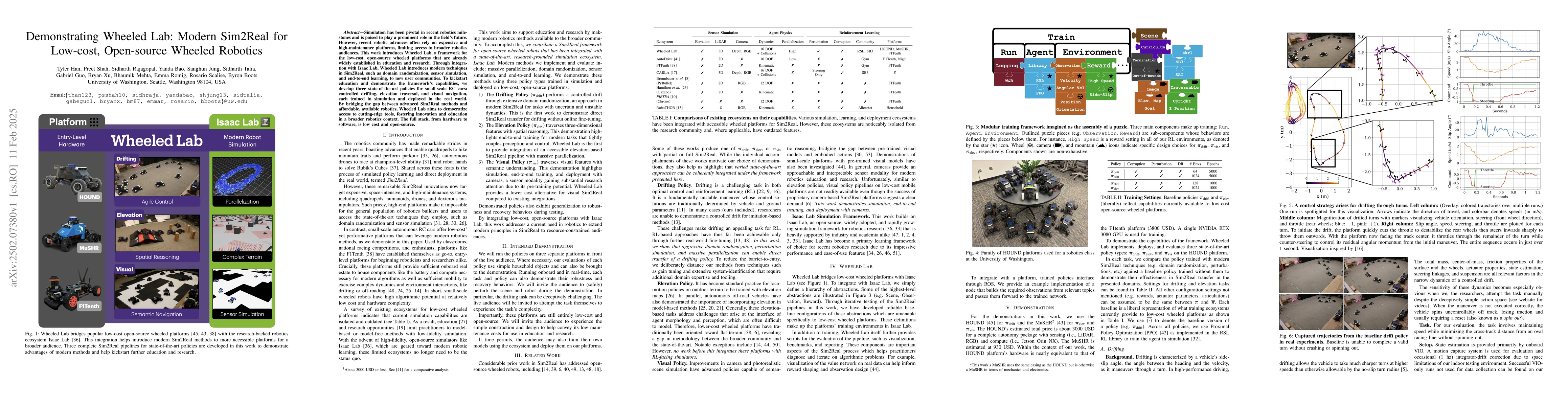
Simulation has been pivotal in recent robotics milestones and is poised to play a prominent role in the field's future. However, recent robotic advances often rely on expensive and high-maintenance pl...
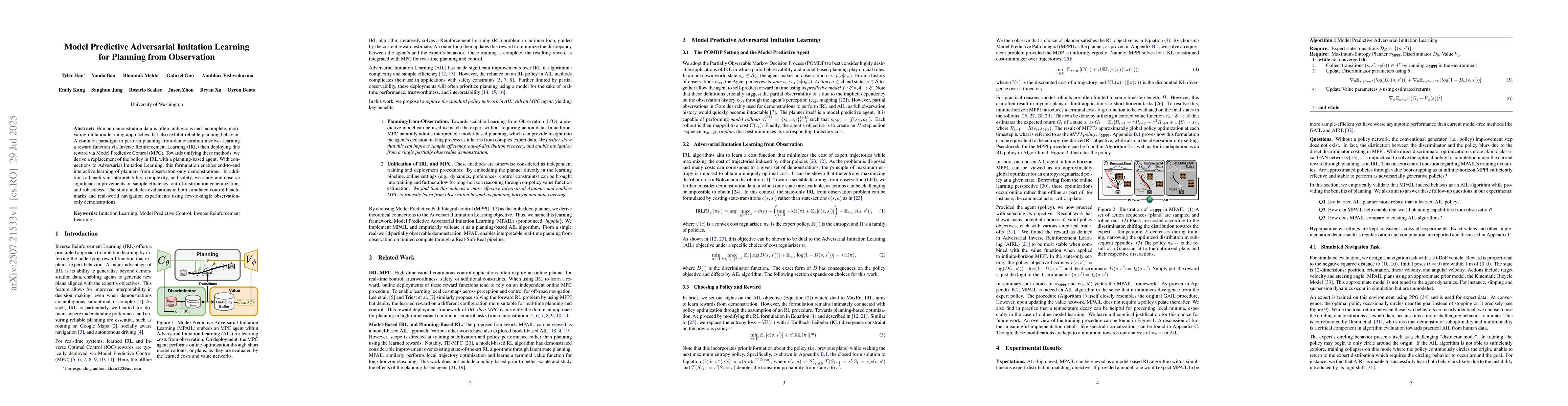
Human demonstration data is often ambiguous and incomplete, motivating imitation learning approaches that also exhibit reliable planning behavior. A common paradigm to perform planning-from-demonstrat...
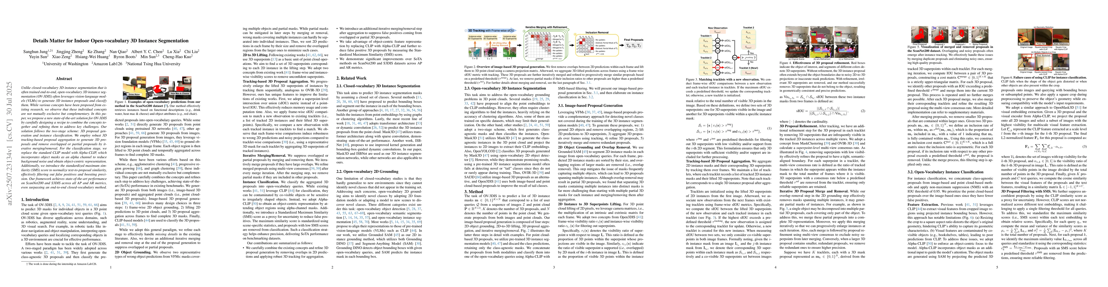
Unlike closed-vocabulary 3D instance segmentation that is often trained end-to-end, open-vocabulary 3D instance segmentation (OV-3DIS) often leverages vision-language models (VLMs) to generate 3D inst...
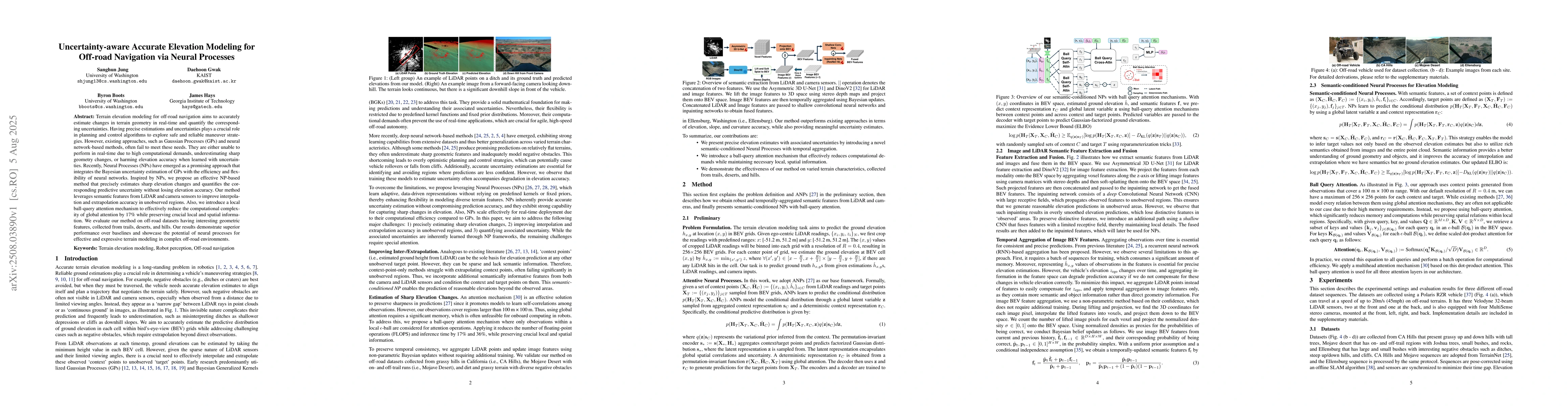
Terrain elevation modeling for off-road navigation aims to accurately estimate changes in terrain geometry in real-time and quantify the corresponding uncertainties. Having precise estimations and unc...
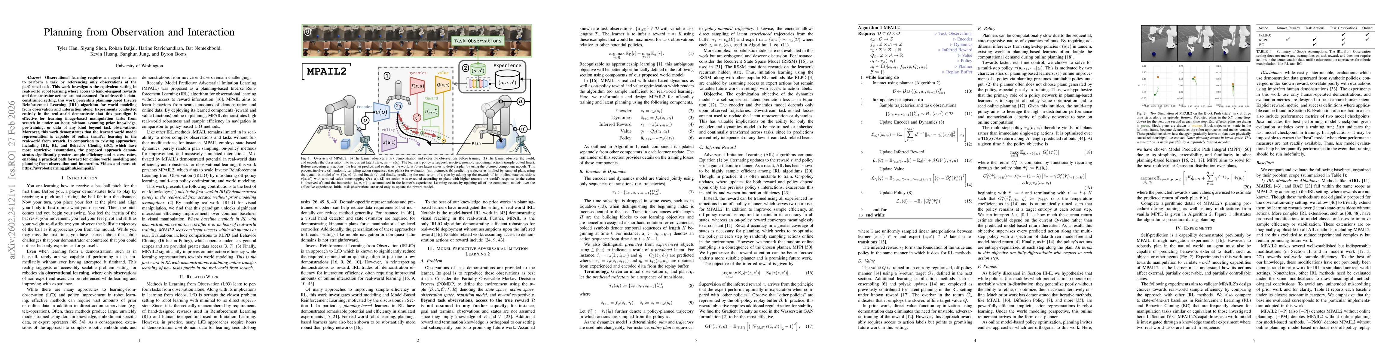
Observational learning requires an agent to learn to perform a task by referencing only observations of the performed task. This work investigates the equivalent setting in real-world robot learning w...