Saugat Adhikari

3 papers on arXiv

Academic Profile

Name: S. Adhikari
Total Papers: 7

Statistics

arXiv Papers 3
Total Publications 7

Papers on arXiv

Thumbnail for EvaNet: Elevation-Guided Flood Extent Mapping on Earth Imagery

EvaNet: Elevation-Guided Flood Extent Mapping on Earth Imagery

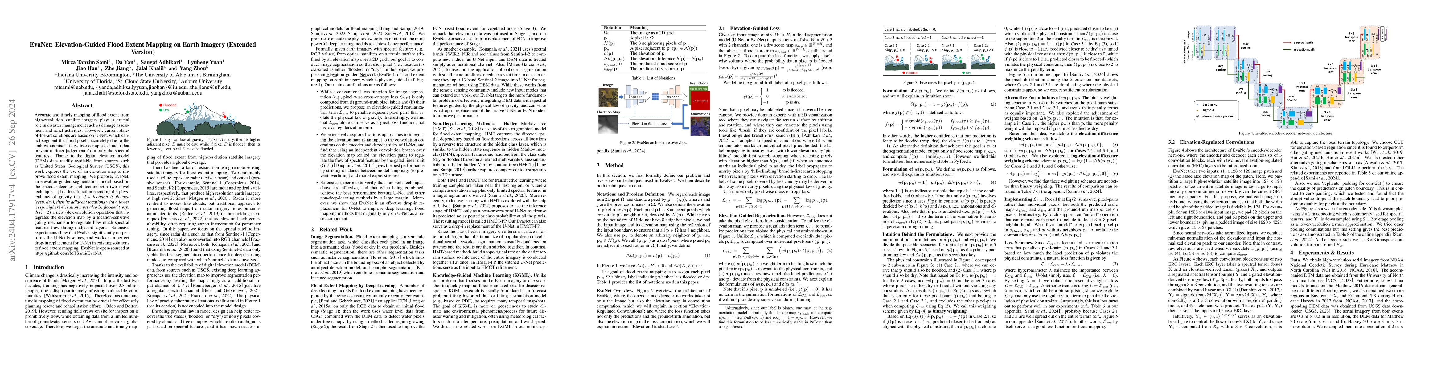
Accurate and timely mapping of flood extent from high-resolution satellite imagery plays a crucial role in disaster management such as damage assessment and relief activities. However, current state...

Thumbnail for Enabling Quick, Accurate Crowdsourced Annotation for Elevation-Aware
  Flood Extent Mapping

Enabling Quick, Accurate Crowdsourced Annotation for Elevation-Aware Flood Extent Mapping

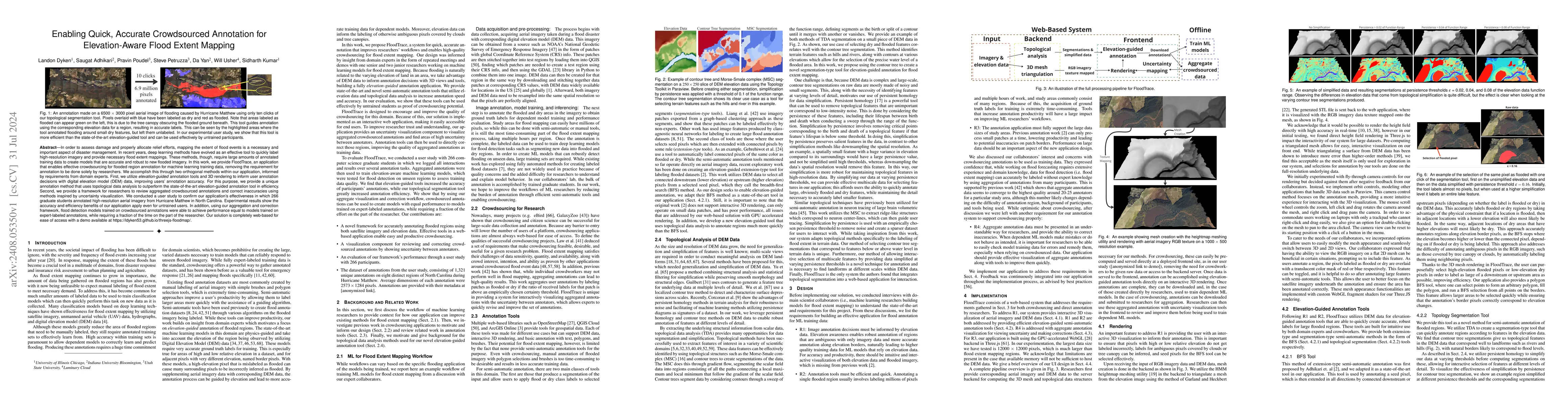
In order to assess damage and properly allocate relief efforts, mapping the extent of flood events is a necessary and important aspect of disaster management. In recent years, deep learning methods ha...

Thumbnail for EarthSpatialBench: Benchmarking Spatial Reasoning Capabilities of Multimodal LLMs on Earth Imagery

EarthSpatialBench: Benchmarking Spatial Reasoning Capabilities of Multimodal LLMs on Earth Imagery

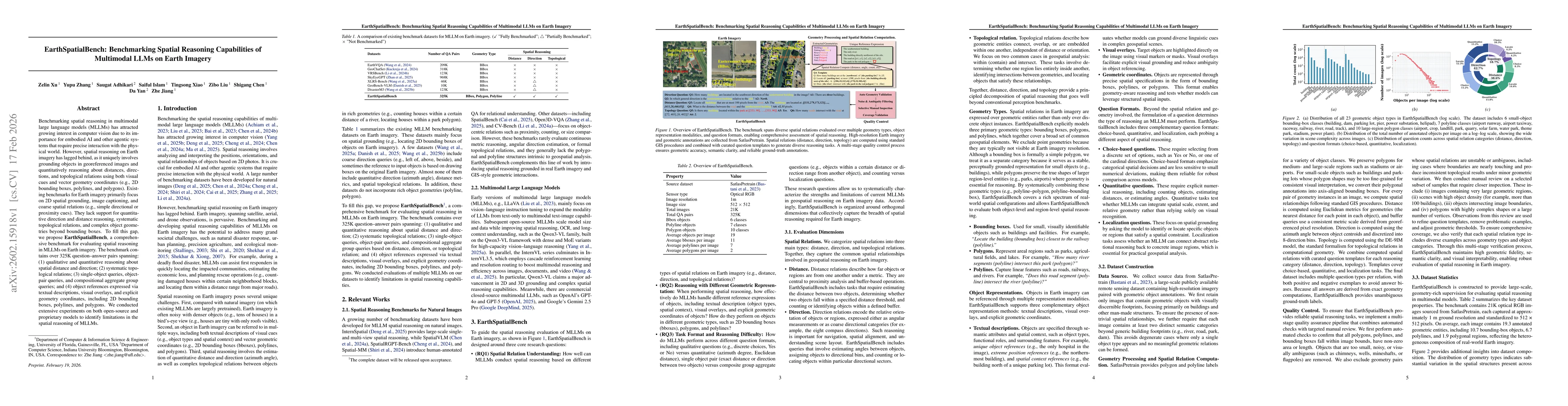
Benchmarking spatial reasoning in multimodal large language models (MLLMs) has attracted growing interest in computer vision due to its importance for embodied AI and other agentic systems that requir...

This website uses cookies to ensure you get the best experience. Learn more