Academic Profile
Statistics
Similar Authors
Papers on arXiv
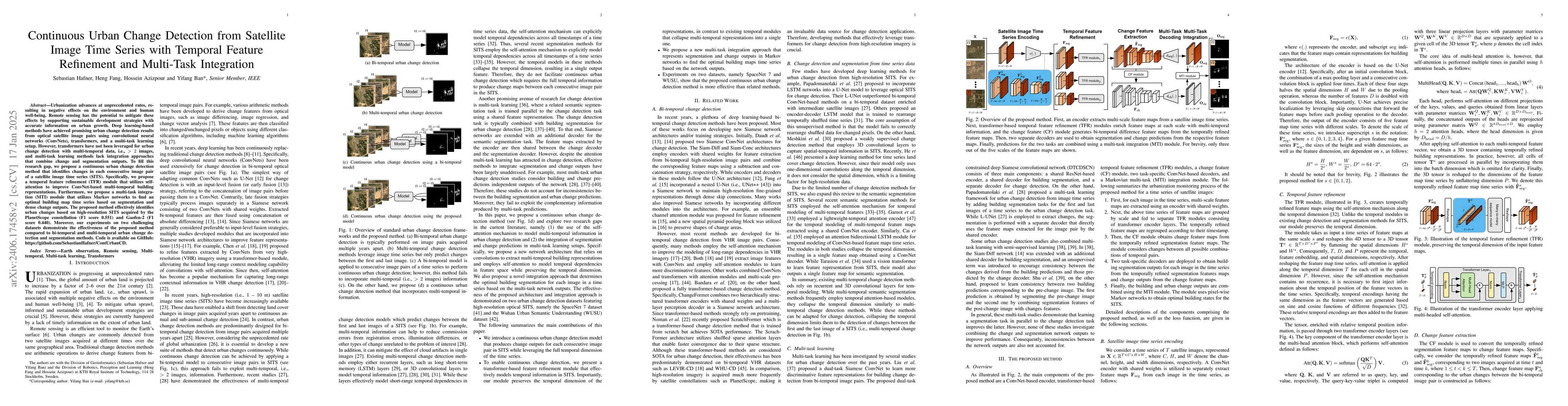
Urbanization advances at unprecedented rates, resulting in negative effects on the environment and human well-being. Remote sensing has the potential to mitigate these effects by supporting sustainabl...
This paper proposes a novel multi-temporal urban mapping approach using multi-modal satellite data from the Sentinel-1 Synthetic Aperture Radar (SAR) and Sentinel-2 MultiSpectral Instrument (MSI) mi...
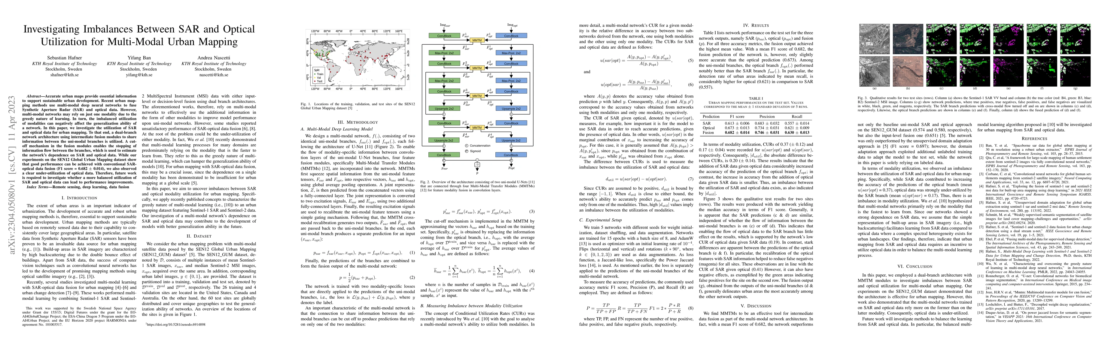
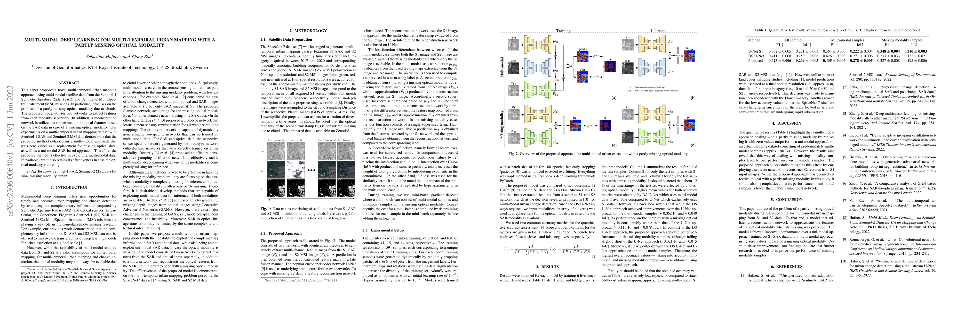
Accurate urban maps provide essential information to support sustainable urban development. Recent urban mapping methods use multi-modal deep neural networks to fuse Synthetic Aperture Radar (SAR) a...
To better understand current trends of urban population growth in Sub-Saharan Africa, high-quality spatiotemporal population estimates are necessary. While the joint use of remote sensing and deep l...
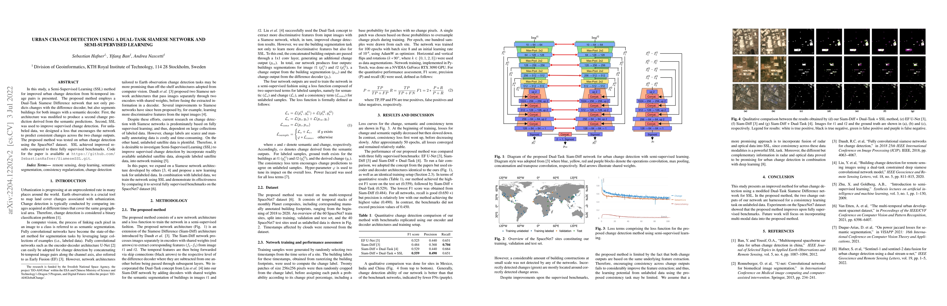
In this study, a Semi-Supervised Learning (SSL) method for improving urban change detection from bi-temporal image pairs was presented. The proposed method adapted a Dual-Task Siamese Difference net...
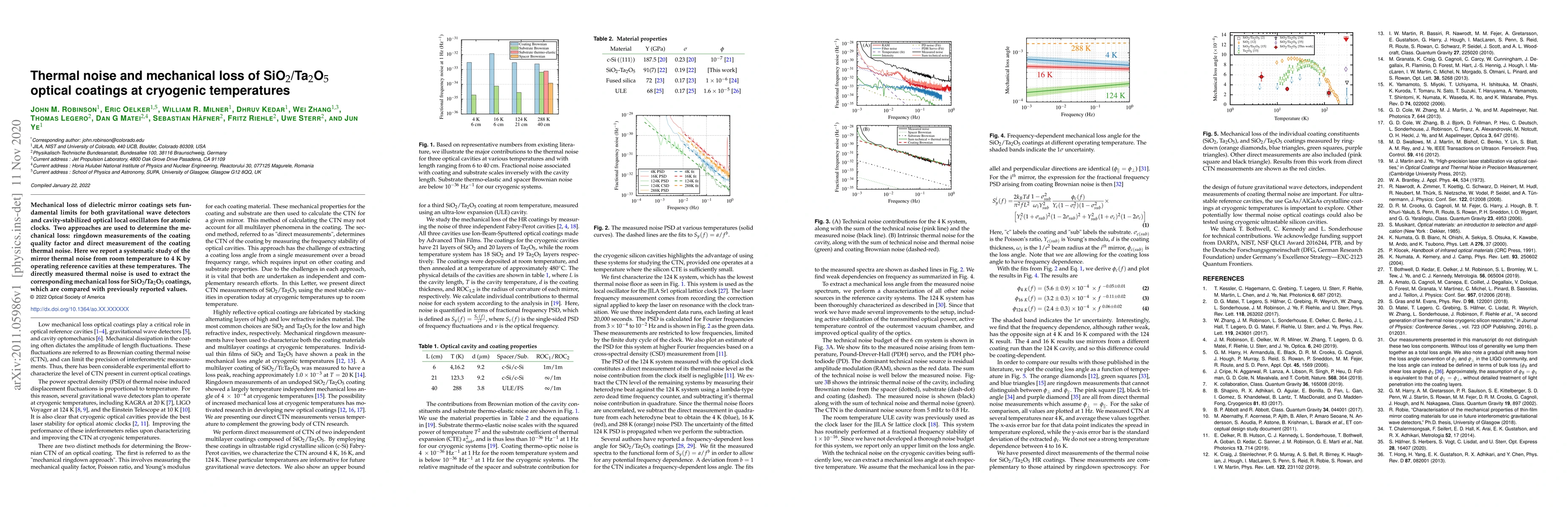
Mechanical loss of dielectric mirror coatings sets fundamental limits for both gravitational wave detectors and cavity-stabilized optical local oscillators for atomic clocks. Two approaches are used...
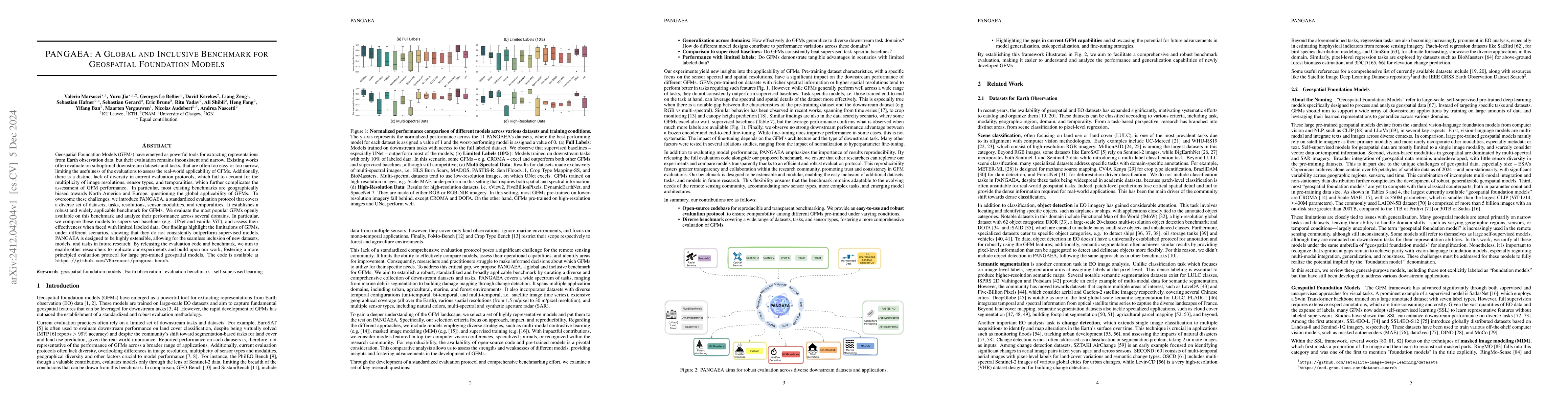
Geospatial Foundation Models (GFMs) have emerged as powerful tools for extracting representations from Earth observation data, but their evaluation remains inconsistent and narrow. Existing works ofte...
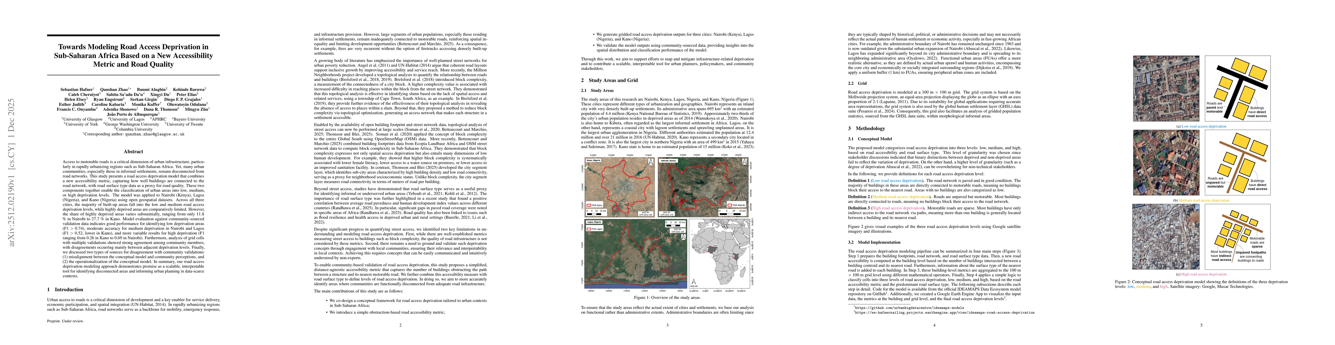
Access to motorable roads is a critical dimension of urban infrastructure, particularly in rapidly urbanizing regions such as Sub-Saharan Africa. Yet, many urban communities, especially those in infor...