Academic Profile
Statistics
Similar Authors
Papers on arXiv
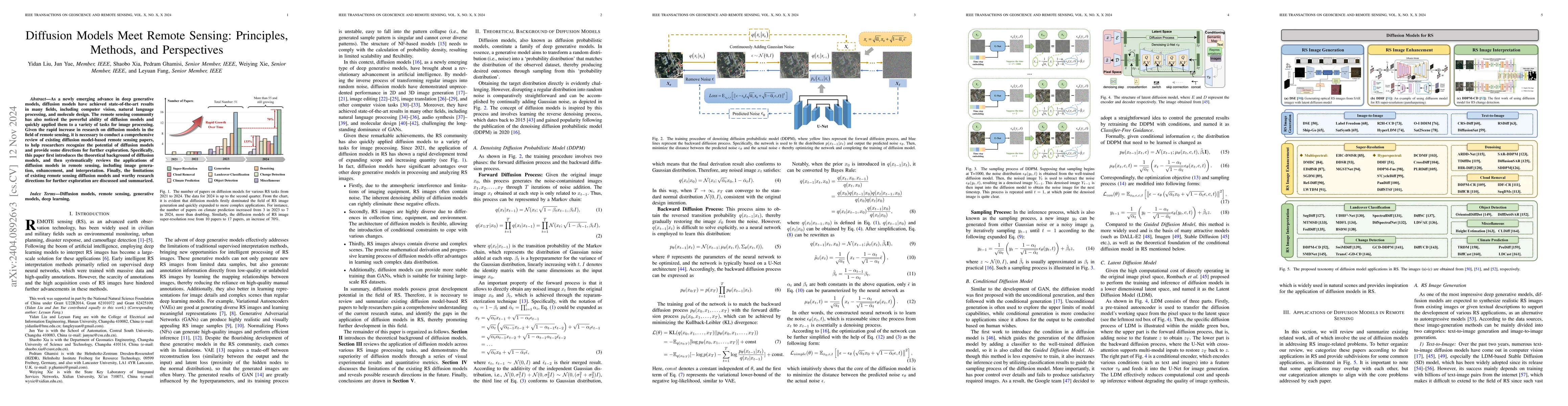
As a newly emerging advance in deep generative models, diffusion models have achieved state-of-the-art results in many fields, including computer vision, natural language processing, and molecule de...
We propose a weakly supervised semantic segmentation method for point clouds that predicts "per-point" labels from just "whole-scene" annotations while achieving the performance of recent fully supe...
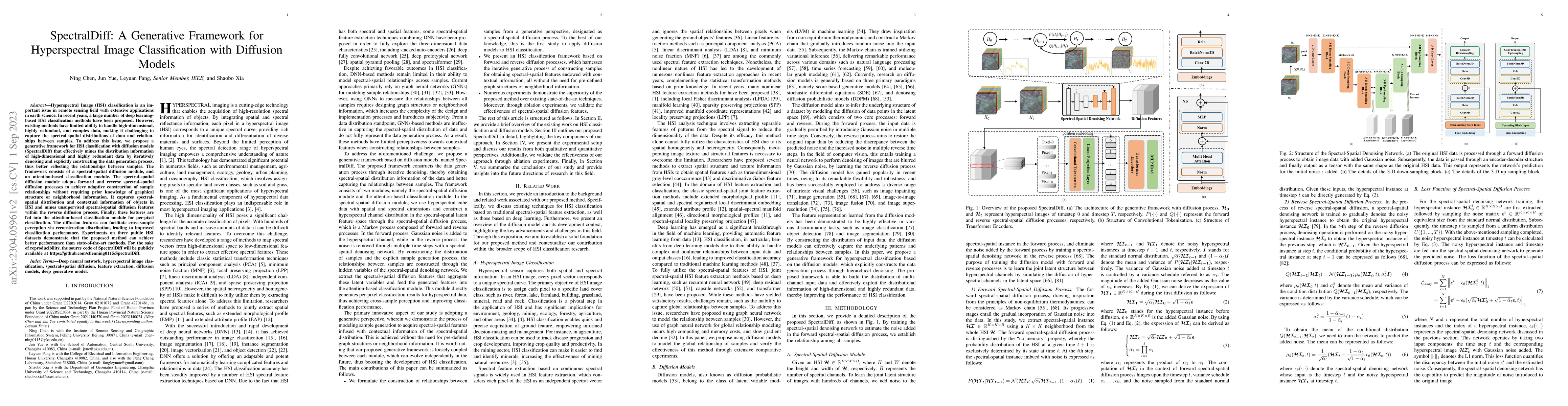
Hyperspectral Image (HSI) classification is an important issue in remote sensing field with extensive applications in earth science. In recent years, a large number of deep learning-based HSI classi...
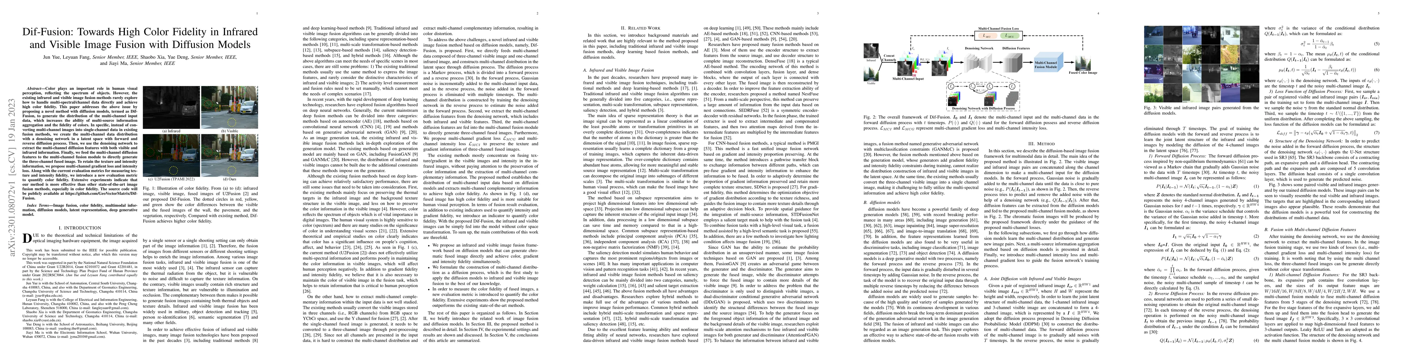
Color plays an important role in human visual perception, reflecting the spectrum of objects. However, the existing infrared and visible image fusion methods rarely explore how to handle multi-spect...
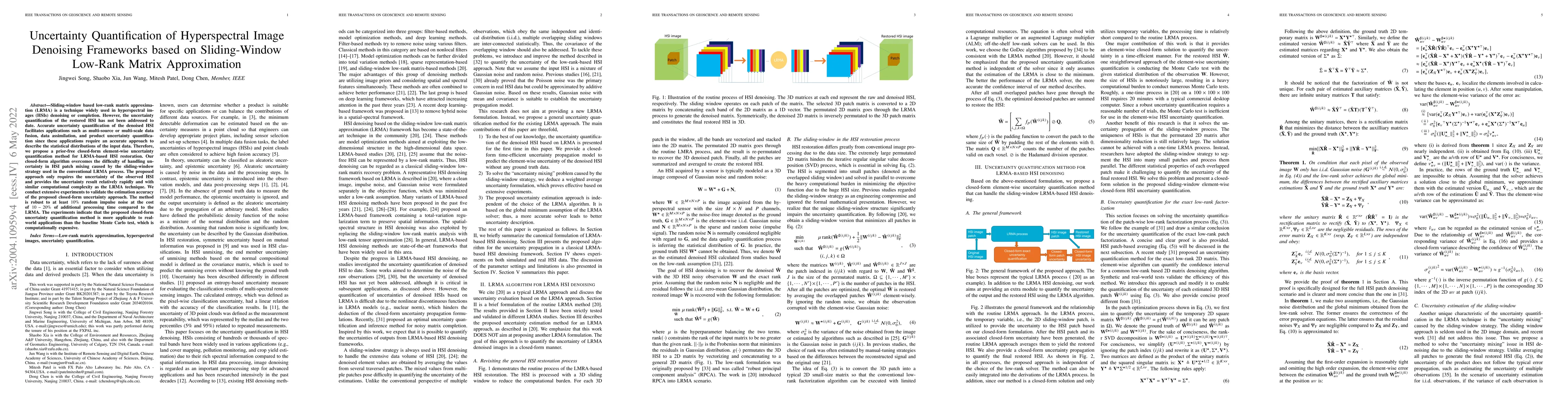
Sliding-window based low-rank matrix approximation (LRMA) is a technique widely used in hyperspectral images (HSIs) denoising or completion. However, the uncertainty quantification of the restored H...
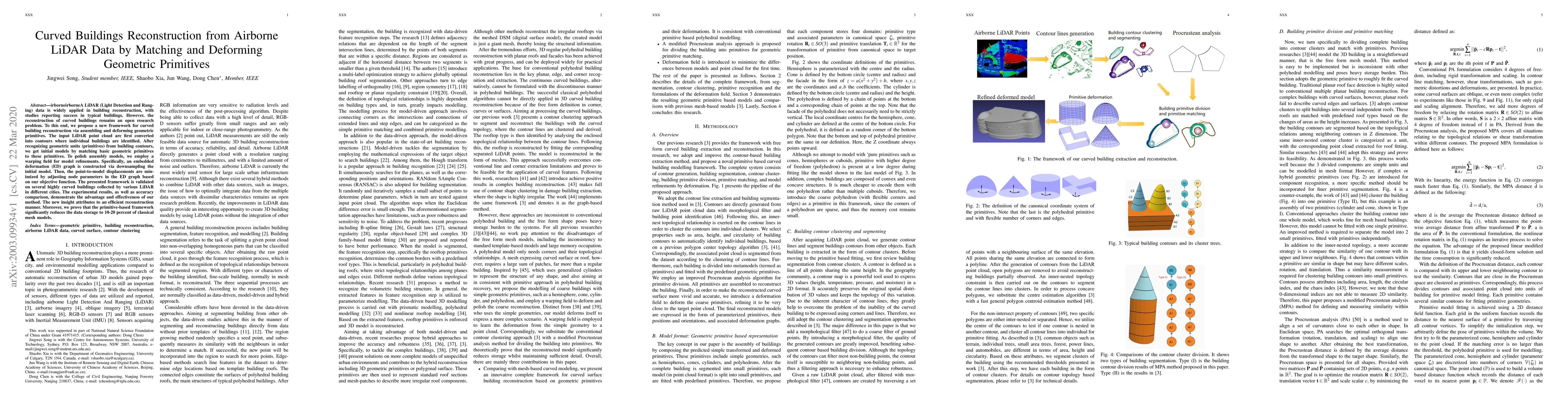
Airborne LiDAR (Light Detection and Ranging) data is widely applied in building reconstruction, with studies reporting success in typical buildings. However, the reconstruction of curved buildings r...
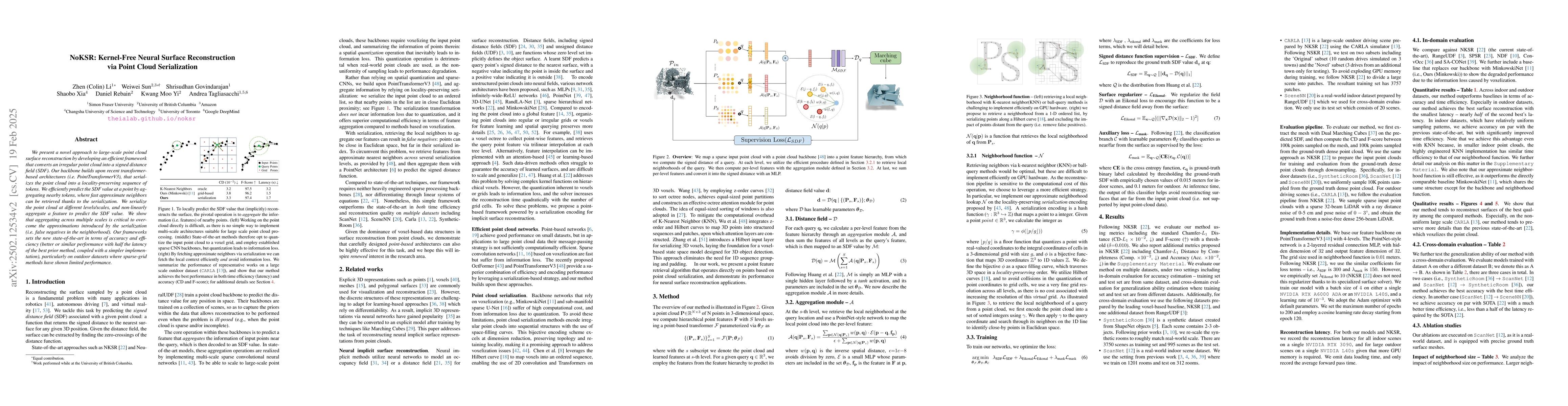
We present a novel approach to large-scale point cloud surface reconstruction by developing an efficient framework that converts an irregular point cloud into a signed distance field (SDF). Our backbo...
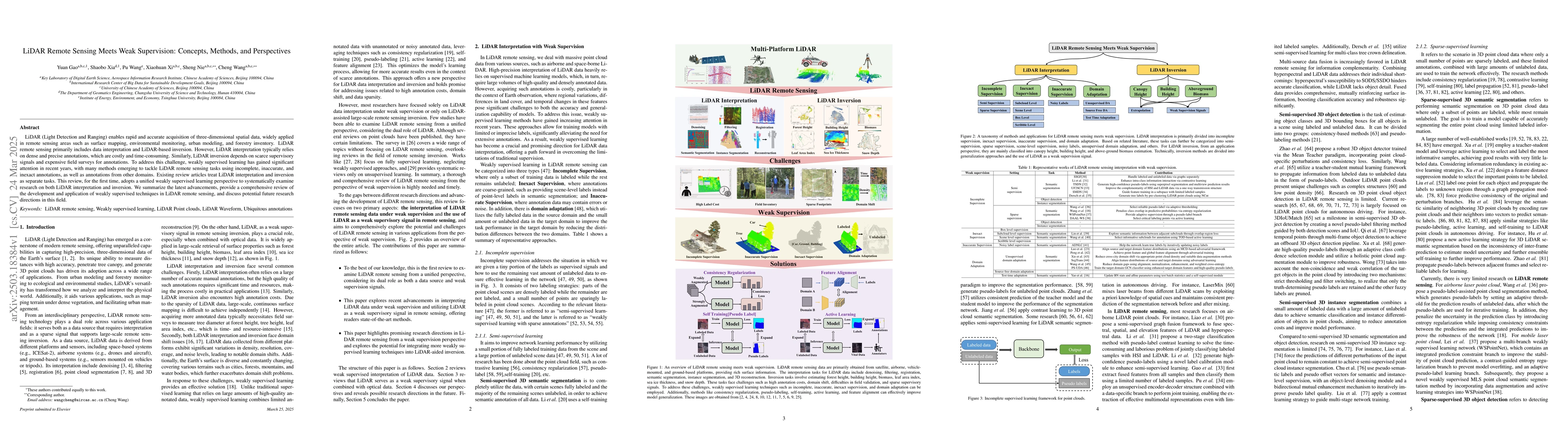
LiDAR (Light Detection and Ranging) enables rapid and accurate acquisition of three-dimensional spatial data, widely applied in remote sensing areas such as surface mapping, environmental monitoring, ...
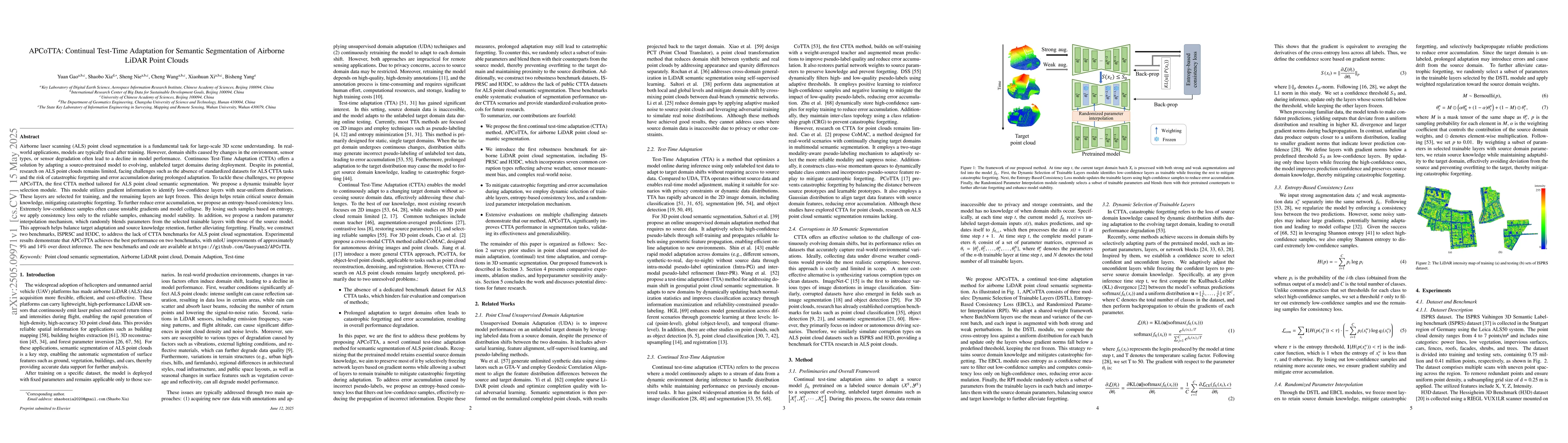
Airborne laser scanning (ALS) point cloud segmentation is a fundamental task for large-scale 3D scene understanding. In real-world applications, models are typically fixed after training. However, dom...
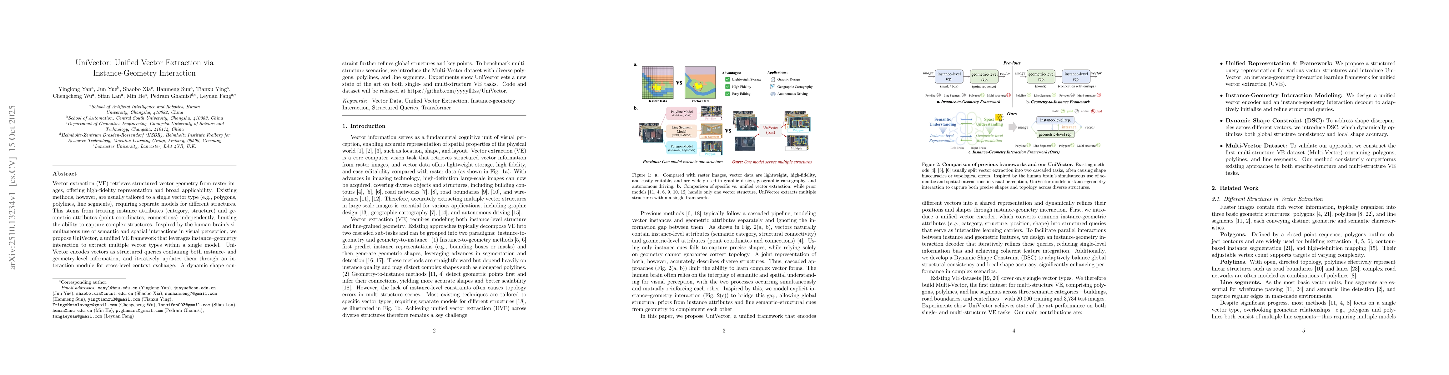
Vector extraction retrieves structured vector geometry from raster images, offering high-fidelity representation and broad applicability. Existing methods, however, are usually tailored to a single ve...
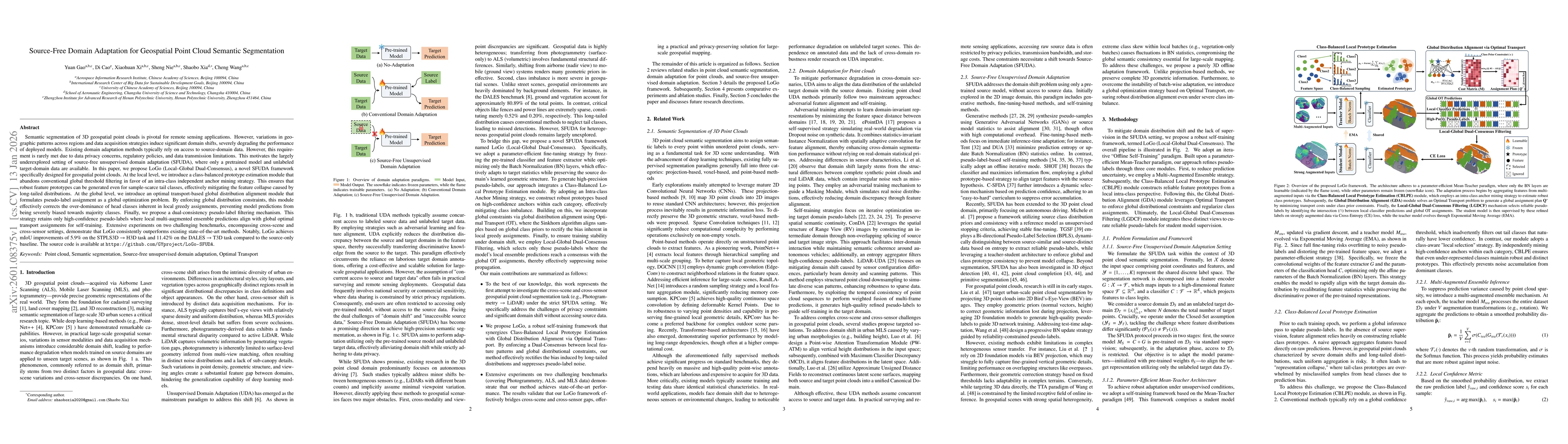
Semantic segmentation of 3D geospatial point clouds is pivotal for remote sensing applications. However, variations in geographic patterns across regions and data acquisition strategies induce signifi...
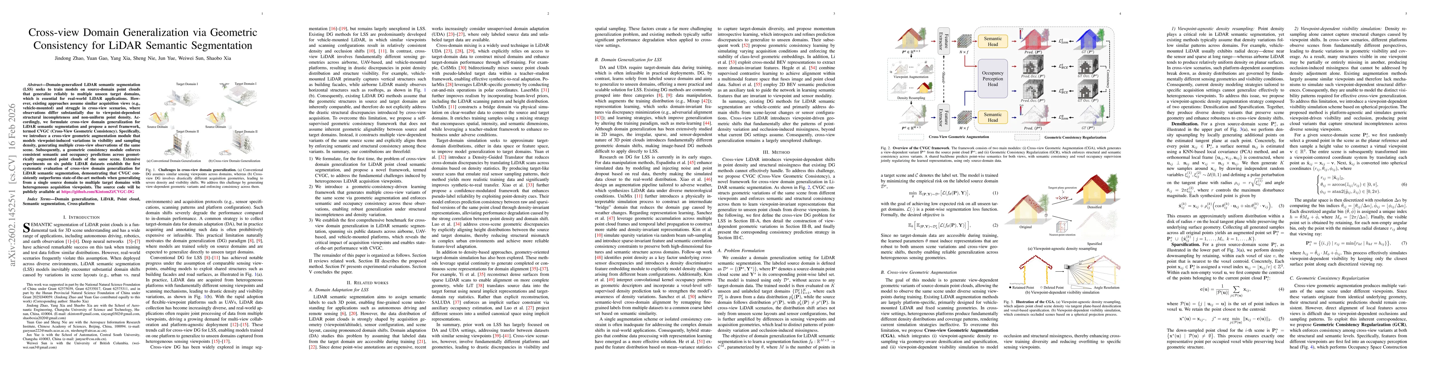
Domain-generalized LiDAR semantic segmentation (LSS) seeks to train models on source-domain point clouds that generalize reliably to multiple unseen target domains, which is essential for real-world L...
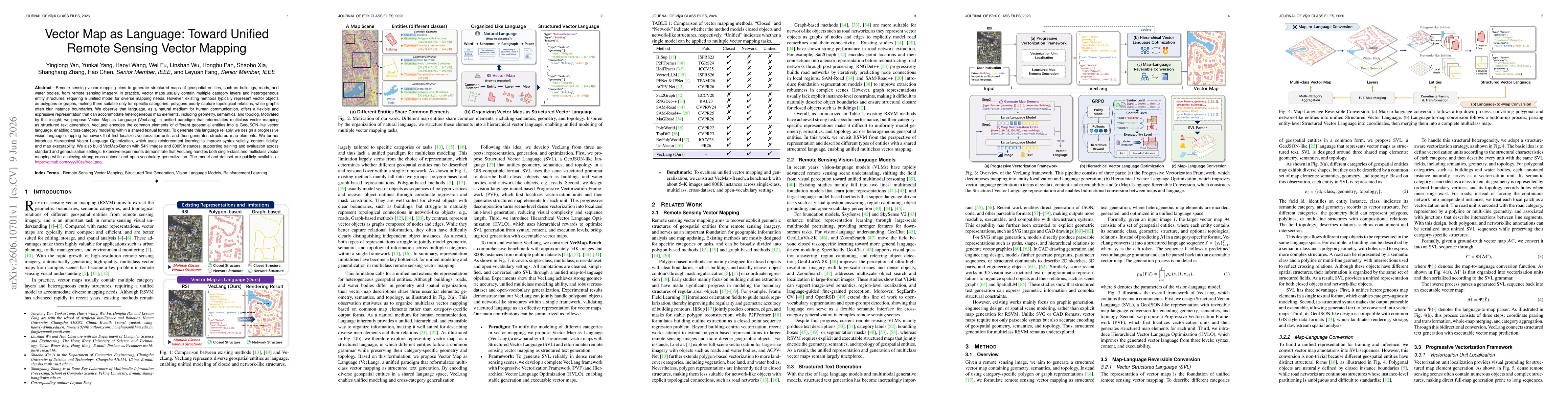
Remote sensing vector mapping aims to generate structured maps of geospatial entities, such as buildings, roads, and water bodies, from remote sensing imagery. In practice, vector maps usually contain...