Academic Profile
Statistics
Similar Authors
Papers on arXiv
Given a set \emph{S} of spatial feature types, its feature instances, a study area, and a neighbor relationship, the goal is to find pairs $<$a region ($r_{g}$), a subset \emph{C} of \emph{S}$>$ such ...
Given a collection of Boolean spatial feature types, their instances, a neighborhood relation (e.g., proximity), and a hierarchical taxonomy of the feature types, the goal is to find the subsets of ...
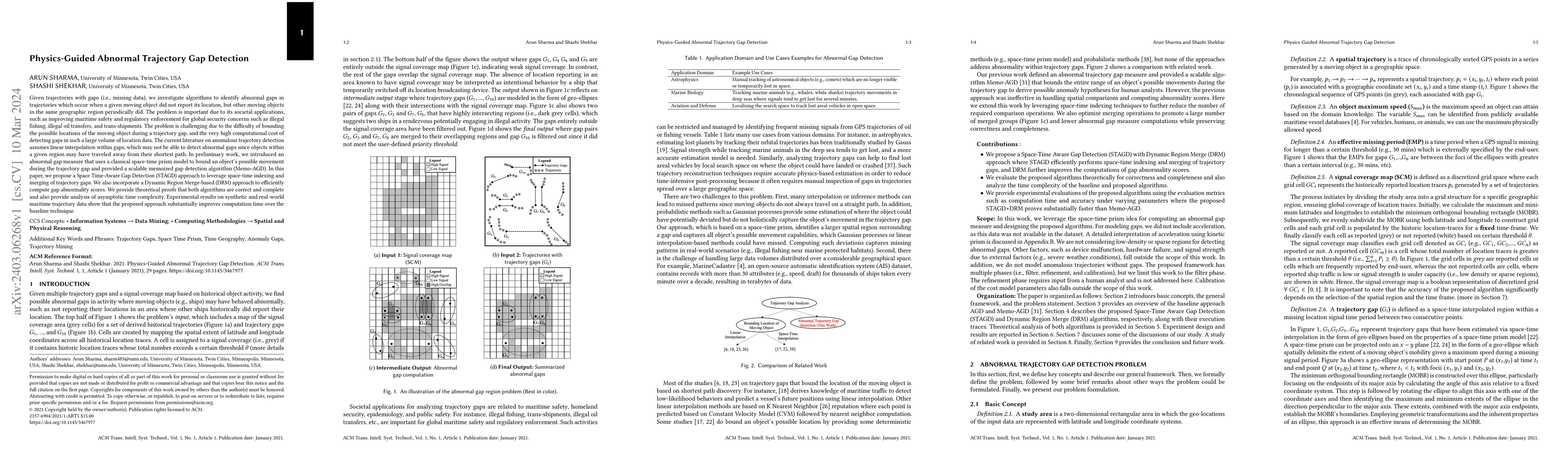
Given trajectories with gaps (i.e., missing data), we investigate algorithms to identify abnormal gaps in trajectories which occur when a given moving object did not report its location, but other m...
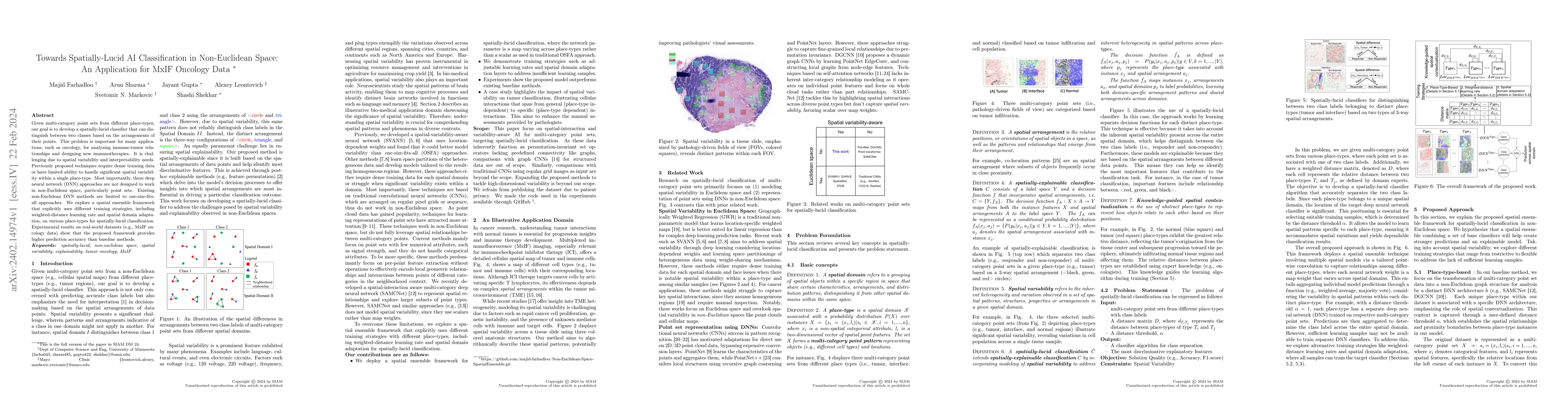
Given multi-category point sets from different place-types, our goal is to develop a spatially-lucid classifier that can distinguish between two classes based on the arrangements of their points. Th...
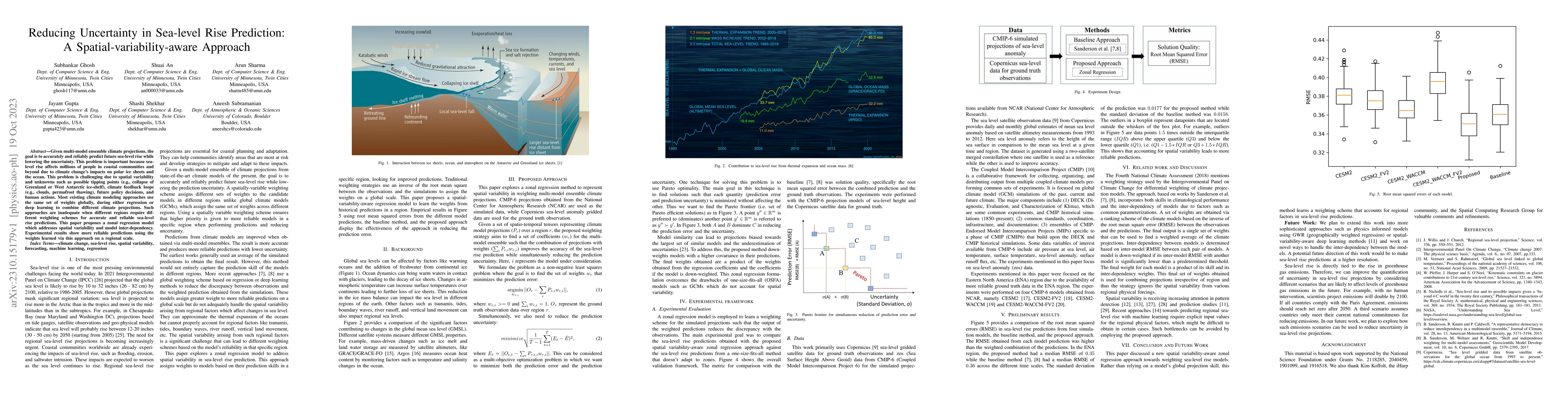
Given multi-model ensemble climate projections, the goal is to accurately and reliably predict future sea-level rise while lowering the uncertainty. This problem is important because sea-level rise ...
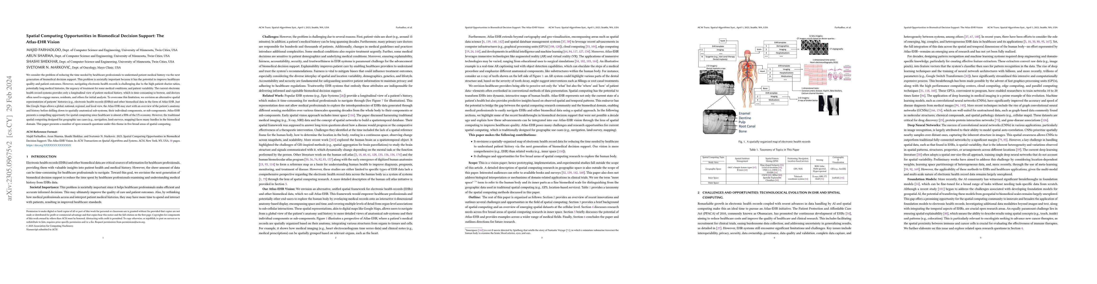
We consider the problem of reducing the time needed by healthcare professionals to understand patient medical history via the next generation of biomedical decision support. This problem is societal...
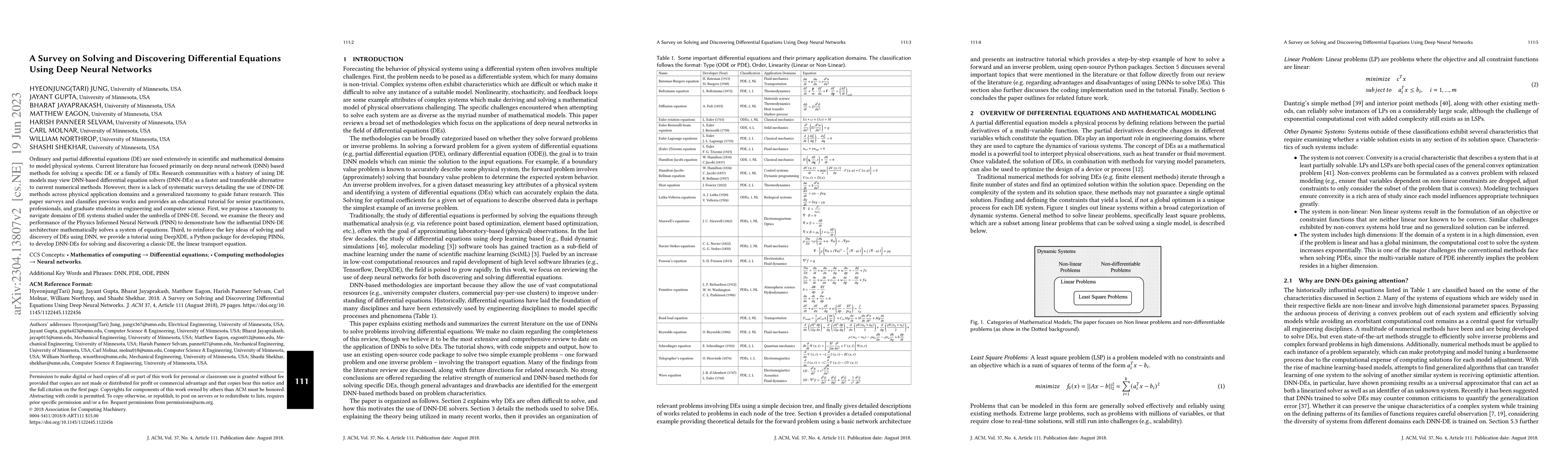
Ordinary and partial differential equations (DE) are used extensively in scientific and mathematical domains to model physical systems. Current literature has focused primarily on deep neural networ...
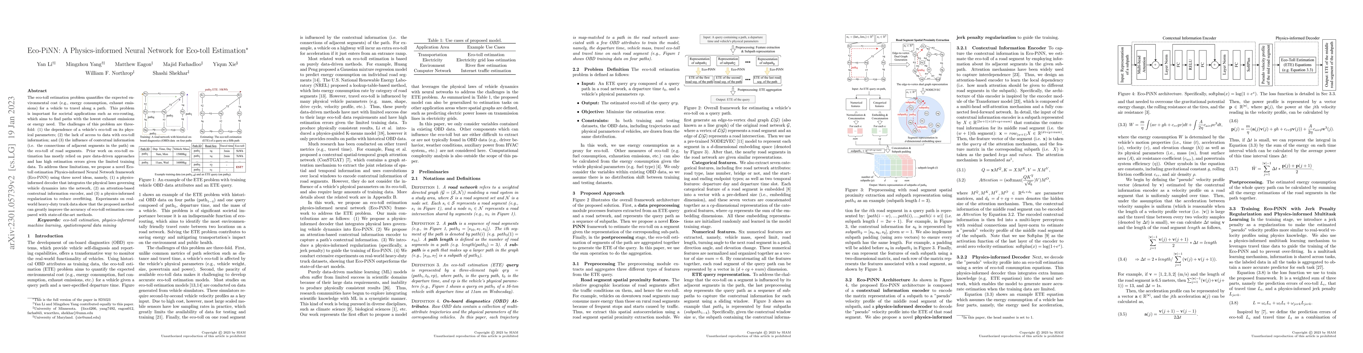
The eco-toll estimation problem quantifies the expected environmental cost (e.g., energy consumption, exhaust emissions) for a vehicle to travel along a path. This problem is important for societal ...
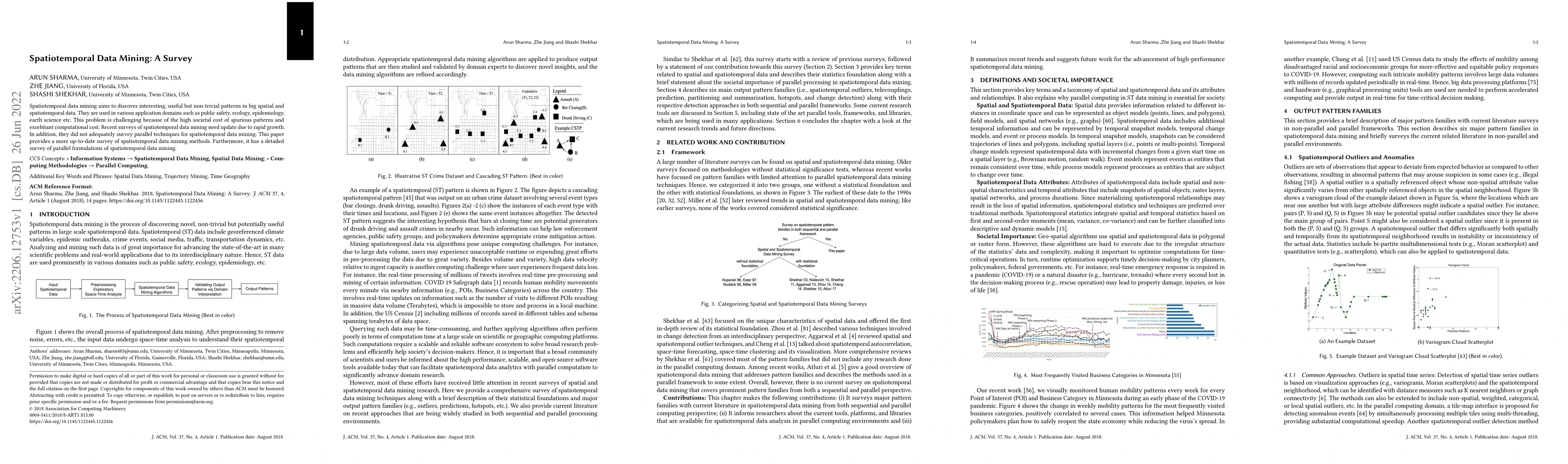
Spatiotemporal data mining aims to discover interesting, useful but non-trivial patterns in big spatial and spatiotemporal data. They are used in various application domains such as public safety, e...
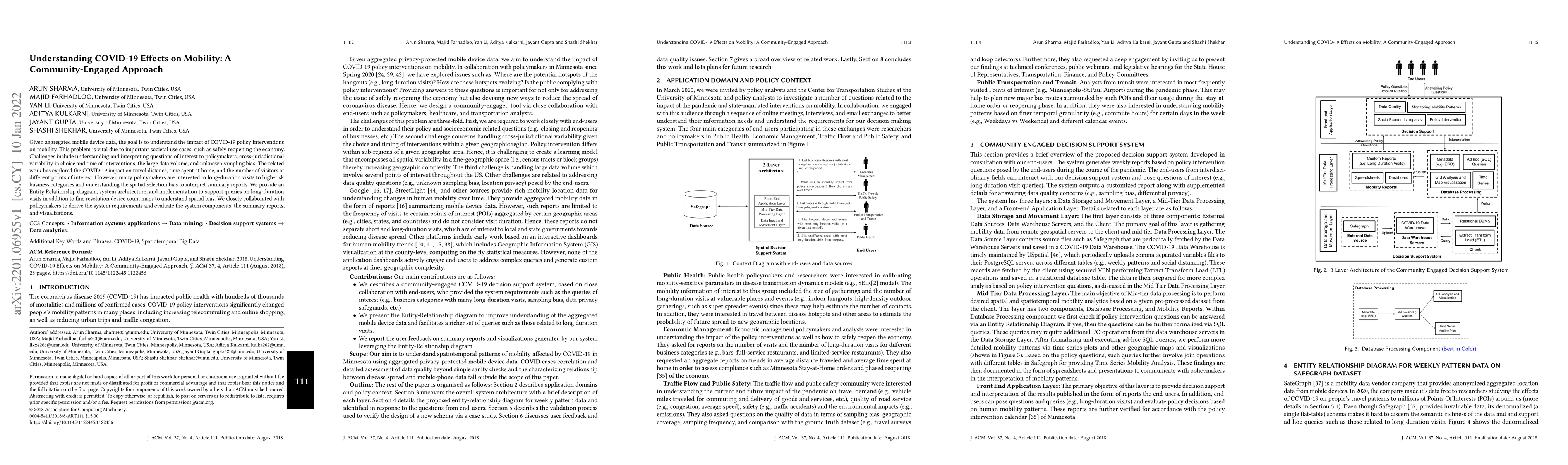
Given aggregated mobile device data, the goal is to understand the impact of COVID-19 policy interventions on mobility. This problem is vital due to important societal use cases, such as safely reop...
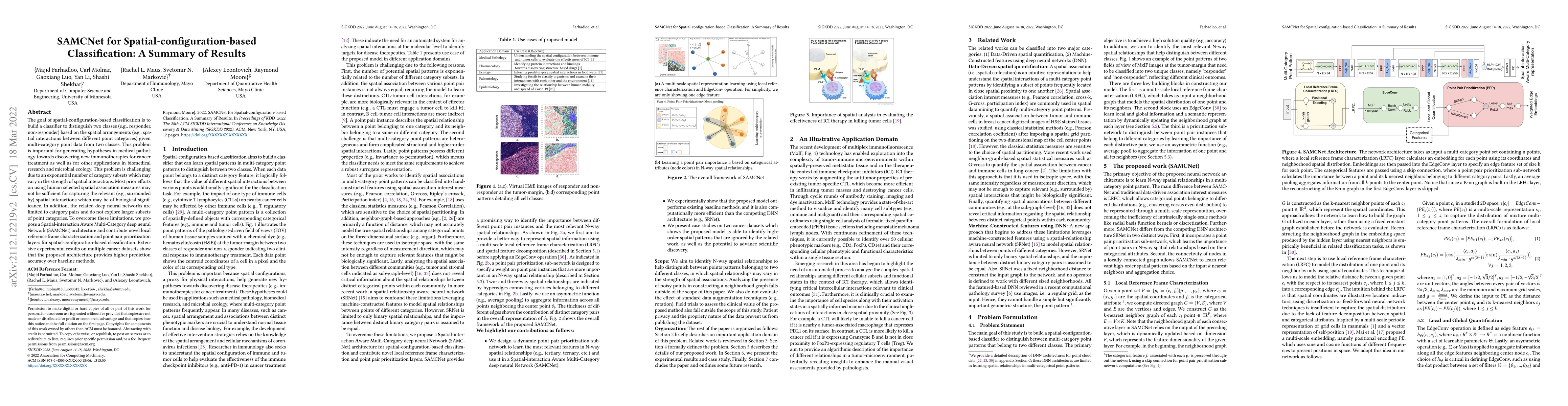
The goal of spatial-configuration-based classification is to build a classifier to distinguish two classes (e.g., responder, non-responder) based on the spatial arrangements (e.g., spatial interacti...
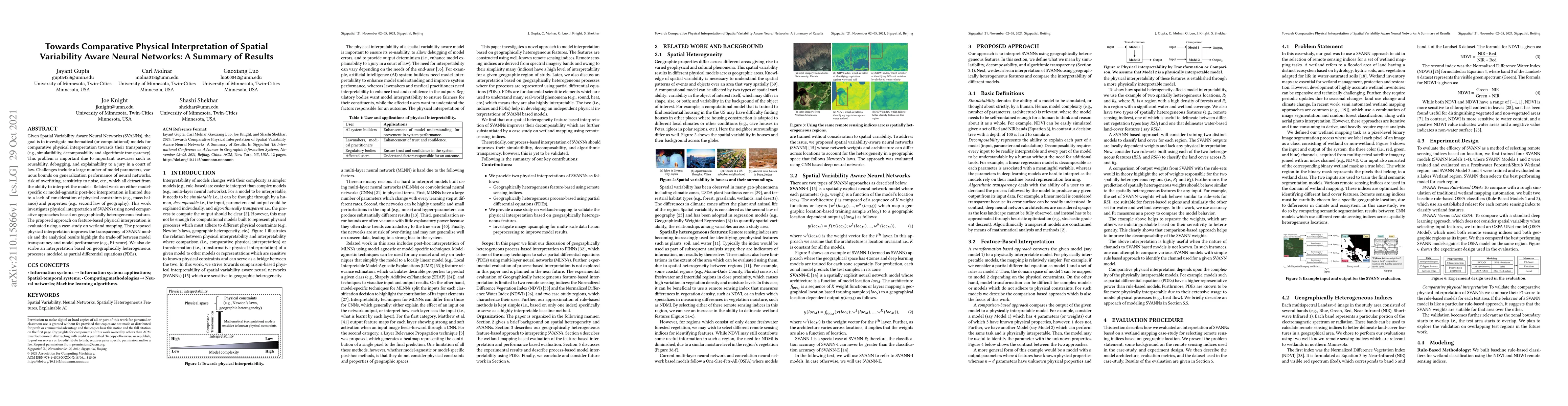
Given Spatial Variability Aware Neural Networks (SVANNs), the goal is to investigate mathematical (or computational) models for comparative physical interpretation towards their transparency (e.g., ...
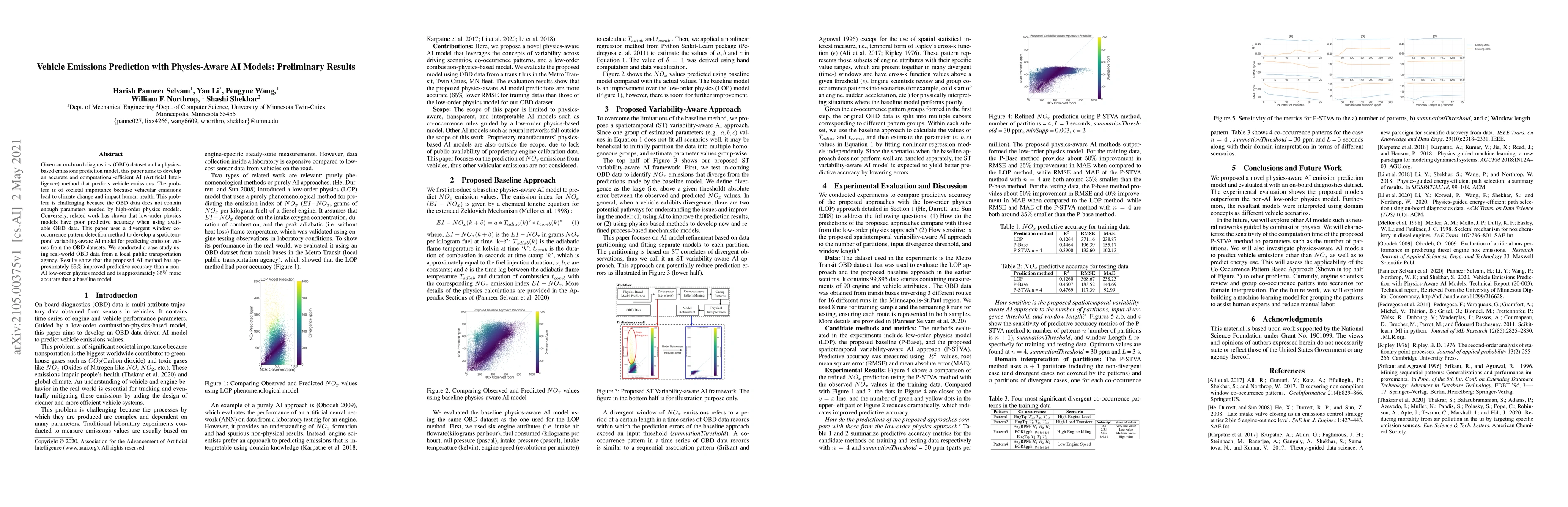
Given an on-board diagnostics (OBD) dataset and a physics-based emissions prediction model, this paper aims to develop an accurate and computational-efficient AI (Artificial Intelligence) method tha...
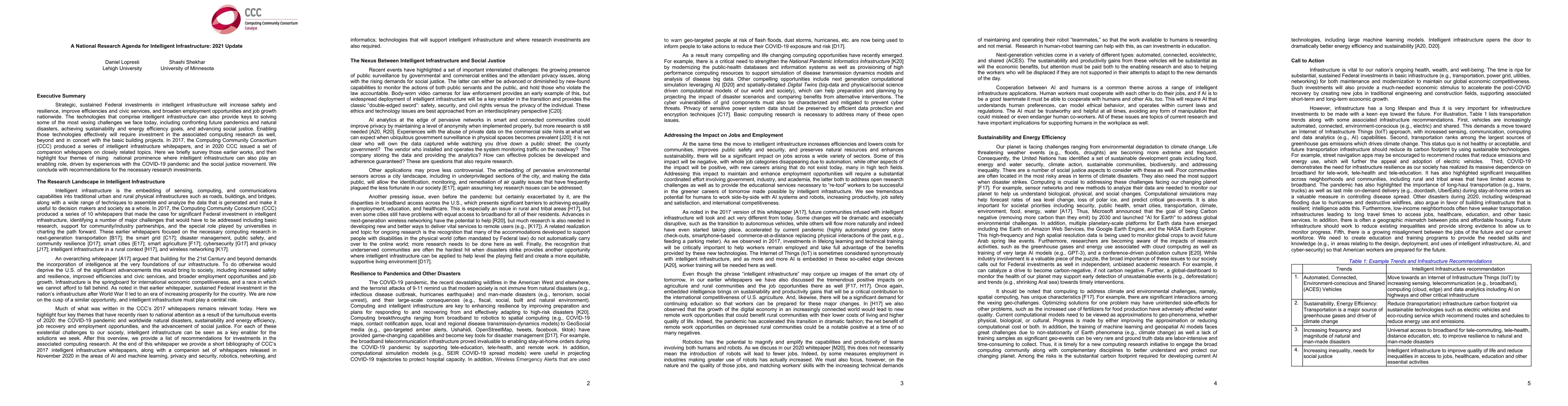
Strategic, sustained Federal investments in intelligent infrastructure will increase safety and resilience, improve efficiencies and civic services, and broaden employment opportunities and job grow...
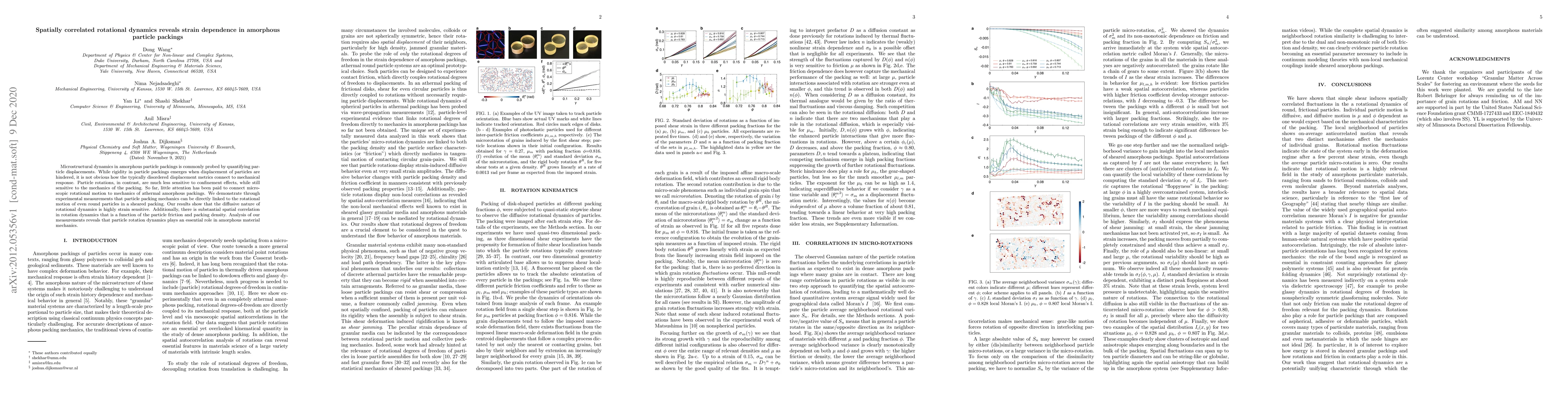
Microstructural dynamics in amorphous particle packings is commonly probed by quantifying particle displacements. While rigidity in particle packings emerges when displacement of particles are hinde...
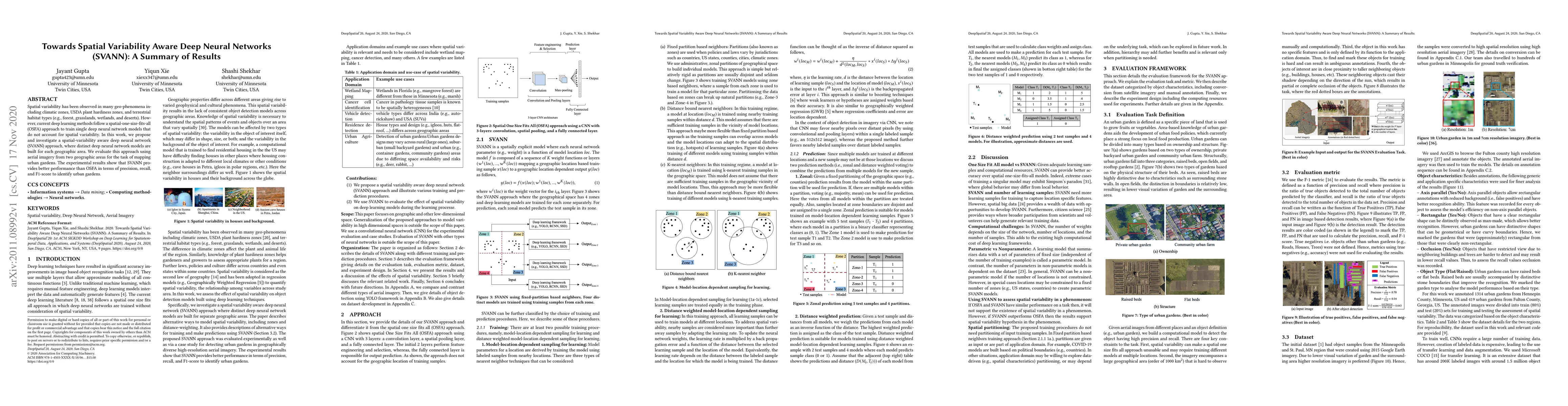
Spatial variability has been observed in many geo-phenomena including climatic zones, USDA plant hardiness zones, and terrestrial habitat types (e.g., forest, grasslands, wetlands, and deserts). How...
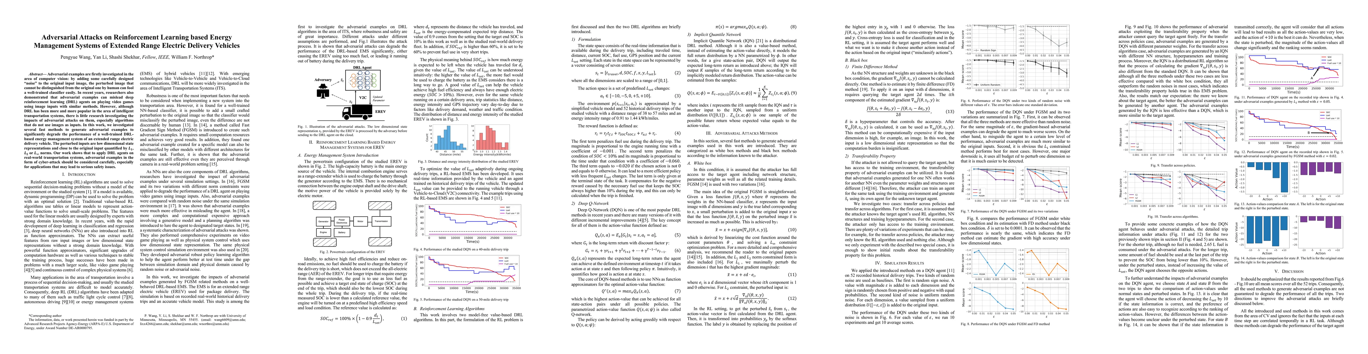
Adversarial examples are firstly investigated in the area of computer vision: by adding some carefully designed ''noise'' to the original input image, the perturbed image that cannot be distinguishe...
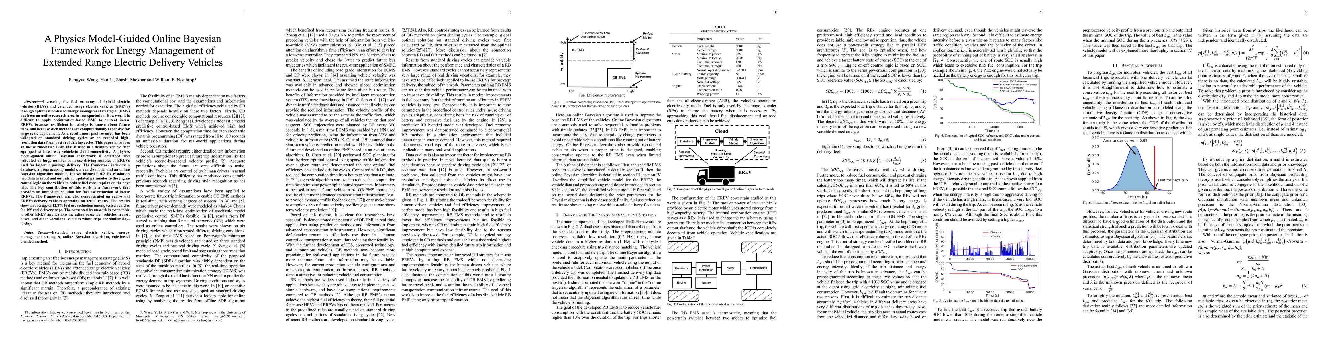
Increasing the fuel economy of hybrid electric vehicles (HEVs) and extended range electric vehicles (EREVs) through optimization-based energy management strategies (EMS) has been an active research ...
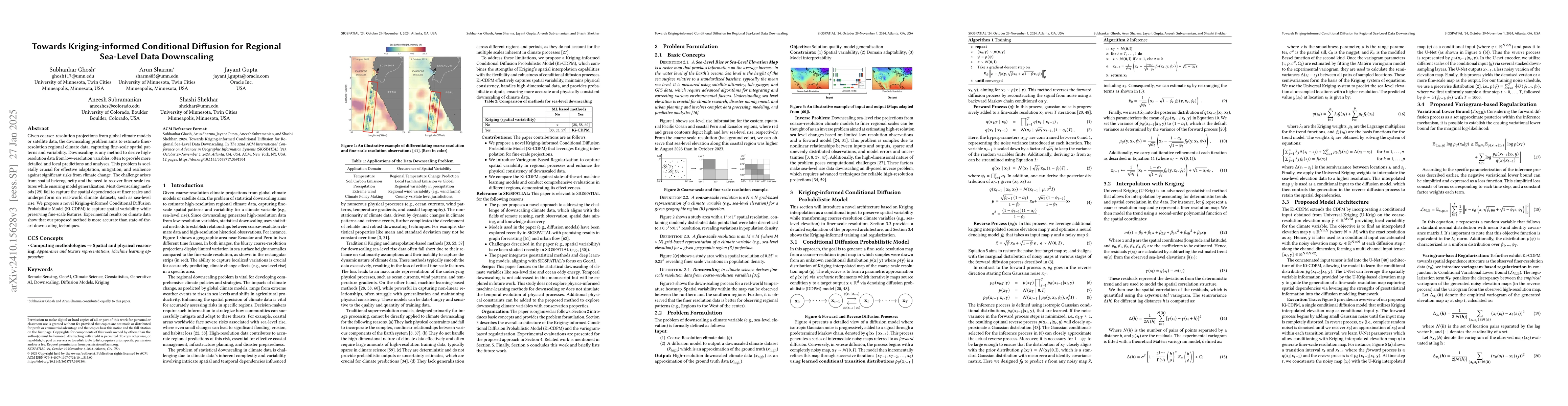
Given coarser-resolution projections from global climate models or satellite data, the downscaling problem aims to estimate finer-resolution regional climate data, capturing fine-scale spatial pattern...
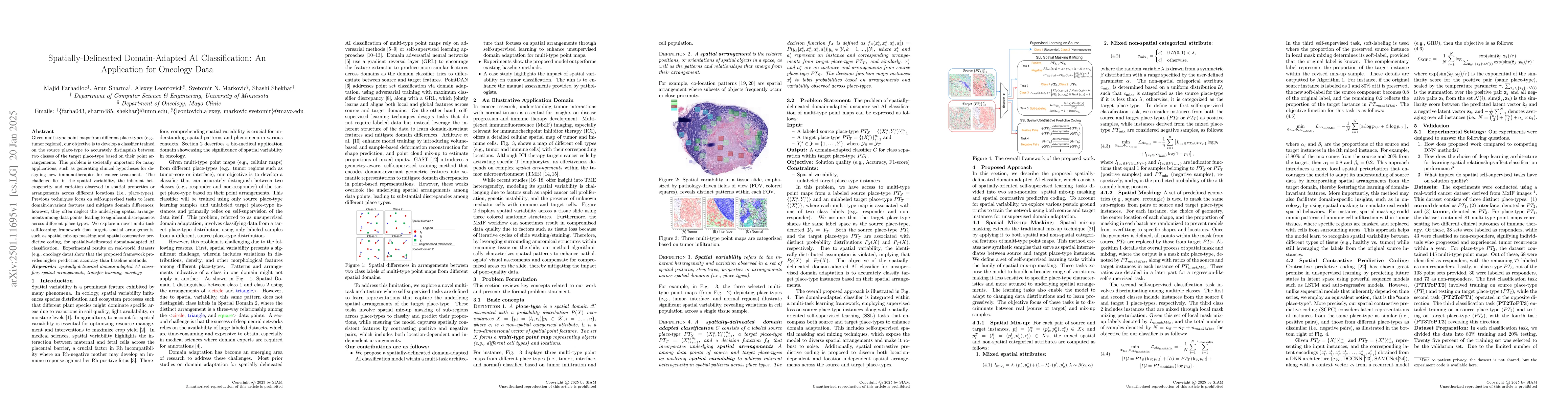
Given multi-type point maps from different place-types (e.g., tumor regions), our objective is to develop a classifier trained on the source place-type to accurately distinguish between two classes of...
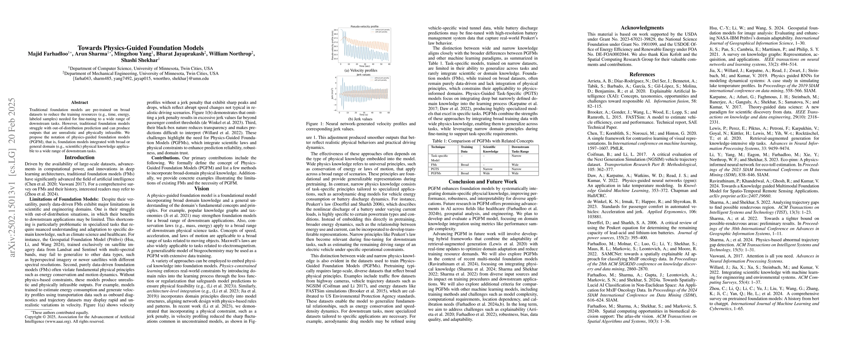
Traditional foundation models are pre-trained on broad datasets to reduce the training resources (e.g., time, energy, labeled samples) needed for fine-tuning a wide range of downstream tasks. However,...
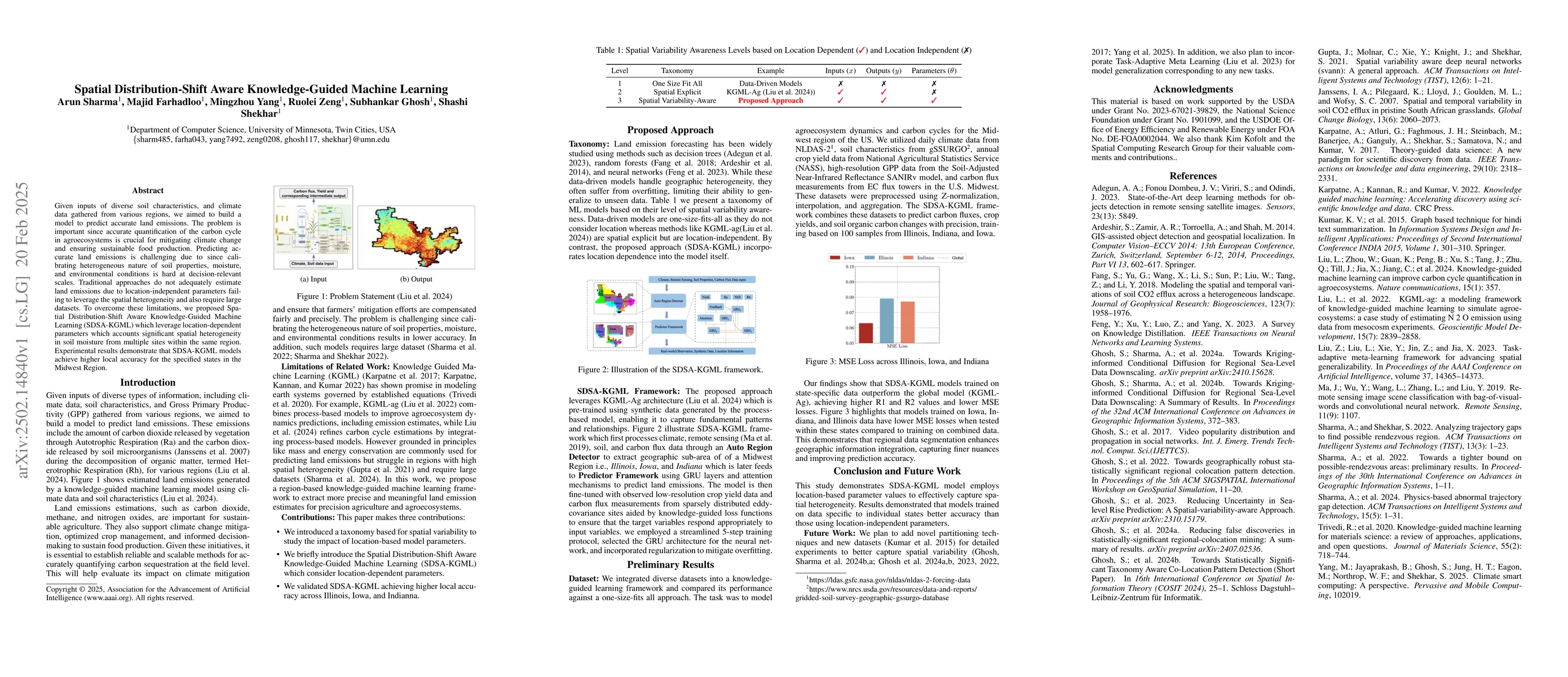
Given inputs of diverse soil characteristics and climate data gathered from various regions, we aimed to build a model to predict accurate land emissions. The problem is important since accurate quant...
This work presents a physics-based machine learning framework to predict and analyze oxides of nitrogen (NOx) emissions from compression-ignition engine-powered vehicles using on-board diagnostics (OB...
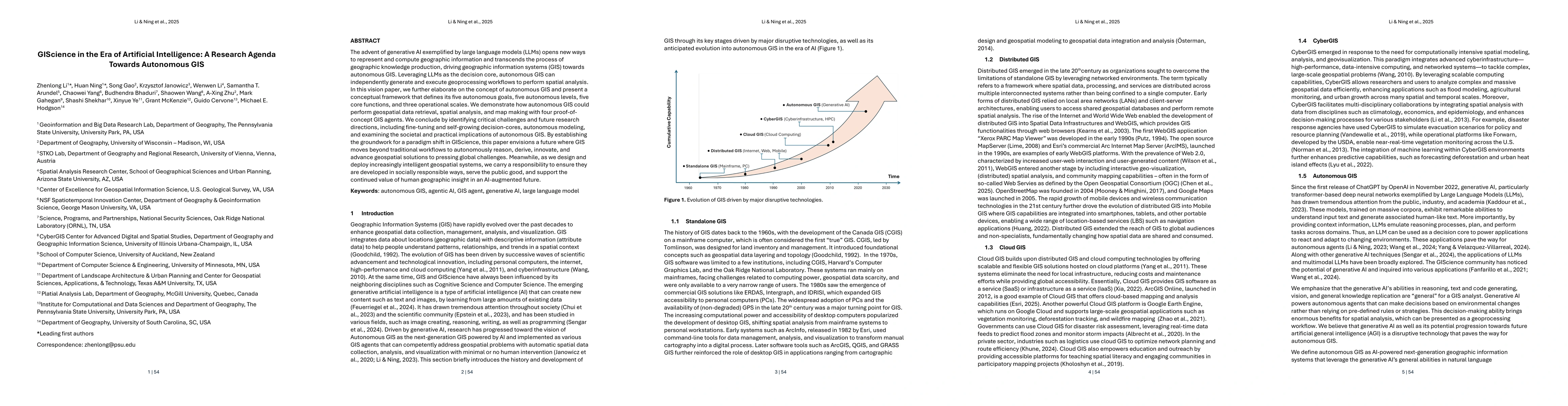
The advent of generative AI exemplified by large language models (LLMs) opens new ways to represent and compute geographic information and transcends the process of geographic knowledge production, dr...
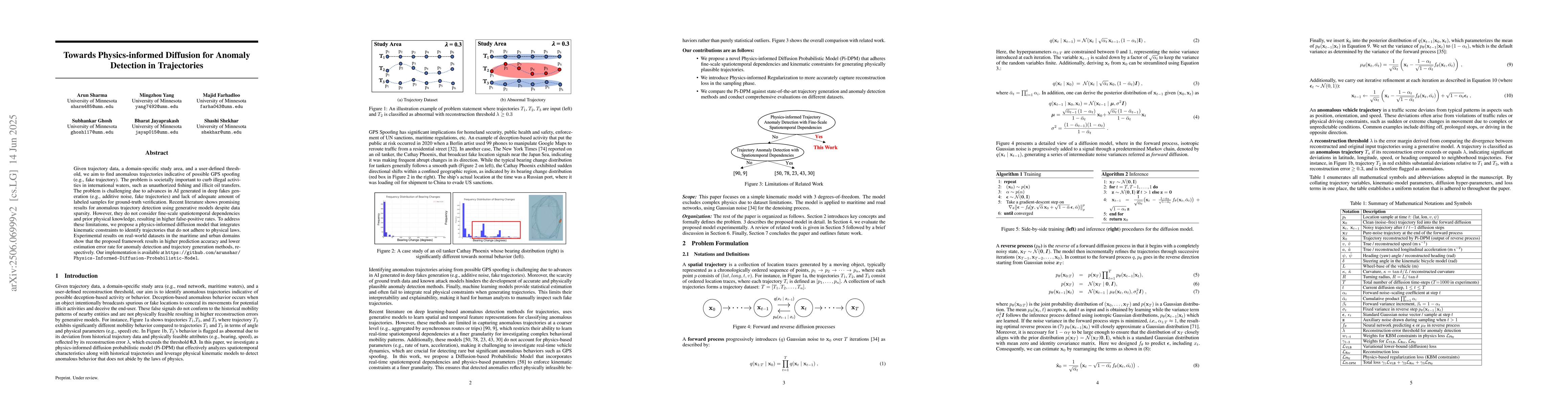
Given trajectory data, a domain-specific study area, and a user-defined threshold, we aim to find anomalous trajectories indicative of possible GPS spoofing (e.g., fake trajectory). The problem is soc...

Artificial intelligence (AI) is increasingly being adopted in most industries, and for applications such as note taking and checking grammar, there is typically not a cause for concern. However, when ...
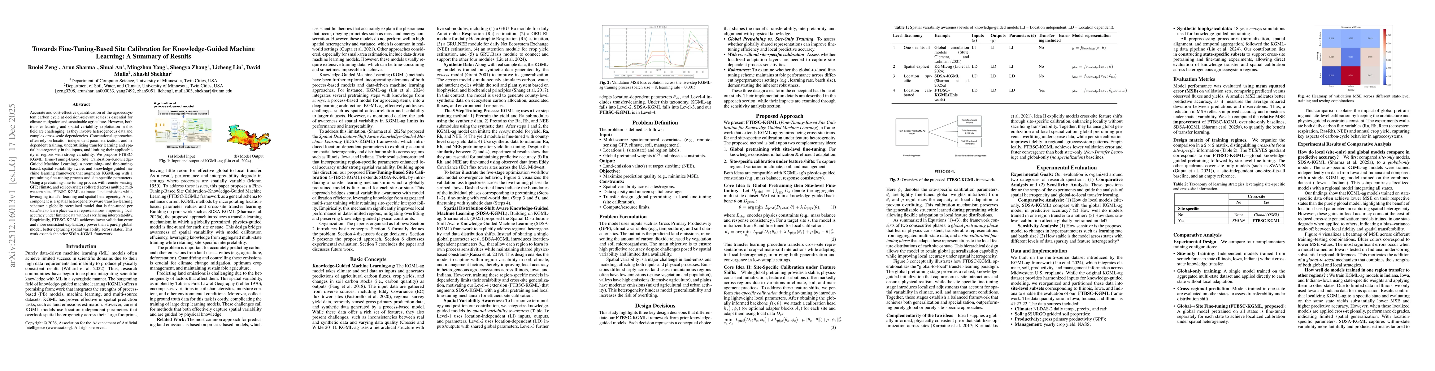
Accurate and cost-effective quantification of the agroecosystem carbon cycle at decision-relevant scales is essential for climate mitigation and sustainable agriculture. However, both transfer learnin...