Siddha Ganju
Nvidia corporation, Carnegie Mellon University
Academic Profile
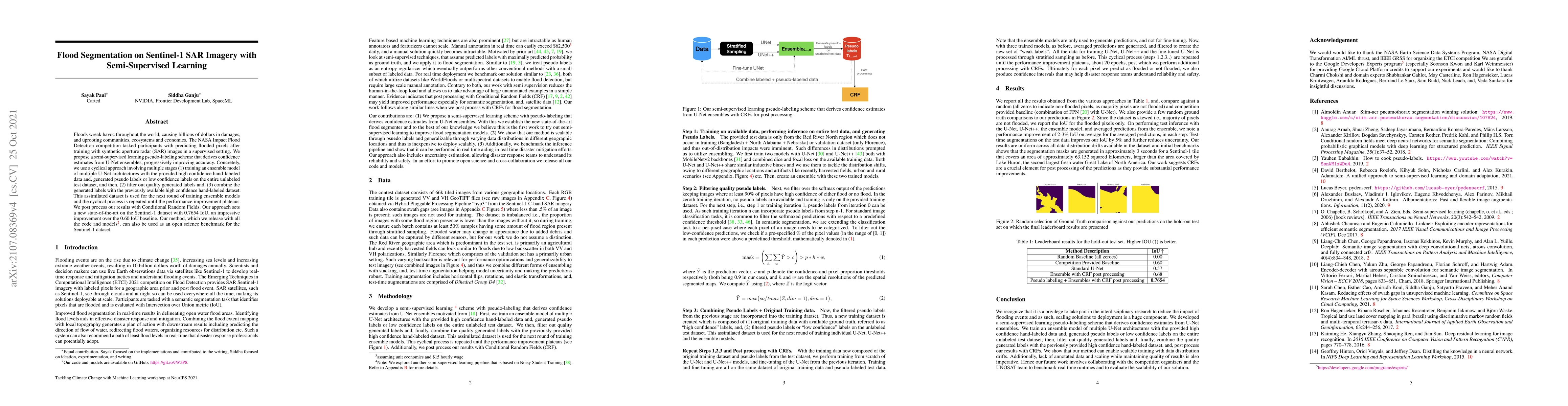
Statistics
Similar Authors
Papers on arXiv
Deep learning harnesses massive parallel floating-point processing to train and evaluate large neural networks. Trends indicate that deeper and larger neural networks with an increasing number of pa...
The Cameras for Allsky Meteor Surveillance (CAMS) project, funded by NASA starting in 2010, aims to map our meteor showers by triangulating meteor trajectories detected in low-light video cameras fr...
Applying Machine learning to domains like Earth Sciences is impeded by the lack of labeled data, despite a large corpus of raw data available in such domains. For instance, training a wildfire class...
This work aims to produce landslide density estimates using Synthetic Aperture Radar (SAR) satellite imageries to prioritise emergency resources for rapid response. We use the United States Geologic...
Rapid assessment after a natural disaster is key for prioritizing emergency resources. In the case of landslides, rapid assessment involves determining the extent of the area affected and measuring ...
With climate change predicted to increase the likelihood of landslide events, there is a growing need for rapid landslide detection technologies that help inform emergency responses. Synthetic Apert...
Geomagnetically Induced Currents (GICs) arise from spatio-temporal changes to Earth's magnetic field which arise from the interaction of the solar wind with Earth's magnetosphere, and drive catastro...
We present the results of our autonomous racing virtual challenge, based on the newly-released Learn-to-Race (L2R) simulation framework, which seeks to encourage interdisciplinary research in autono...
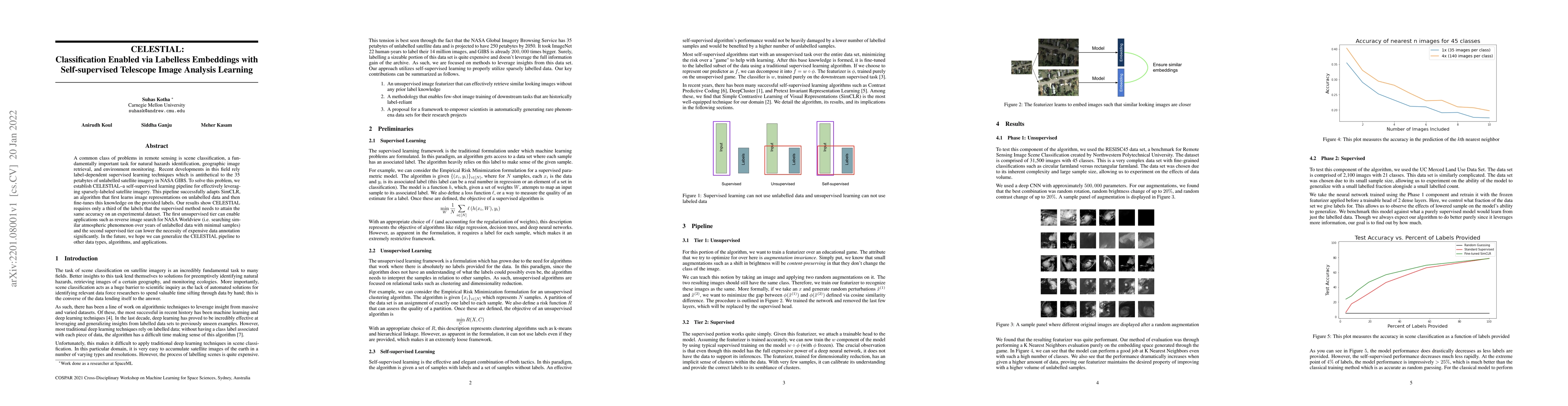
A common class of problems in remote sensing is scene classification, a fundamentally important task for natural hazards identification, geographic image retrieval, and environment monitoring. Recen...
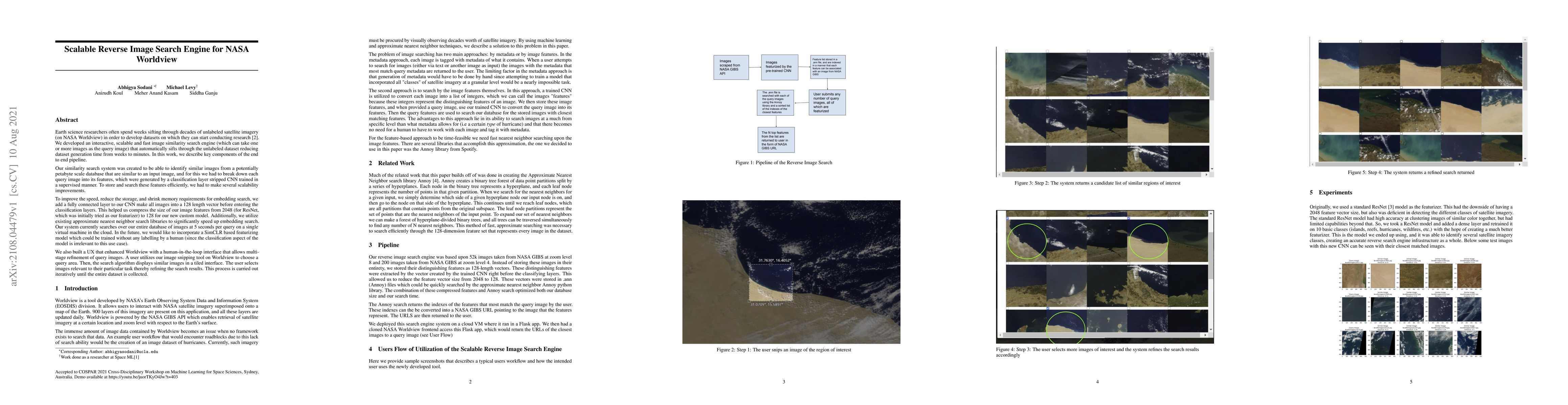
Researchers often spend weeks sifting through decades of unlabeled satellite imagery(on NASA Worldview) in order to develop datasets on which they can start conducting research. We developed an inte...
Floods wreak havoc throughout the world, causing billions of dollars in damages, and uprooting communities, ecosystems and economies. The NASA Impact Flood Detection competition tasked participants ...
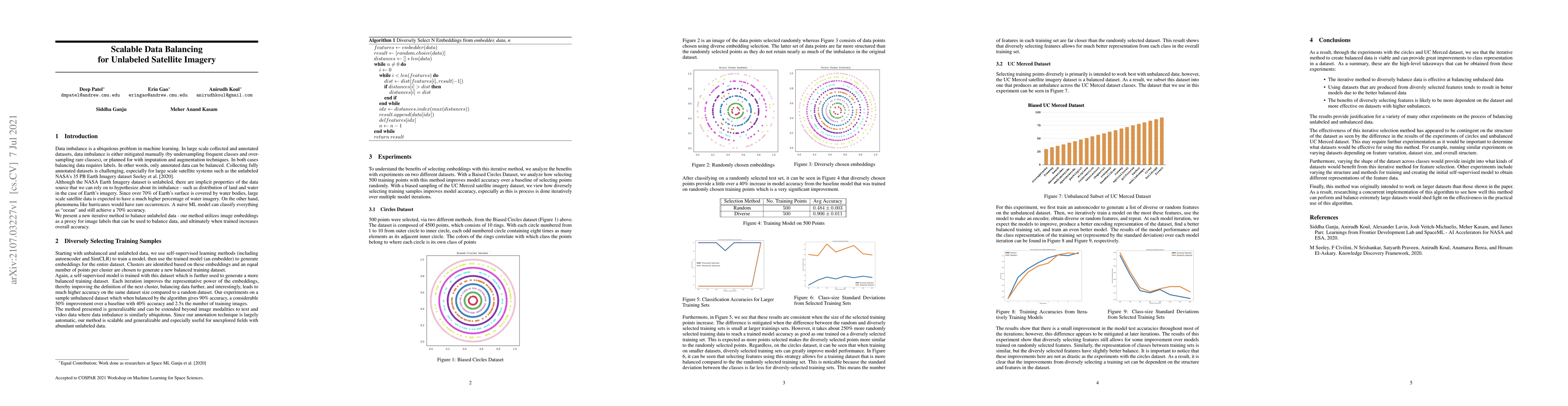
Data imbalance is a ubiquitous problem in machine learning. In large scale collected and annotated datasets, data imbalance is either mitigated manually by undersampling frequent classes and oversam...
Future short or long-term space missions require a new generation of monitoring and diagnostic systems due to communication impasses as well as limitations in specialized crew and equipment. Machine...
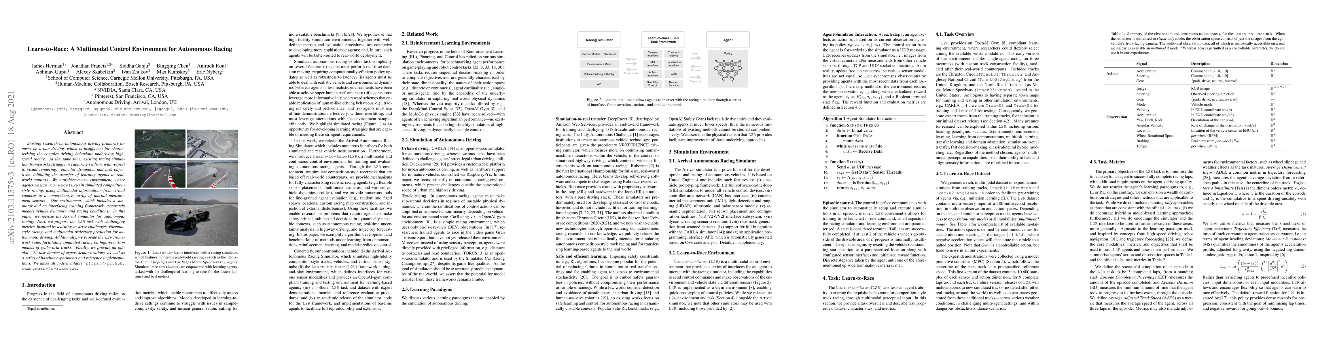
Existing research on autonomous driving primarily focuses on urban driving, which is insufficient for characterising the complex driving behaviour underlying high-speed racing. At the same time, exi...
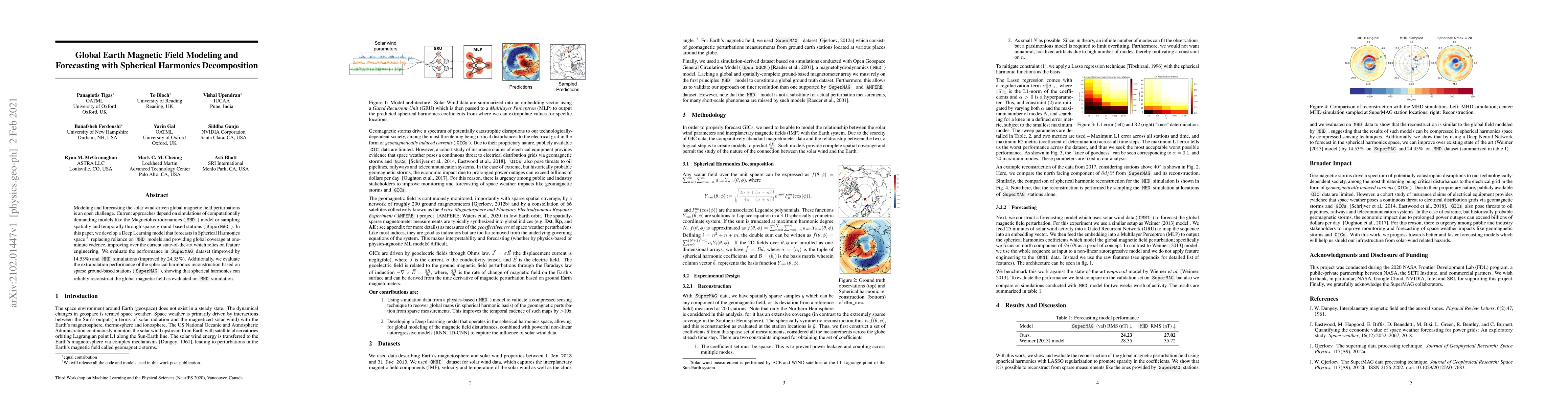
Modeling and forecasting the solar wind-driven global magnetic field perturbations is an open challenge. Current approaches depend on simulations of computationally demanding models like the Magneto...
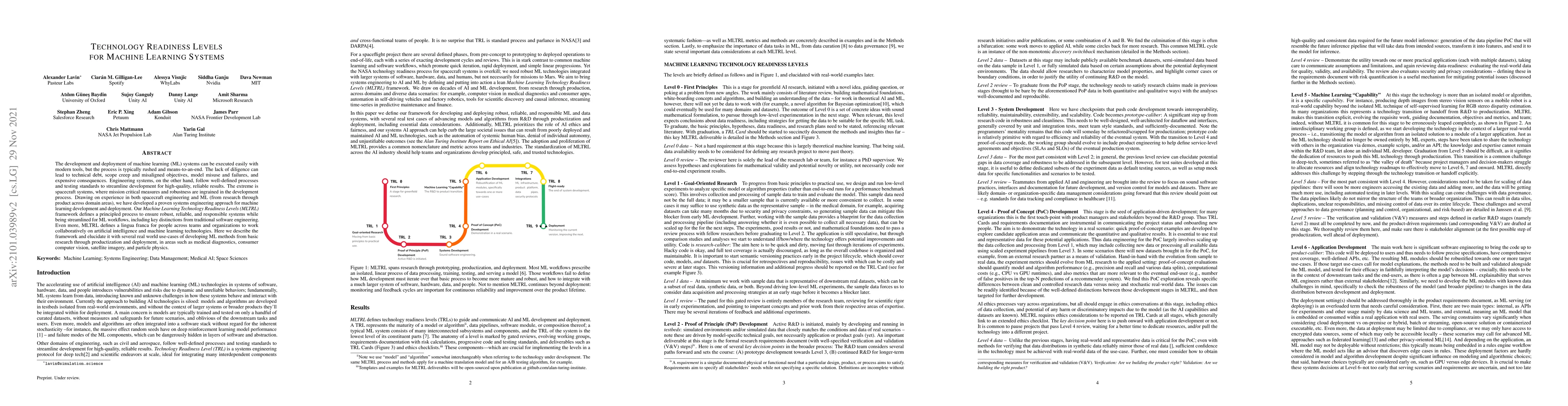
The development and deployment of machine learning (ML) systems can be executed easily with modern tools, but the process is typically rushed and means-to-an-end. The lack of diligence can lead to t...
Research with AI and ML technologies lives in a variety of settings with often asynchronous goals and timelines: academic labs and government organizations pursue open-ended research focusing on dis...