Academic Profile
Statistics
Similar Authors
Papers on arXiv
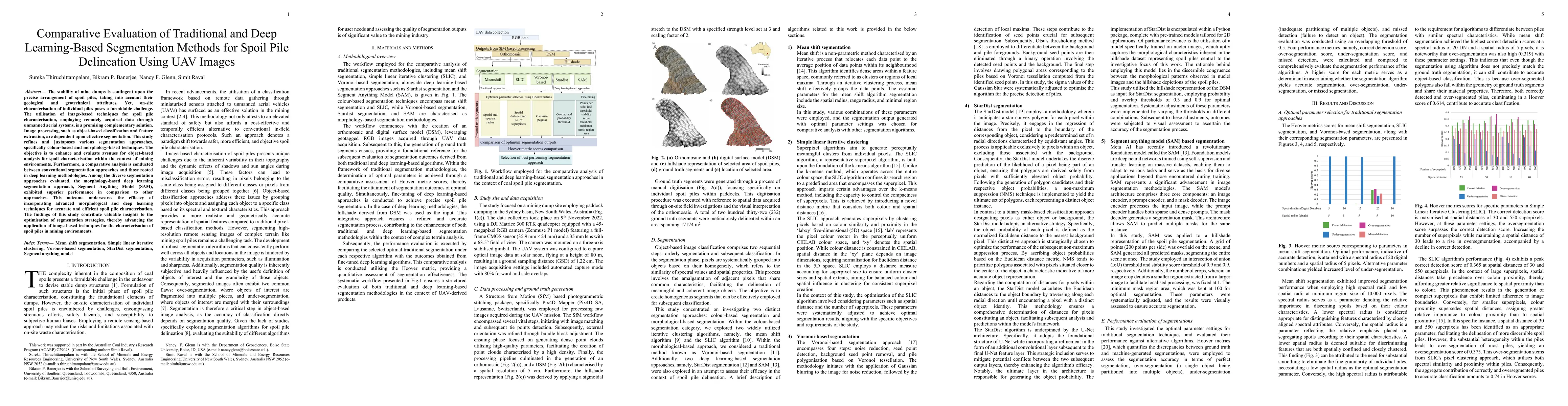
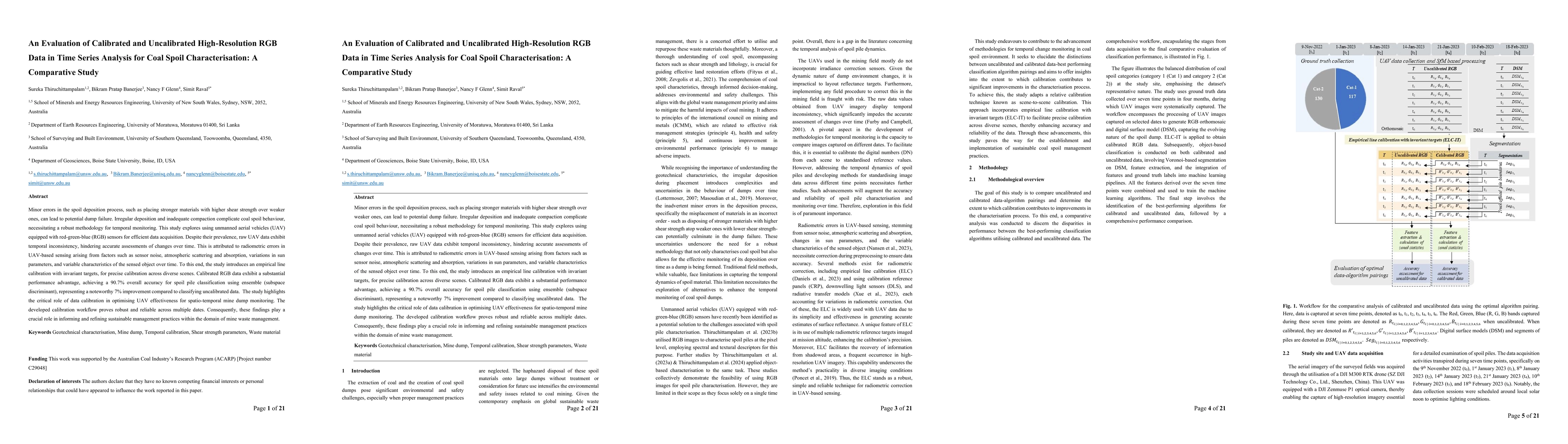
The stability of mine dumps is contingent upon the precise arrangement of spoil piles, taking into account their geological and geotechnical attributes. Yet, on-site characterisation of individual p...
Minor errors in the spoil deposition process, such as placing stronger materials with higher shear strength over weaker ones, can lead to potential dump failure. Irregular deposition and inadequate ...
The characterisation of materials is a prerequisite for evaluating and predicting the stability of mining waste dumps. Over the past three decades, the BHP Mitsubishi Alliance Coal framework has bee...
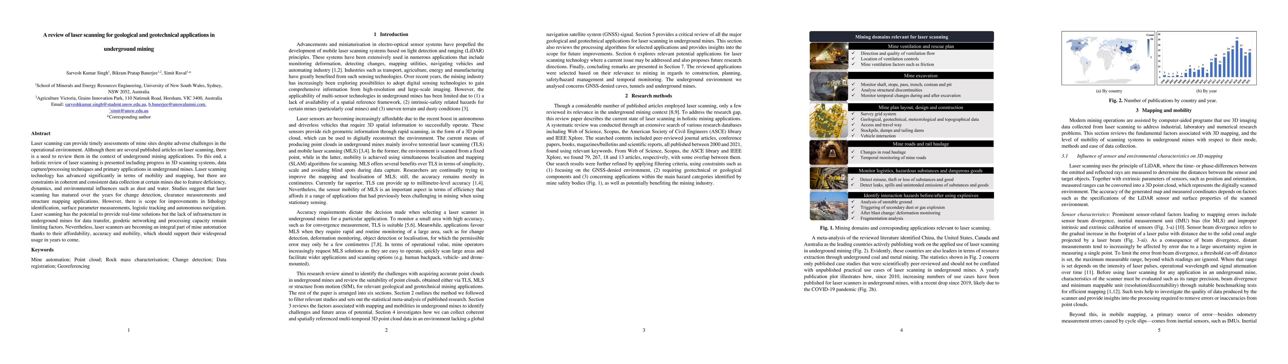
Laser scanning can provide timely assessments of mine sites despite adverse challenges in the operational environment. Although there are several published articles on laser scanning, there is a nee...
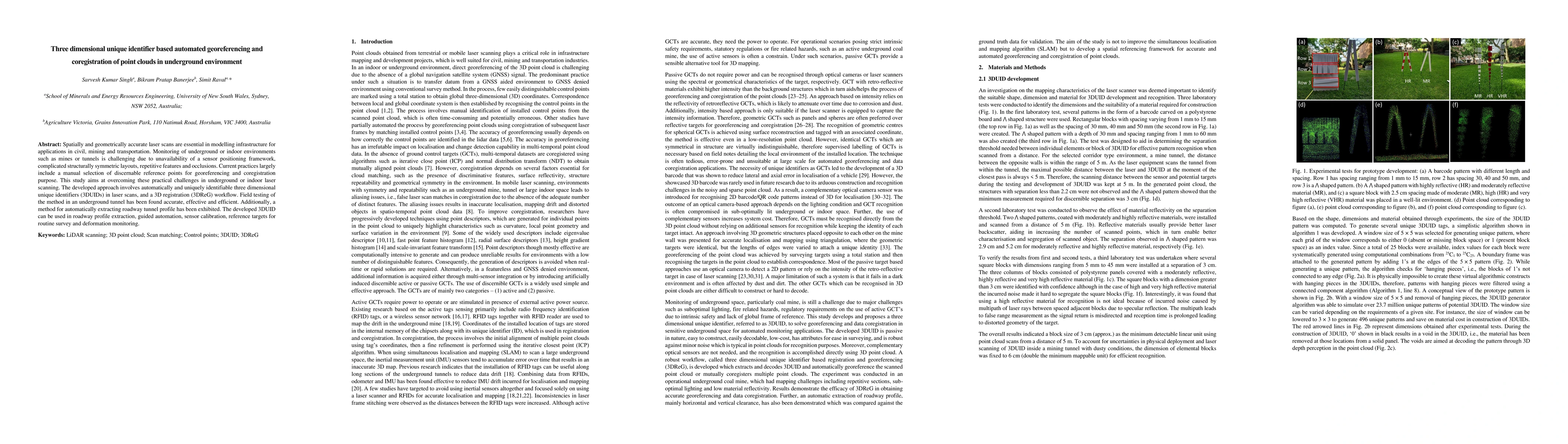
Spatially and geometrically accurate laser scans are essential in modelling infrastructure for applications in civil, mining and transportation. Monitoring of underground or indoor environments such...
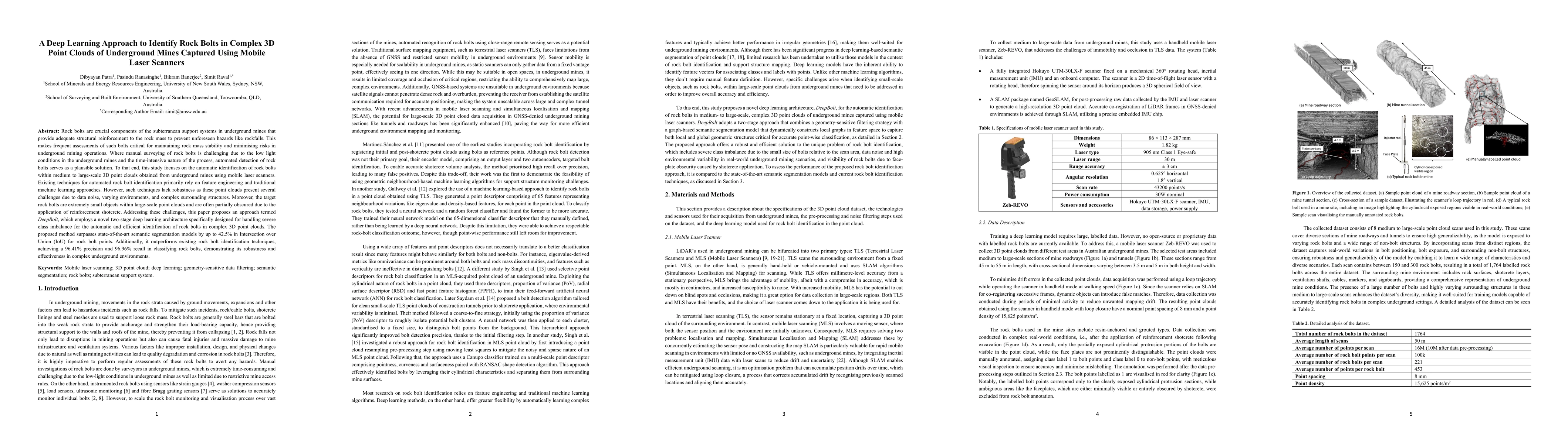
Rock bolts are crucial components of the subterranean support systems in underground mines that provide adequate structural reinforcement to the rock mass to prevent unforeseen hazards like rockfalls....
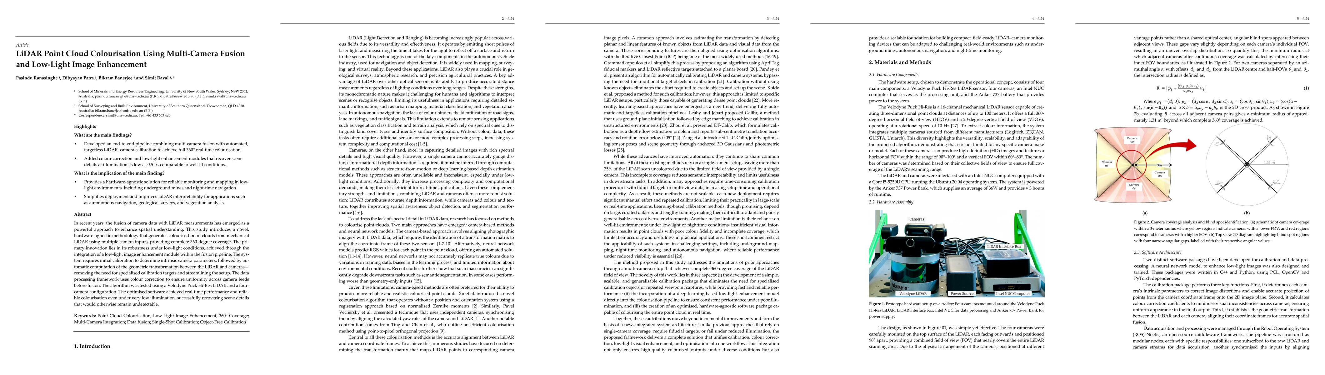
In recent years, the fusion of camera data with LiDAR measurements has emerged as a powerful approach to enhance spatial understanding. This study introduces a novel, hardware-agnostic methodology tha...
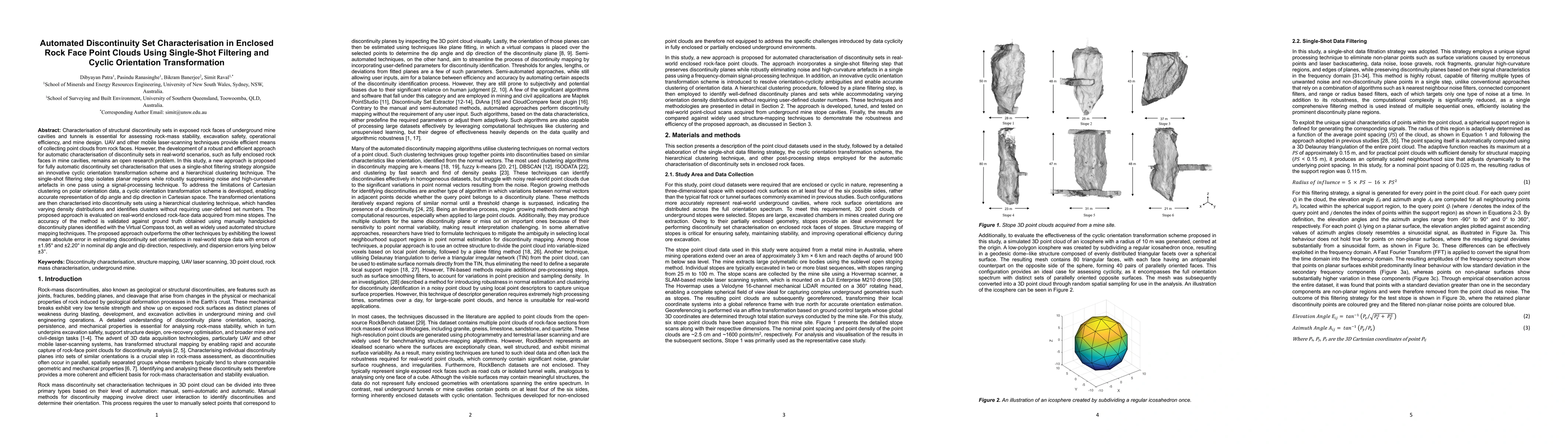
Characterisation of structural discontinuity sets in exposed rock faces of underground mine cavities is essential for assessing rock-mass stability, excavation safety, and operational efficiency. UAV ...
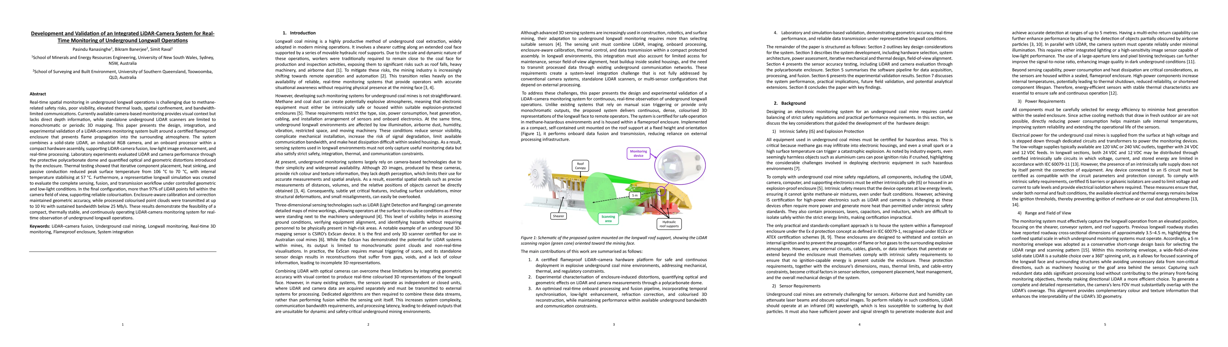
Real-time spatial monitoring in underground longwall operations is challenging due to methane-related safety risks, poor visibility, elevated thermal loads, spatial confinement, and bandwidth-limited ...
The effectiveness of rock support in underground mines depends on the interaction between installed rock bolts and the structural fabric of the surrounding rock mass. However, discontinuity characteri...
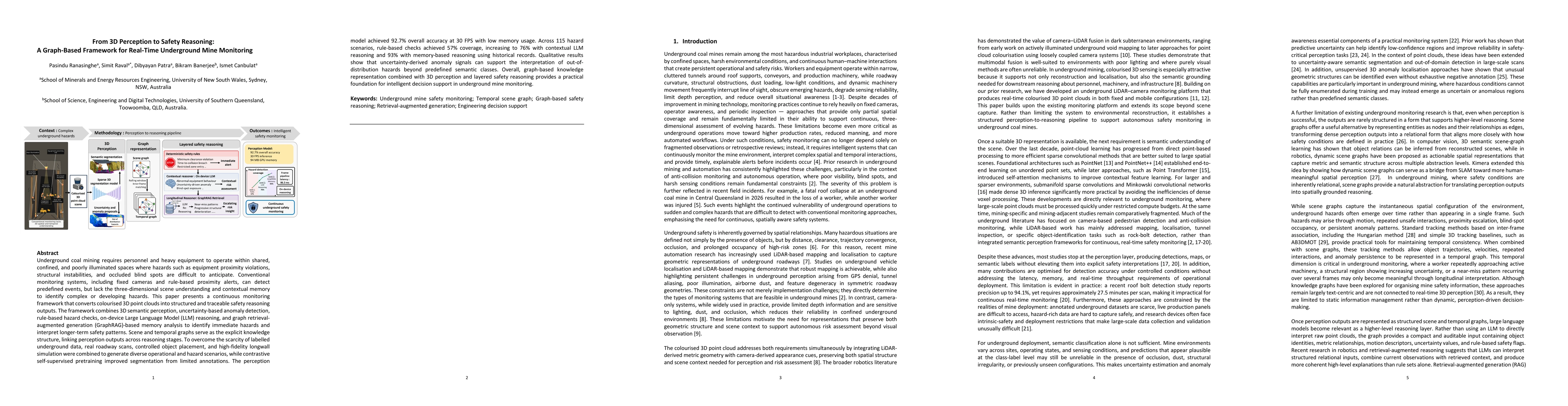
Underground coal mining requires personnel and heavy equipment to operate within shared, confined, and poorly illuminated spaces where hazards such as equipment proximity violations, structural instab...