Academic Profile
Statistics
Similar Authors
Papers on arXiv
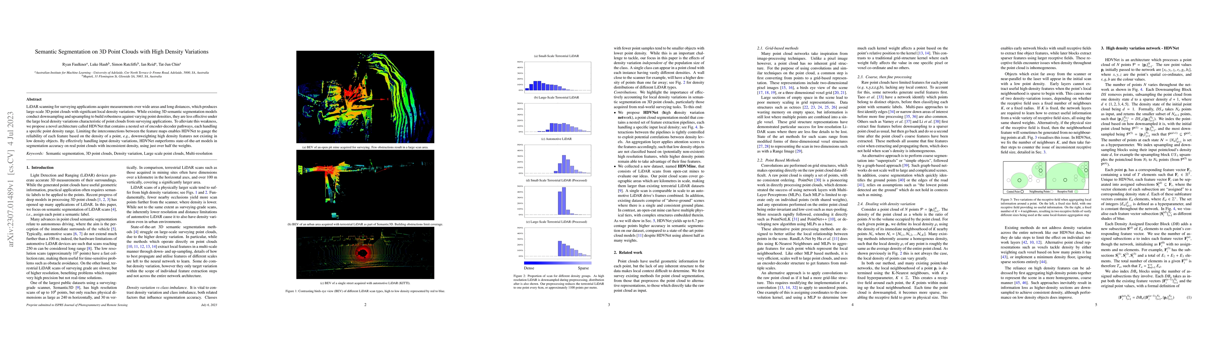
LiDAR scanning for surveying applications acquire measurements over wide areas and long distances, which produces large-scale 3D point clouds with significant local density variations. While existin...
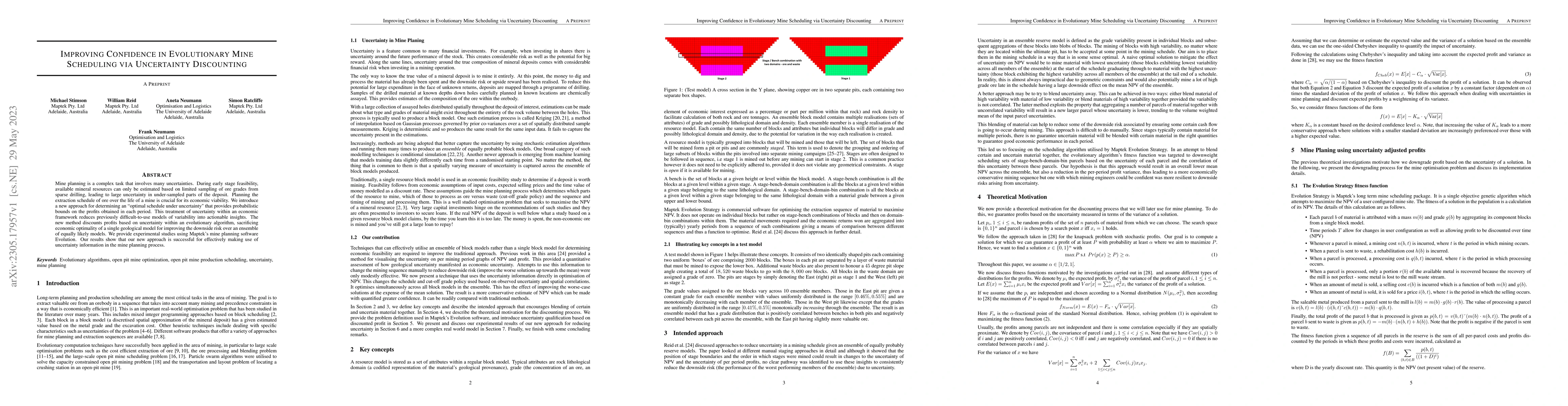
Mine planning is a complex task that involves many uncertainties. During early stage feasibility, available mineral resources can only be estimated based on limited sampling of ore grades from spars...
In this paper, we investigate the impact of uncertainty in advanced ore mine optimisation. We consider Maptek's software system Evolution which optimizes extraction sequences based on evolutionary c...
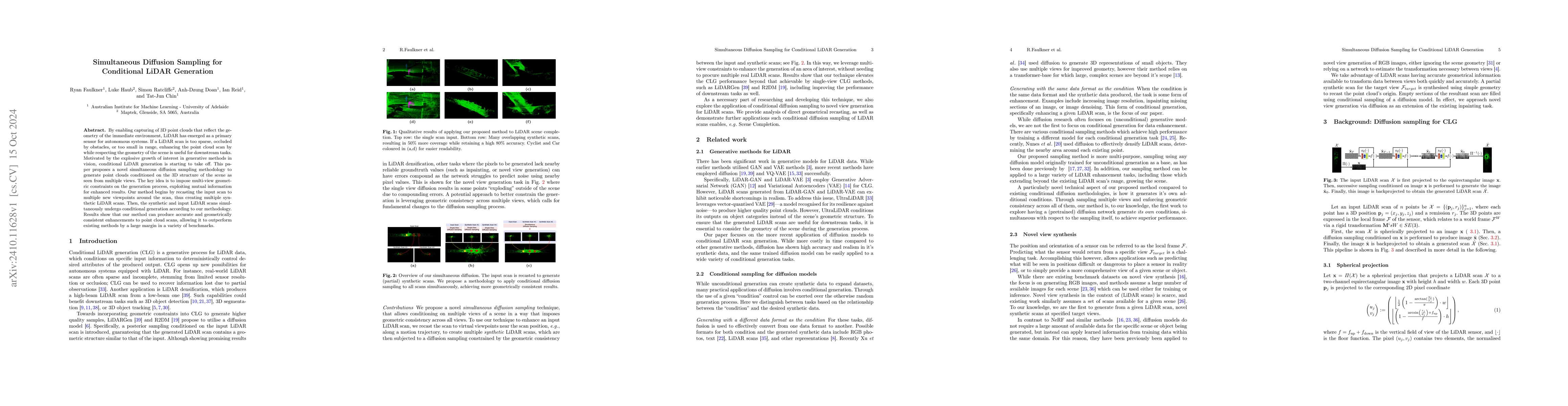
By enabling capturing of 3D point clouds that reflect the geometry of the immediate environment, LiDAR has emerged as a primary sensor for autonomous systems. If a LiDAR scan is too sparse, occluded b...
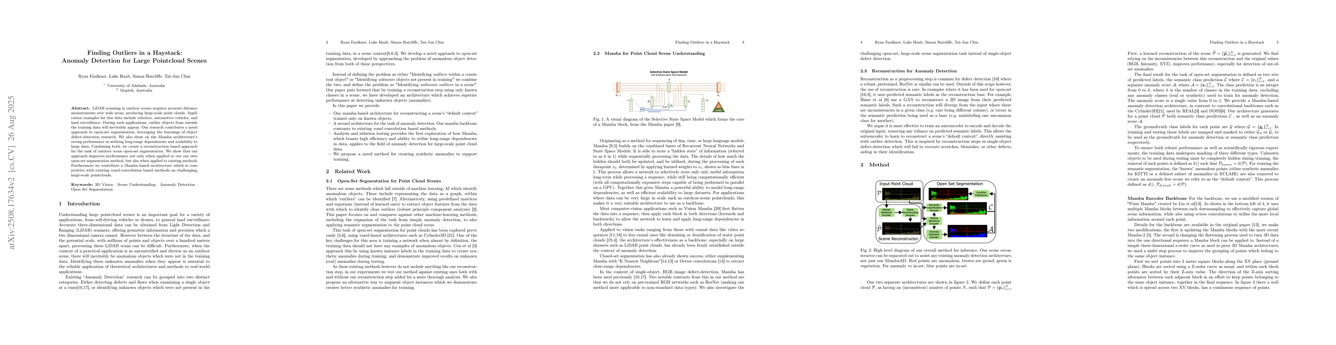
LiDAR scanning in outdoor scenes acquires accurate distance measurements over wide areas, producing large-scale point clouds. Application examples for this data include robotics, automotive vehicles, ...
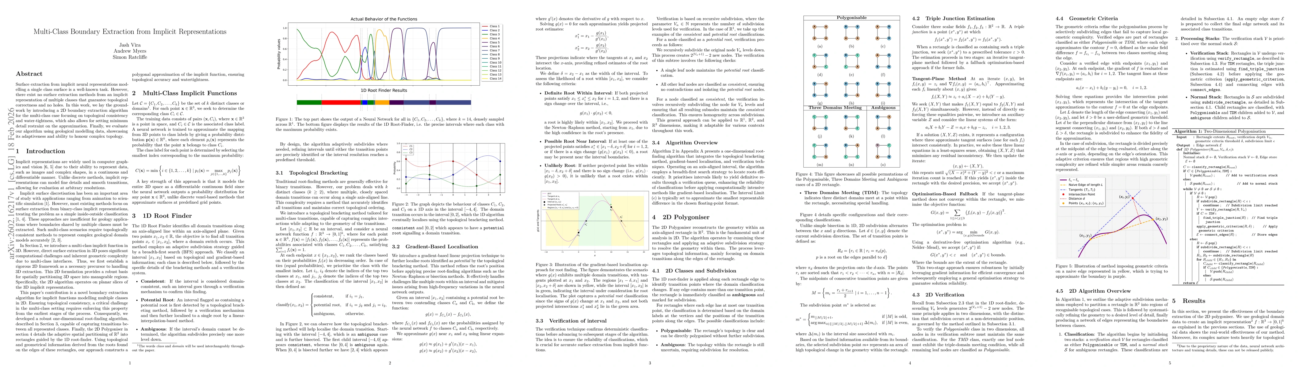
Surface extraction from implicit neural representations modelling a single class surface is a well-known task. However, there exist no surface extraction methods from an implicit representation of mul...