Academic Profile
Statistics
Similar Authors
Papers on arXiv
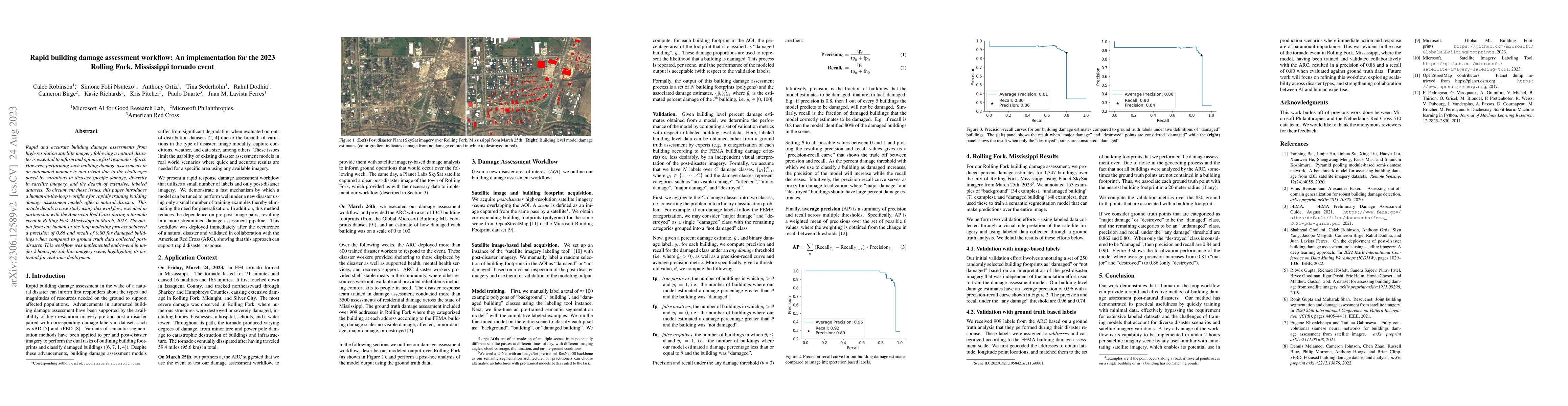
Rapid and accurate building damage assessments from high-resolution satellite imagery following a natural disaster is essential to inform and optimize first responder efforts. However, performing su...
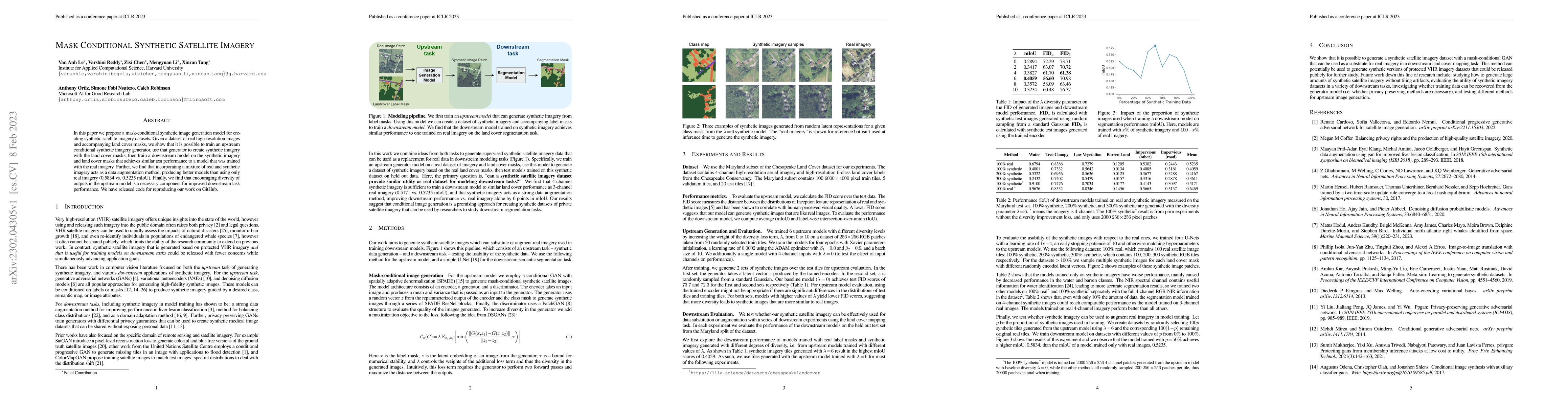
In this paper we propose a mask-conditional synthetic image generation model for creating synthetic satellite imagery datasets. Given a dataset of real high-resolution images and accompanying land c...

Floods cause extensive global damage annually, making effective monitoring essential. While satellite observations have proven invaluable for flood detection and tracking, comprehensive global flood d...
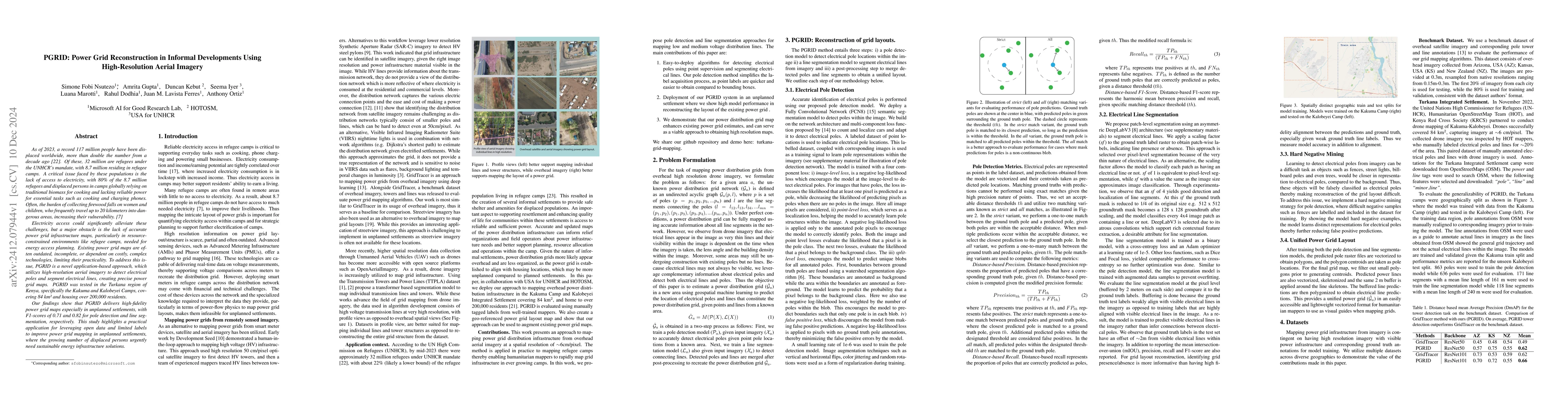
As of 2023, a record 117 million people have been displaced worldwide, more than double the number from a decade ago [22]. Of these, 32 million are refugees under the UNHCR mandate, with 8.7 million r...
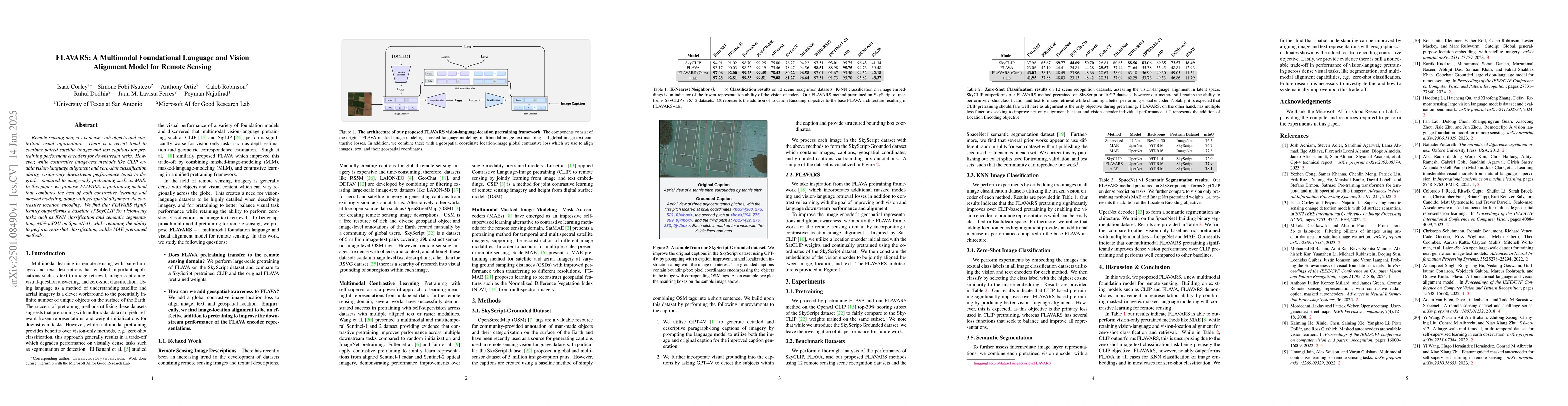
Remote sensing imagery is dense with objects and contextual visual information. There is a recent trend to combine paired satellite images and text captions for pretraining performant encoders for dow...
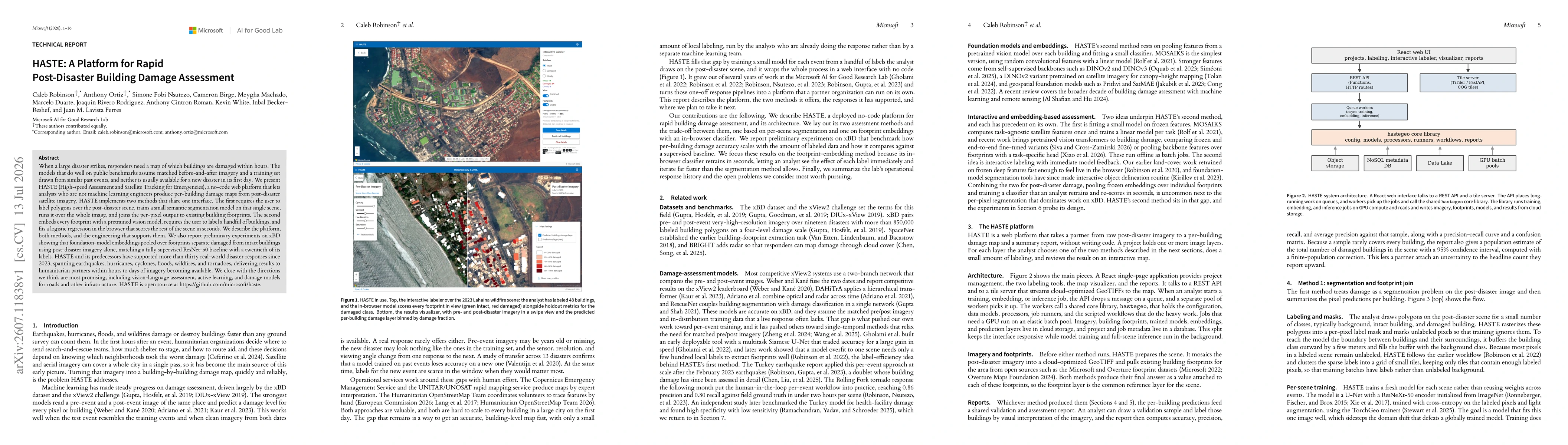
When a large disaster strikes, responders need a map of which buildings are damaged within hours. The models that do well on public benchmarks assume matched before-and-after imagery and a training se...