Academic Profile
Statistics
Similar Authors
Papers on arXiv
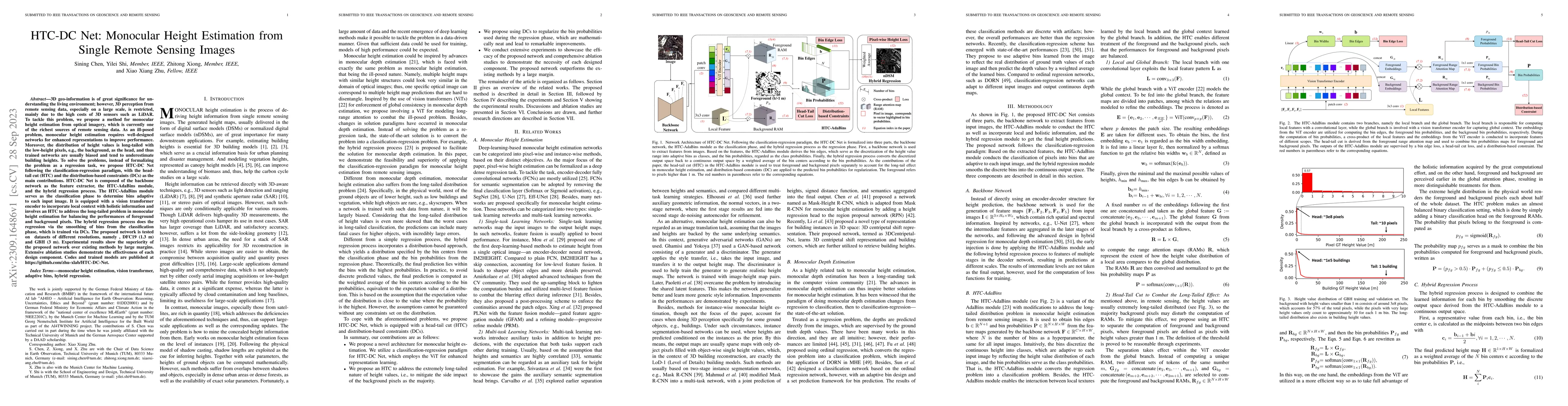
3D geo-information is of great significance for understanding the living environment; however, 3D perception from remote sensing data, especially on a large scale, is restricted. To tackle this prob...
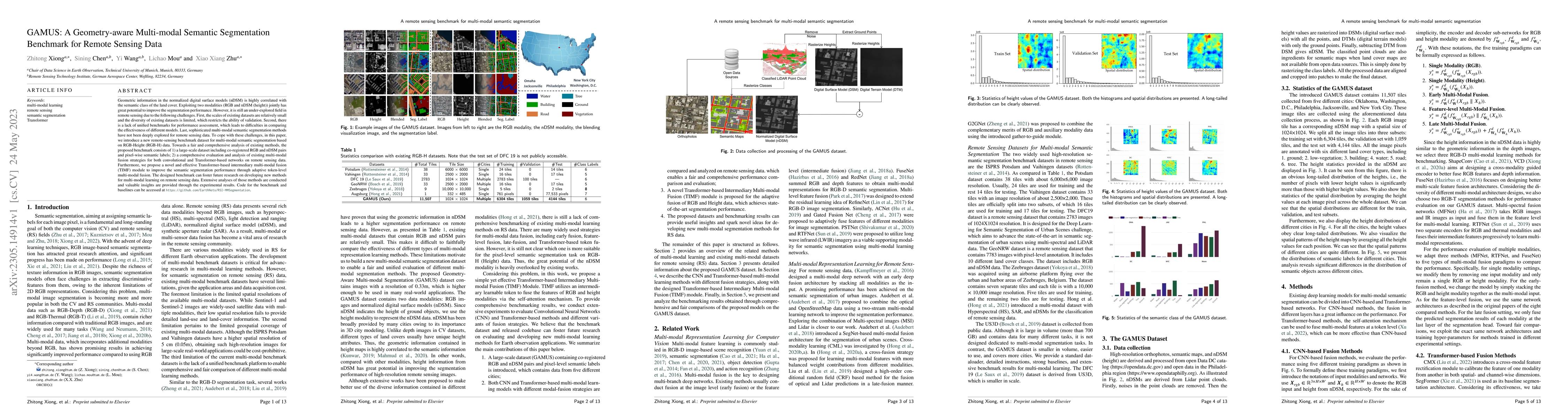
Geometric information in the normalized digital surface models (nDSM) is highly correlated with the semantic class of the land cover. Exploiting two modalities (RGB and nDSM (height)) jointly has gr...
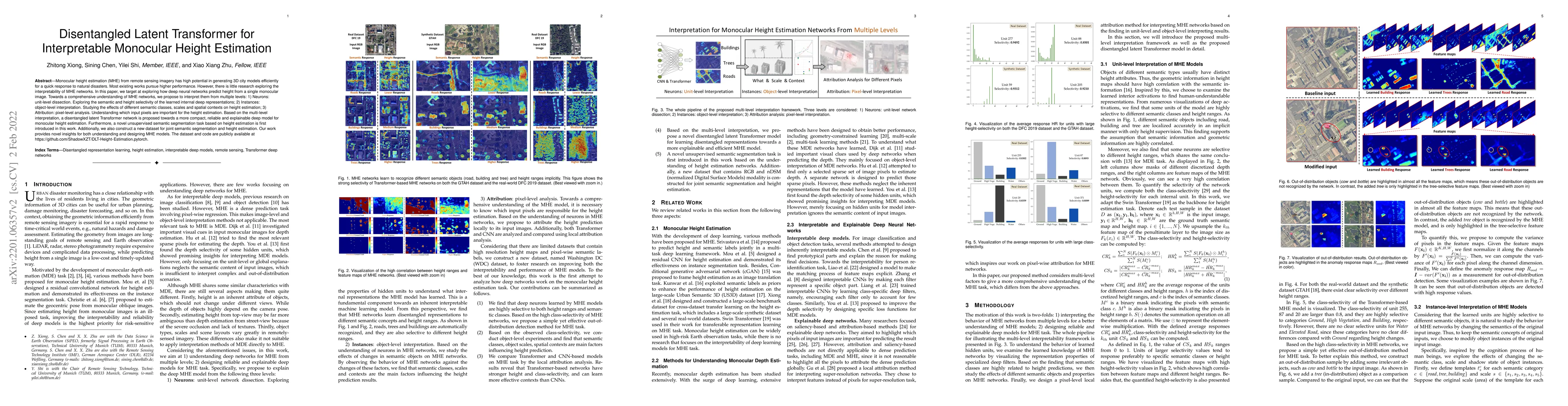
Monocular height estimation (MHE) from remote sensing imagery has high potential in generating 3D city models efficiently for a quick response to natural disasters. Most existing works pursue higher...
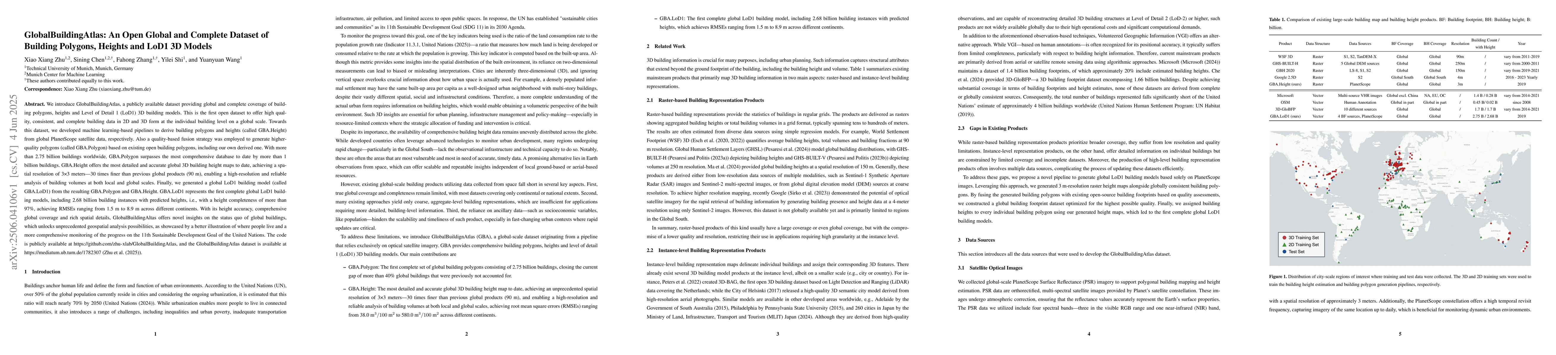
We introduce GlobalBuildingAtlas, a publicly available dataset providing global and complete coverage of building polygons, heights and Level of Detail 1 (LoD1) 3D building models. This is the first o...
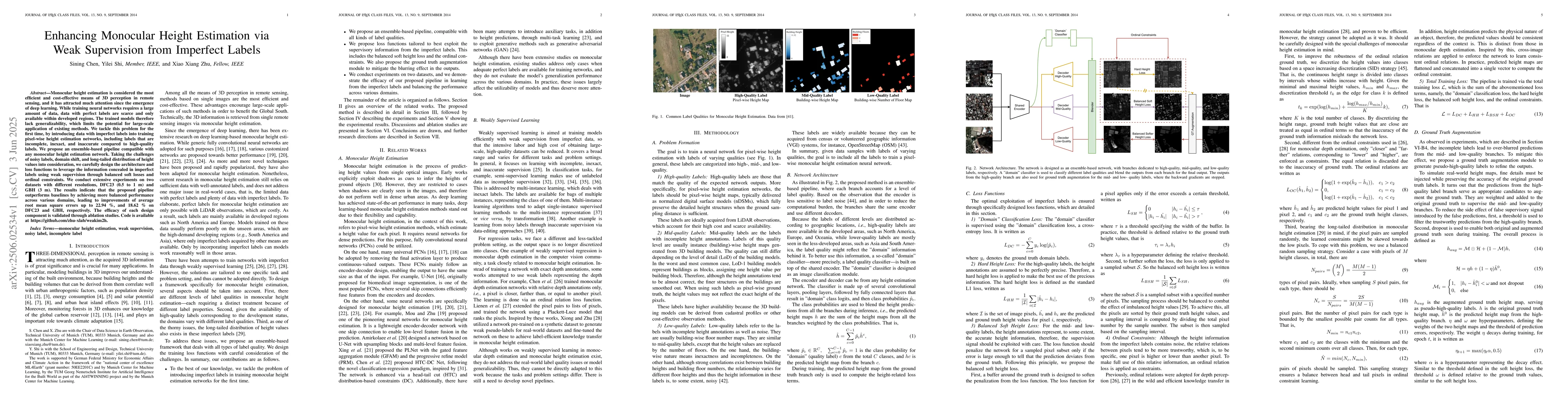
Monocular height estimation is considered the most efficient and cost-effective means of 3D perception in remote sensing, and it has attracted much attention since the emergence of deep learning. Whil...
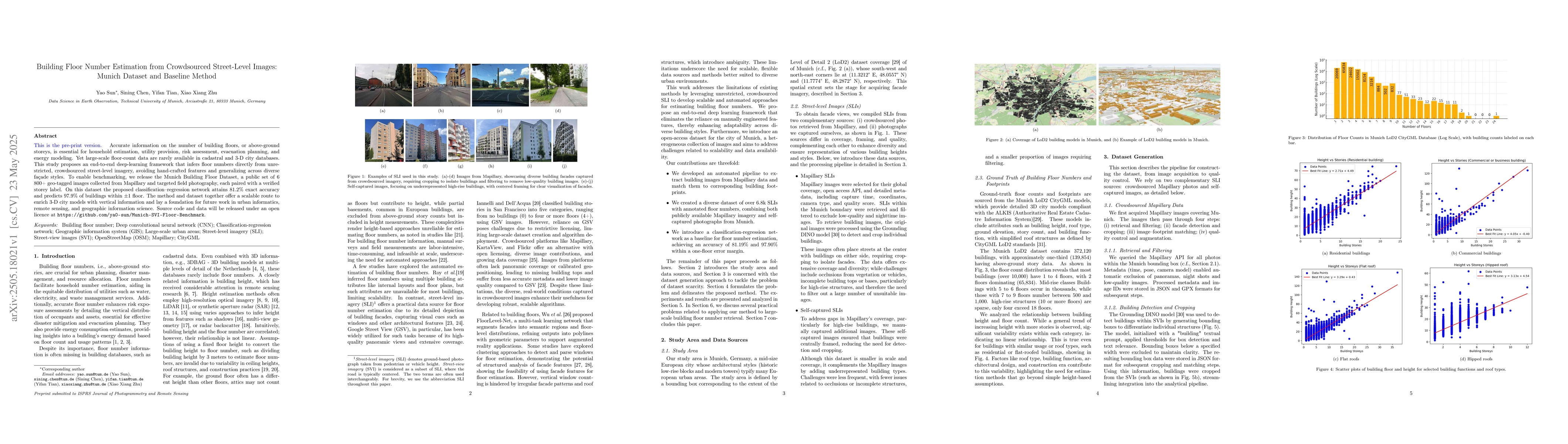
Accurate information on the number of building floors, or above-ground storeys, is essential for household estimation, utility provision, risk assessment, evacuation planning, and energy modeling. Yet...
Monocular height estimation plays a critical role in 3D perception for remote sensing, offering a cost-effective alternative to multi-view or LiDAR-based methods. While deep learning has significantly...