Academic Profile
Statistics
Similar Authors
Papers on arXiv
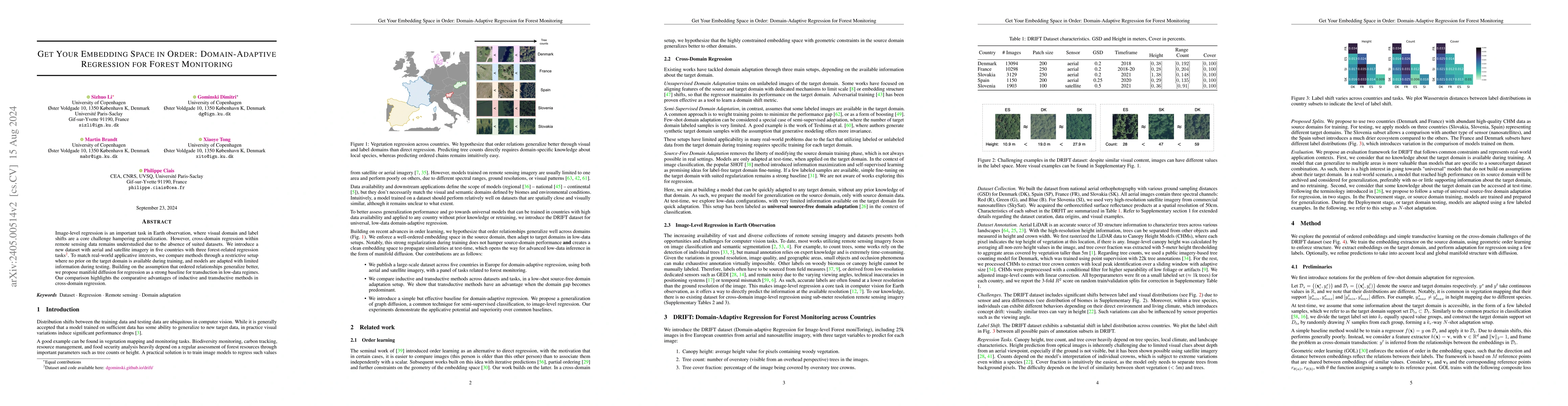
Image-level regression is an important task in Earth observation, where visual domain and label shifts are a core challenge hampering generalization. However, cross-domain regression with remote sen...
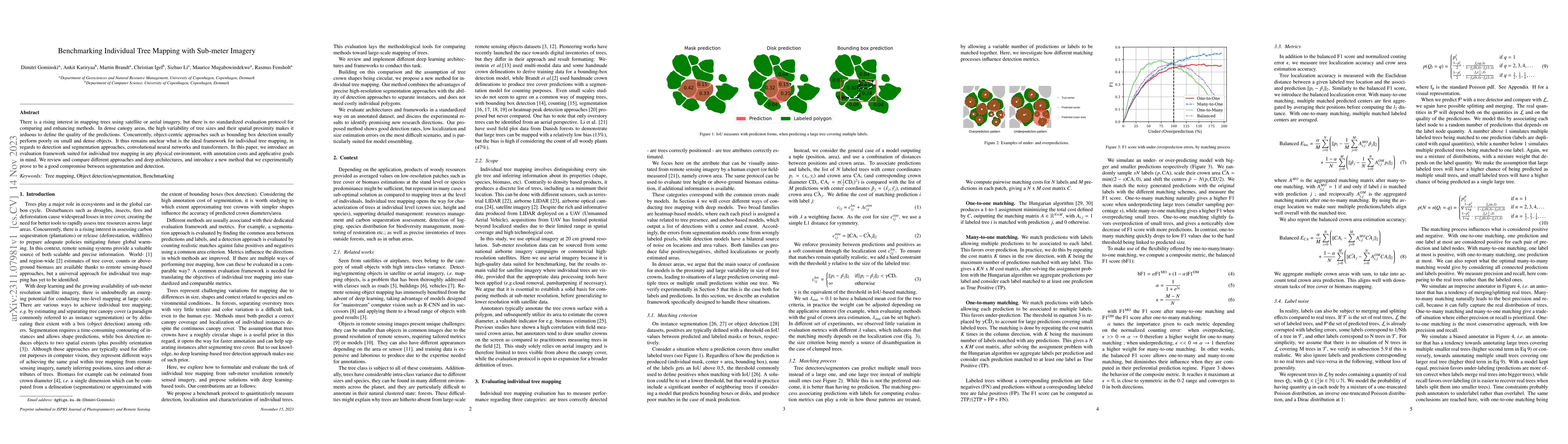
There is a rising interest in mapping trees using satellite or aerial imagery, but there is no standardized evaluation protocol for comparing and enhancing methods. In dense canopy areas, the high v...
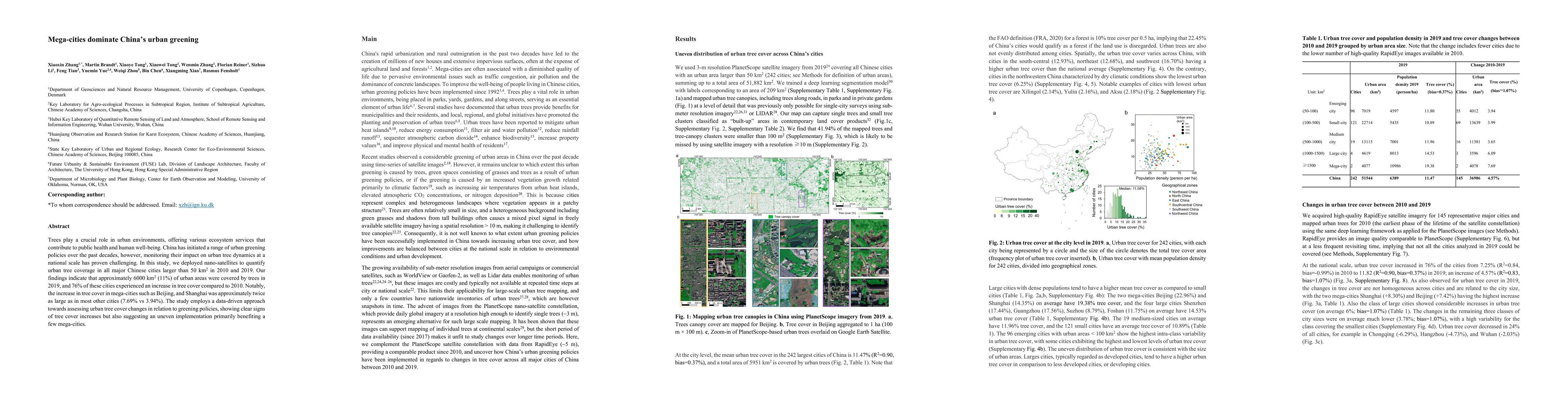
Trees play a crucial role in urban environments, offering various ecosystem services that contribute to public health and human well-being. China has initiated a range of urban greening policies ove...
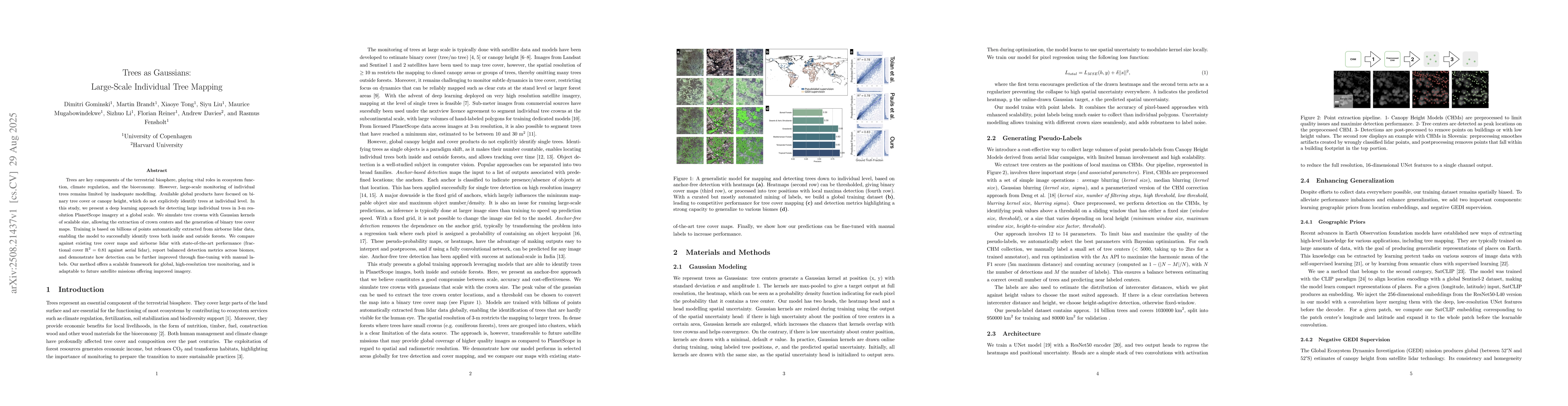
Trees are key components of the terrestrial biosphere, playing vital roles in ecosystem function, climate regulation, and the bioeconomy. However, large-scale monitoring of individual trees remains li...