Academic Profile
Statistics
Similar Authors
Papers on arXiv
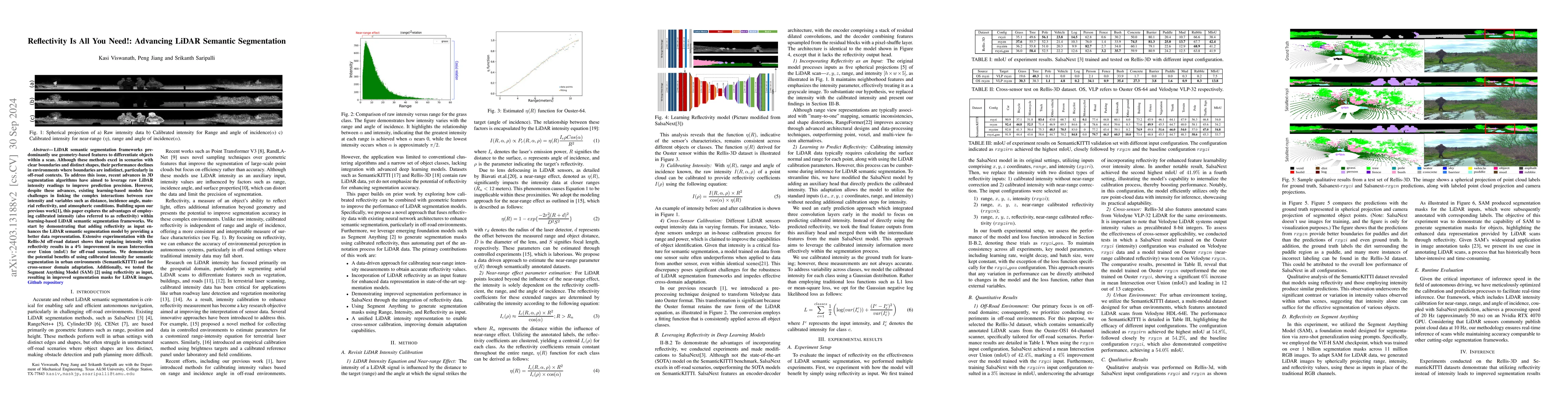
LiDAR semantic segmentation frameworks predominantly leverage geometry-based features to differentiate objects within a scan. While these methods excel in scenarios with clear boundaries and distinc...
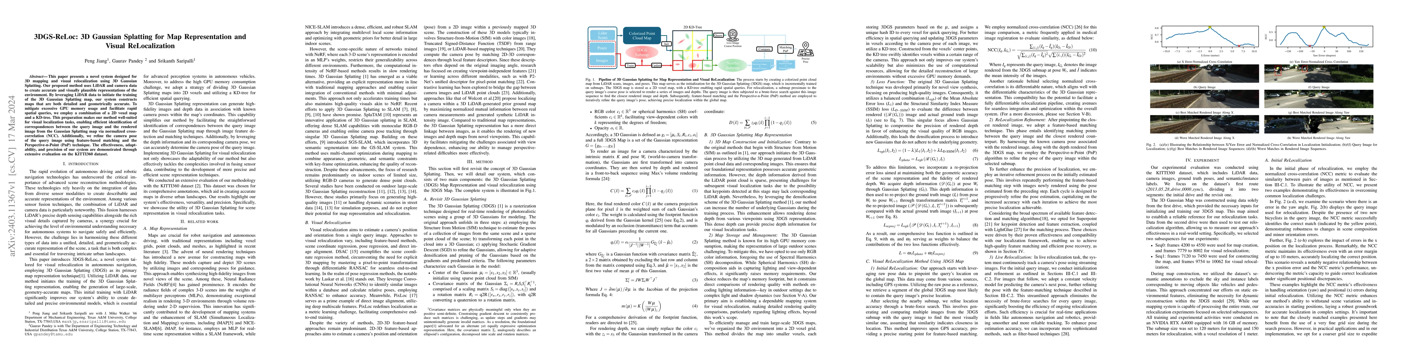
This paper presents a novel system designed for 3D mapping and visual relocalization using 3D Gaussian Splatting. Our proposed method uses LiDAR and camera data to create accurate and visually plaus...
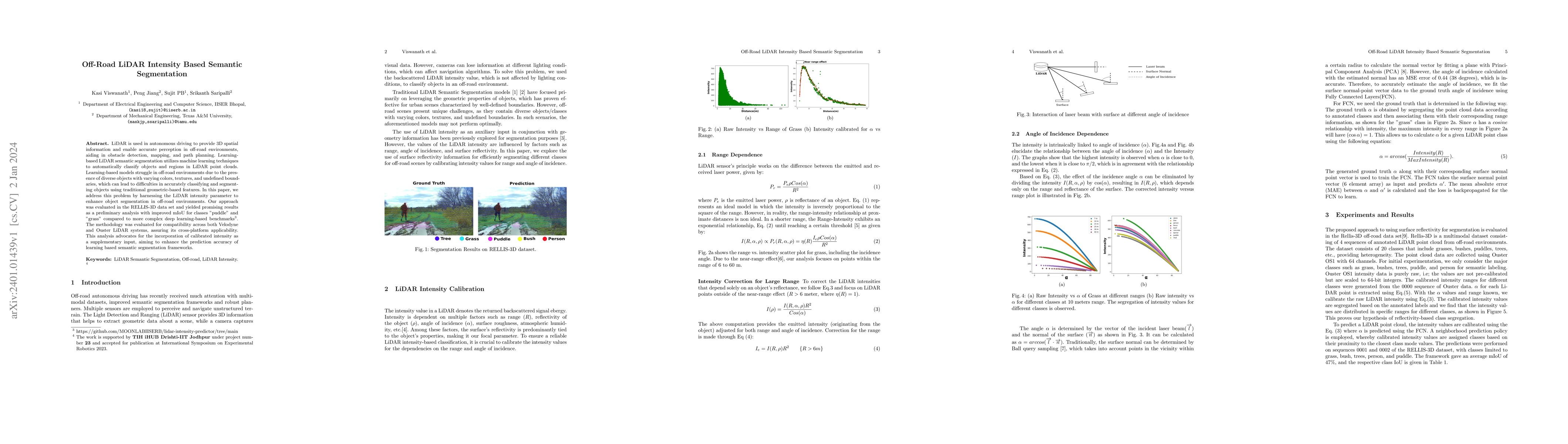
LiDAR is used in autonomous driving to provide 3D spatial information and enable accurate perception in off-road environments, aiding in obstacle detection, mapping, and path planning. Learning-base...
Predicting pedestrian behavior is the key to ensure safety and reliability of autonomous vehicles. While deep learning methods have been promising by learning from annotated video frame sequences, t...
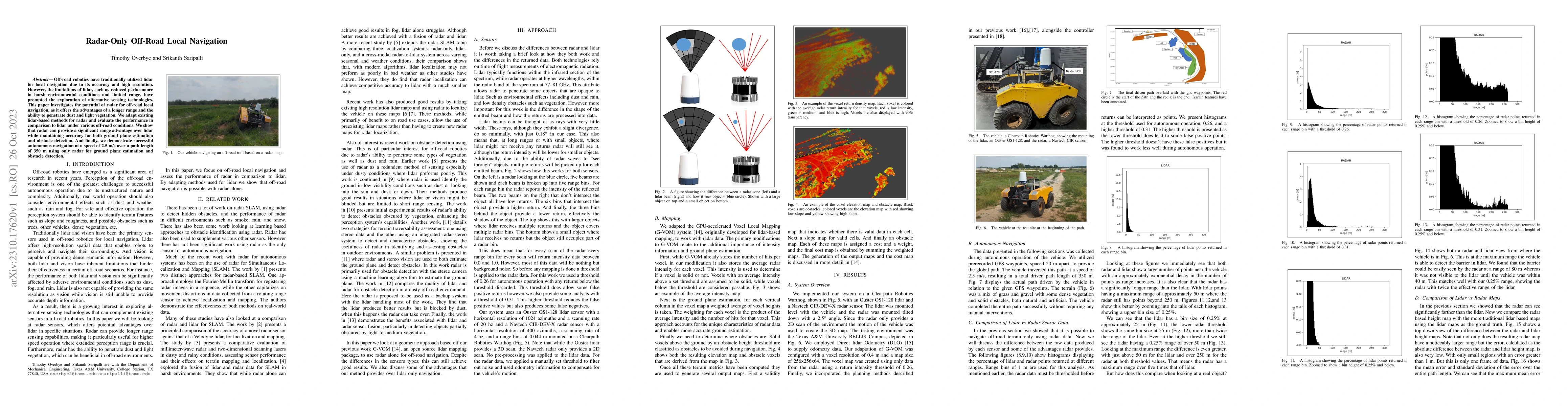
Off-road robotics have traditionally utilized lidar for local navigation due to its accuracy and high resolution. However, the limitations of lidar, such as reduced performance in harsh environmenta...

As the demand for autonomous navigation in off-road environments increases, the need for effective solutions to understand these surroundings becomes essential. In this study, we confront the inhere...
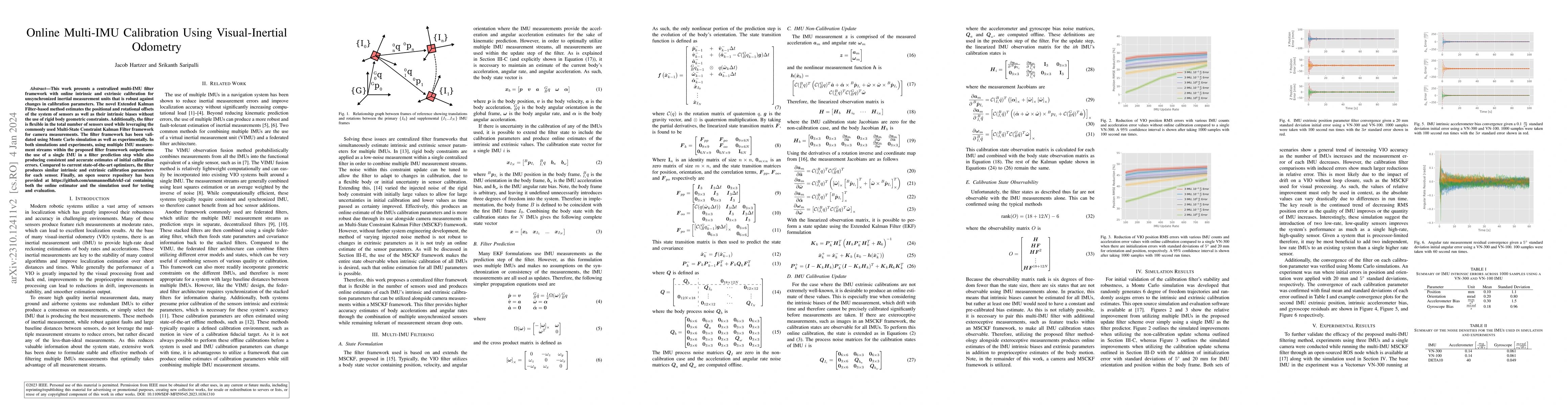
This work presents a centralized multi-IMU filter framework with online intrinsic and extrinsic calibration for unsynchronized inertial measurement units that is robust against changes in calibratio...
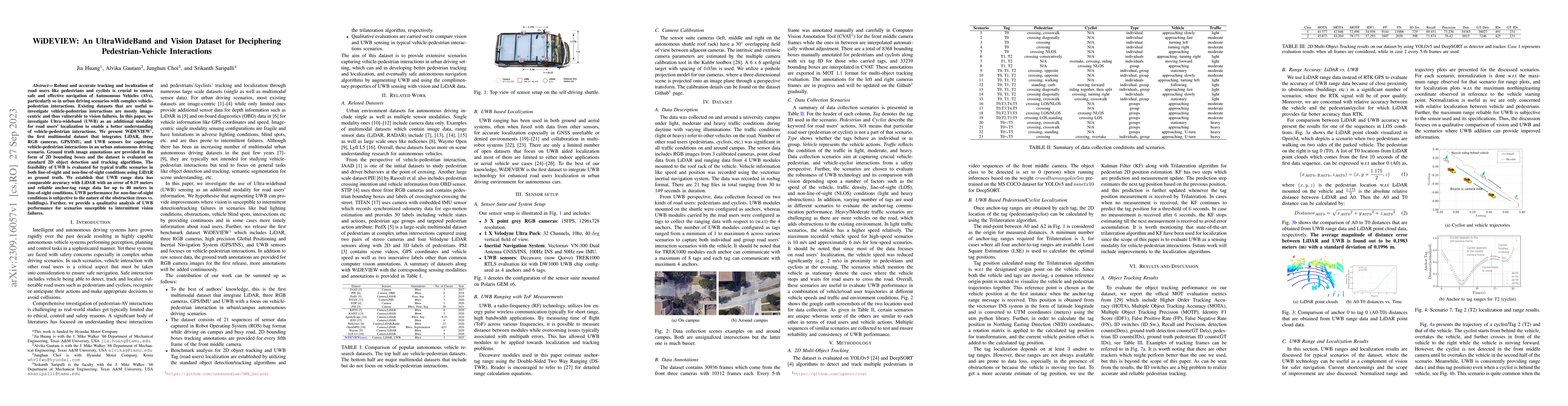
Robust and accurate tracking and localization of road users like pedestrians and cyclists is crucial to ensure safe and effective navigation of Autonomous Vehicles (AVs), particularly so in urban dr...
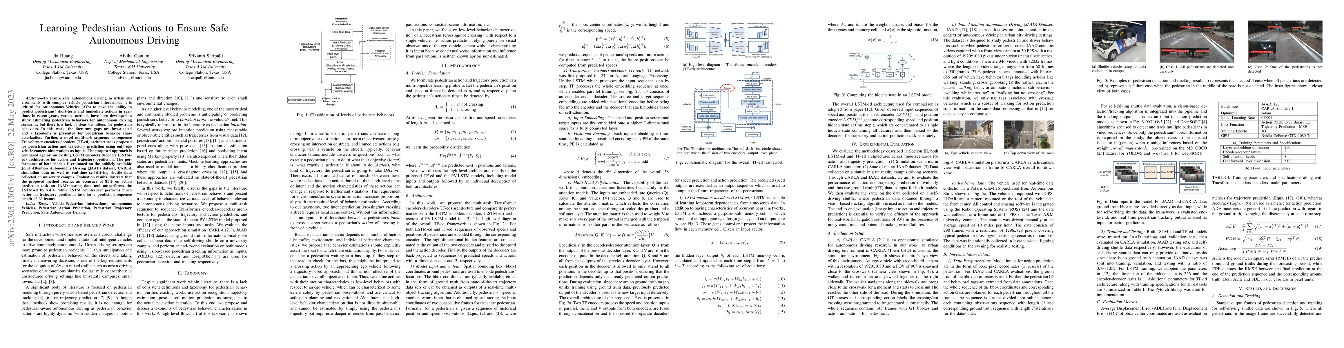
To ensure safe autonomous driving in urban environments with complex vehicle-pedestrian interactions, it is critical for Autonomous Vehicles (AVs) to have the ability to predict pedestrians' short-t...
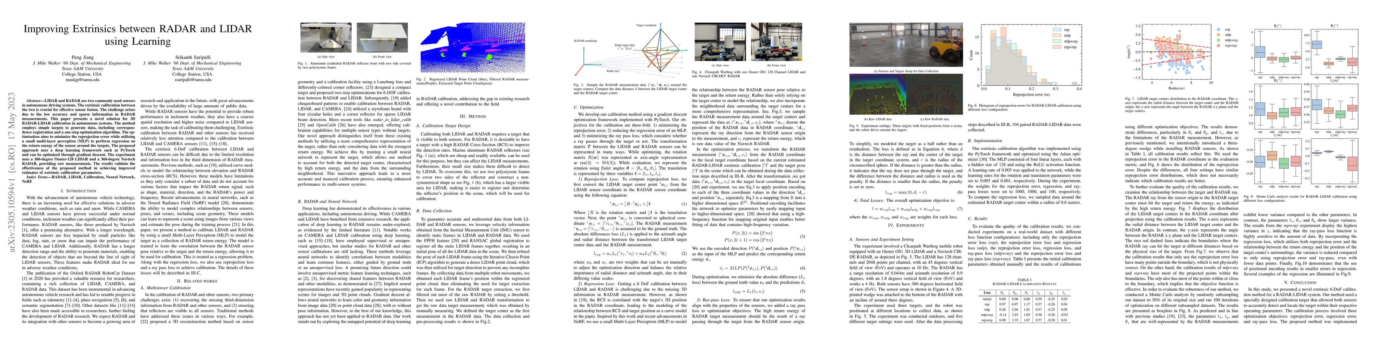
LIDAR and RADAR are two commonly used sensors in autonomous driving systems. The extrinsic calibration between the two is crucial for effective sensor fusion. The challenge arises due to the low acc...
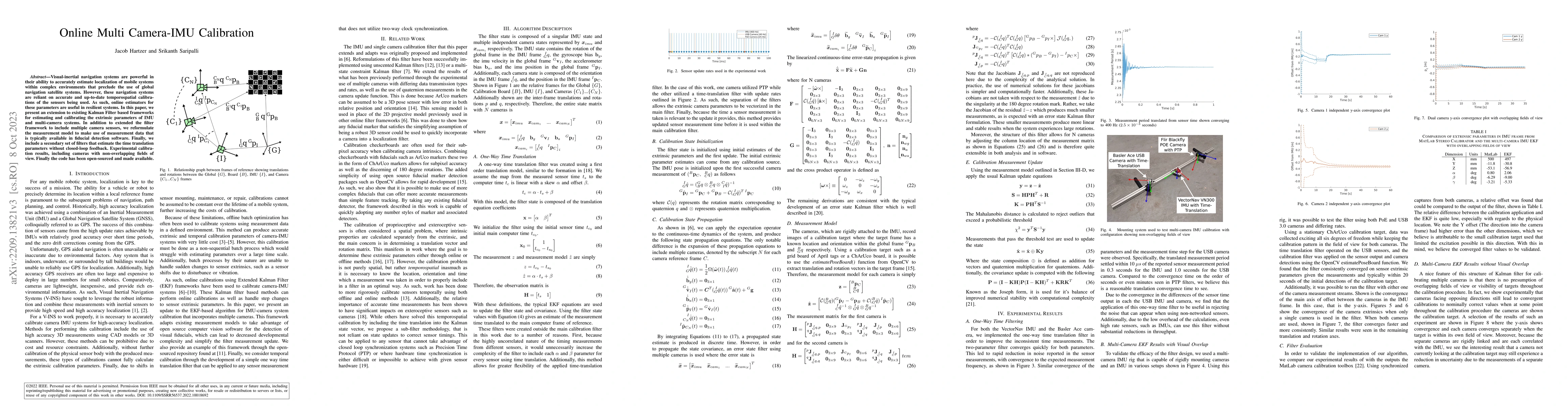
Visual-inertial navigation systems are powerful in their ability to accurately estimate localization of mobile systems within complex environments that preclude the use of global navigation satellit...
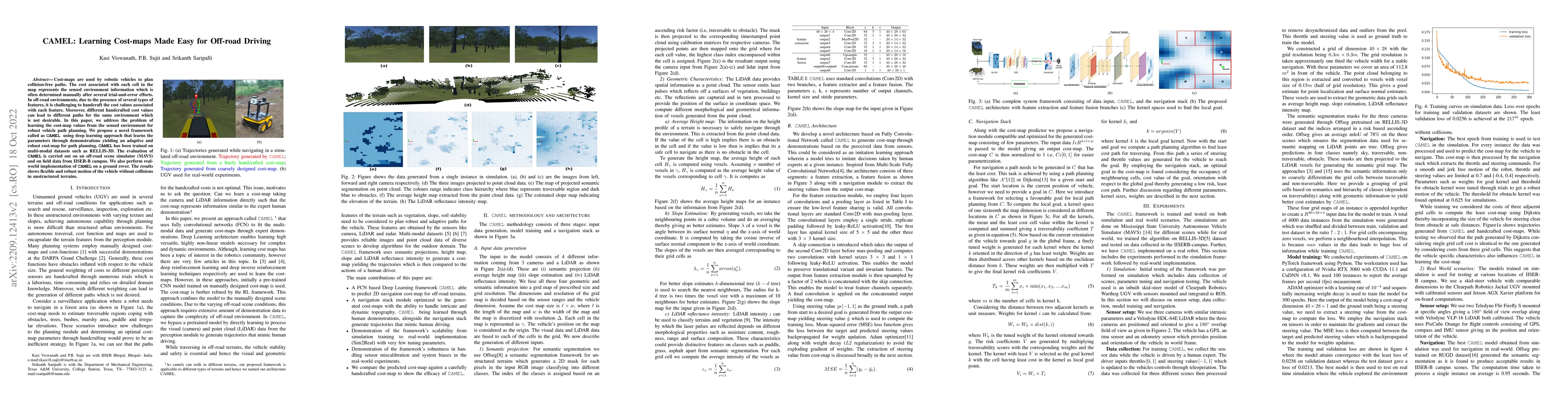
Cost-maps are used by robotic vehicles to plan collision-free paths. The cost associated with each cell in the map represents the sensed environment information which is often determined manually af...
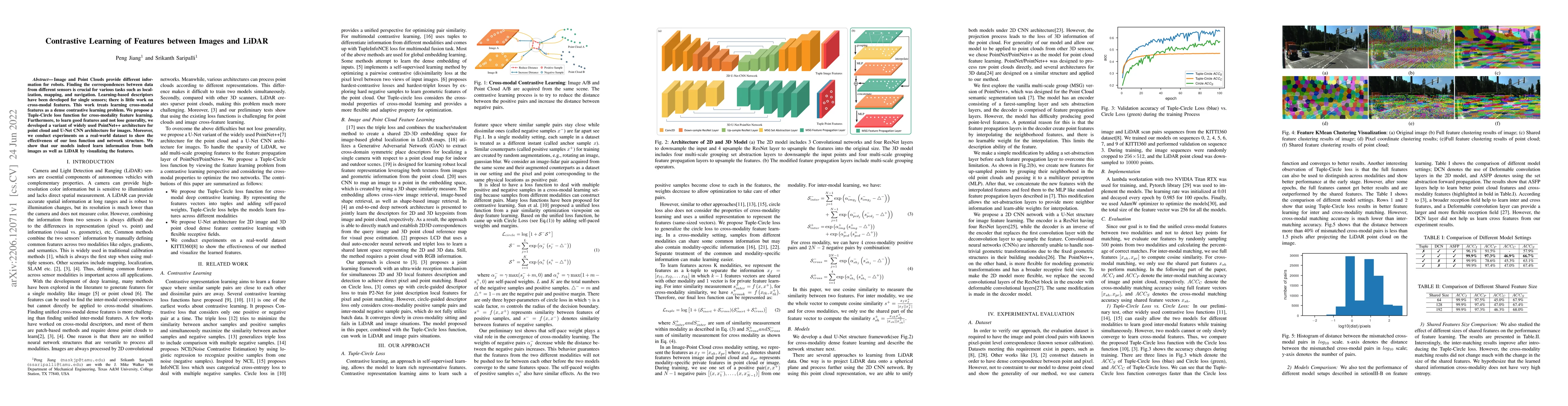
Image and Point Clouds provide different information for robots. Finding the correspondences between data from different sensors is crucial for various tasks such as localization, mapping, and navig...
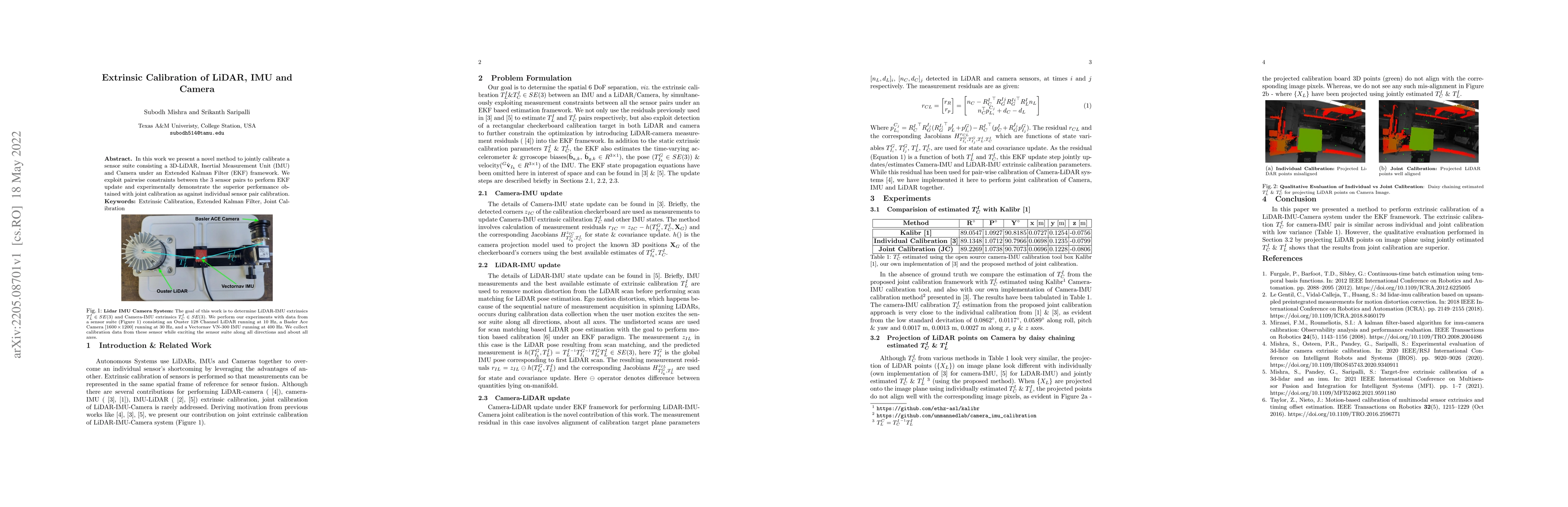
In this work we present a novel method to jointly calibrate a sensor suite consisting a 3D-LiDAR, Inertial Measurement Unit (IMU) and Camera under an Extended Kalman Filter (EKF) framework. We explo...
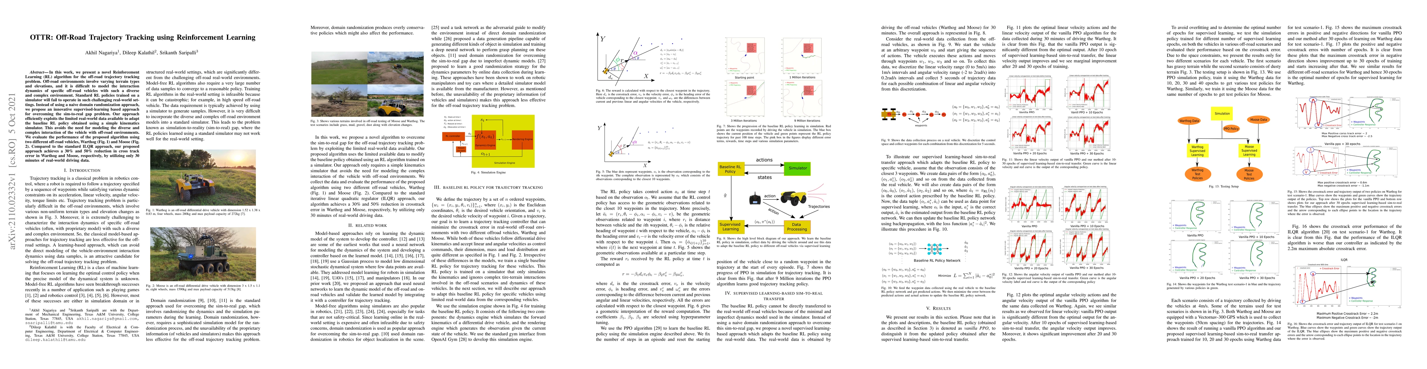
In this work, we present a novel Reinforcement Learning (RL) algorithm for the off-road trajectory tracking problem. Off-road environments involve varying terrain types and elevations, and it is dif...
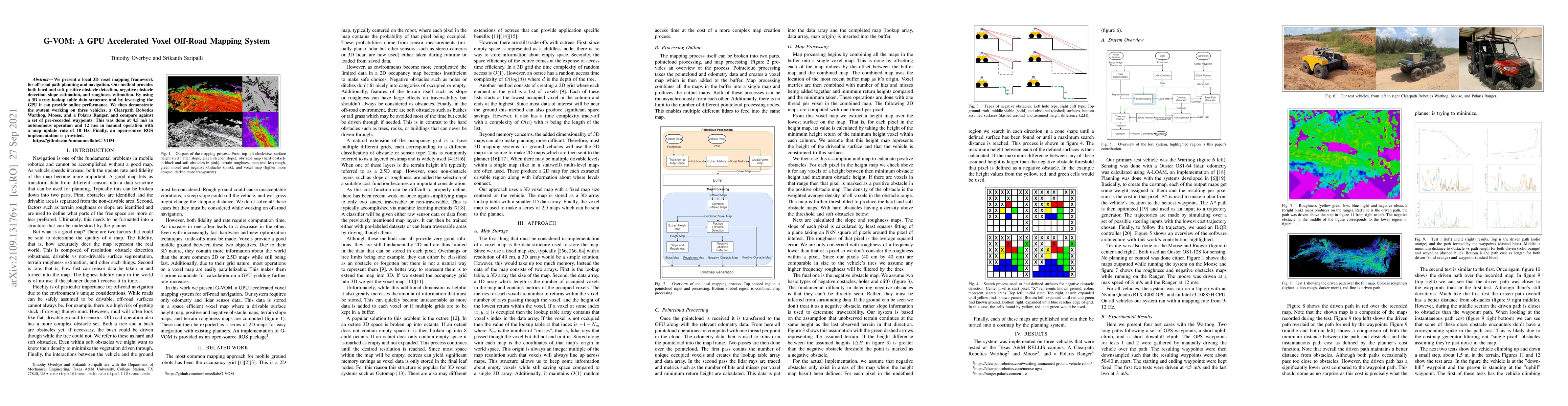
We present a local 3D voxel mapping framework for off-road path planning and navigation. Our method provides both hard and soft positive obstacle detection, negative obstacle detection, slope estima...
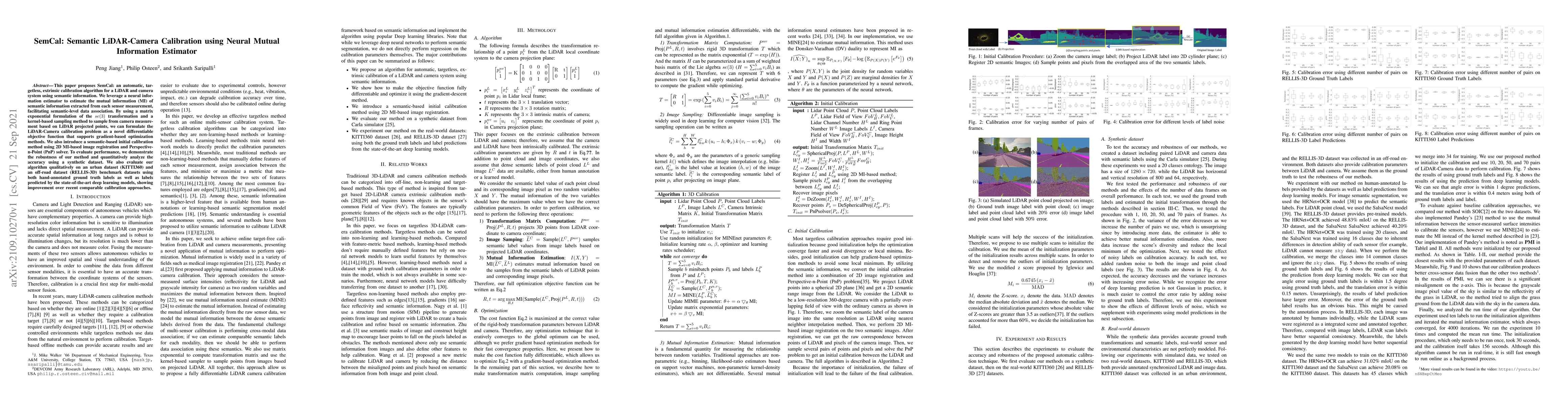
This paper proposes SemCal: an automatic, targetless, extrinsic calibration algorithm for a LiDAR and camera system using semantic information. We leverage a neural information estimator to estimate...
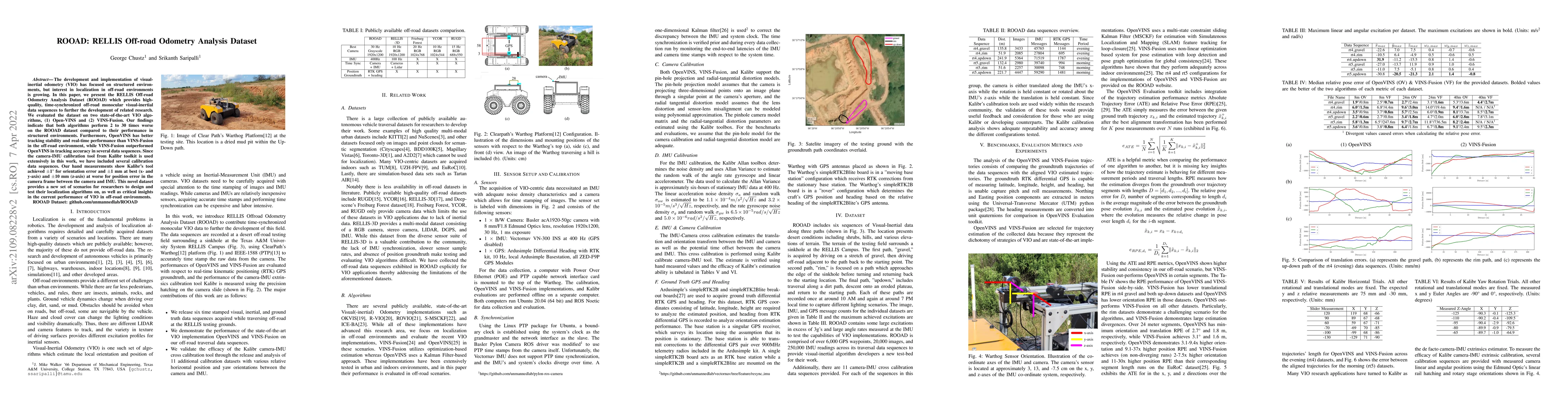
The development and implementation of visual-inertial odometry (VIO) has focused on structured environments, but interest in localization in off-road environments is growing. In this paper, we prese...
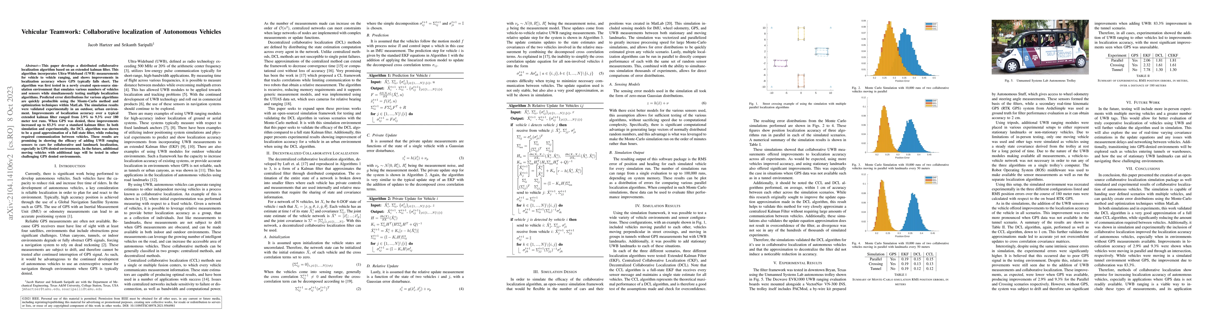
This paper develops a distributed collaborative localization algorithm based on an extended kalman filter. This algorithm incorporates Ultra-Wideband (UWB) measurements for vehicle to vehicle rangin...
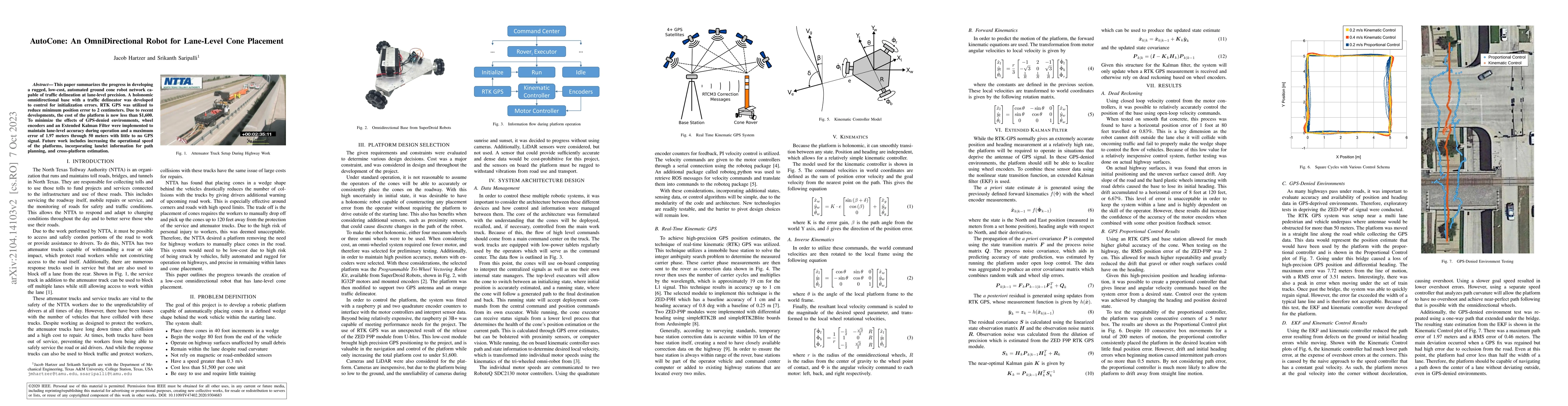
This paper summarizes the progress in developing a rugged, low-cost, automated ground cone robot network capable of traffic delineation at lane-level precision. A holonomic omnidirectional base with...
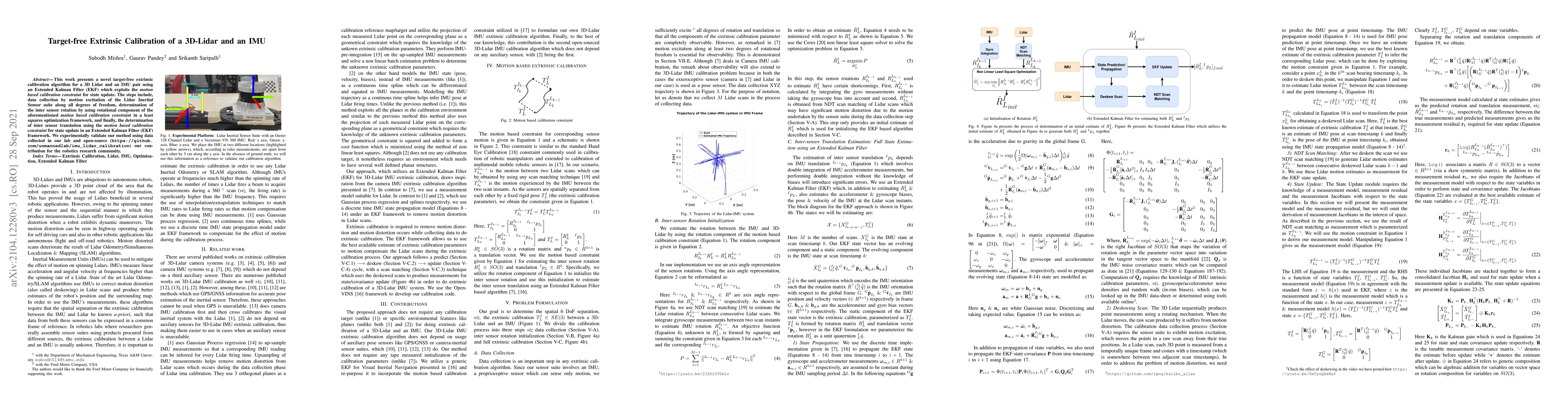
This work presents a novel target-free extrinsic calibration algorithm for a 3D Lidar and an IMU pair using an Extended Kalman Filter (EKF) which exploits the \textit{motion based calibration constr...
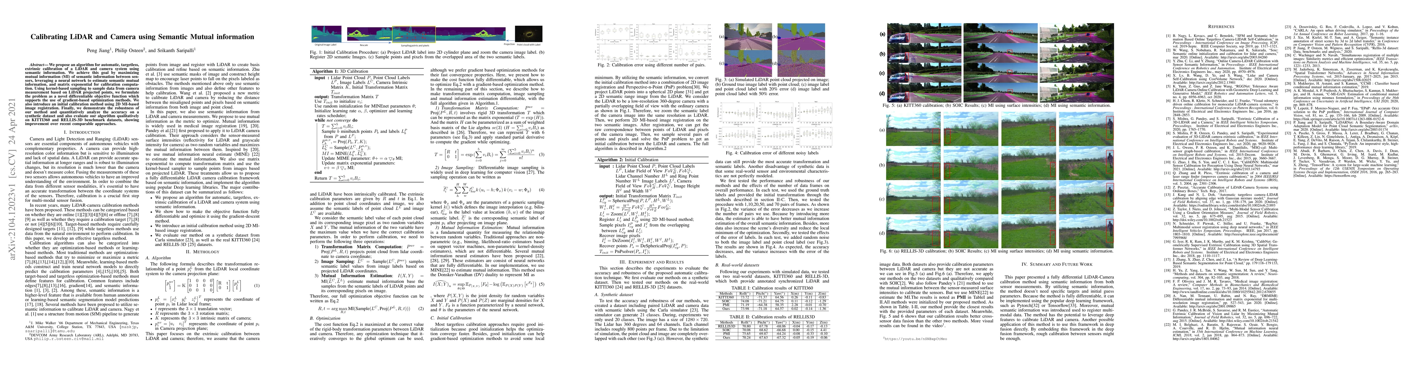
We propose an algorithm for automatic, targetless, extrinsic calibration of a LiDAR and camera system using semantic information. We achieve this goal by maximizing mutual information (MI) of semant...
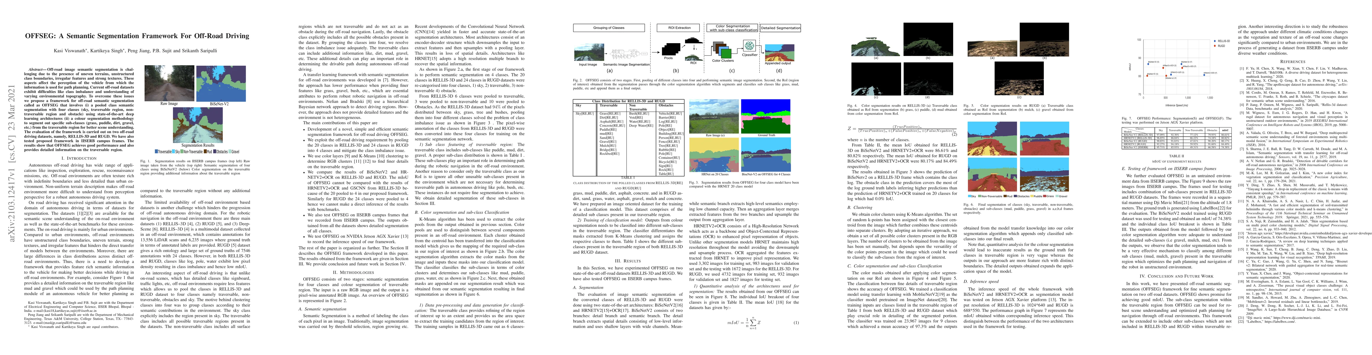
Off-road image semantic segmentation is challenging due to the presence of uneven terrains, unstructured class boundaries, irregular features and strong textures. These aspects affect the perception...
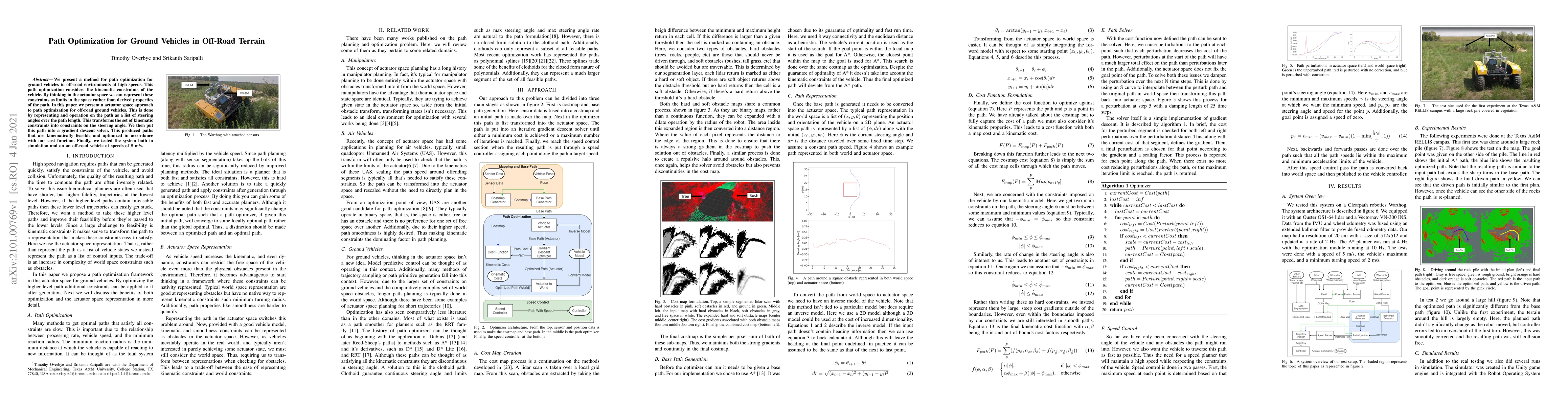
We present a method for path optimization for ground vehicles in off-road environments at high speeds. This path optimization considers the kinematic constraints of the vehicle. By thinking in the a...
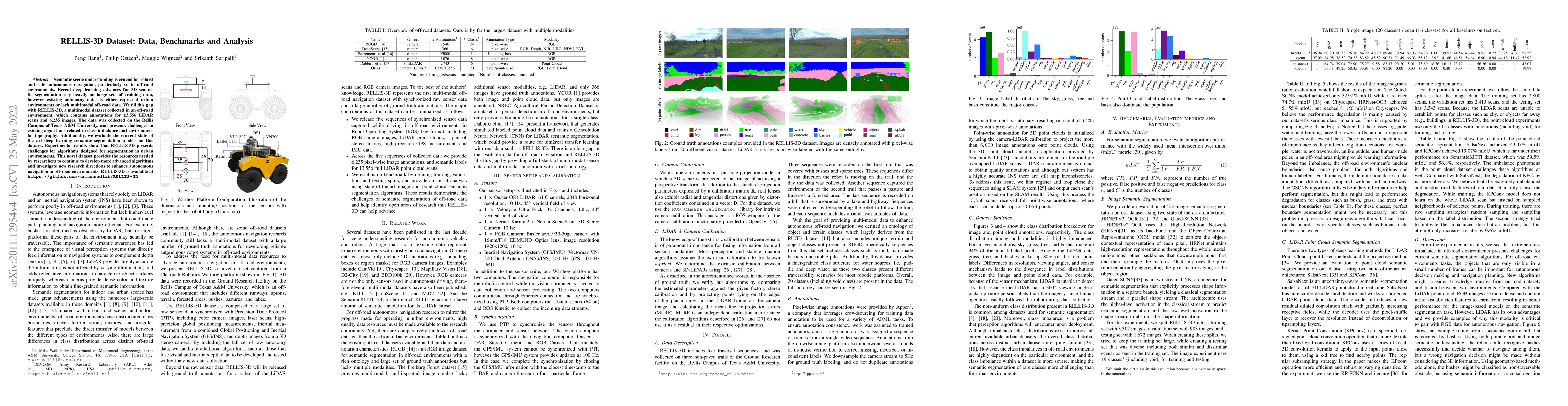
Semantic scene understanding is crucial for robust and safe autonomous navigation, particularly so in off-road environments. Recent deep learning advances for 3D semantic segmentation rely heavily o...
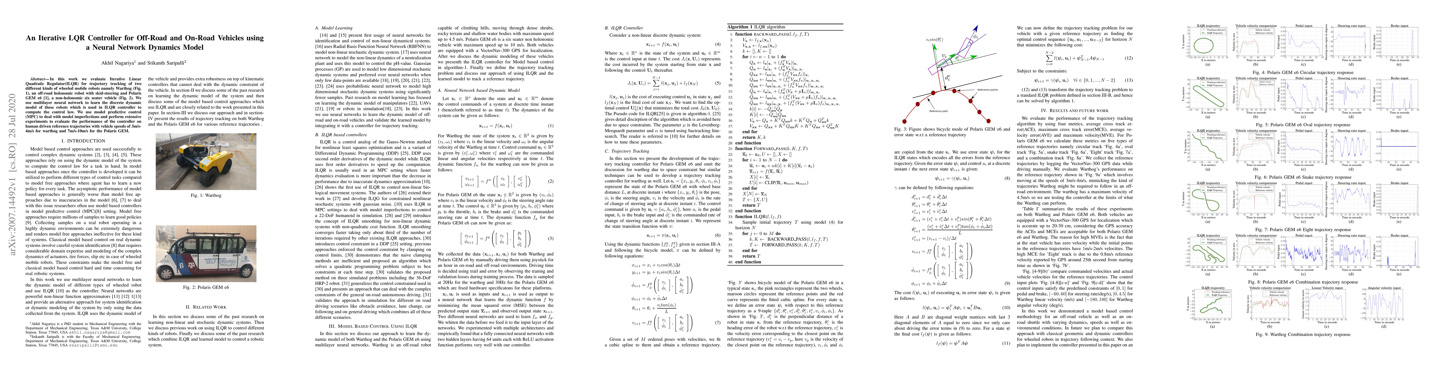
In this work we evaluate Iterative Linear Quadratic Regulator(ILQR) for trajectory tracking of two different kinds of wheeled mobile robots namely Warthog (Fig. 1), an off-road holonomic robot with ...
In this paper we perform an experimental comparison of three different target based 3D-LIDAR camera calibration algorithms. We briefly elucidate the mathematical background behind each method and pr...
This work presents an extrinsic parameter estimation algorithm between a 3D LIDAR and a Projective Camera using a marker-less planar target, by exploiting Planar Surface Point to Plane and Planar Ed...
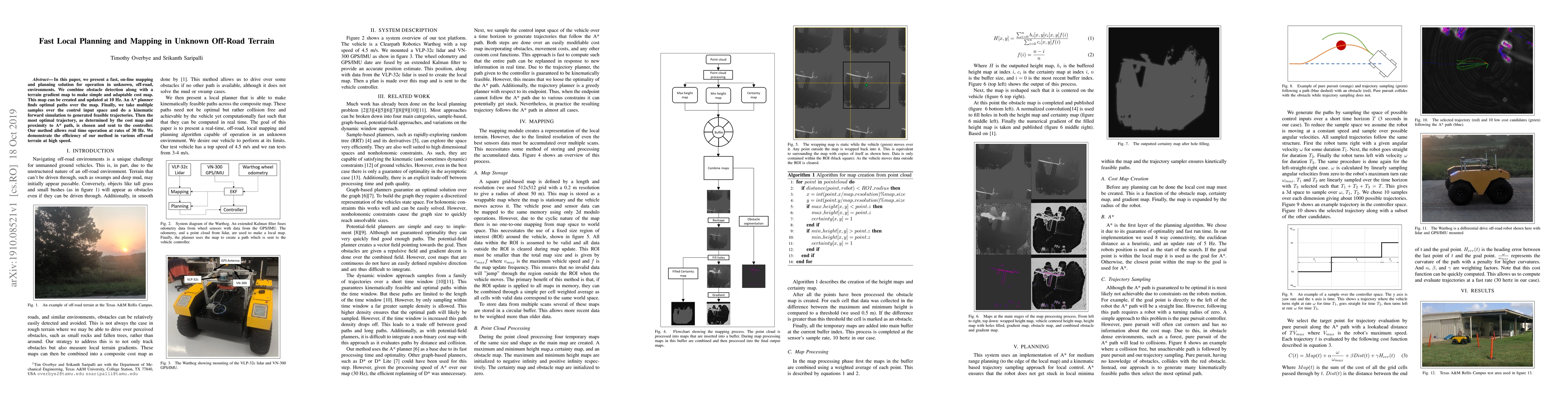
In this paper, we present a fast, on-line mapping and planning solution for operation in unknown, off-road, environments. We combine obstacle detection along with a terrain gradient map to make simp...
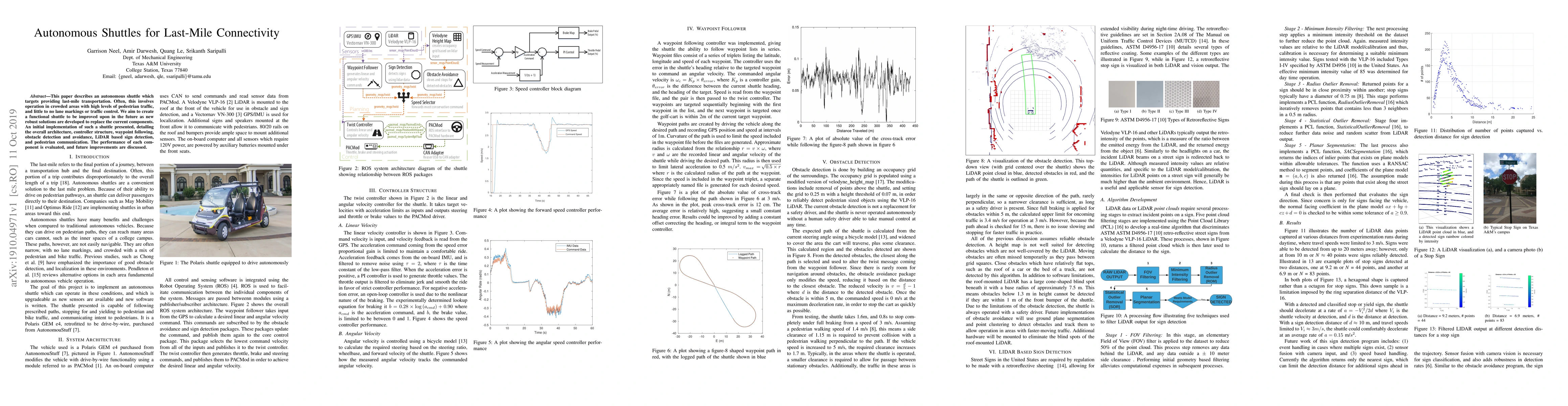
This paper describes an autonomous shuttle which targets providing last-mile transportation. Often, this involves operation in crowded areas with high levels of pedestrian traffic, and little to no ...
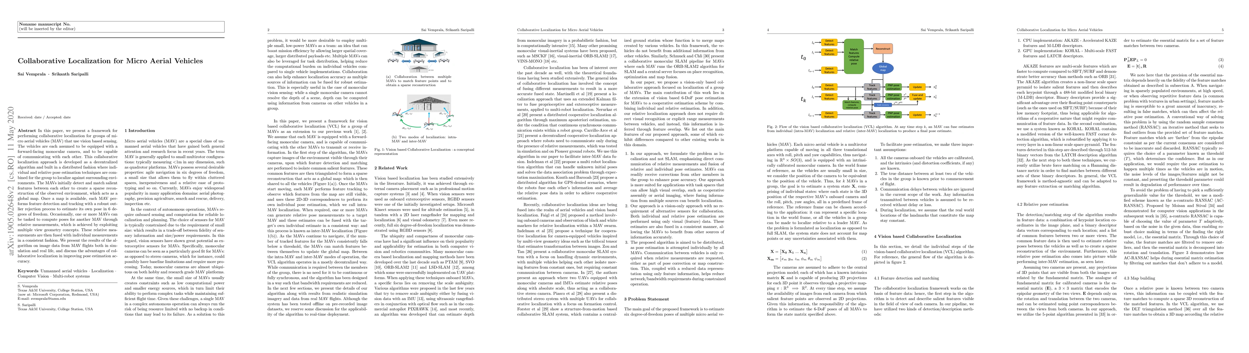
In this paper, we present a framework for performing collaborative localization for groups of micro aerial vehicles (MAV) that use vision based sensing. The vehicles are each assumed to be equipped ...
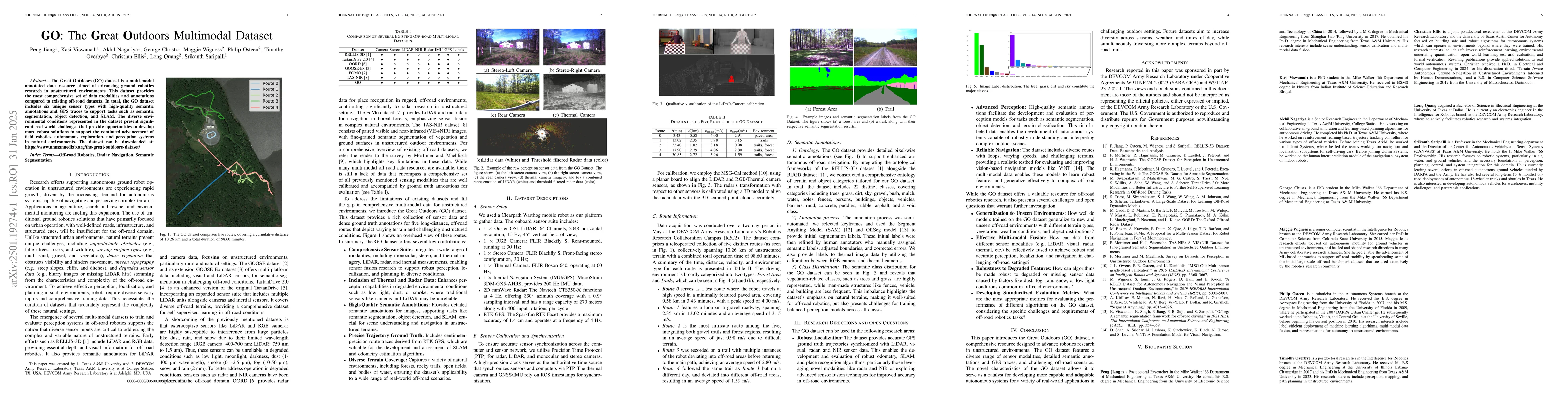
The Great Outdoors (GO) dataset is a multi-modal annotated data resource aimed at advancing ground robotics research in unstructured environments. This dataset provides the most comprehensive set of d...
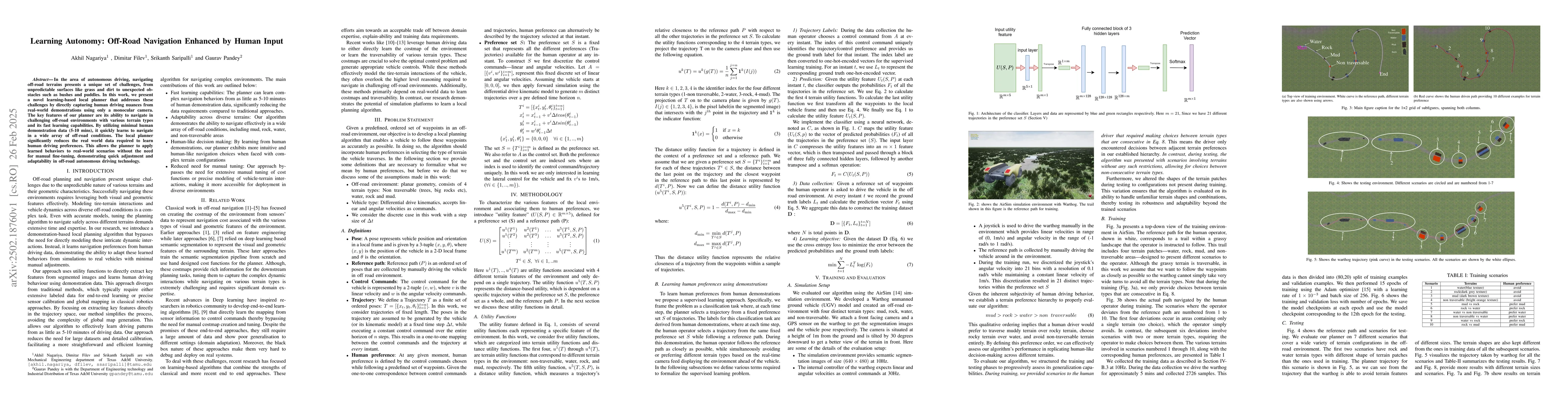
In the area of autonomous driving, navigating off-road terrains presents a unique set of challenges, from unpredictable surfaces like grass and dirt to unexpected obstacles such as bushes and puddles....
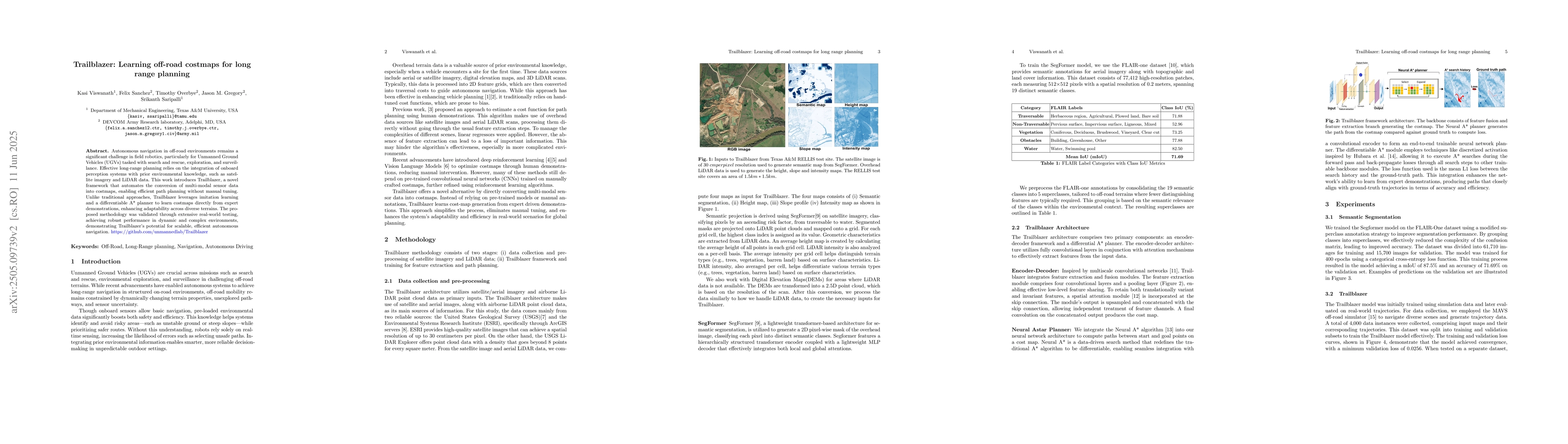
Autonomous navigation in off-road environments remains a significant challenge in field robotics, particularly for Unmanned Ground Vehicles (UGVs) tasked with search and rescue, exploration, and surve...
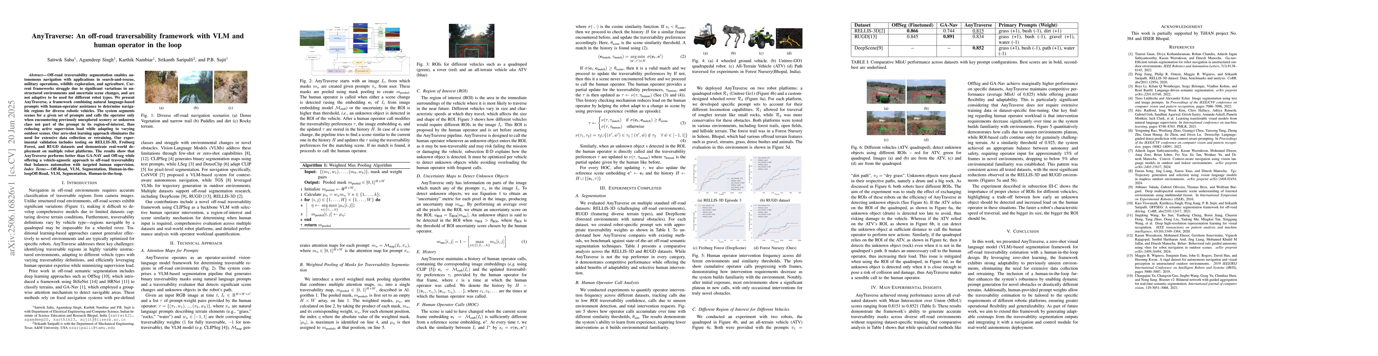
Off-road traversability segmentation enables autonomous navigation with applications in search-and-rescue, military operations, wildlife exploration, and agriculture. Current frameworks struggle due t...
We present Stylos, a single-forward 3D Gaussian framework for 3D style transfer that operates on unposed content, from a single image to a multi-view collection, conditioned on a separate reference st...
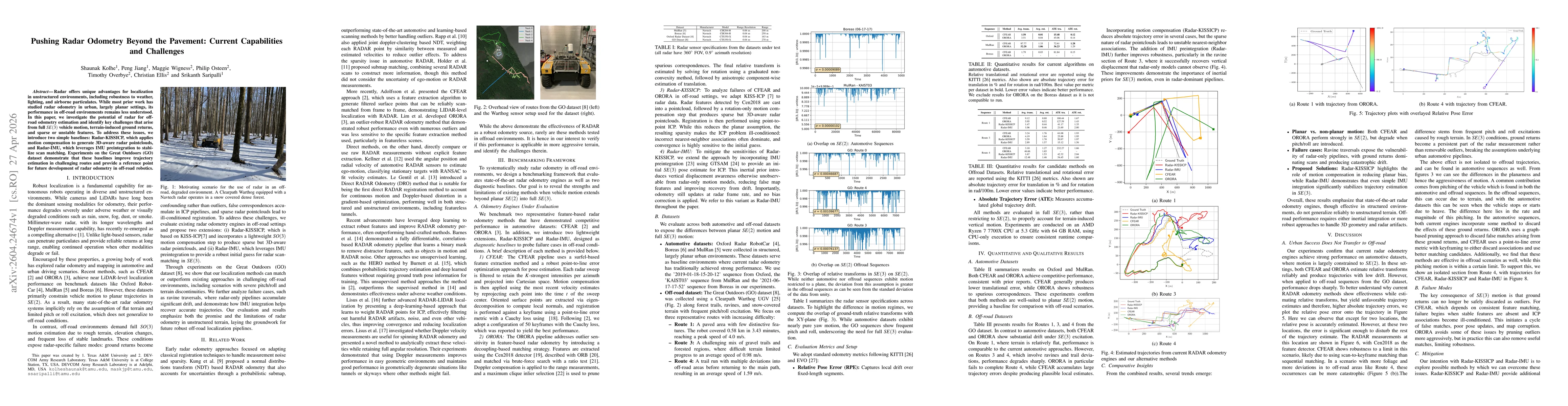
Radar offers unique advantages for localization in unstructured environments, including robustness to weather, lighting, and airborne particulates. While most prior work has studied radar odometry in ...