Academic Profile
Statistics
Similar Authors
Papers on arXiv
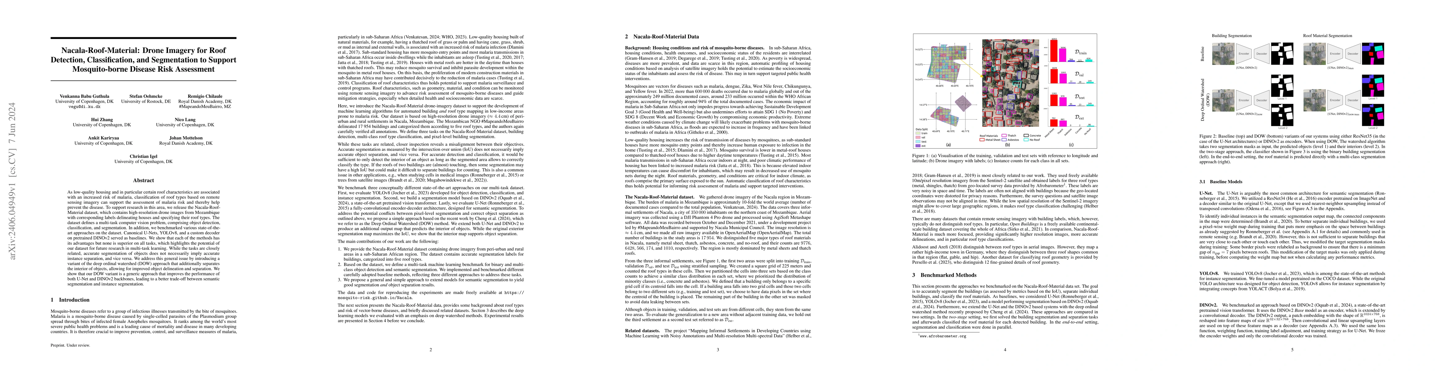
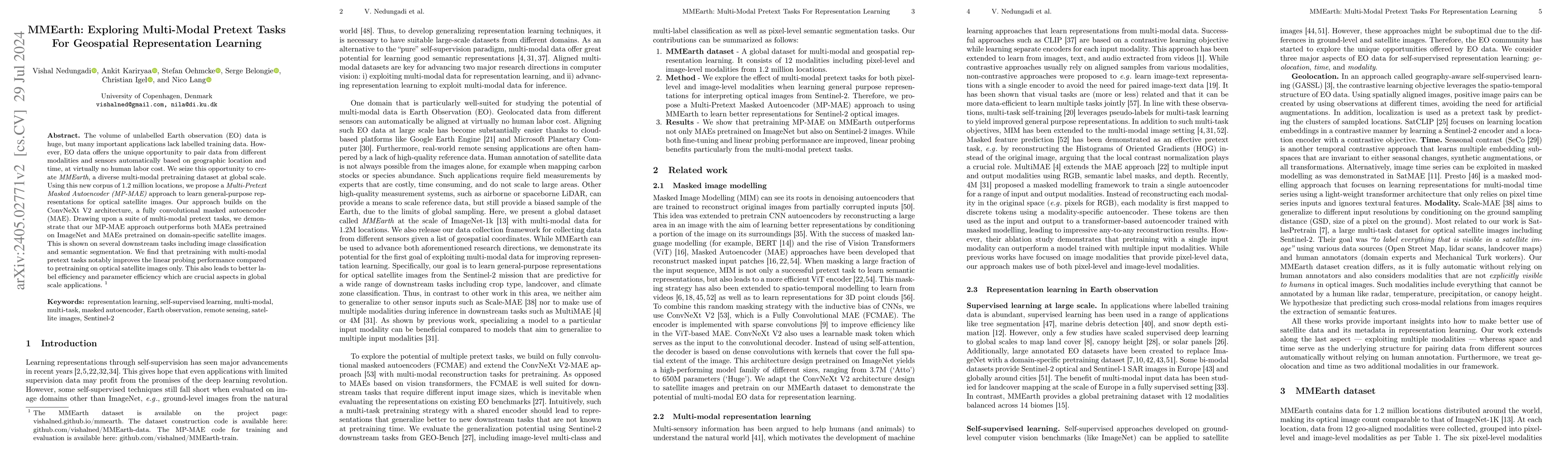
As low-quality housing and in particular certain roof characteristics are associated with an increased risk of malaria, classification of roof types based on remote sensing imagery can support the a...
The volume of unlabelled Earth observation (EO) data is huge, but many important applications lack labelled training data. However, EO data offers the unique opportunity to pair data from different ...
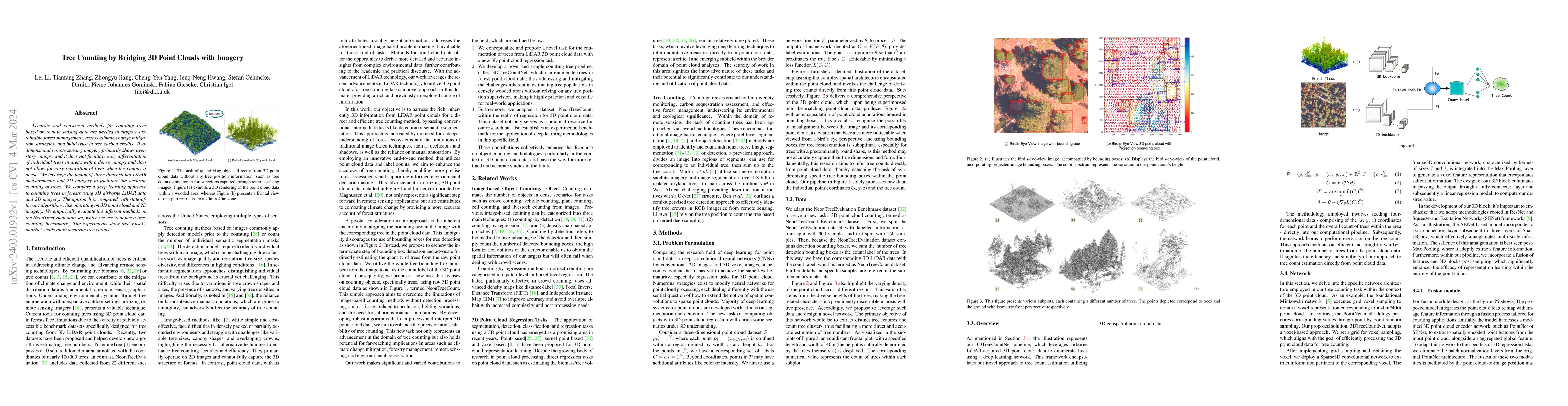
Accurate and consistent methods for counting trees based on remote sensing data are needed to support sustainable forest management, assess climate change mitigation strategies, and build trust in t...
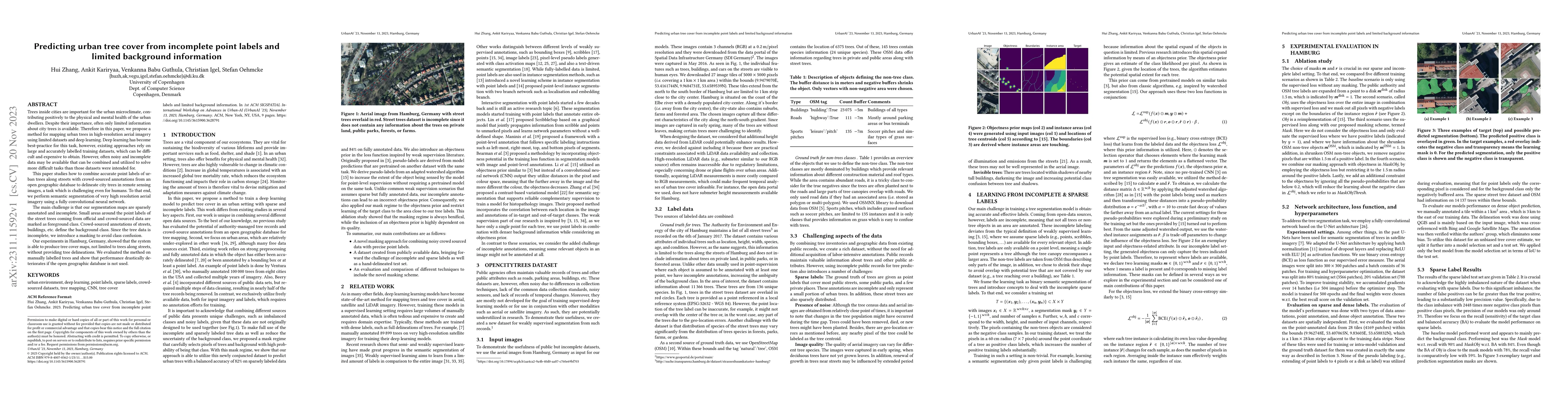
Trees inside cities are important for the urban microclimate, contributing positively to the physical and mental health of the urban dwellers. Despite their importance, often only limited informatio...
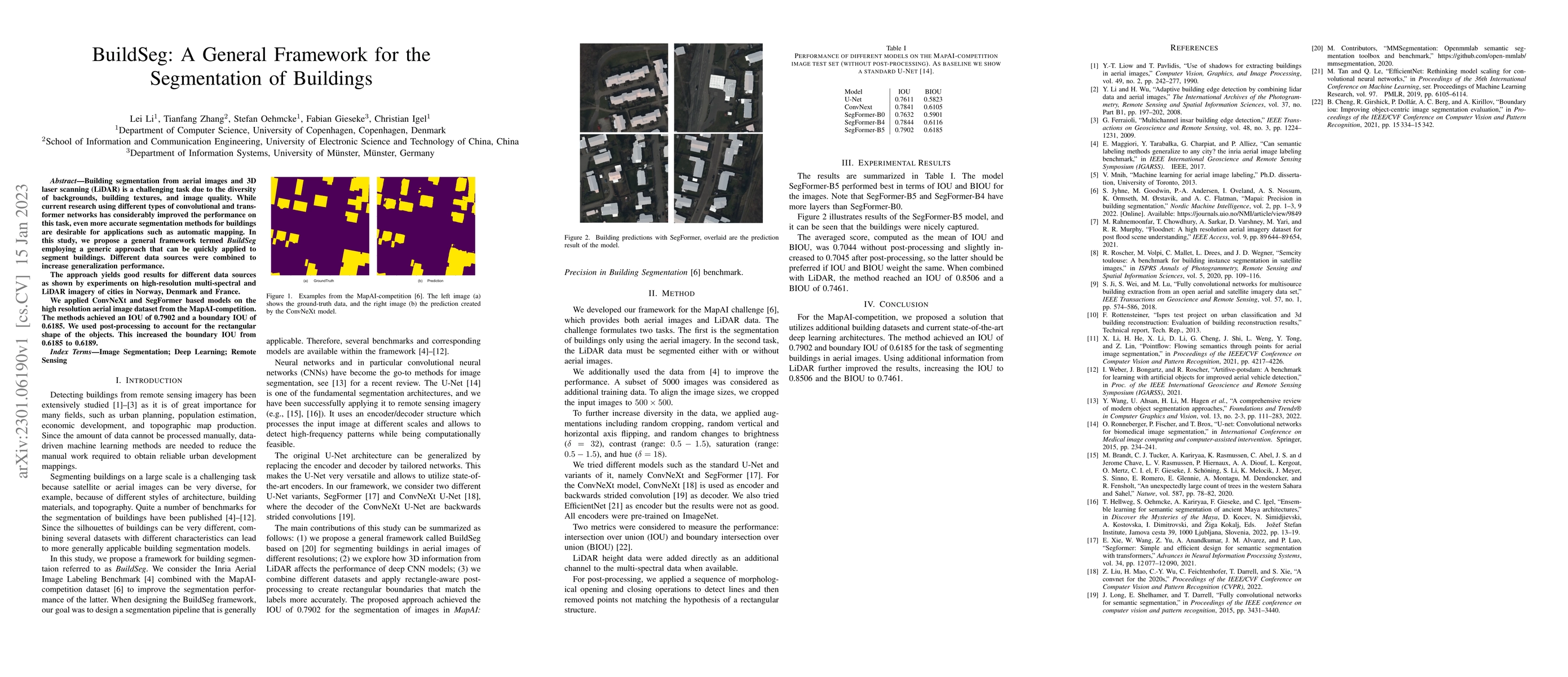
Building segmentation from aerial images and 3D laser scanning (LiDAR) is a challenging task due to the diversity of backgrounds, building textures, and image quality. While current research using d...
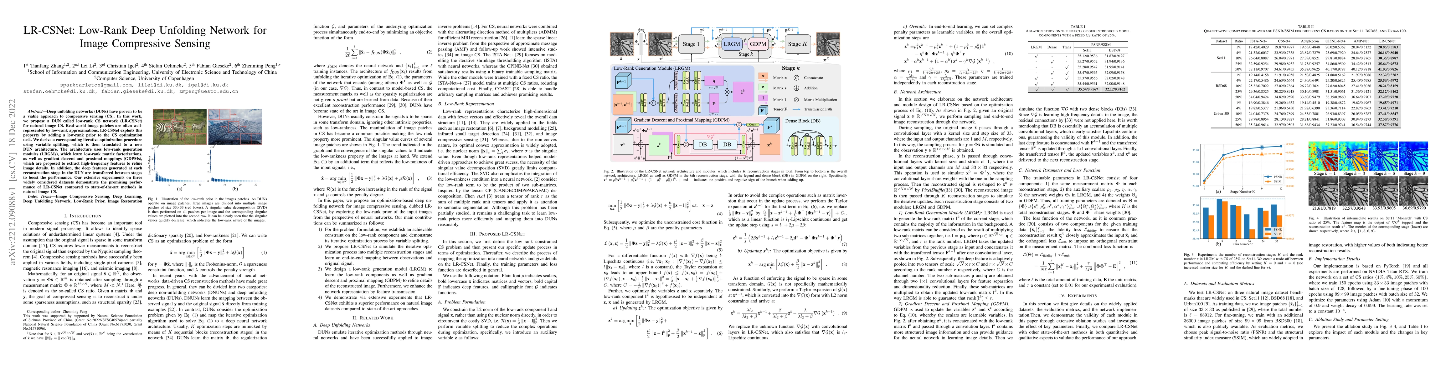
Deep unfolding networks (DUNs) have proven to be a viable approach to compressive sensing (CS). In this work, we propose a DUN called low-rank CS network (LR-CSNet) for natural image CS. Real-world ...
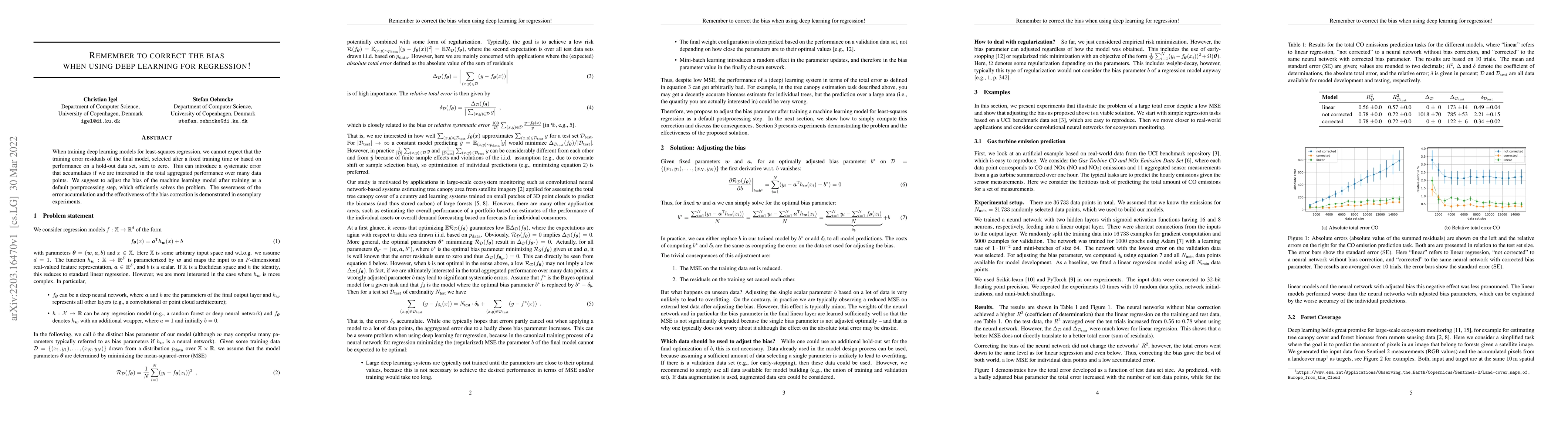
When training deep learning models for least-squares regression, we cannot expect that the training error residuals of the final model, selected after a fixed training time or based on performance o...
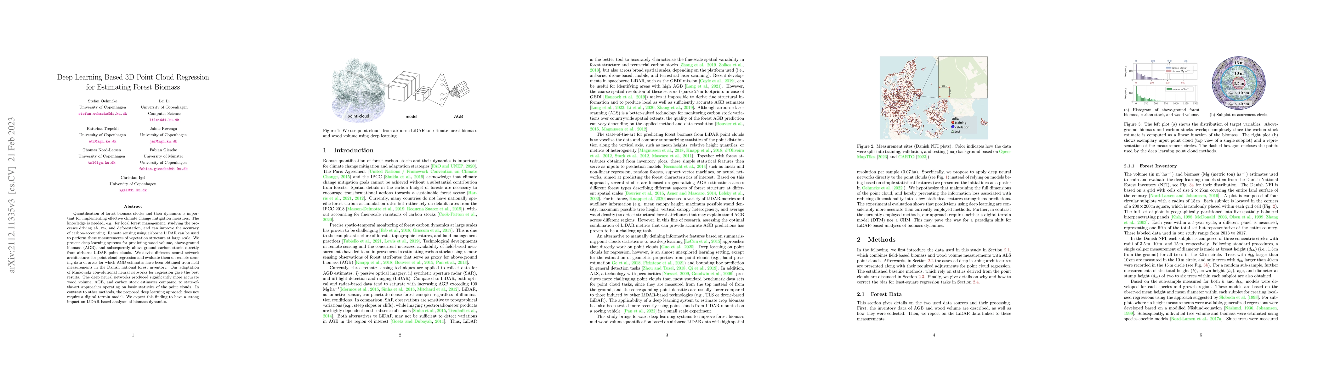
Quantification of forest biomass stocks and their dynamics is important for implementing effective climate change mitigation measures. The knowledge is needed, e.g., for local forest management, stu...
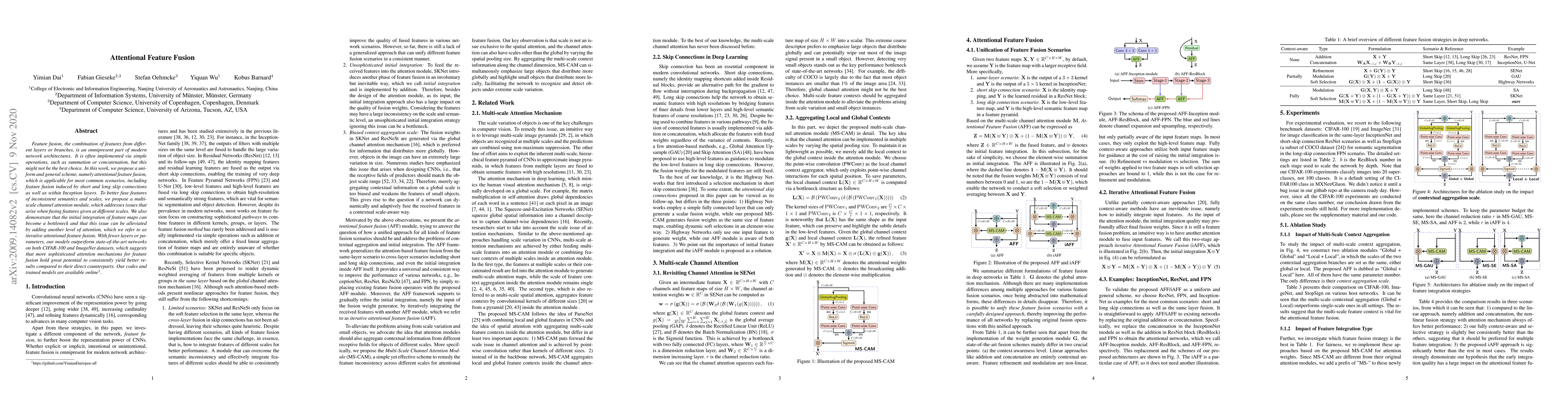
Feature fusion, the combination of features from different layers or branches, is an omnipresent part of modern network architectures. It is often implemented via simple operations, such as summatio...
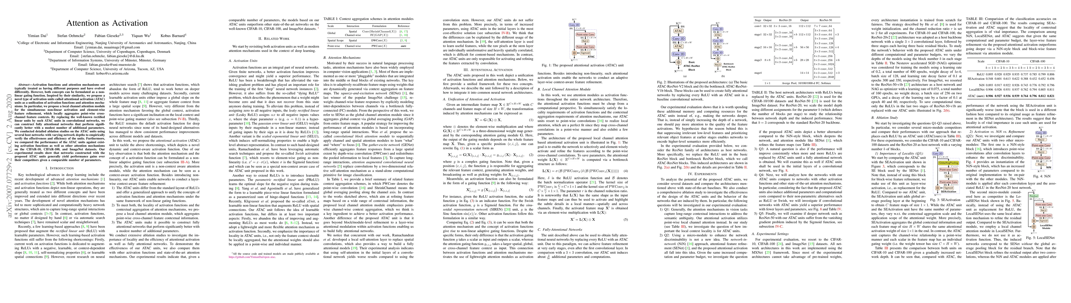
Activation functions and attention mechanisms are typically treated as having different purposes and have evolved differently. However, both concepts can be formulated as a non-linear gating functio...
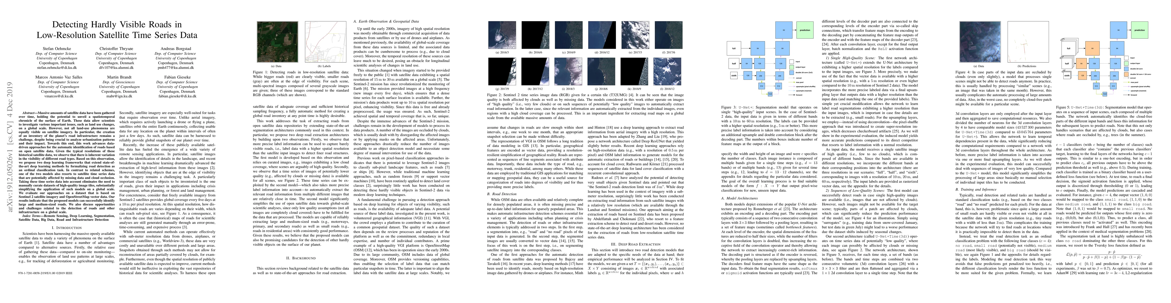
Massive amounts of satellite data have been gathered over time, holding the potential to unveil a spatiotemporal chronicle of the surface of Earth. These data allow scientists to investigate various...
Neural networks have achieved dramatic improvements in recent years and depict the state-of-the-art methods for many real-world tasks nowadays. One drawback is, however, that many of these models ar...
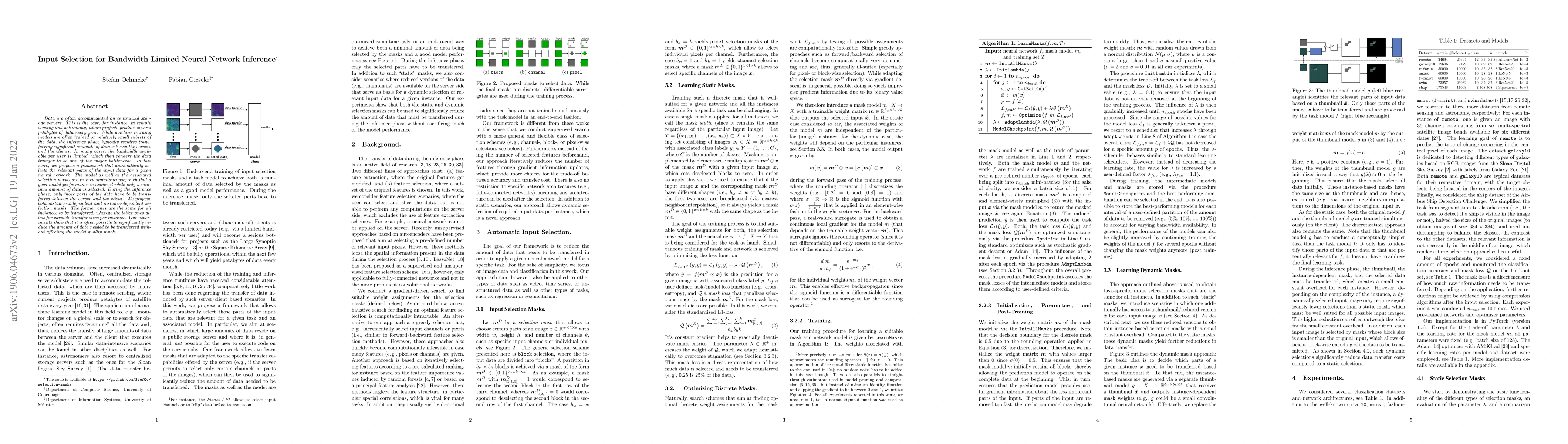
Data are often accommodated on centralized storage servers. This is the case, for instance, in remote sensing and astronomy, where projects produce several petabytes of data every year. While machin...
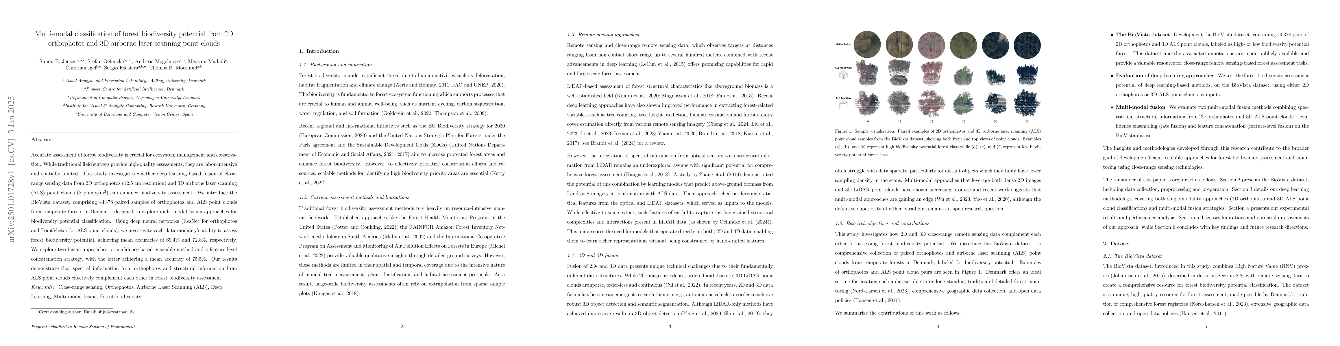
Accurate assessment of forest biodiversity is crucial for ecosystem management and conservation. While traditional field surveys provide high-quality assessments, they are labor-intensive and spatiall...
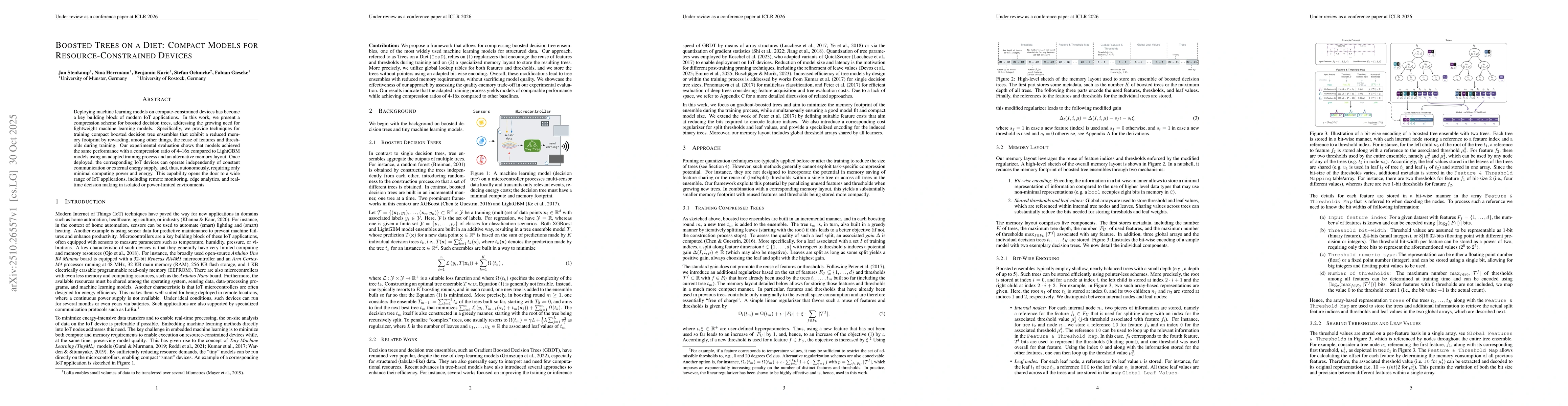
Deploying machine learning models on compute-constrained devices has become a key building block of modern IoT applications. In this work, we present a compression scheme for boosted decision trees, a...
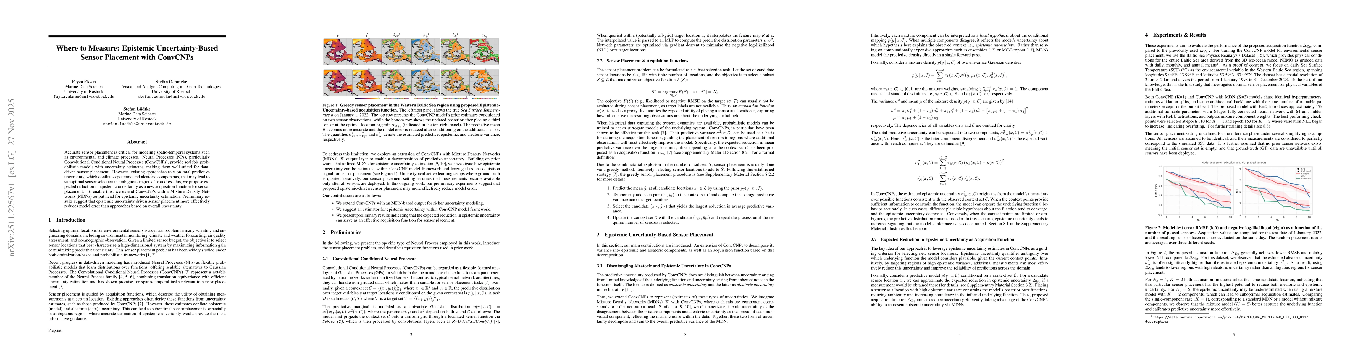
Accurate sensor placement is critical for modeling spatio-temporal systems such as environmental and climate processes. Neural Processes (NPs), particularly Convolutional Conditional Neural Processes ...
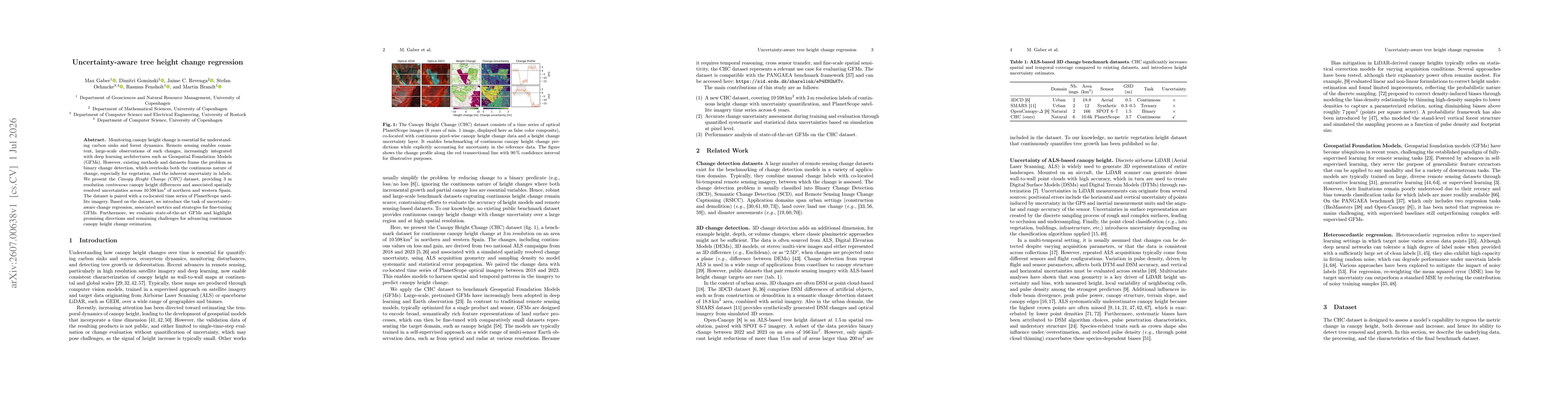
Monitoring canopy height change is essential for understanding carbon sinks and forest dynamics. Remote sensing enables consistent, large-scale observations of such changes, increasingly integrated wi...