Academic Profile
Statistics
Similar Authors
Papers on arXiv
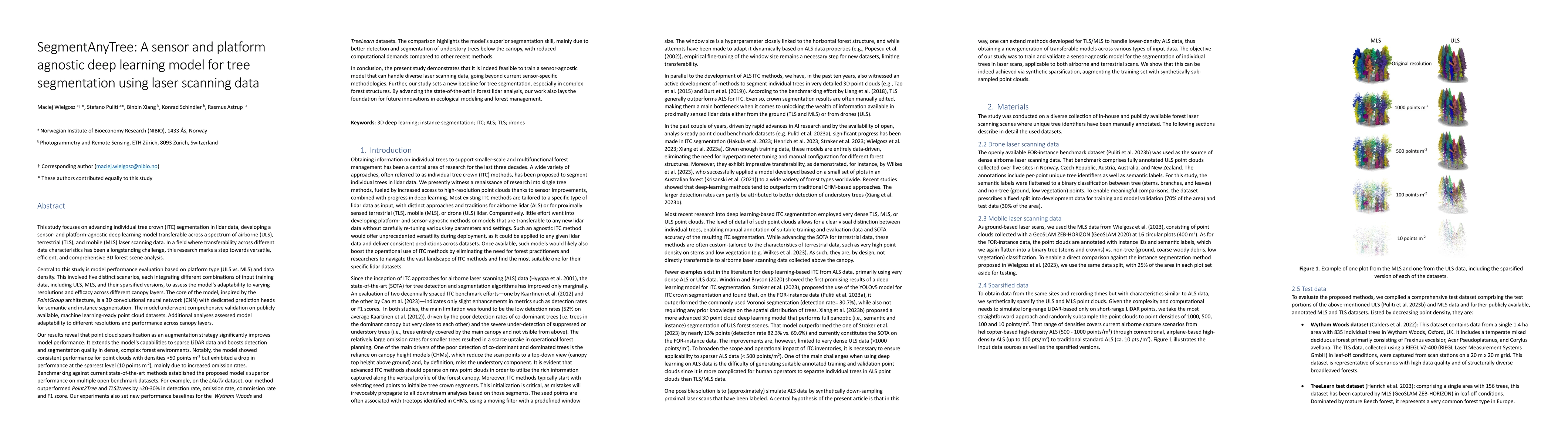
This research advances individual tree crown (ITC) segmentation in lidar data, using a deep learning model applicable to various laser scanning types: airborne (ULS), terrestrial (TLS), and mobile (...
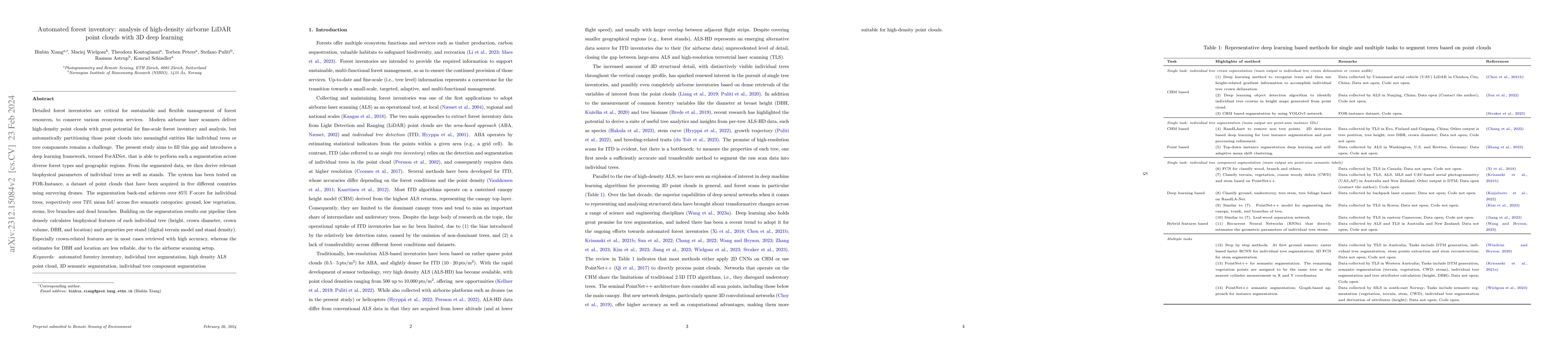
Detailed forest inventories are critical for sustainable and flexible management of forest resources, to conserve various ecosystem services. Modern airborne laser scanners deliver high-density poin...
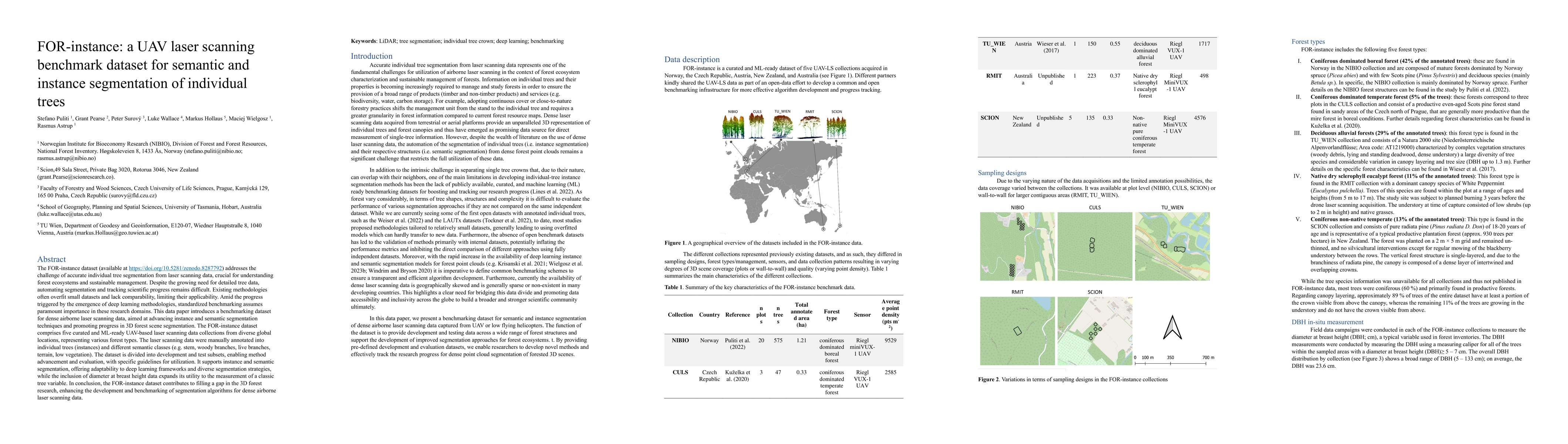
The FOR-instance dataset (available at https://doi.org/10.5281/zenodo.8287792) addresses the challenge of accurate individual tree segmentation from laser scanning data, crucial for understanding fo...
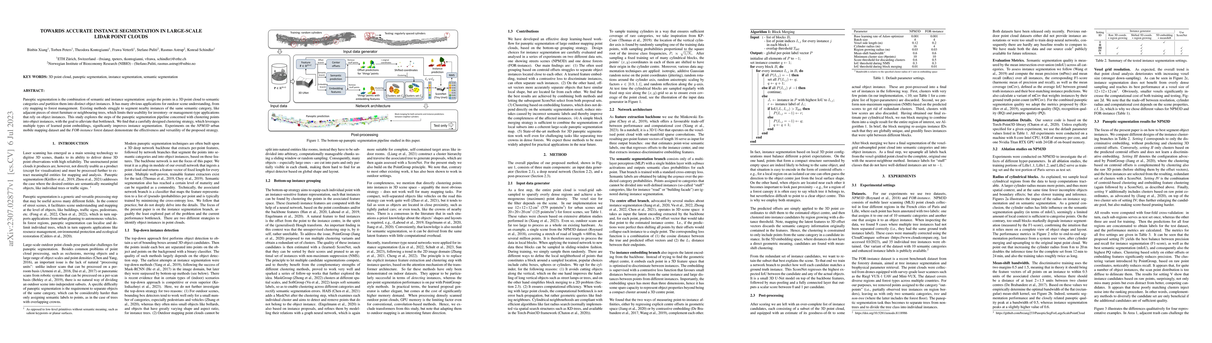
Panoptic segmentation is the combination of semantic and instance segmentation: assign the points in a 3D point cloud to semantic categories and partition them into distinct object instances. It has...
This article introduces Point2Tree, a novel framework that incorporates a three-stage process involving semantic segmentation, instance segmentation, optimization analysis of hyperparemeters importa...
With the rise in high resolution remote sensing technologies there has been an explosion in the amount of data available for forest monitoring, and an accompanying growth in artificial intelligence ...
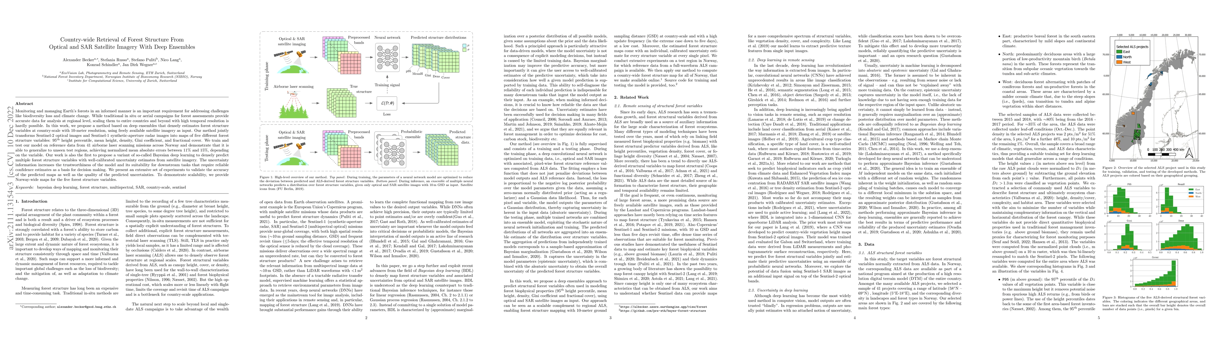
Monitoring and managing Earth's forests in an informed manner is an important requirement for addressing challenges like biodiversity loss and climate change. While traditional in situ or aerial cam...
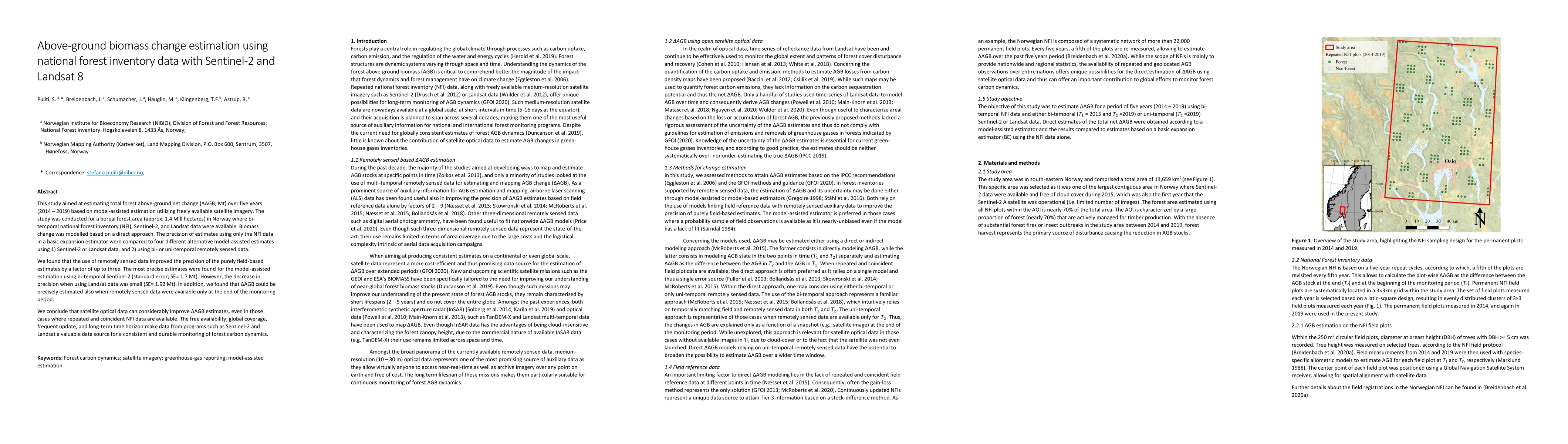
This study aimed at estimating total forest above-ground net change (Delta AGB, Mt) over five years (2014-2019) based on model-assisted estimation utilizing freely available satellite imagery. The s...
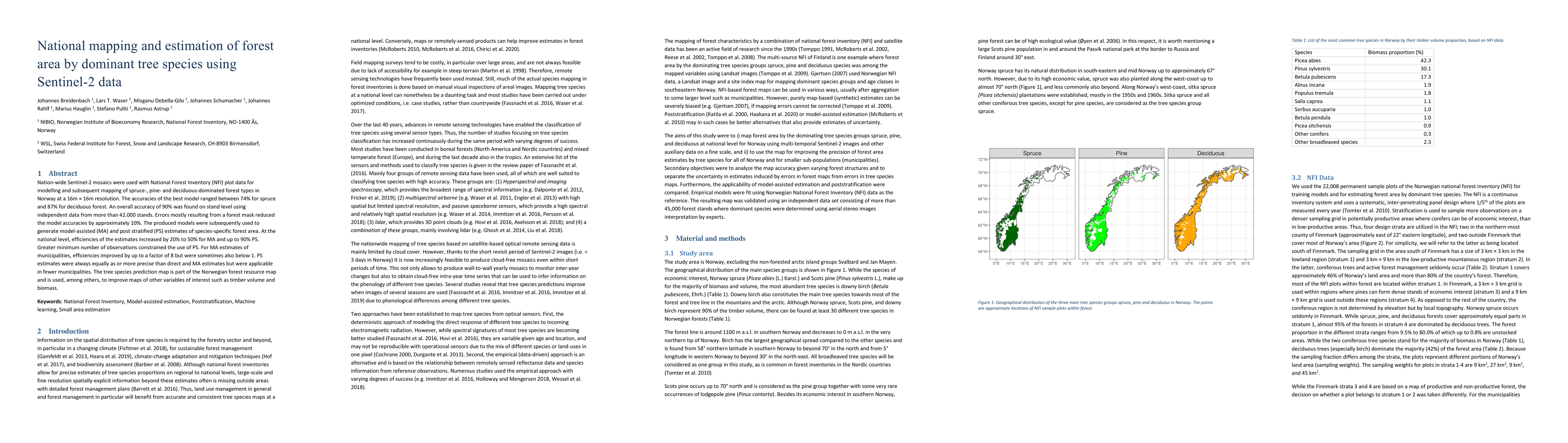
Nation-wide Sentinel-2 mosaics were used with National Forest Inventory (NFI) data for modelling and subsequent mapping of spruce, pine and deciduous forest in Norway in 16 m $\times$ 16 m resolutio...
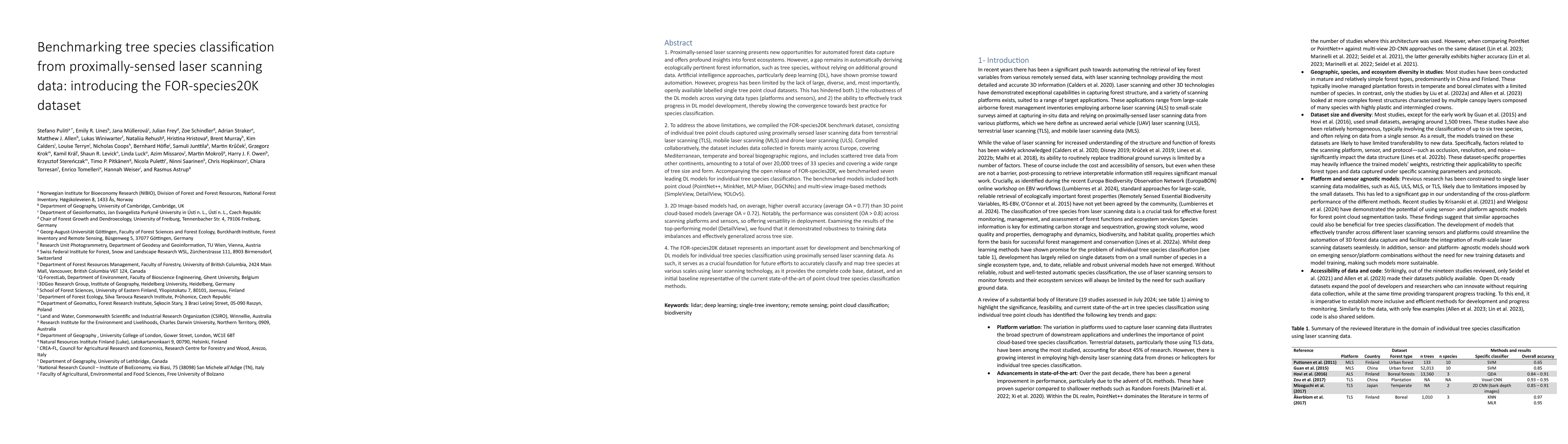
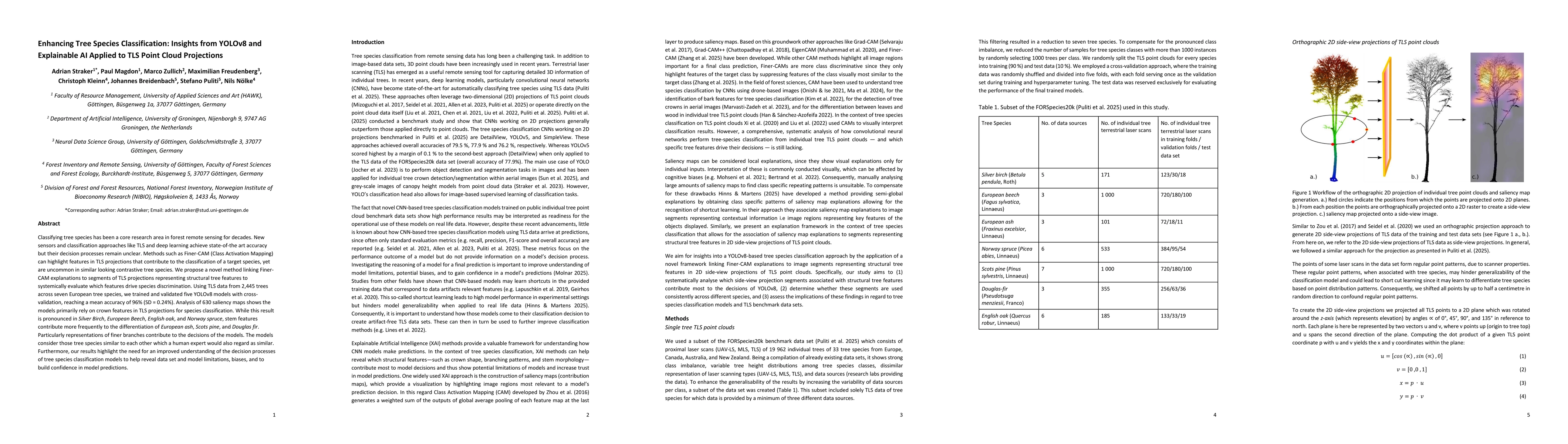
Proximally-sensed laser scanning offers significant potential for automated forest data capture, but challenges remain in automatically identifying tree species without additional ground data. Deep le...
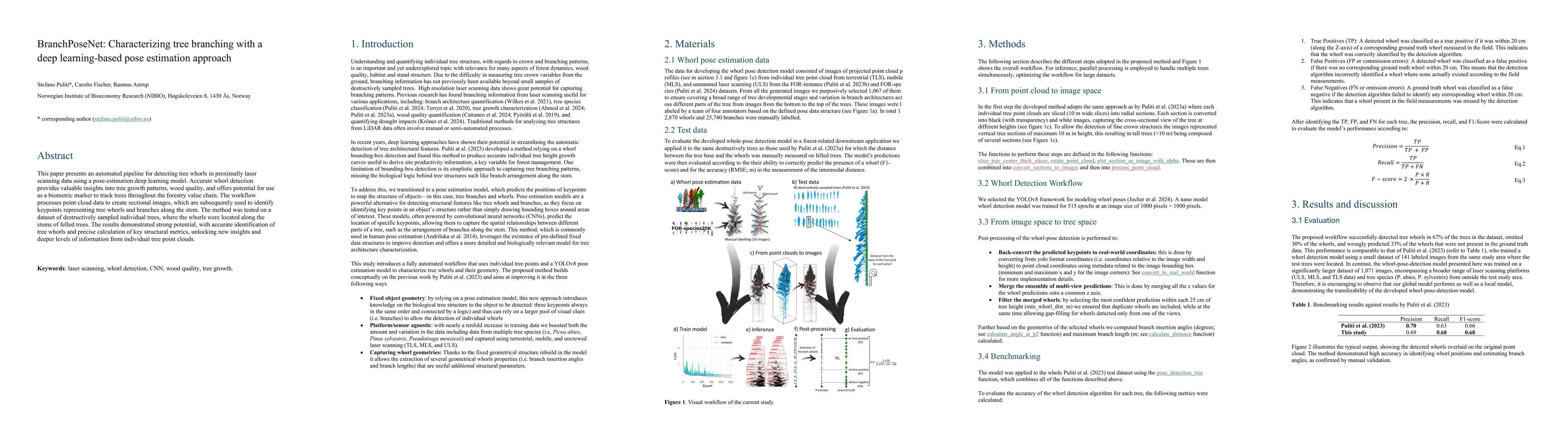
This paper presents an automated pipeline for detecting tree whorls in proximally laser scanning data using a pose-estimation deep learning model. Accurate whorl detection provides valuable insights i...
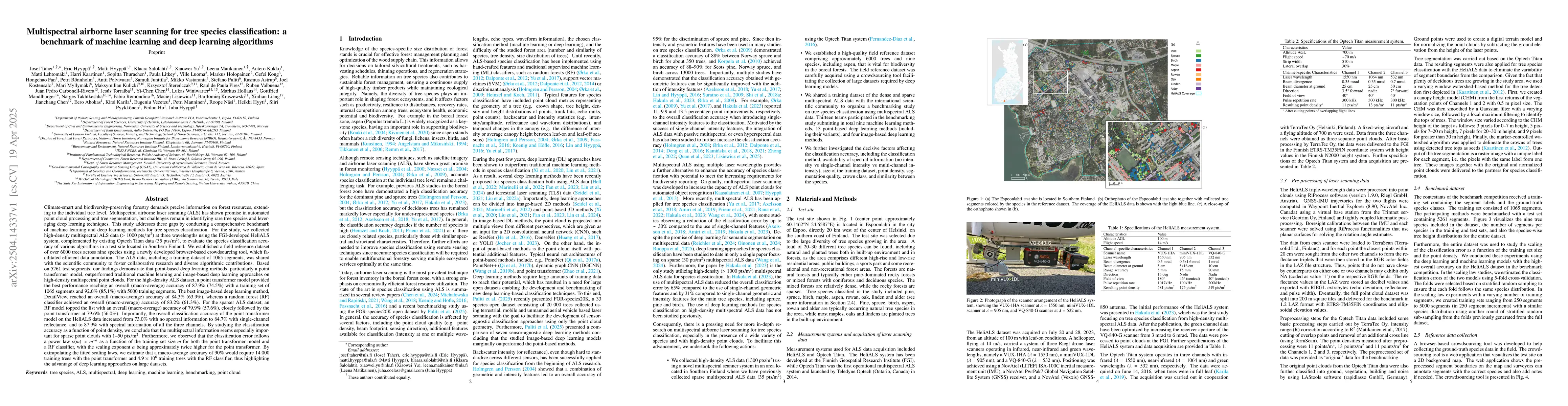
Climate-smart and biodiversity-preserving forestry demands precise information on forest resources, extending to the individual tree level. Multispectral airborne laser scanning (ALS) has shown promis...
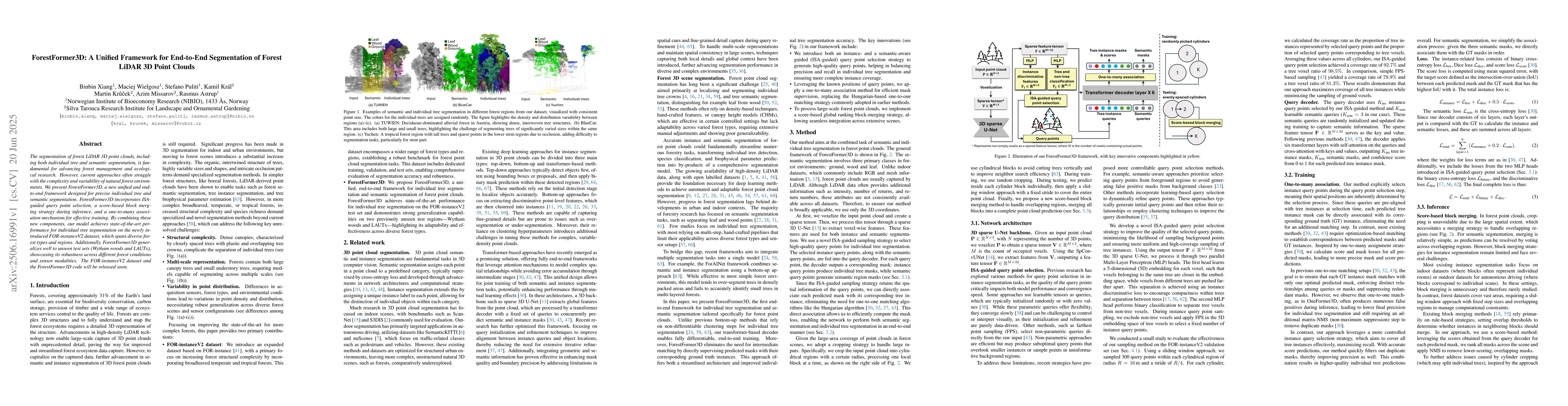
The segmentation of forest LiDAR 3D point clouds, including both individual tree and semantic segmentation, is fundamental for advancing forest management and ecological research. However, current app...
Classifying tree species has been a core research area in forest remote sensing for decades. New sensors and classification approaches like TLS and deep learning achieve state-of-the art accuracy but ...
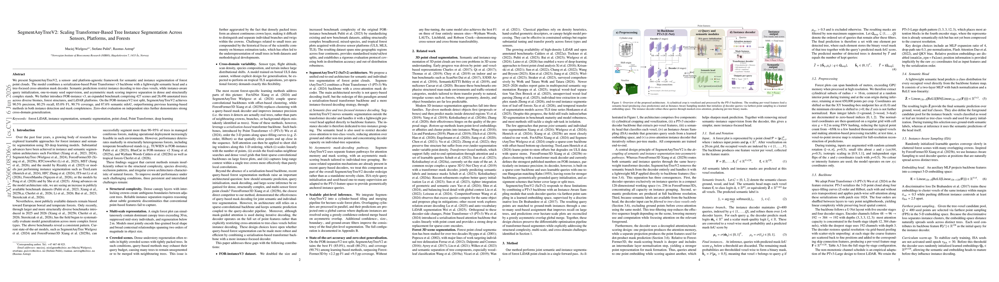
We present SegmentAnyTreeV2, a sensor- and platform-agnostic framework for semantic and instance segmentation of forest point clouds. The model combines a serialization-based Point Transformer v3 back...