Academic Profile
Statistics
Similar Authors
Papers on arXiv
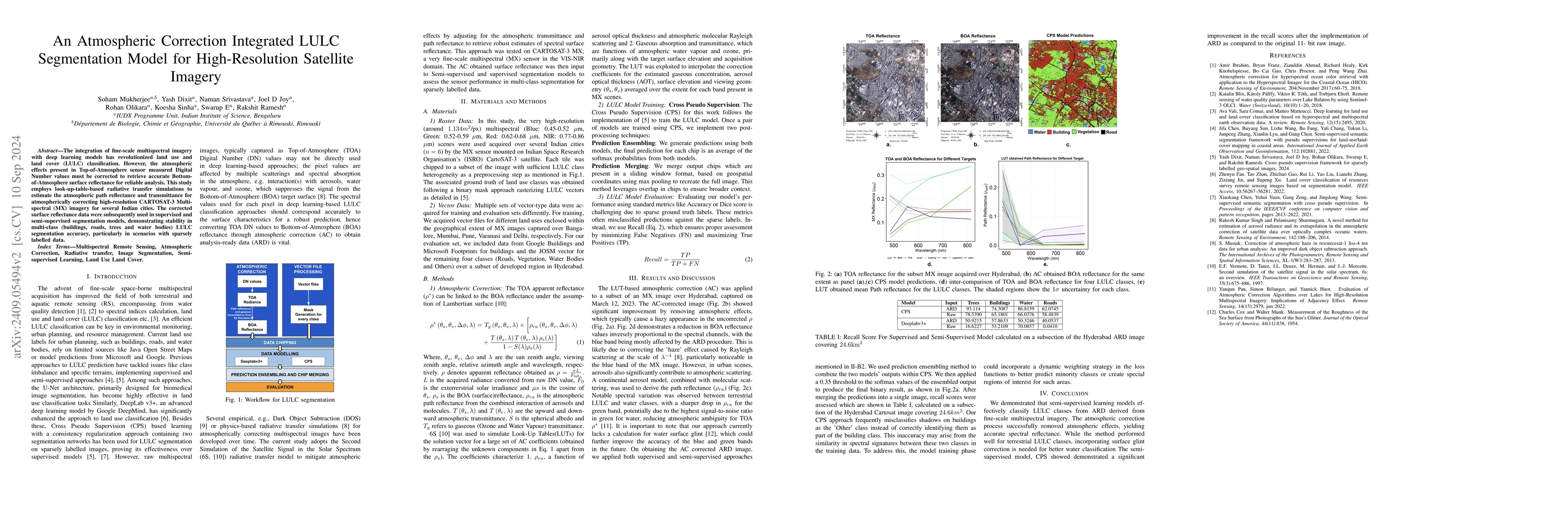
The integration of fine-scale multispectral imagery with deep learning models has revolutionized land use and land cover (LULC) classification. However, the atmospheric effects present in Top-of-Atmos...
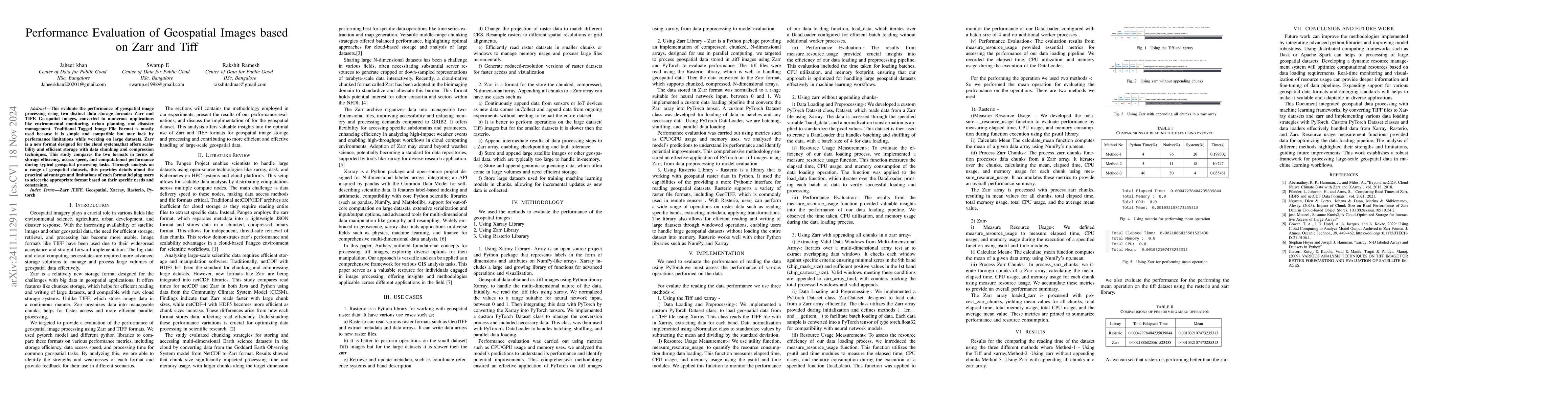
This evaluate the performance of geospatial image processing using two distinct data storage formats: Zarr and TIFF. Geospatial images, converted to numerous applications like environmental monitoring...
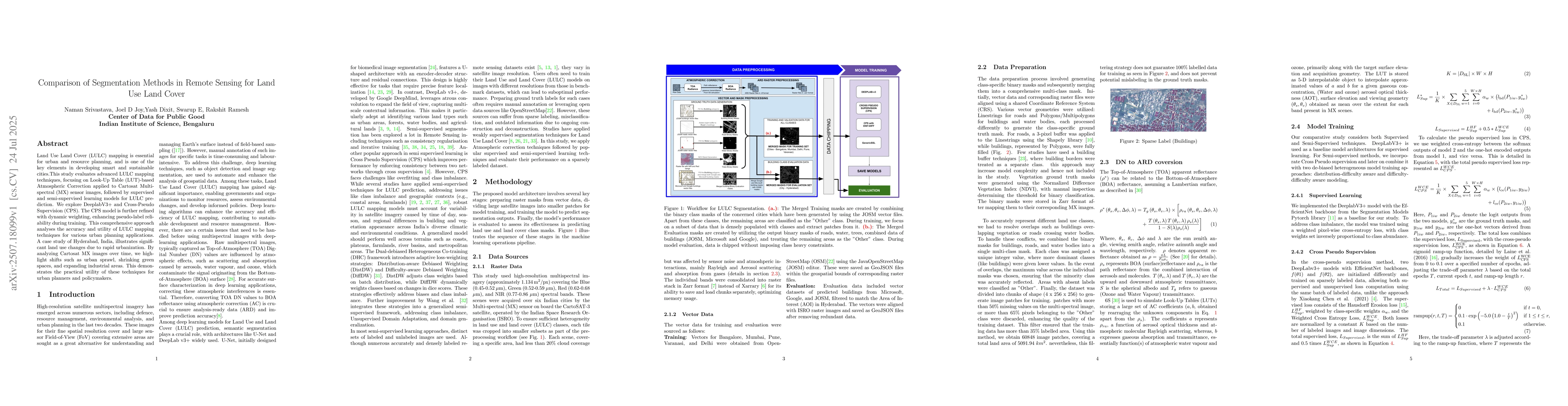
Land Use Land Cover (LULC) mapping is essential for urban and resource planning, and is one of the key elements in developing smart and sustainable cities.This study evaluates advanced LULC mapping te...