Academic Profile
Statistics
Similar Authors
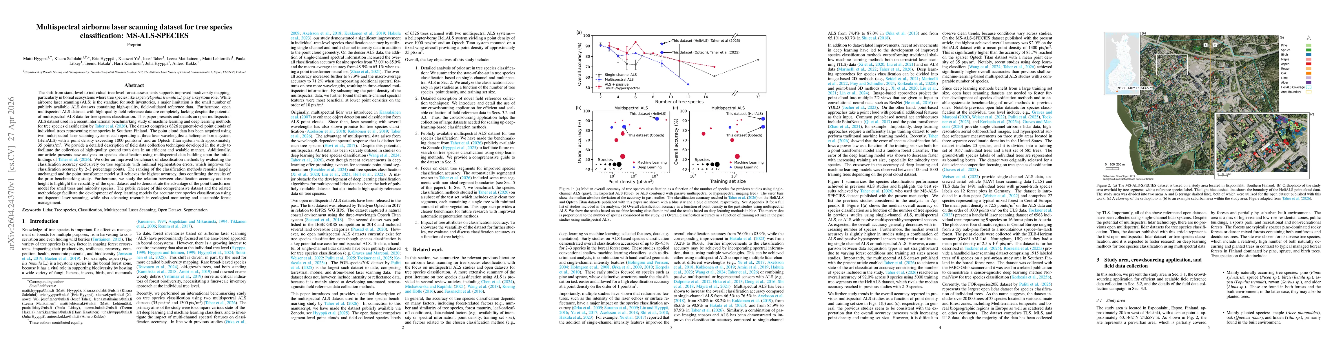
Papers on arXiv
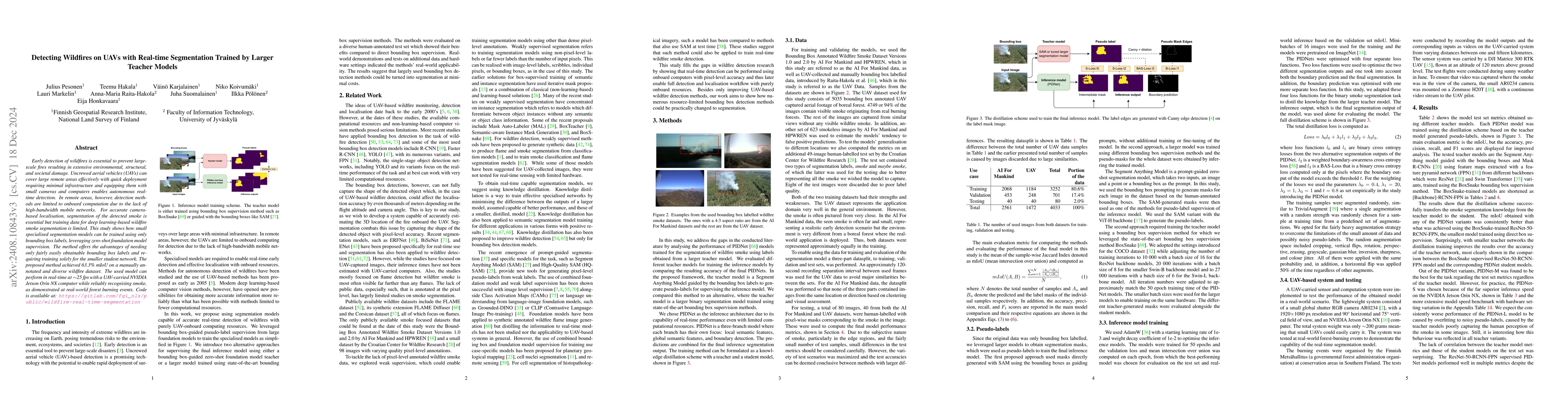
Early detection of wildfires is essential to prevent large-scale fires resulting in extensive environmental, structural, and societal damage. Uncrewed aerial vehicles (UAVs) can cover large remote are...
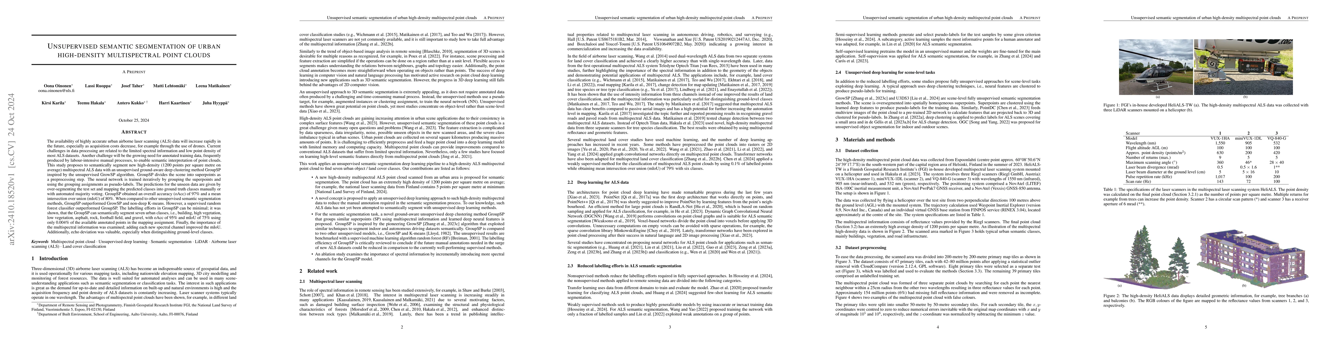
The availability of highly accurate urban airborne laser scanning (ALS) data will increase rapidly in the future, especially as acquisition costs decrease, for example through the use of drones. Curre...
Drones are increasingly used in forestry to capture high-resolution remote sensing data. While operations above the forest canopy are already highly automated, flying inside forests remains challengin...
The interest in the usage of uncrewed aerial vehicles (UAVs) for forest applications has increased in recent years. While above-canopy flight has reached a high level of autonomy, navigating under-can...
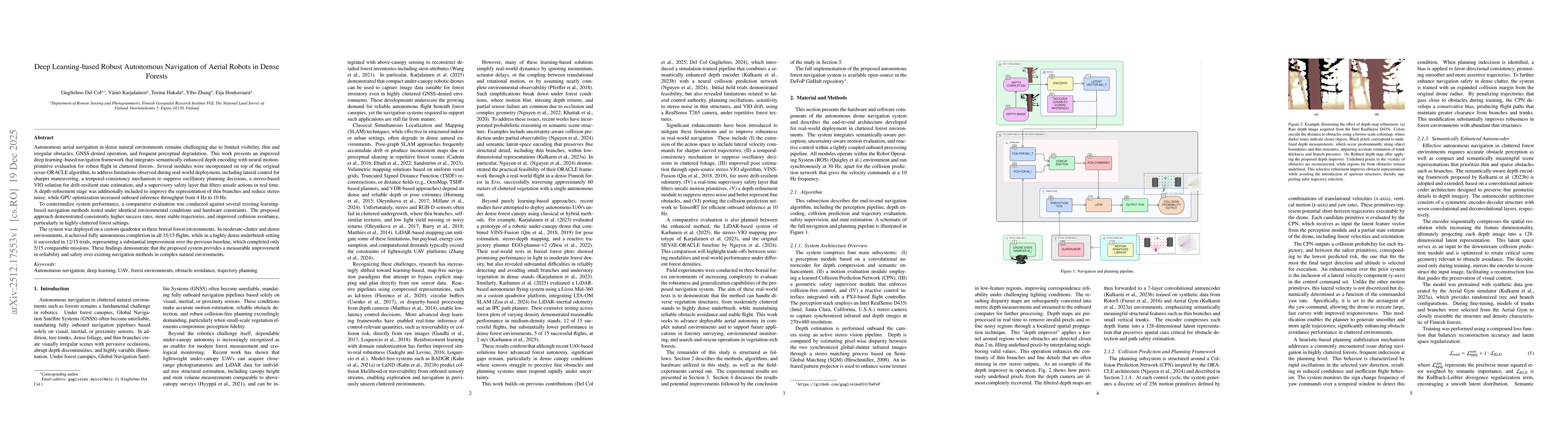
Autonomous aerial navigation in dense natural environments remains challenging due to limited visibility, thin and irregular obstacles, GNSS-denied operation, and frequent perceptual degradation. This...
The shift from stand-level to individual-tree-level forest assessments supports improved biodiversity mapping, particularly in boreal ecosystems where tree species like aspen (Populus tremula L.) play...