ArxivLens
T
Researcher

Tewodros Syum Gebre

7 papers on arXiv

7 arXiv Papers
Metrics

Statistics

7 arXiv Papers
Publications

Papers on arXiv

Thumbnail for Cross-Polarization Fusion of VV AND VH SAR Observations for Improved Flood Mapping
arXiv
Cross-Polarization Fusion of VV AND VH SAR Observations for Improved Flood Mapping

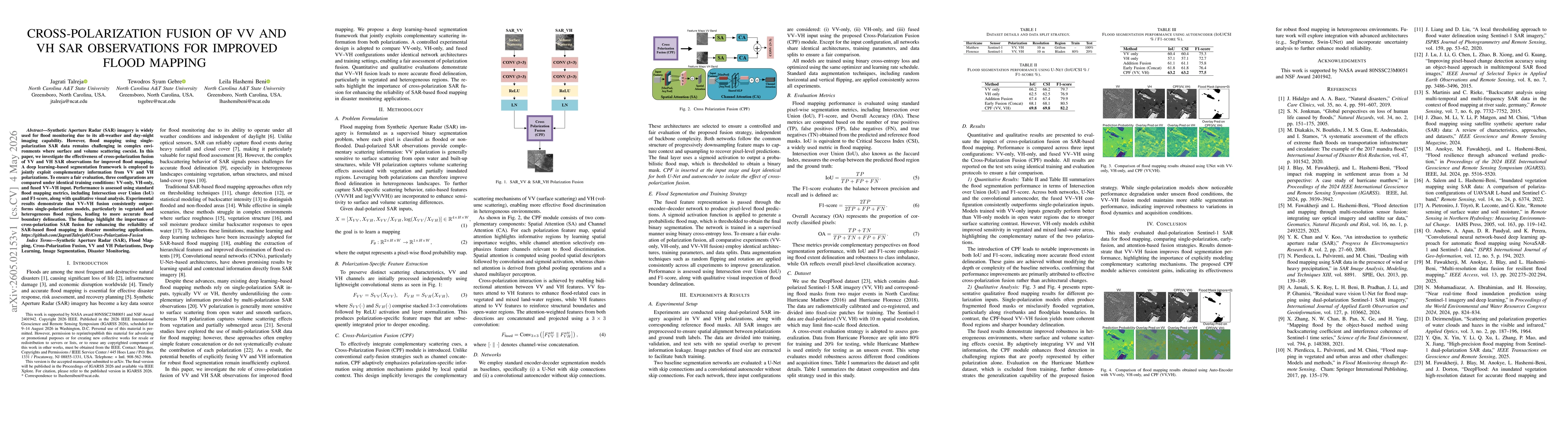
Synthetic Aperture Radar (SAR) imagery is widely used for flood monitoring due to its all-weather and day-night imaging capability. However, flood mapping using single-polarization SAR data remains ch...

Thumbnail for FLoRA: Fusion-Latent for Optical Reconstruction and Flood Area Segmentation via Cross-Modal Multi-Task Distillation Network
arXiv
FLoRA: Fusion-Latent for Optical Reconstruction and Flood Area Segmentation via Cross-Modal Multi-Task Distillation Network

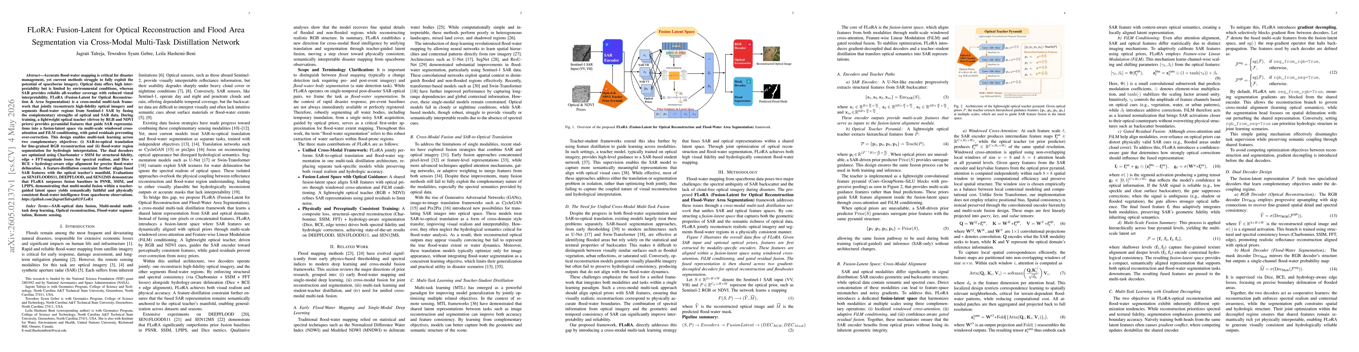
Accurate flood water mapping is critical for disaster management, yet current methods struggle to fully exploit the potential of spaceborne imagery. Optical data offers high interpretability but is li...

Thumbnail for Overcoming "Physics Shock" in Earth Observation A Heteroscedastic Uncertainty Framework for PINN-based Flood Inference
arXiv
Overcoming "Physics Shock" in Earth Observation A Heteroscedastic Uncertainty Framework for PINN-based Flood Inference

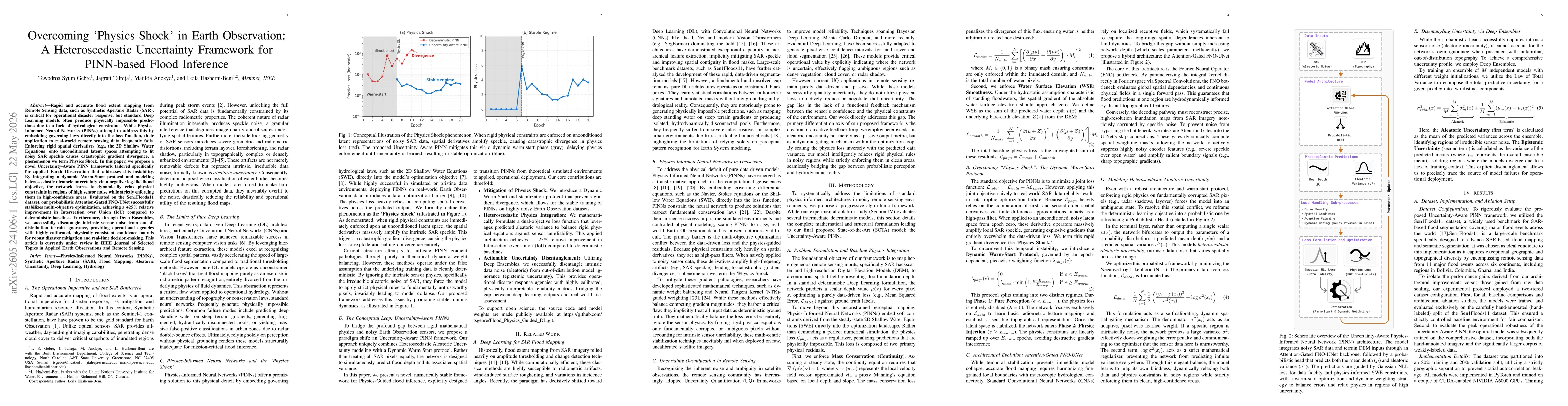
Rapid and accurate flood extent mapping from Remote Sensing data, such as Synthetic Aperture Radar (SAR), is critical for operational disaster response, but standard Deep Learning models often produce...

Thumbnail for Physics-Informed Machine Learning for Short-Term Flood Prediction
arXiv
Physics-Informed Machine Learning for Short-Term Flood Prediction

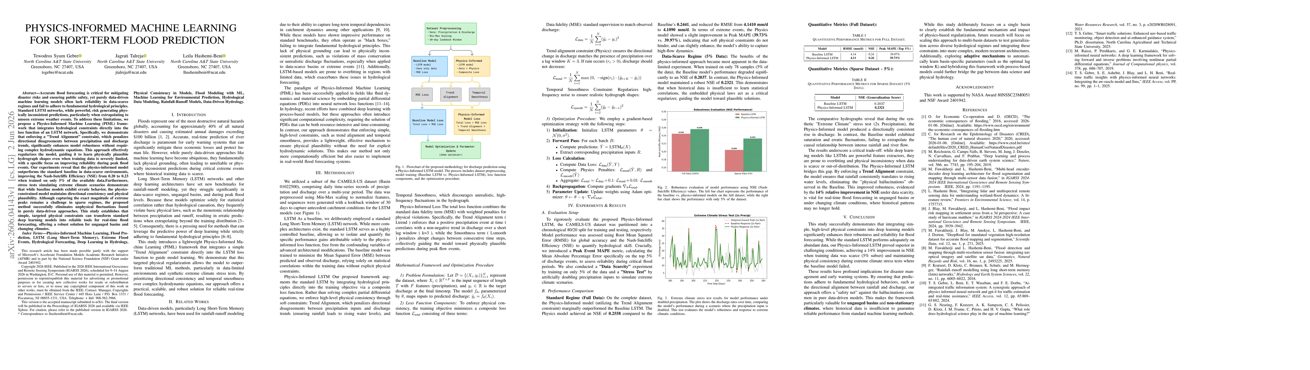
Accurate flood forecasting is essential for mitigating disaster risks and protecting communities. However, purely data-driven machine learning models often struggle in data-scarce environments and may...

Thumbnail for Comparison of Deep Learning Frameworks For Rice Disease Mapping From UAV Multispectral Imaging
arXiv
Comparison of Deep Learning Frameworks For Rice Disease Mapping From UAV Multispectral Imaging

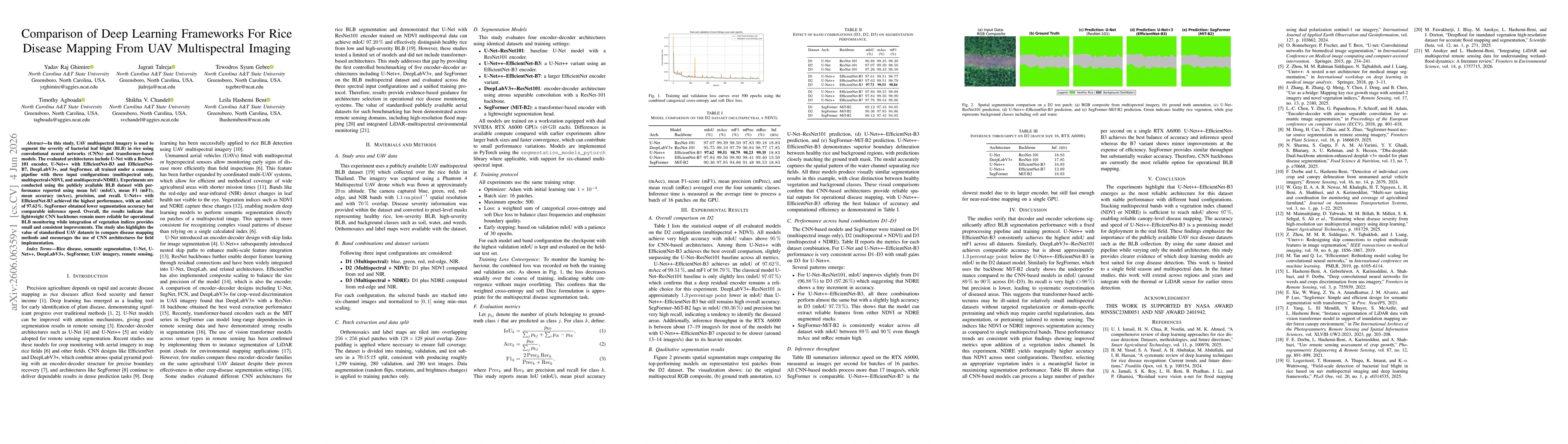
In this study, UAV multispectral imagery is used to segment the severity of bacterial leaf blight (BLB) in rice using convolutional neural networks (CNNs) and transformer-based models. The evaluated a...

Thumbnail for Advanced Flood Prediction with Physics-Guided Deep Learning: Combining UNet, FNO, and SAR/Optical Imagery
arXiv
Advanced Flood Prediction with Physics-Guided Deep Learning: Combining UNet, FNO, and SAR/Optical Imagery

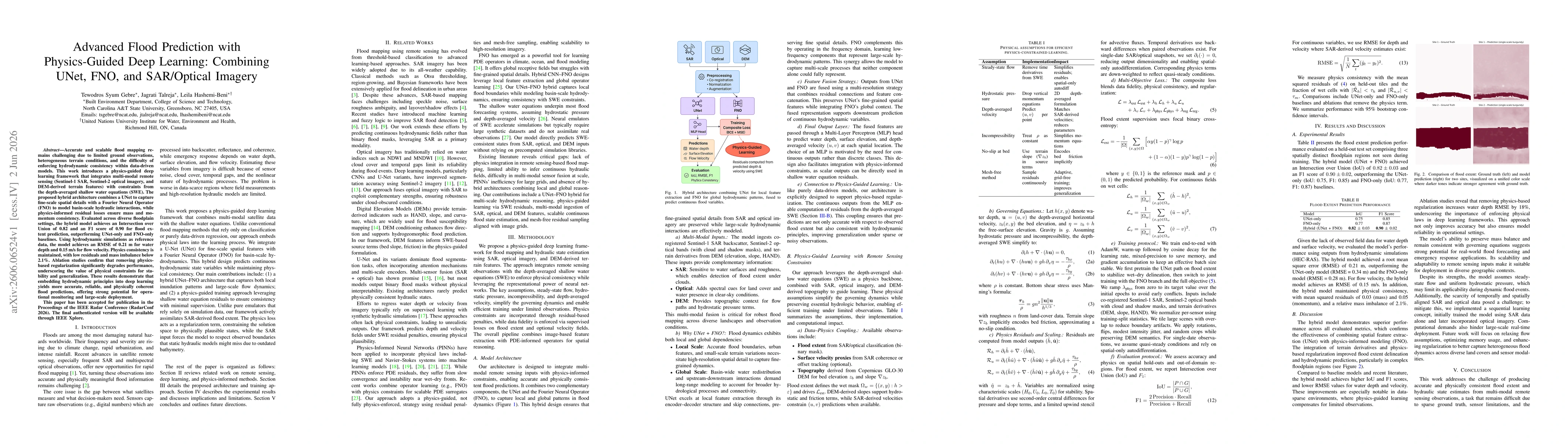
Accurate and scalable flood mapping remains challenging due to limited ground observations, heterogeneous terrain conditions, and the difficulty of enforcing hydrodynamic consistency within data-drive...

Thumbnail for Multi-Modal Attention for Automated Disaster Damage Assessment Using Remote Sensing Imagery and Deep Learning
arXiv
Multi-Modal Attention for Automated Disaster Damage Assessment Using Remote Sensing Imagery and Deep Learning

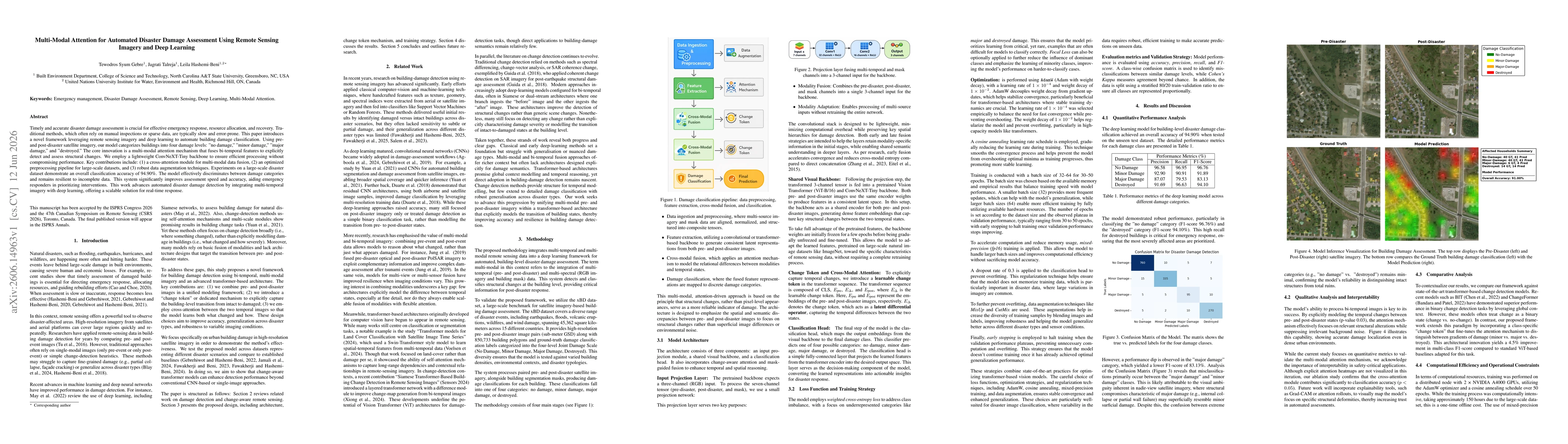
Timely and accurate disaster damage assessment is crucial for effective emergency response, resource allocation, and recovery. Traditional methods, which often rely on manual inspections or sparse dat...

This website uses cookies to ensure you get the best experience. Learn more