Academic Profile
Statistics
Similar Authors
Papers on arXiv
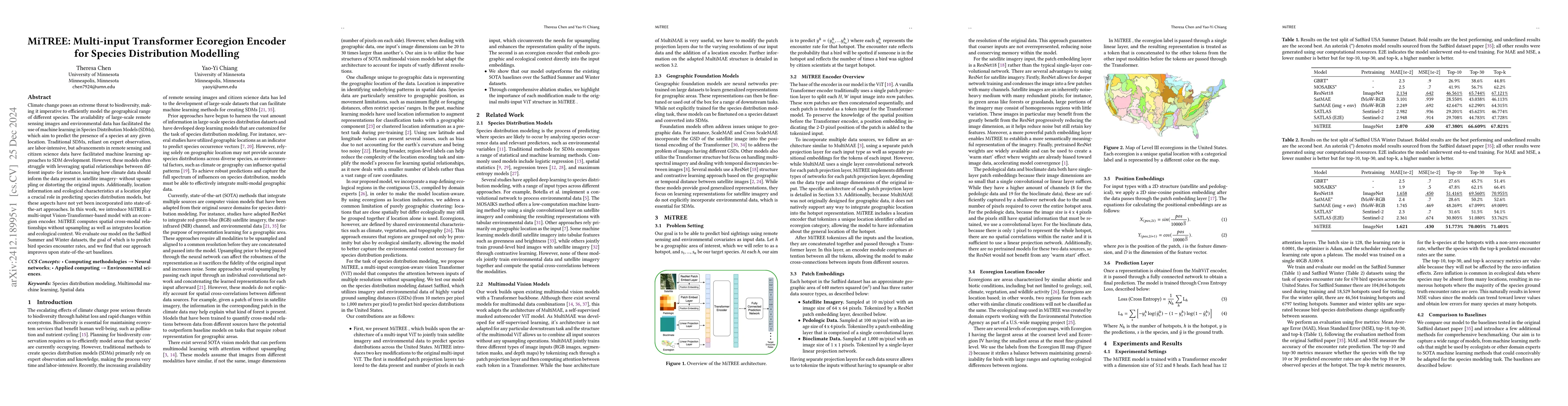
Climate change poses an extreme threat to biodiversity, making it imperative to efficiently model the geographical range of different species. The availability of large-scale remote sensing images and...
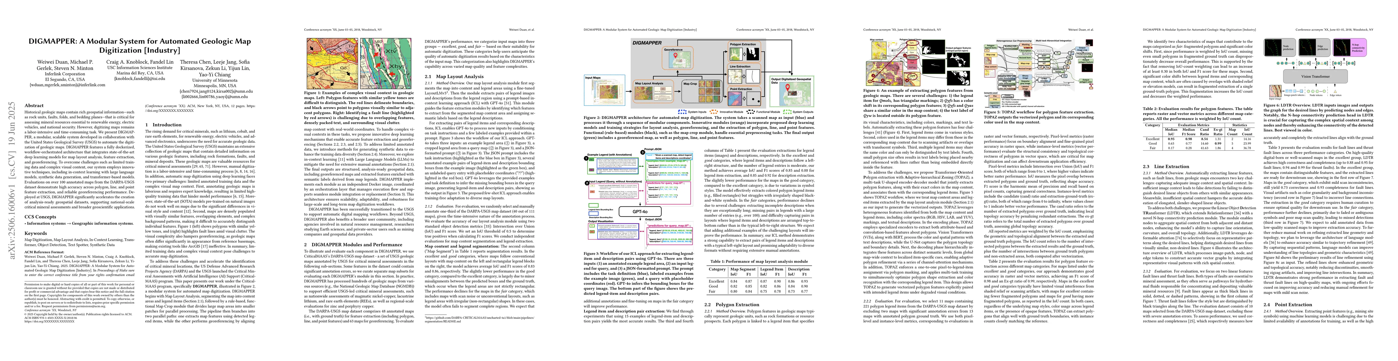
Historical geologic maps contain rich geospatial information, such as rock units, faults, folds, and bedding planes, that is critical for assessing mineral resources essential to renewable energy, ele...
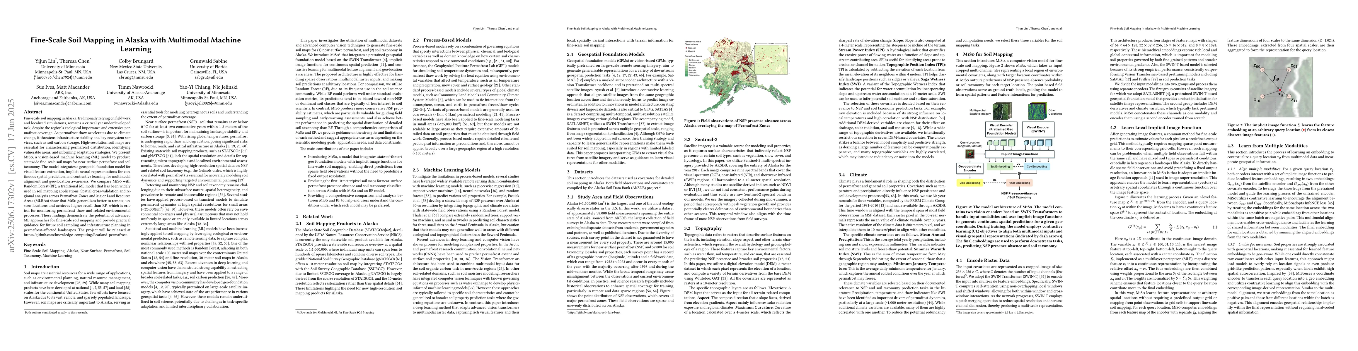
Fine-scale soil mapping in Alaska, traditionally relying on fieldwork and localized simulations, remains a critical yet underdeveloped task, despite the region's ecological importance and extensive pe...