Academic Profile
Statistics
Similar Authors
Papers on arXiv
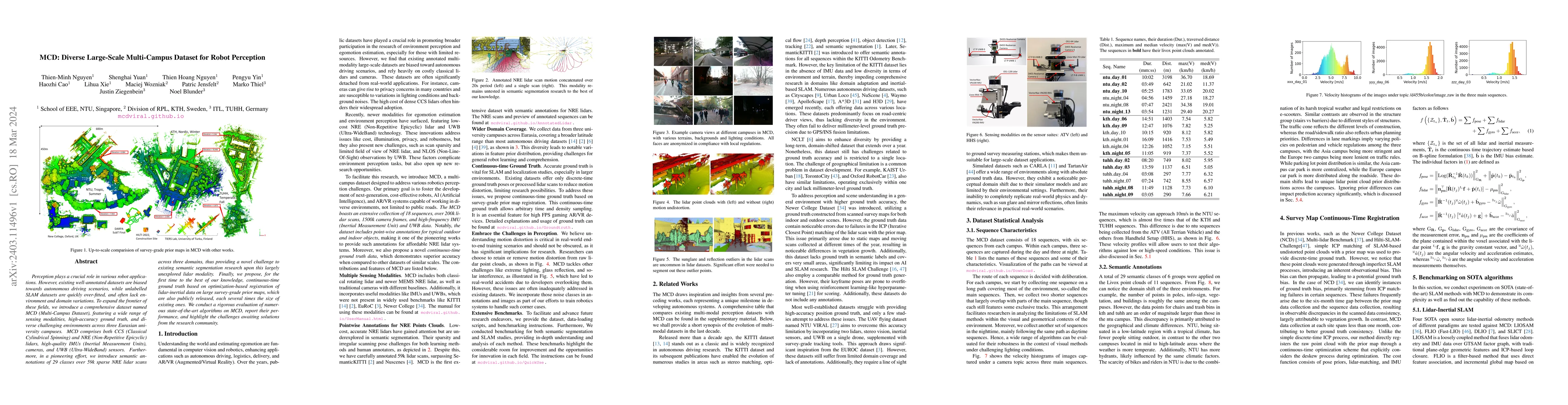
Perception plays a crucial role in various robot applications. However, existing well-annotated datasets are biased towards autonomous driving scenarios, while unlabelled SLAM datasets are quickly o...
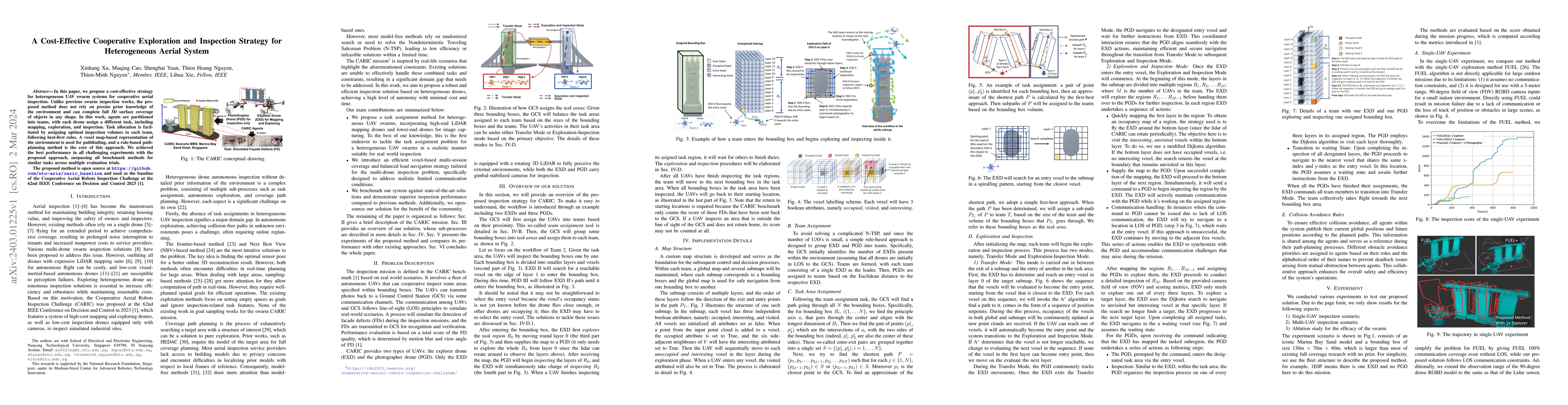
In this paper, we propose a cost-effective strategy for heterogeneous UAV swarm systems for cooperative aerial inspection. Unlike previous swarm inspection works, the proposed method does not rely o...
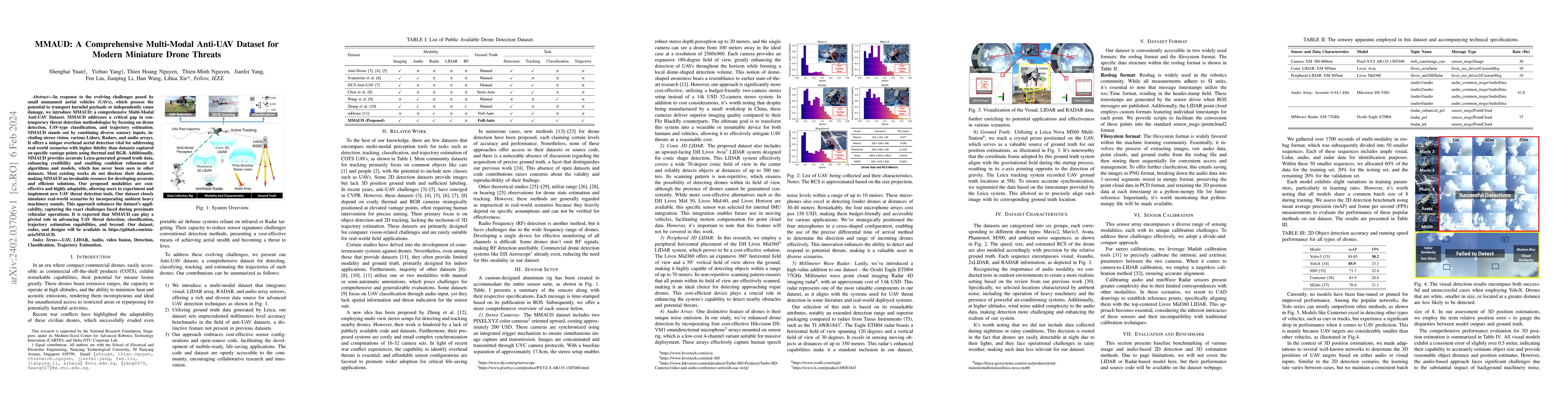
In response to the evolving challenges posed by small unmanned aerial vehicles (UAVs), which possess the potential to transport harmful payloads or independently cause damage, we introduce MMAUD: a ...
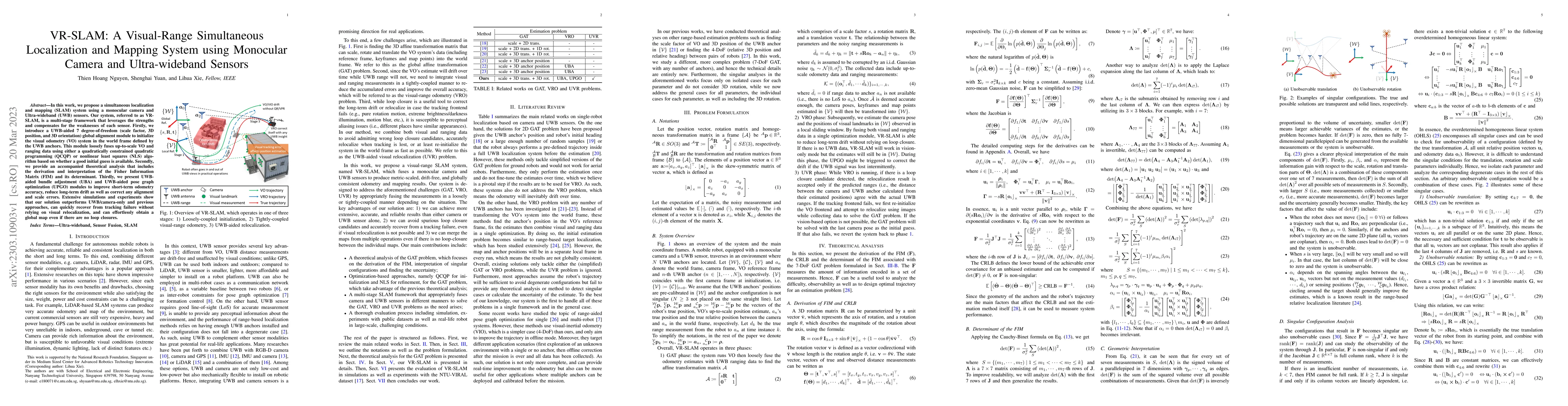
In this work, we propose a simultaneous localization and mapping (SLAM) system using a monocular camera and Ultra-wideband (UWB) sensors. Our system, referred to as VRSLAM, is a multi-stage framewor...
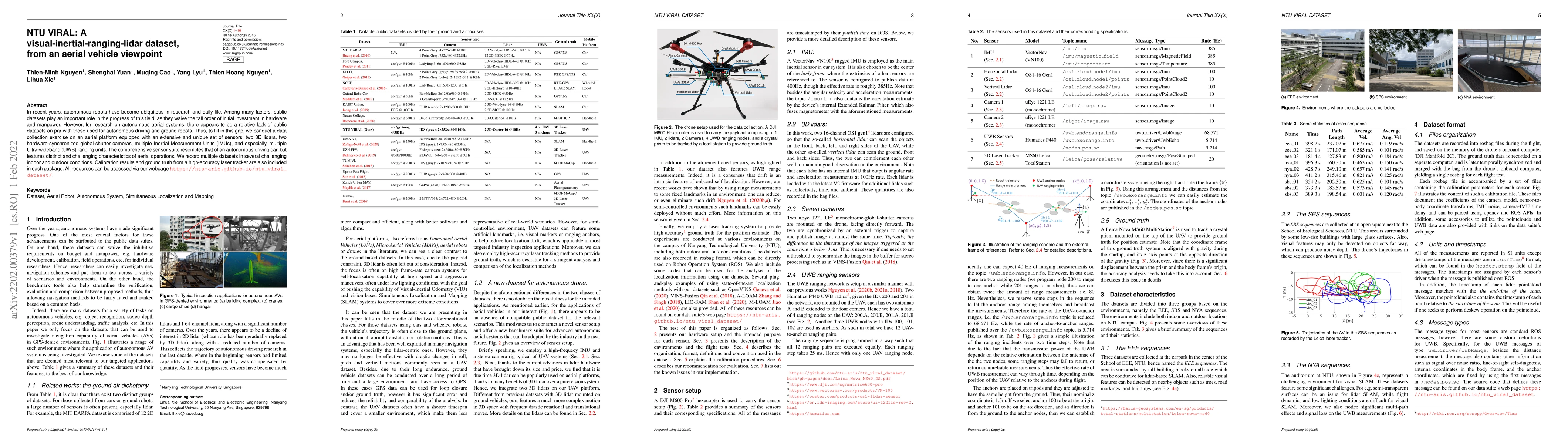
In recent years, autonomous robots have become ubiquitous in research and daily life. Among many factors, public datasets play an important role in the progress of this field, as they waive the tall...
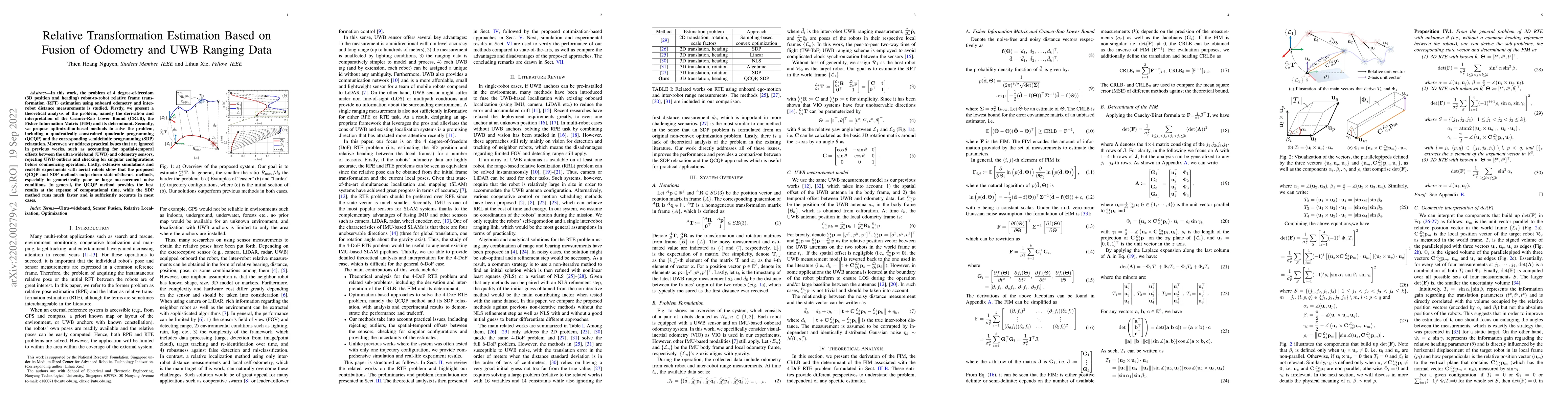
In this work, the problem of 4 degree-of-freedom (3D position and heading) robot-to-robot relative frame transformation estimation using onboard odometry and inter-robot distance measurements is stu...
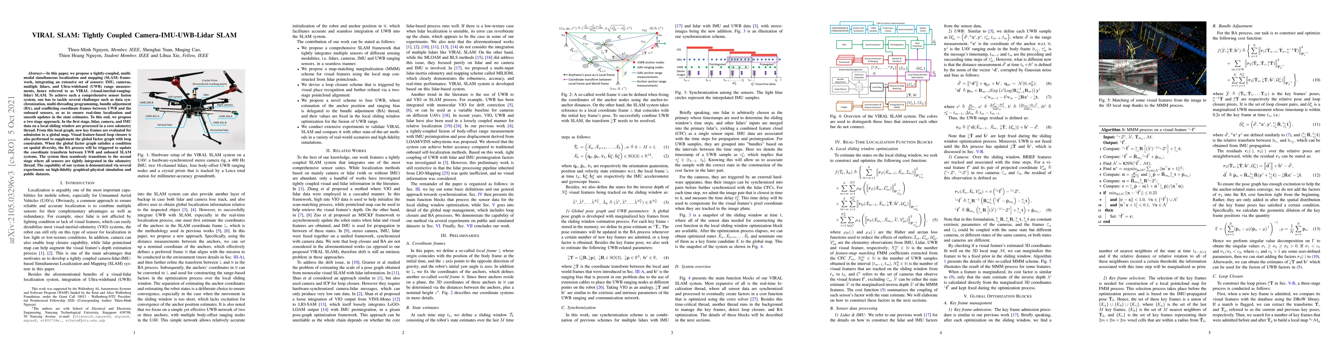
In this paper, we propose a tightly-coupled, multi-modal simultaneous localization and mapping (SLAM) framework, integrating an extensive set of sensors: IMU, cameras, multiple lidars, and Ultra-wid...
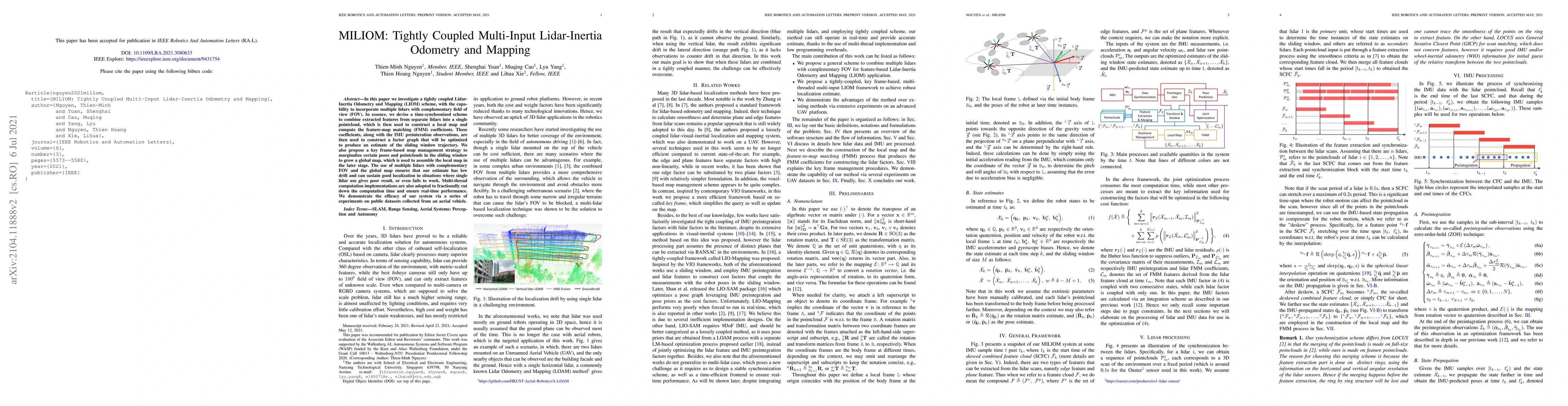
In this letter we investigate a tightly coupled Lidar-Inertia Odometry and Mapping (LIOM) scheme, with the capability to incorporate multiple lidars with complementary field of view (FOV). In essenc...
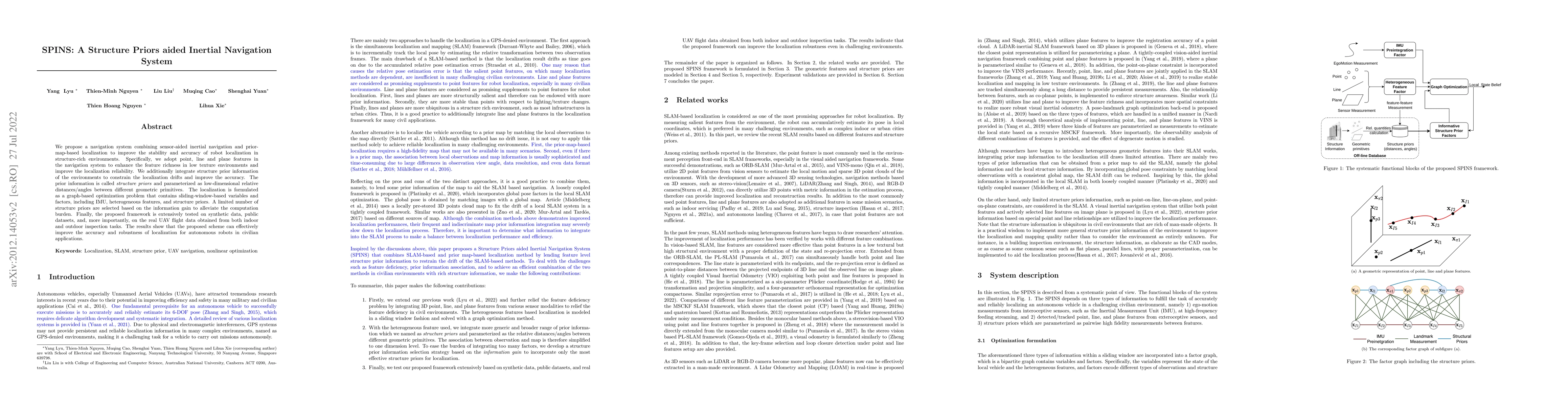
Although Simultaneous Localization and Mapping (SLAM) has been an active research topic for decades, current state-of-the-art methods still suffer from instability or inaccuracy due to feature insuf...
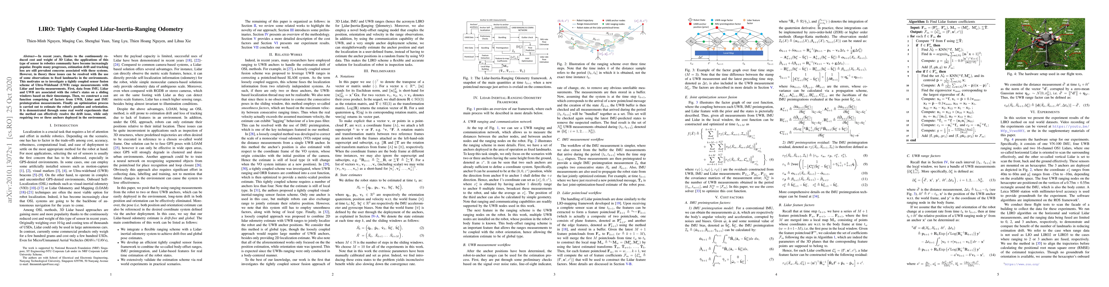
In recent years, thanks to the continuously reduced cost and weight of 3D Lidar, the applications of this type of sensor in robotics community have become increasingly popular. Despite many progress...
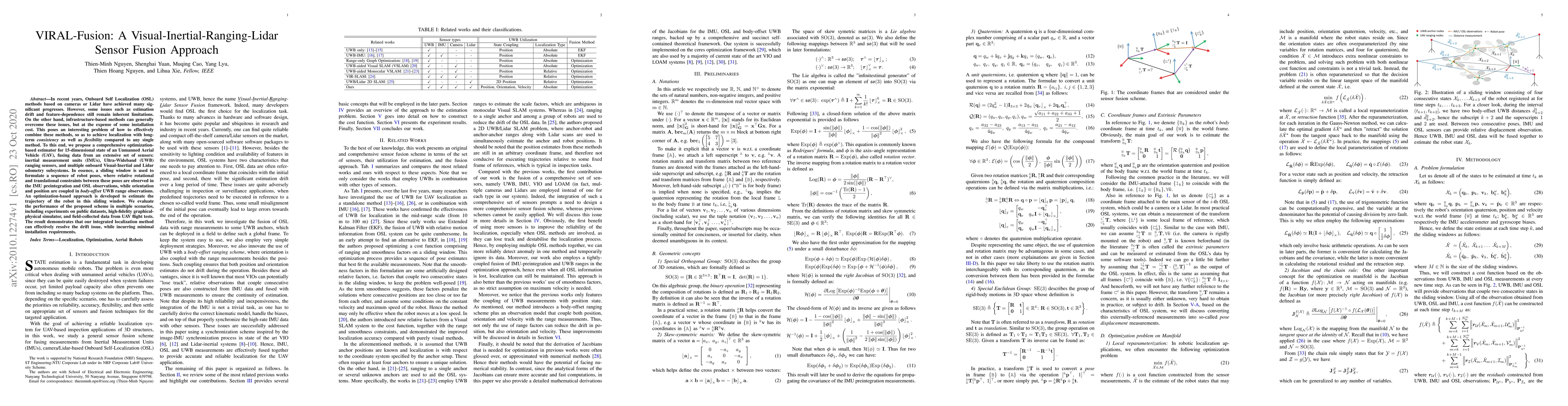
In recent years, Onboard Self Localization (OSL) methods based on cameras or Lidar have achieved many significant progresses. However, some issues such as estimation drift and feature-dependence sti...
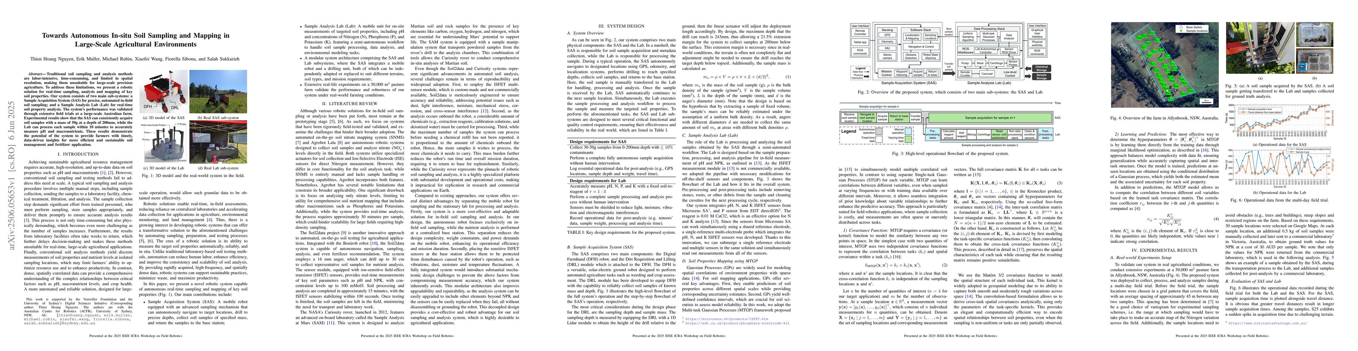
Traditional soil sampling and analysis methods are labor-intensive, time-consuming, and limited in spatial resolution, making them unsuitable for large-scale precision agriculture. To address these li...