Academic Profile
Statistics
Similar Authors
Papers on arXiv
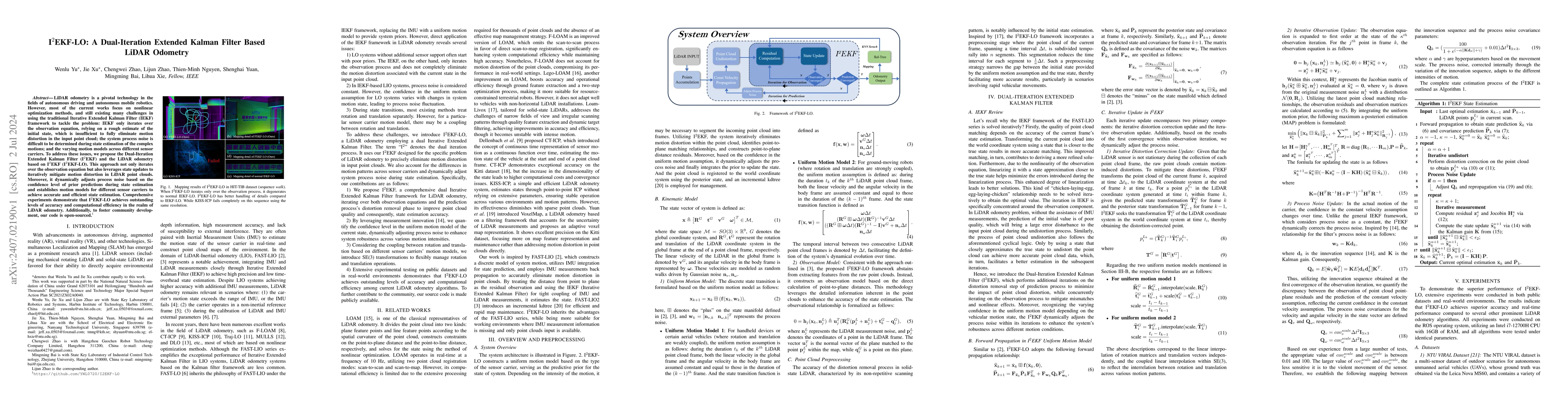
LiDAR odometry is a pivotal technology in the fields of autonomous driving and autonomous mobile robotics. However, most of the current works focus on nonlinear optimization methods, and still exist...
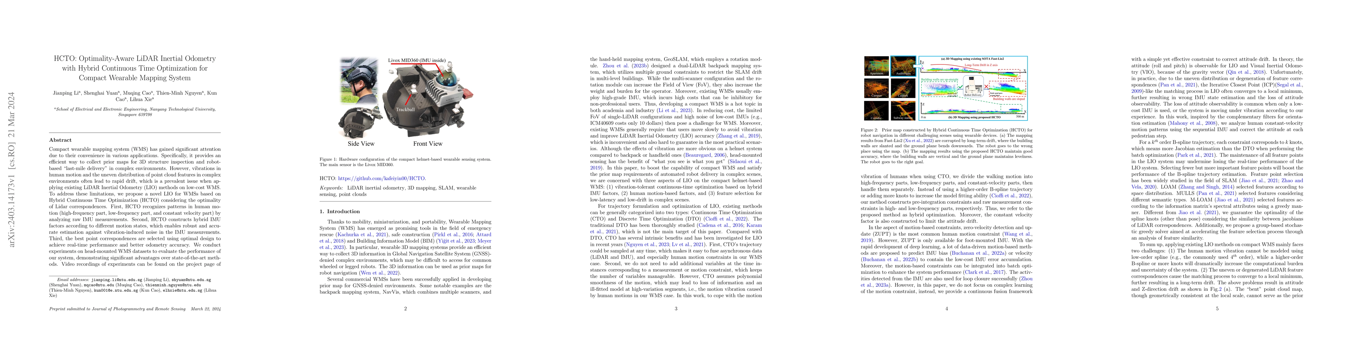
Compact wearable mapping system (WMS) has gained significant attention due to their convenience in various applications. Specifically, it provides an efficient way to collect prior maps for 3D struc...
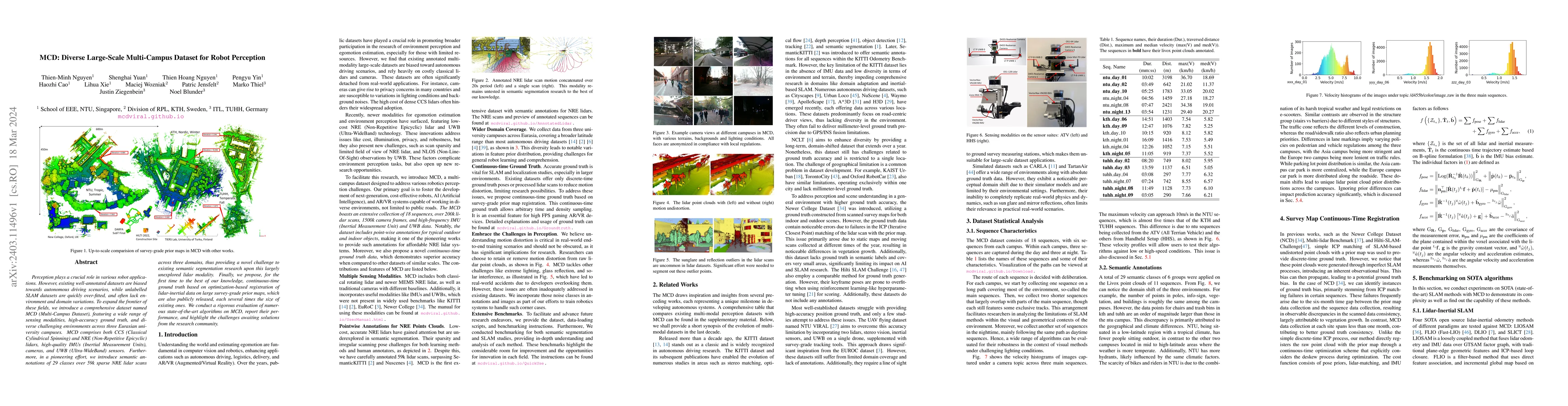
Perception plays a crucial role in various robot applications. However, existing well-annotated datasets are biased towards autonomous driving scenarios, while unlabelled SLAM datasets are quickly o...
Accurate and consistent construction of point clouds from LiDAR scanning data is fundamental for 3D modeling applications. Current solutions, such as multiview point cloud registration and LiDAR bun...
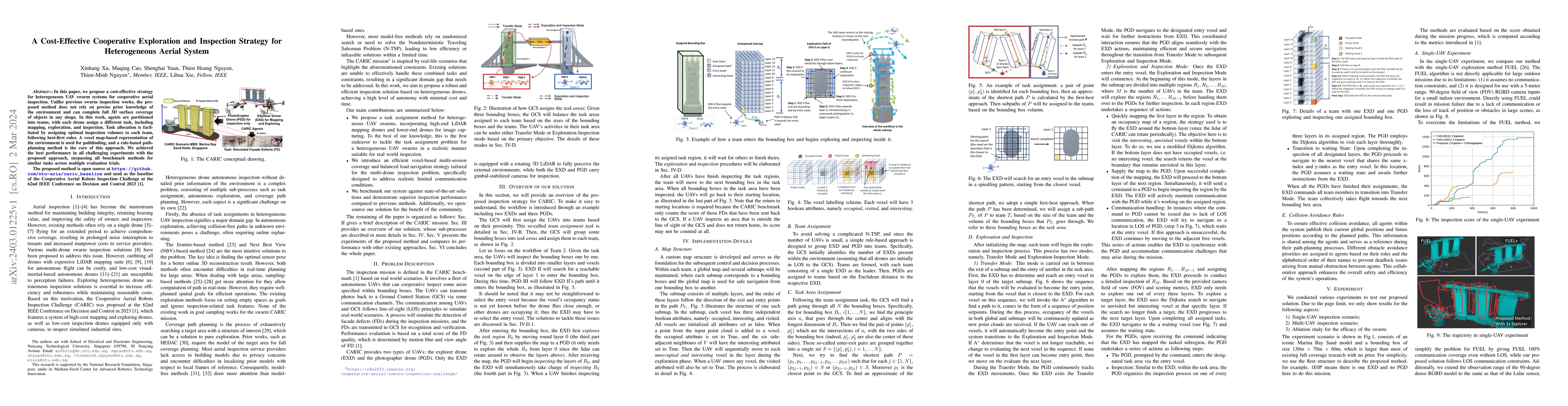
In this paper, we propose a cost-effective strategy for heterogeneous UAV swarm systems for cooperative aerial inspection. Unlike previous swarm inspection works, the proposed method does not rely o...
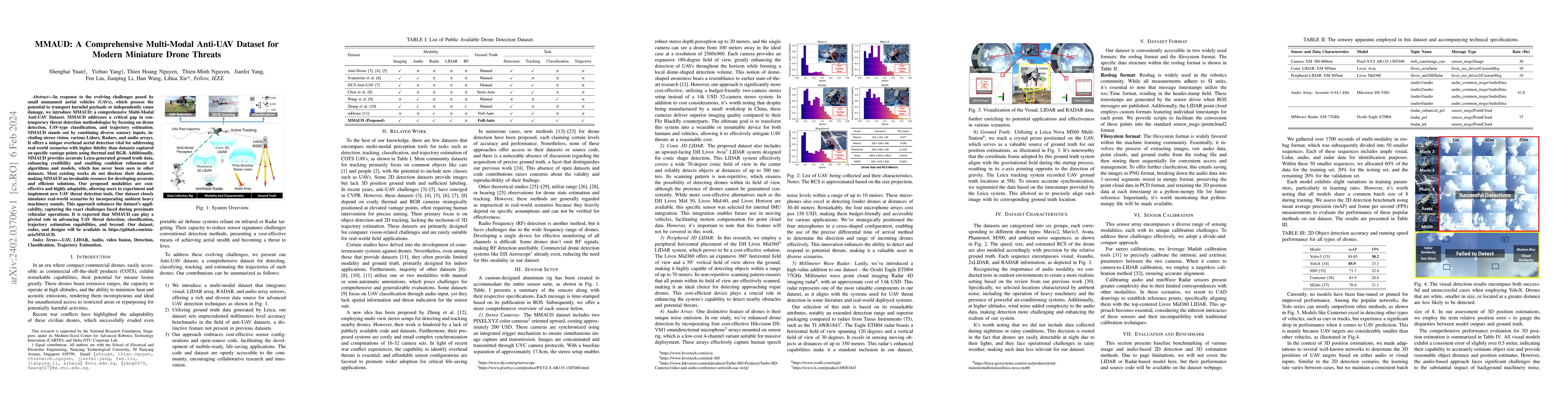
In response to the evolving challenges posed by small unmanned aerial vehicles (UAVs), which possess the potential to transport harmful payloads or independently cause damage, we introduce MMAUD: a ...
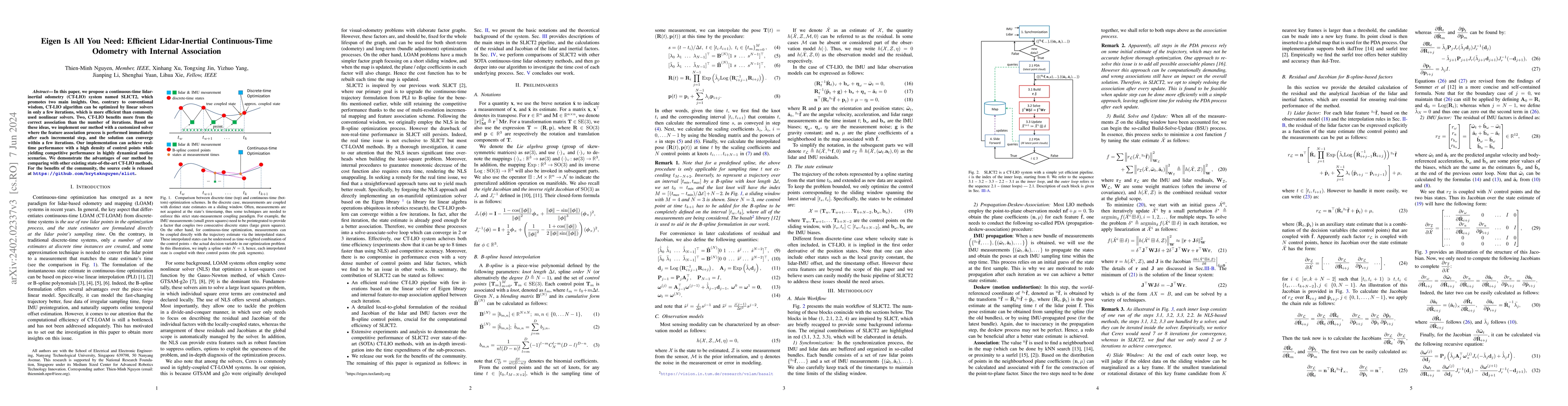
In this paper, we propose a continuous-time lidar-inertial odometry (CT-LIO) system named SLICT2, which promotes two main insights. One, contrary to conventional wisdom, CT-LIO algorithm can be opti...
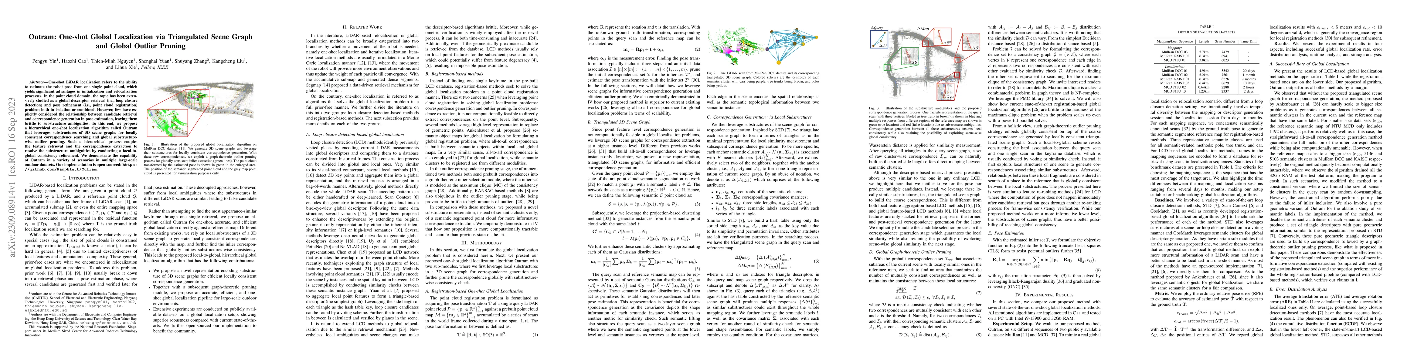
One-shot LiDAR localization refers to the ability to estimate the robot pose from one single point cloud, which yields significant advantages in initialization and relocalization processes. In the p...
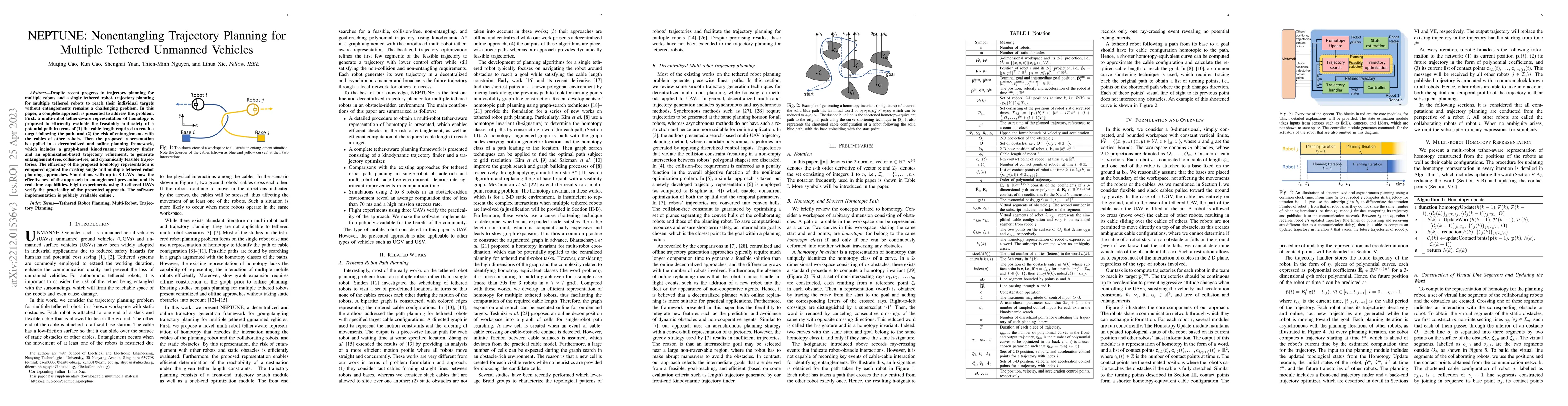
Despite recent progress on trajectory planning of multiple robots and path planning of a single tethered robot, planning of multiple tethered robots to reach their individual targets without entangl...
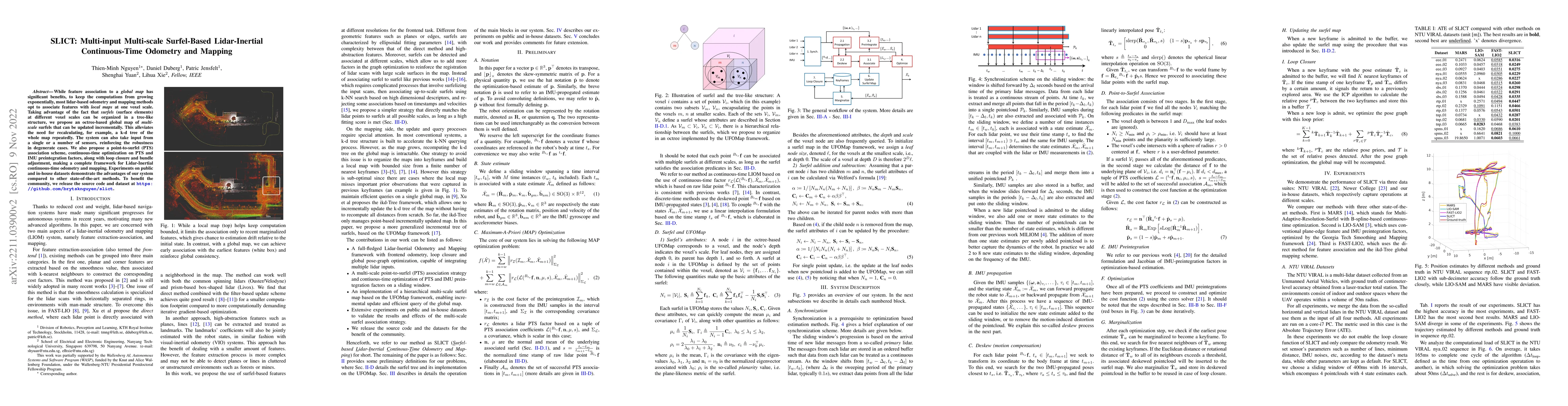
While feature association to a global map has significant benefits, to keep the computations from growing exponentially, most lidar-based odometry and mapping methods opt to associate features with ...
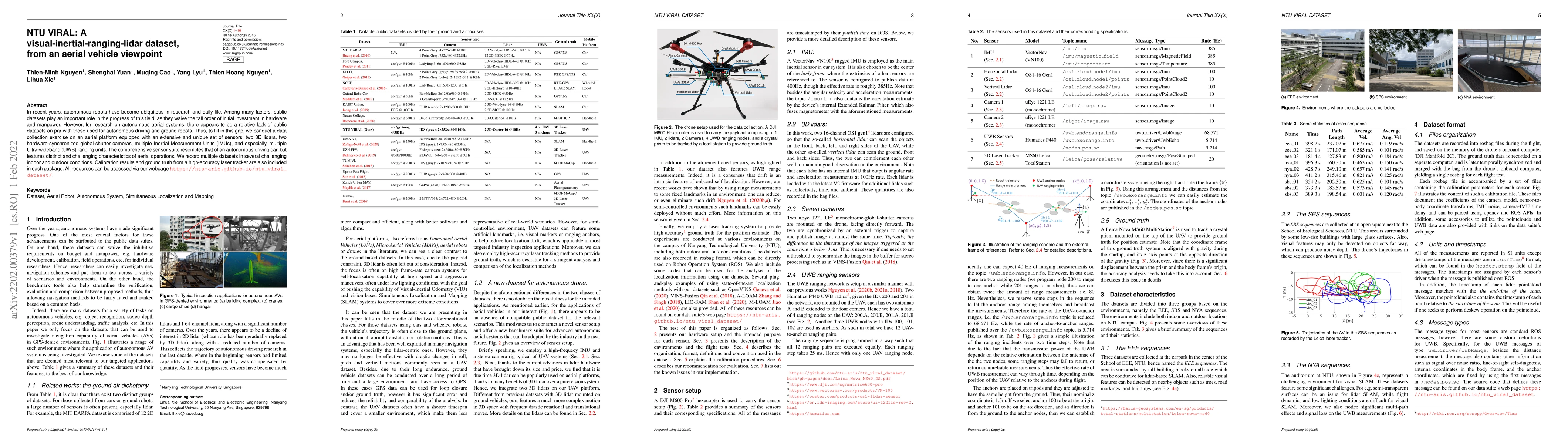
In recent years, autonomous robots have become ubiquitous in research and daily life. Among many factors, public datasets play an important role in the progress of this field, as they waive the tall...
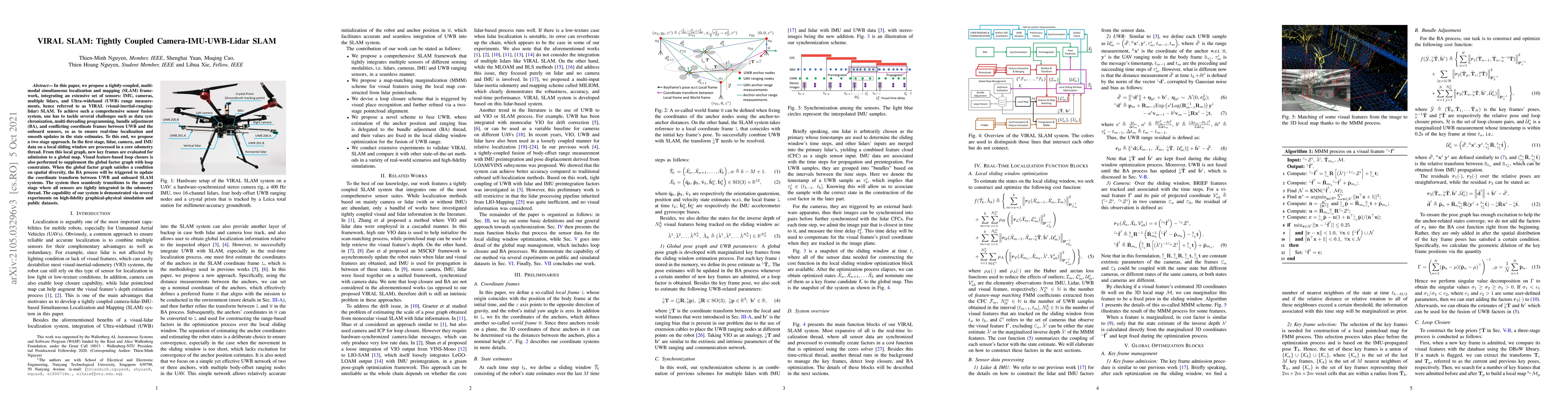
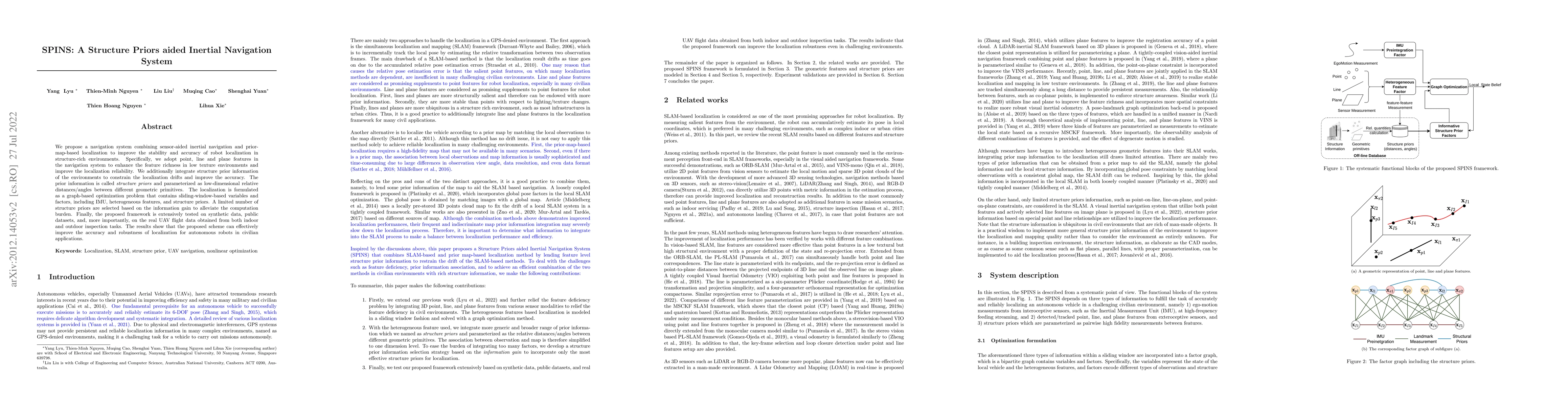
In this paper, we propose a tightly-coupled, multi-modal simultaneous localization and mapping (SLAM) framework, integrating an extensive set of sensors: IMU, cameras, multiple lidars, and Ultra-wid...
In this letter we investigate a tightly coupled Lidar-Inertia Odometry and Mapping (LIOM) scheme, with the capability to incorporate multiple lidars with complementary field of view (FOV). In essenc...
Although Simultaneous Localization and Mapping (SLAM) has been an active research topic for decades, current state-of-the-art methods still suffer from instability or inaccuracy due to feature insuf...
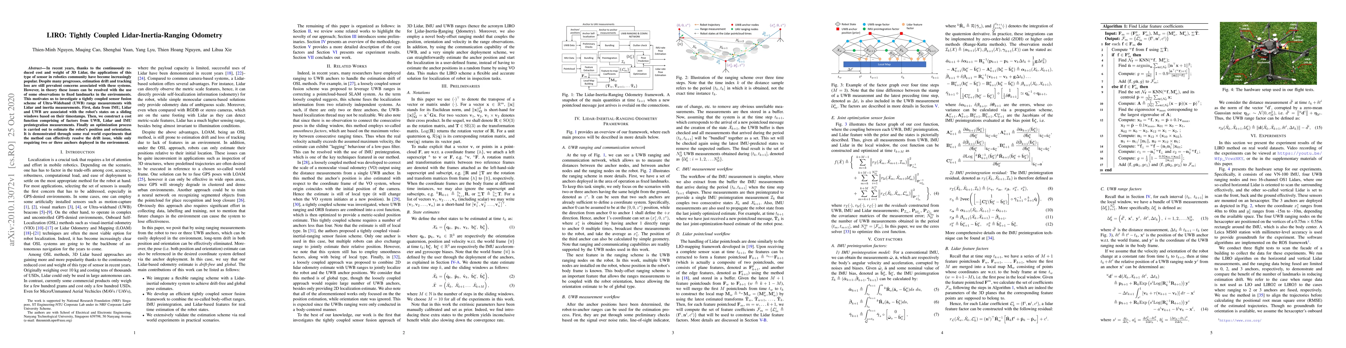
In recent years, thanks to the continuously reduced cost and weight of 3D Lidar, the applications of this type of sensor in robotics community have become increasingly popular. Despite many progress...
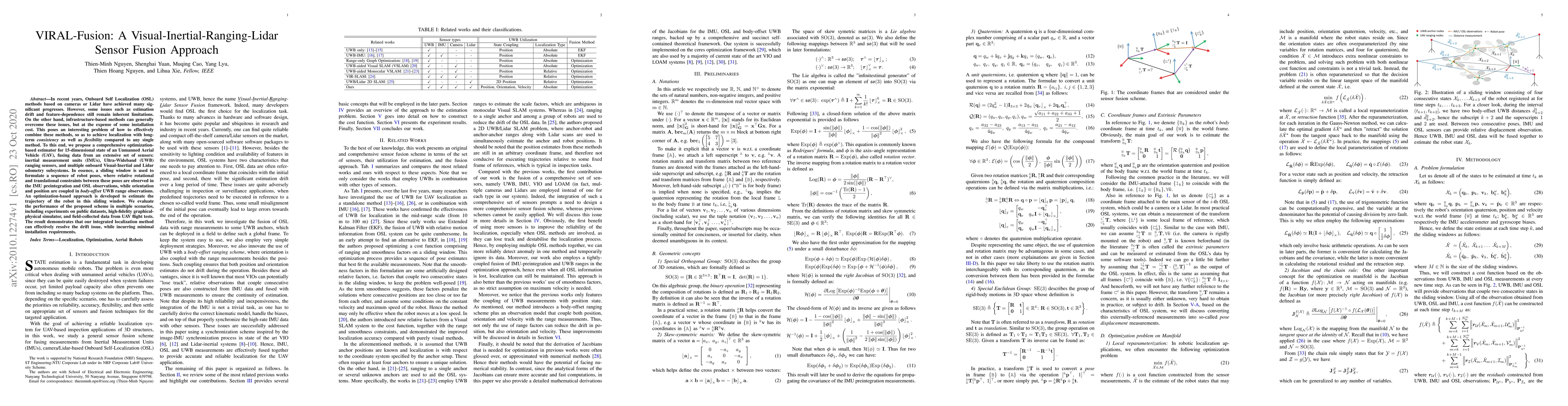
In recent years, Onboard Self Localization (OSL) methods based on cameras or Lidar have achieved many significant progresses. However, some issues such as estimation drift and feature-dependence sti...
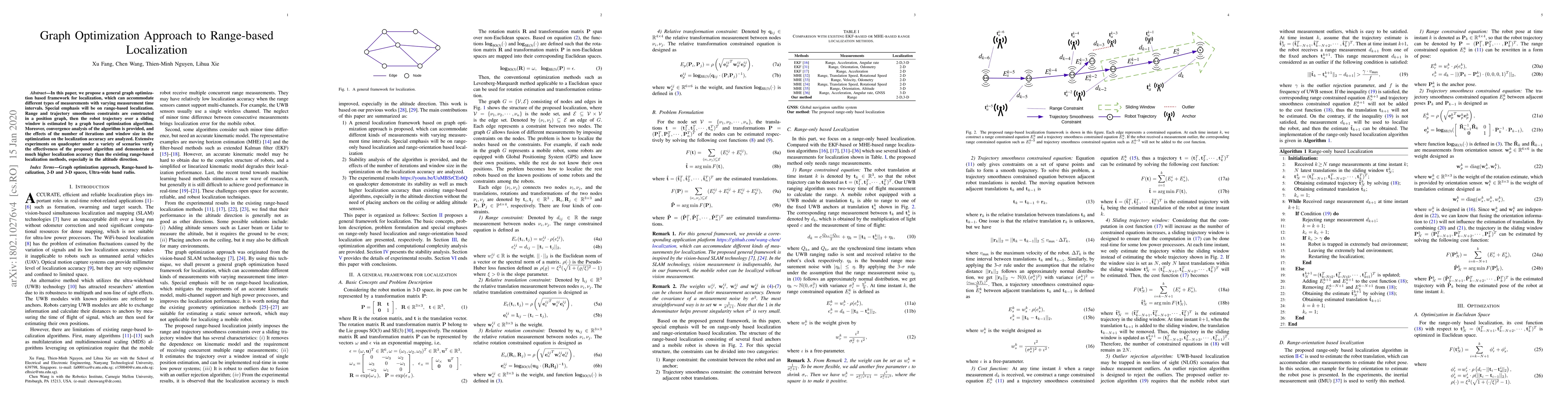
In this paper, we propose a general graph optimization based framework for localization, which can accommodate different types of measurements with varying measurement time intervals. Special emphas...
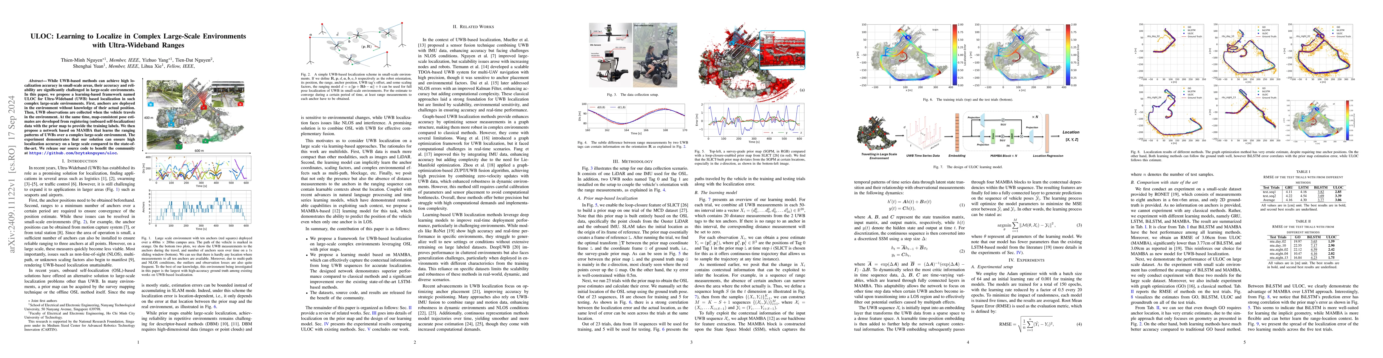
While UWB-based methods can achieve high localization accuracy in small-scale areas, their accuracy and reliability are significantly challenged in large-scale environments. In this paper, we propose ...
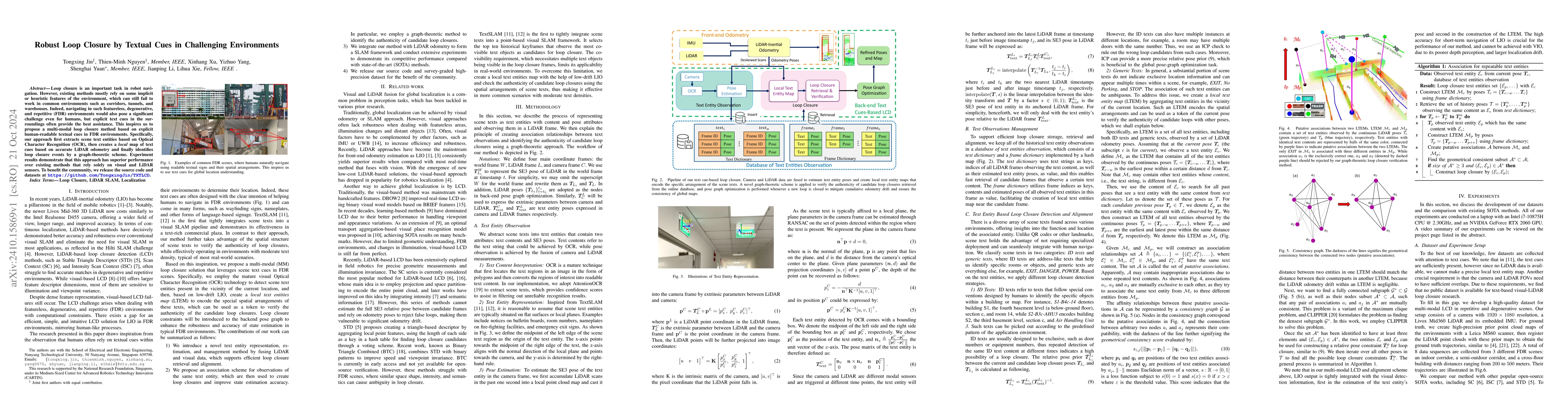
Loop closure is an important task in robot navigation. However, existing methods mostly rely on some implicit or heuristic features of the environment, which can still fail to work in common environme...
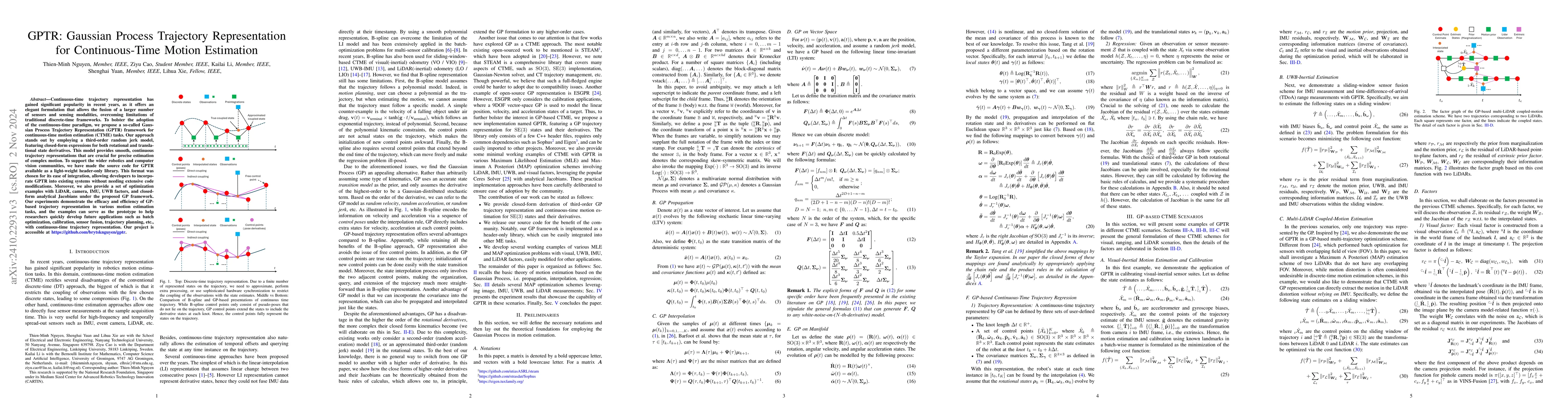
Continuous-time trajectory representation has gained significant popularity in recent years, as it offers an elegant formulation that allows the fusion of a larger number of sensors and sensing modali...
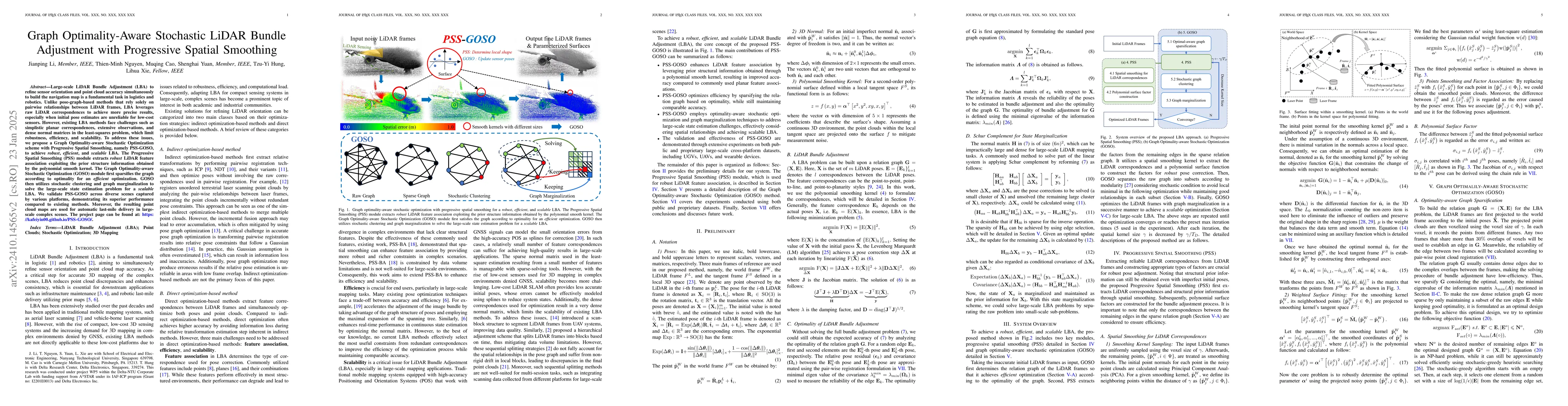
Large-scale LiDAR Bundle Adjustment (LBA) for refining sensor orientation and point cloud accuracy simultaneously is a fundamental task in photogrammetry and robotics, particularly as low-cost 3D sens...
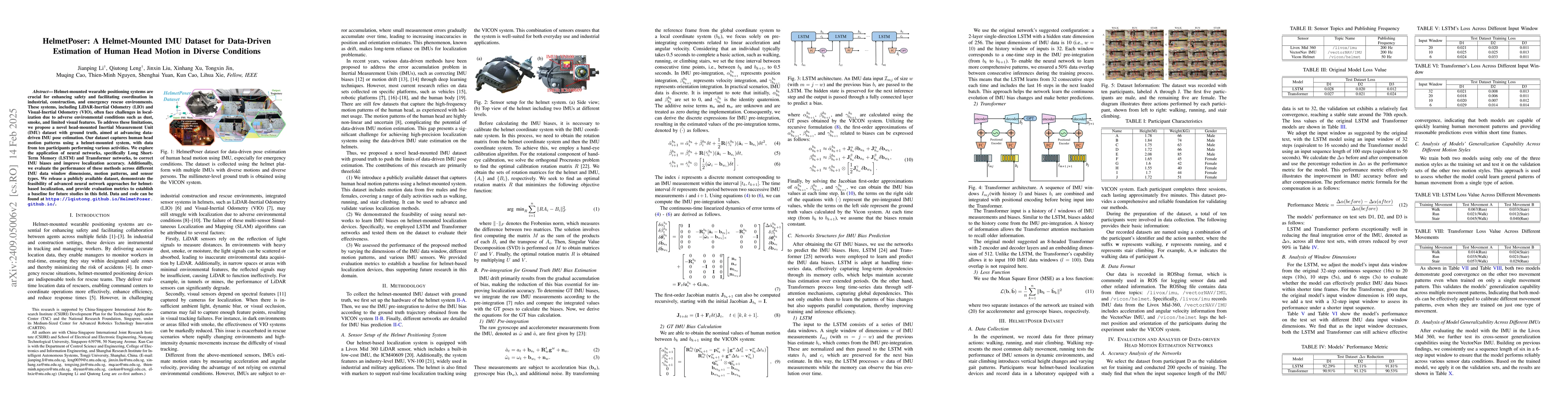
Helmet-mounted wearable positioning systems are crucial for enhancing safety and facilitating coordination in industrial, construction, and emergency rescue environments. These systems, including LiDA...
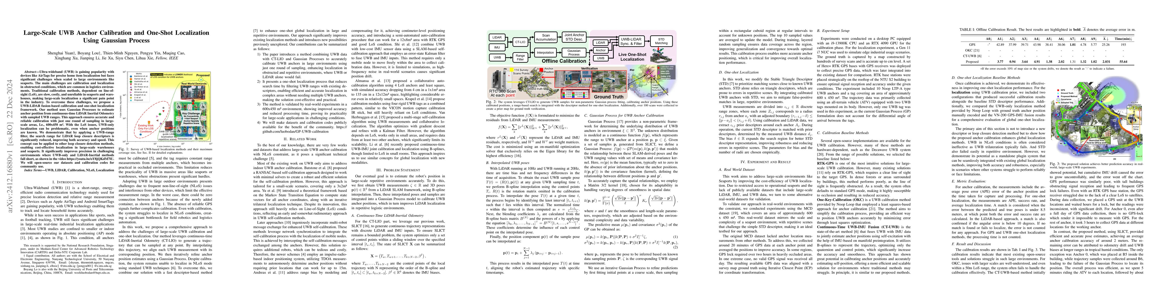
Ultra-wideband (UWB) is gaining popularity with devices like AirTags for precise home item localization but faces significant challenges when scaled to large environments like seaports. The main chall...
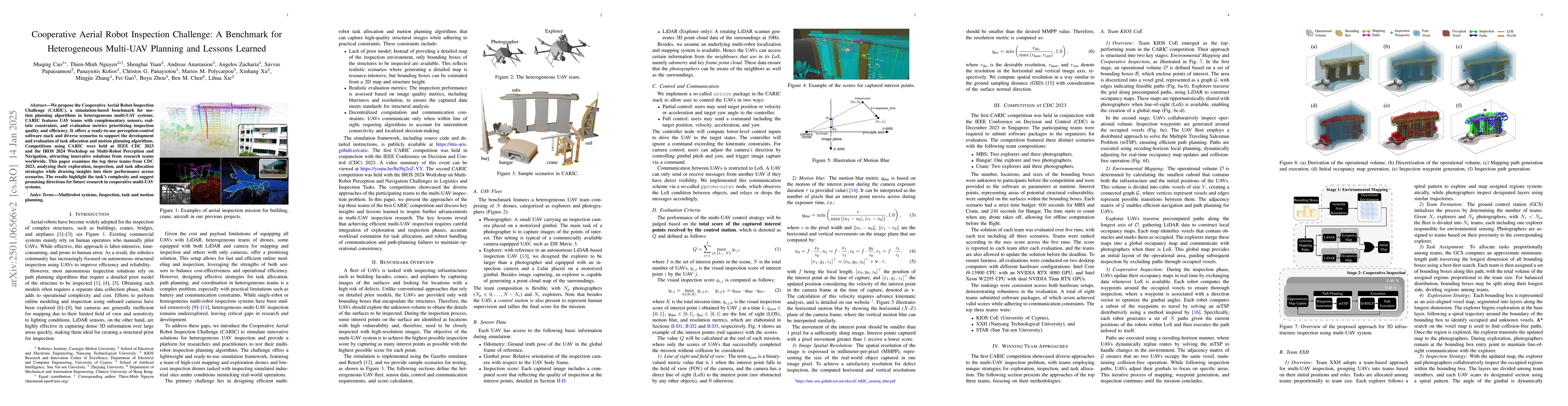
We propose the Cooperative Aerial Robot Inspection Challenge (CARIC), a simulation-based benchmark for motion planning algorithms in heterogeneous multi-UAV systems. CARIC features UAV teams with comp...
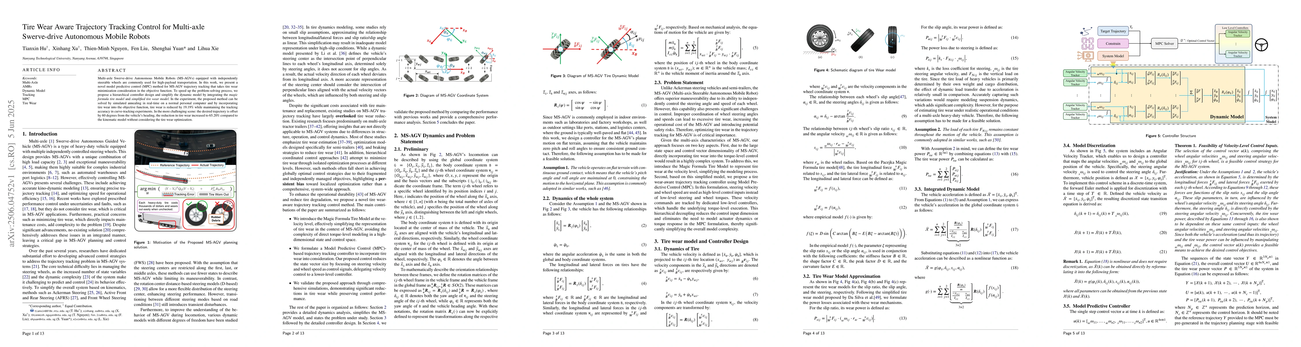
Multi-axle Swerve-drive Autonomous Mobile Robots (MS-AGVs) equipped with independently steerable wheels are commonly used for high-payload transportation. In this work, we present a novel model predic...
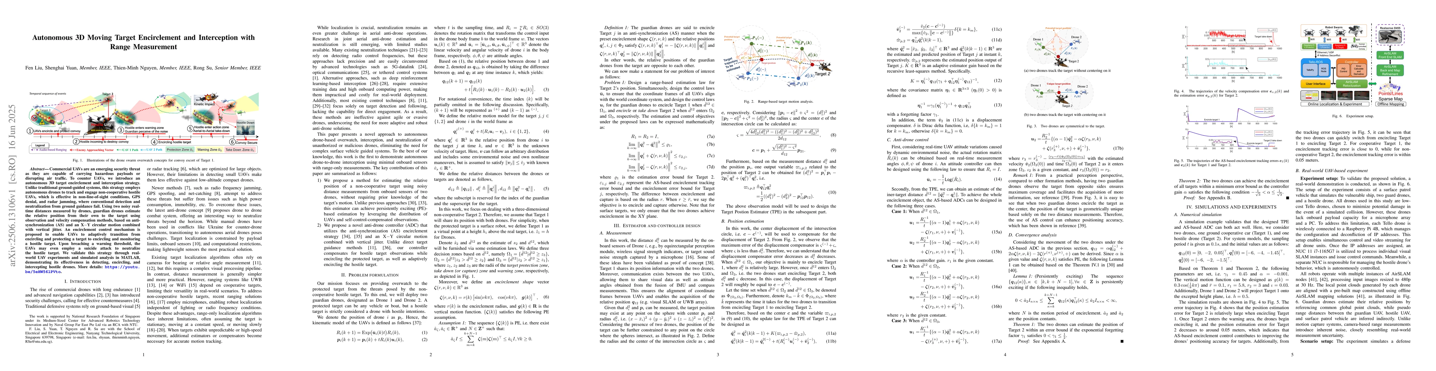
Commercial UAVs are an emerging security threat as they are capable of carrying hazardous payloads or disrupting air traffic. To counter UAVs, we introduce an autonomous 3D target encirclement and int...
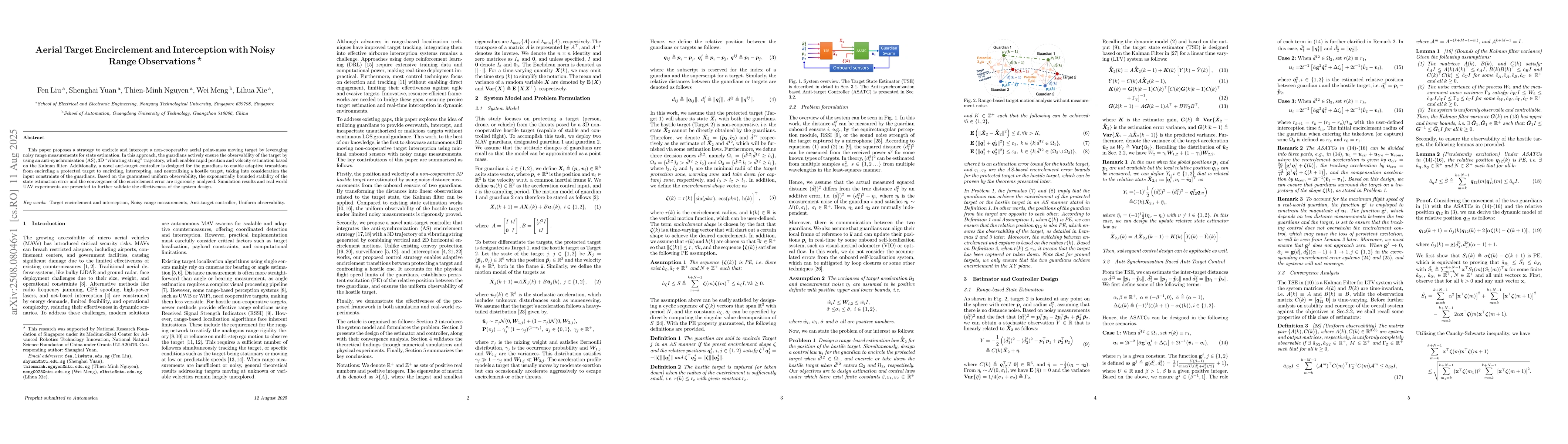
This paper proposes a strategy to encircle and intercept a non-cooperative aerial point-mass moving target by leveraging noisy range measurements for state estimation. In this approach, the guardians ...
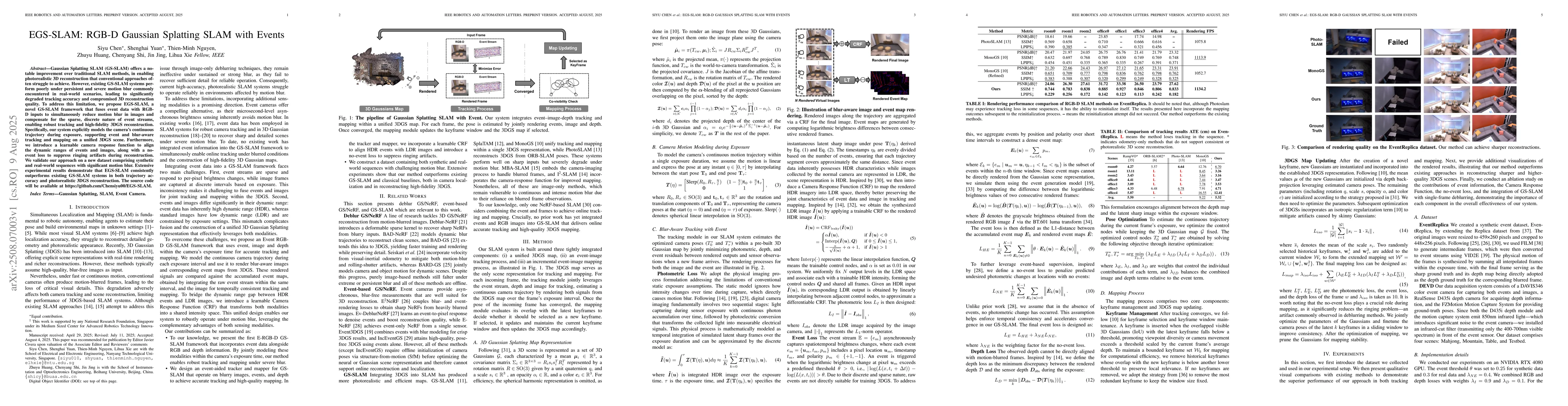
Gaussian Splatting SLAM (GS-SLAM) offers a notable improvement over traditional SLAM methods, enabling photorealistic 3D reconstruction that conventional approaches often struggle to achieve. However,...
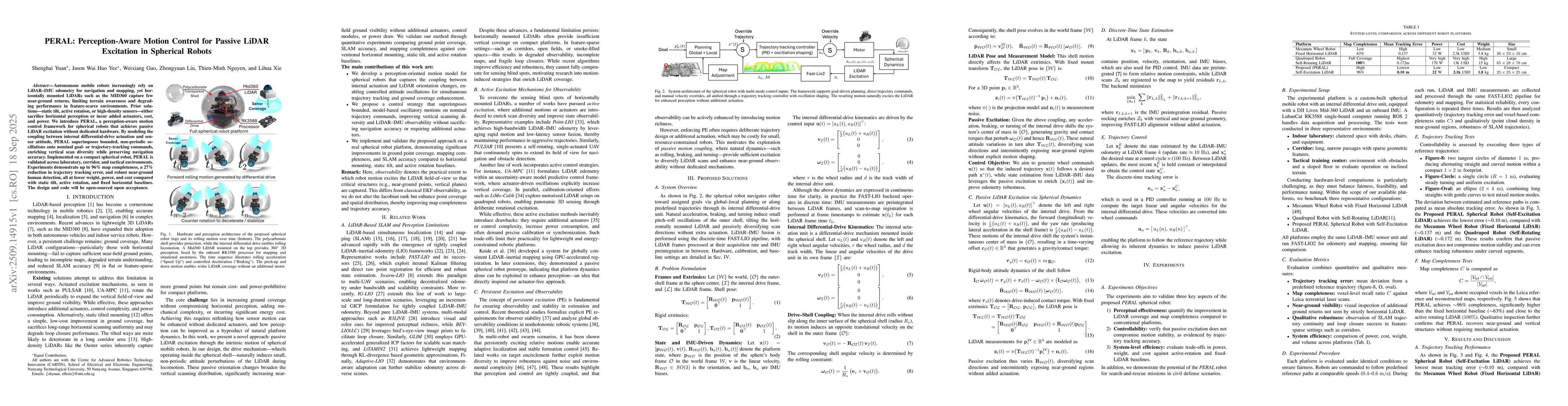
Autonomous mobile robots increasingly rely on LiDAR-IMU odometry for navigation and mapping, yet horizontally mounted LiDARs such as the MID360 capture few near-ground returns, limiting terrain awaren...
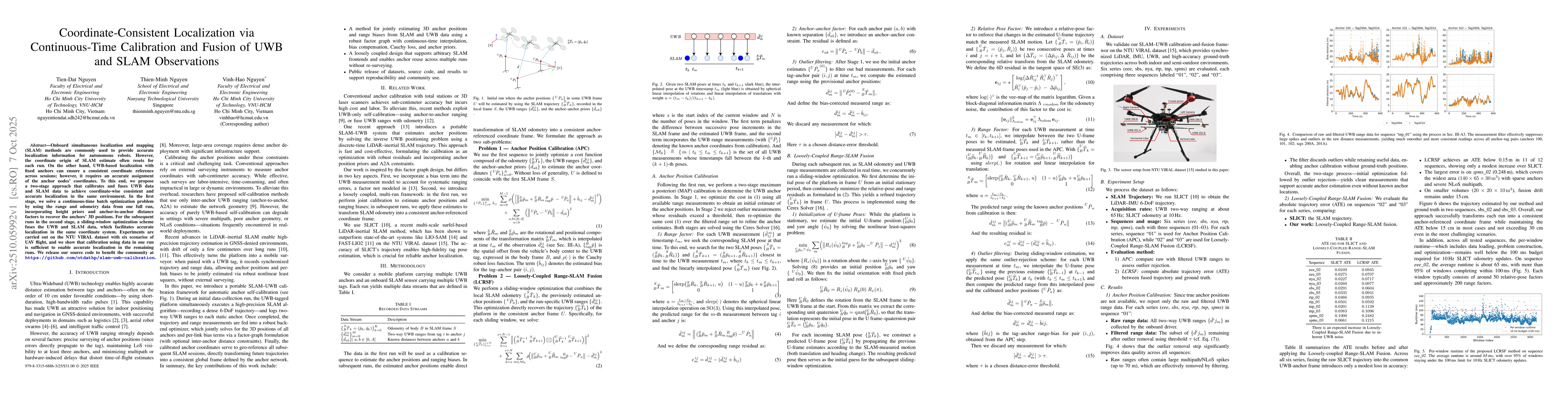
Onboard simultaneous localization and mapping (SLAM) methods are commonly used to provide accurate localization information for autonomous robots. However, the coordinate origin of SLAM estimate often...
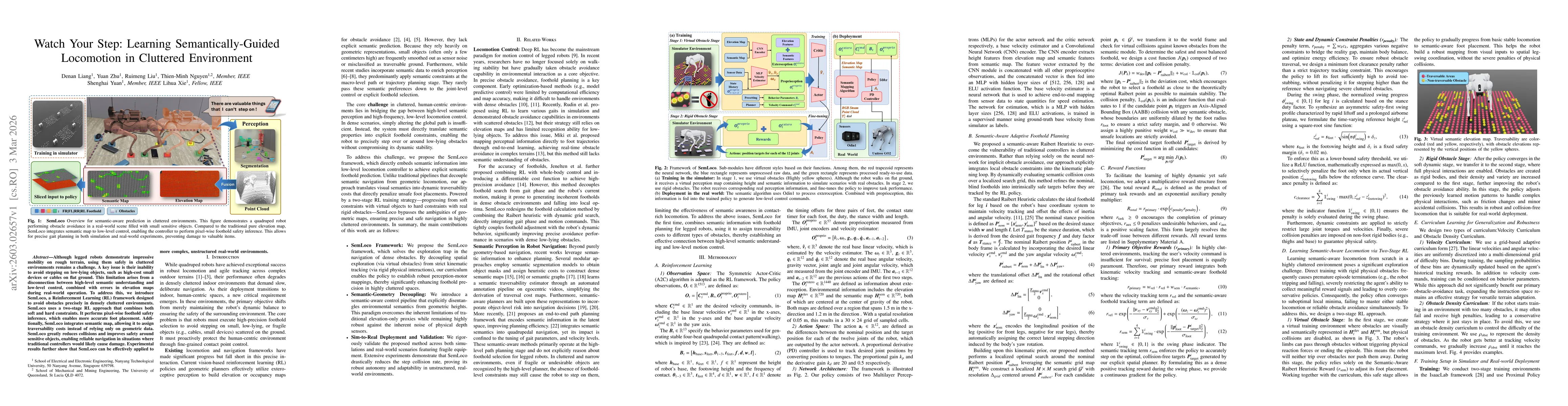
Although legged robots demonstrate impressive mobility on rough terrain, using them safely in cluttered environments remains a challenge. A key issue is their inability to avoid stepping on low-lying ...
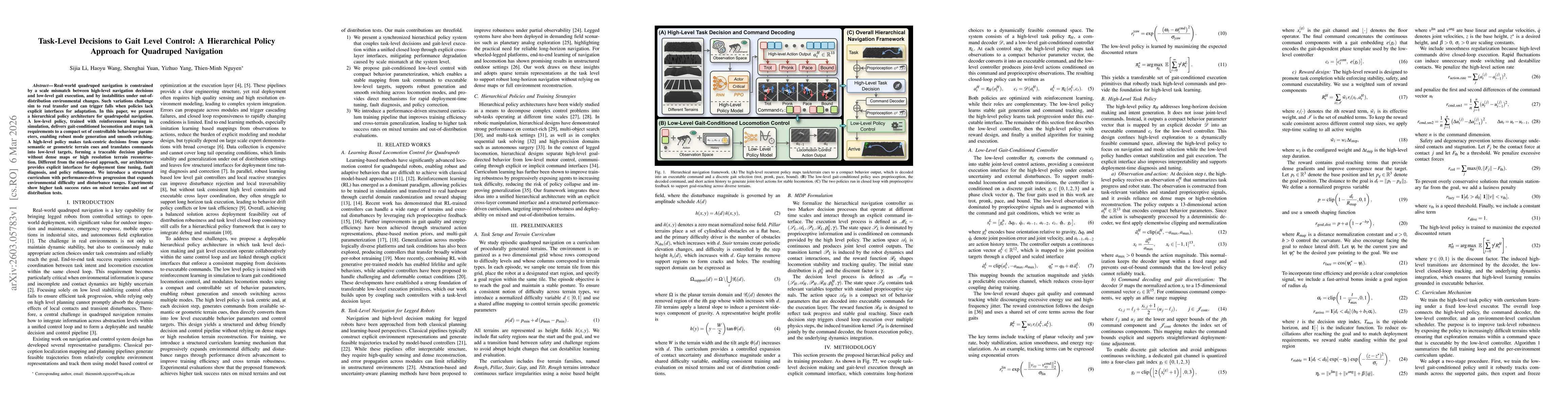
Real-world quadruped navigation is constrained by a scale mismatch between high-level navigation decisions and low-level gait execution, as well as by instabilities under out-of-distribution environme...
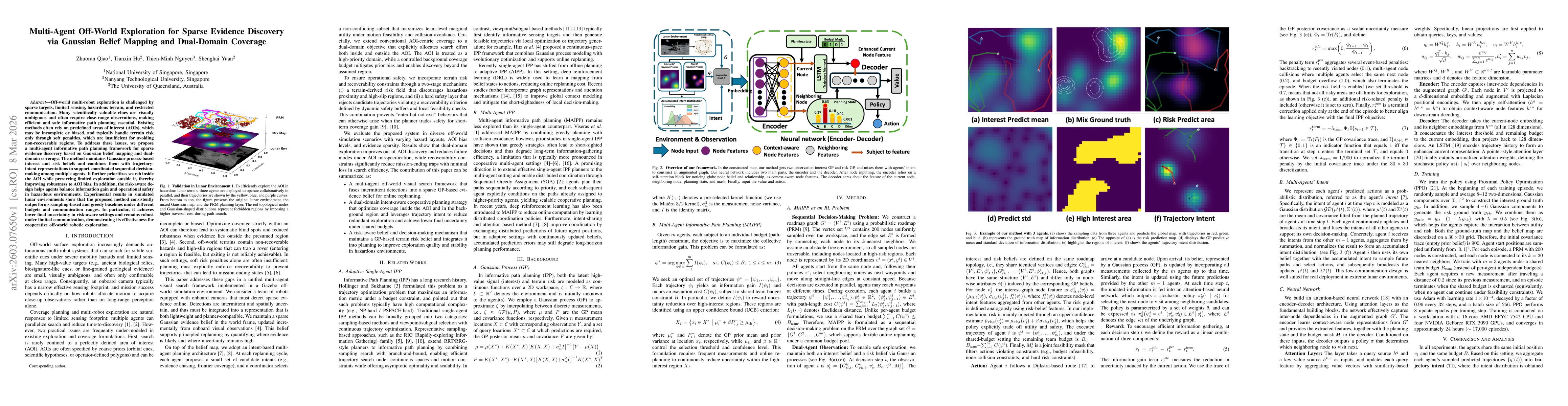
Off-world multi-robot exploration is challenged by sparse targets, limited sensing, hazardous terrain, and restricted communication. Many scientifically valuable clues are visually ambiguous and often...

Autonomous collision-free navigation in cluttered environments requires safe decision-making under partial observability with both static structure and dynamic obstacles. We present \textbf{PanoDP}, a...
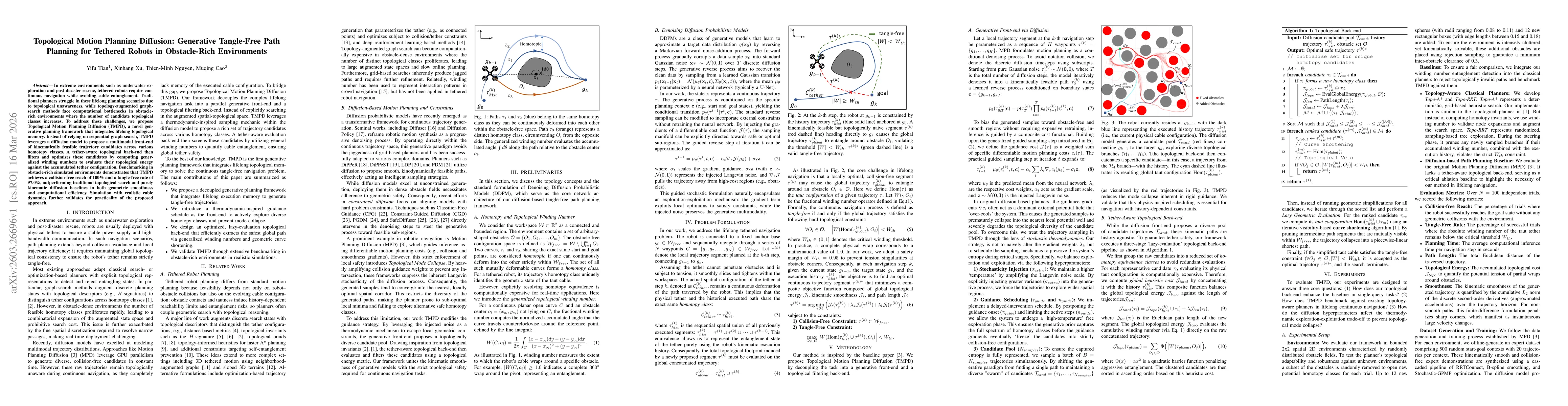
In extreme environments such as underwater exploration and post-disaster rescue, tethered robots require continuous navigation while avoiding cable entanglement. Traditional planners struggle in these...