Academic Profile
Statistics
Similar Authors
Papers on arXiv
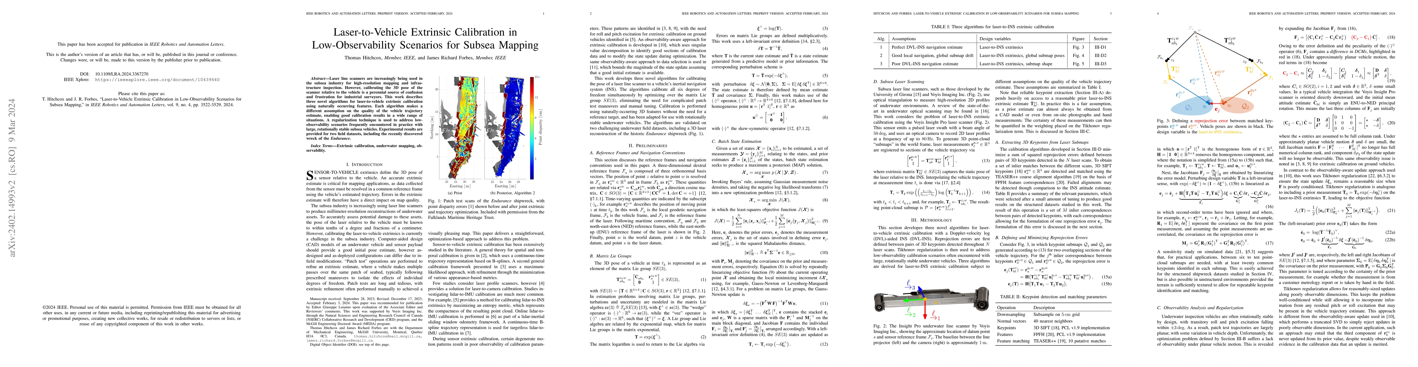
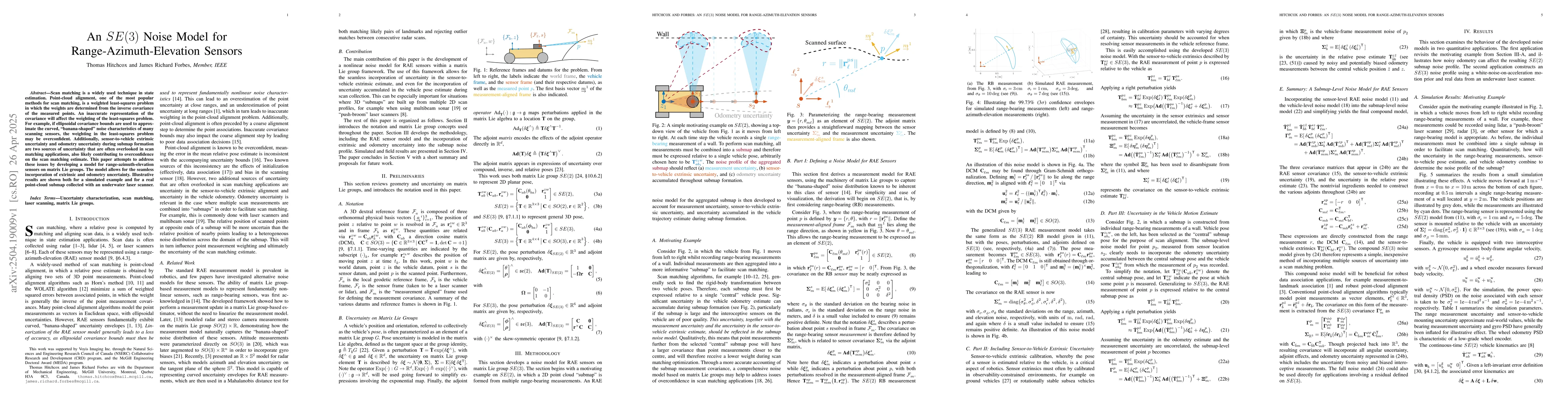
Laser line scanners are increasingly being used in the subsea industry for high-resolution mapping and infrastructure inspection. However, calibrating the 3D pose of the scanner relative to the vehi...
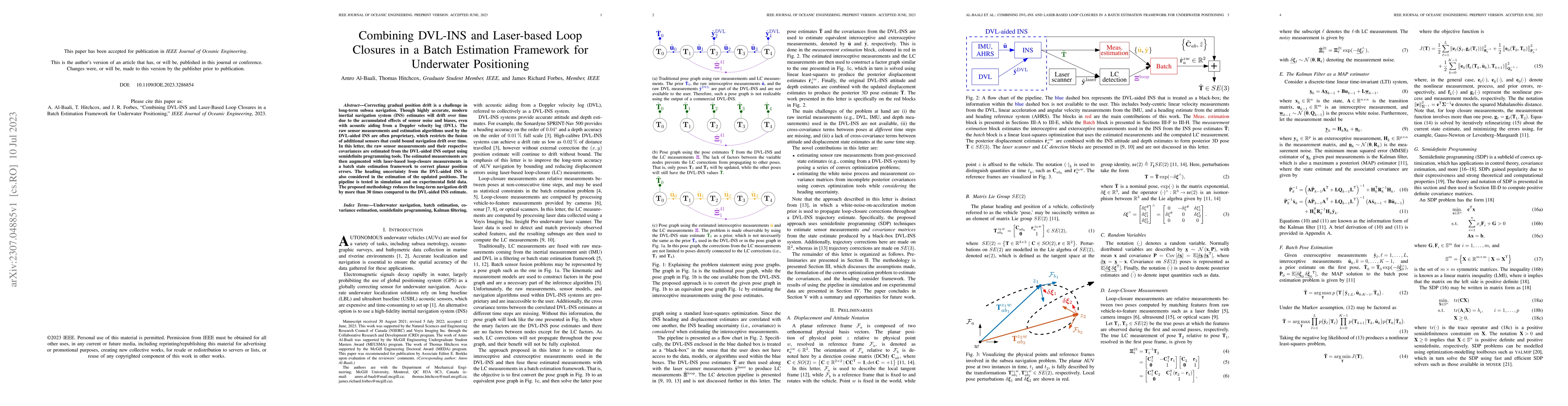
Correcting gradual position drift is a challenge in long-term subsea navigation. Though highly accurate, modern inertial navigation system (INS) estimates will drift over time due to the accumulated...
Many problems in robotics, such as estimating the state from noisy sensor data or aligning two point clouds, can be posed and solved as least-squares problems. Unfortunately, vanilla nonminimal solv...
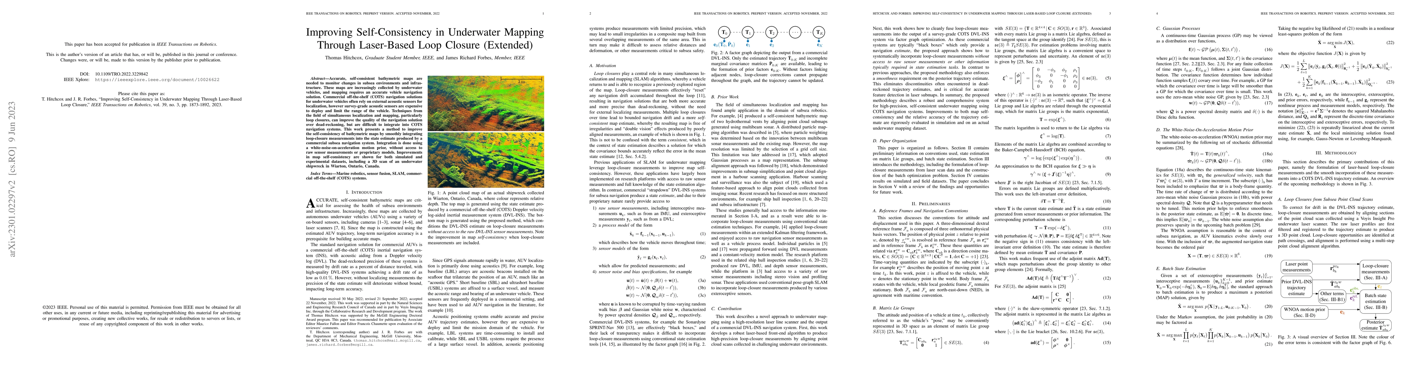
Accurate, self-consistent bathymetric maps are needed to monitor changes in subsea environments and infrastructure. These maps are increasingly collected by underwater vehicles, and mapping requires...
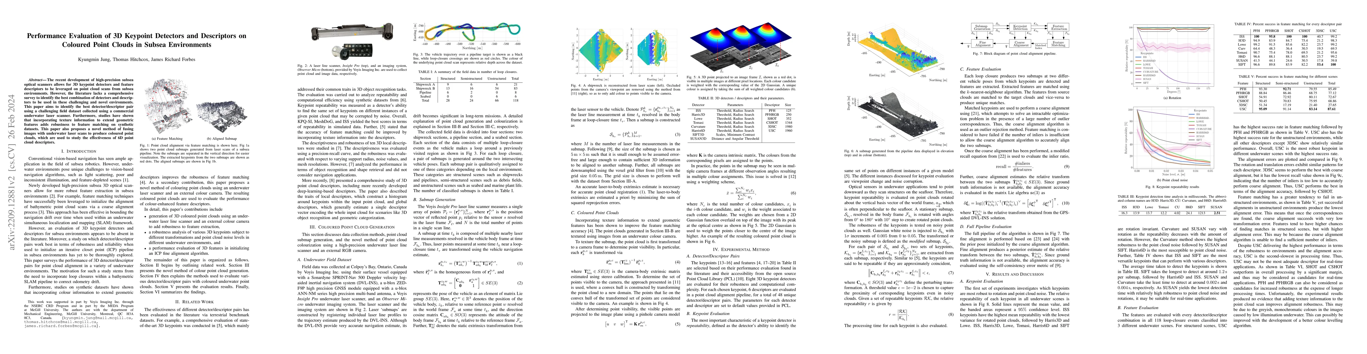
The recent development of high-precision subsea optical scanners allows for 3D keypoint detectors and feature descriptors to be leveraged on point cloud scans from subsea environments. However, the ...
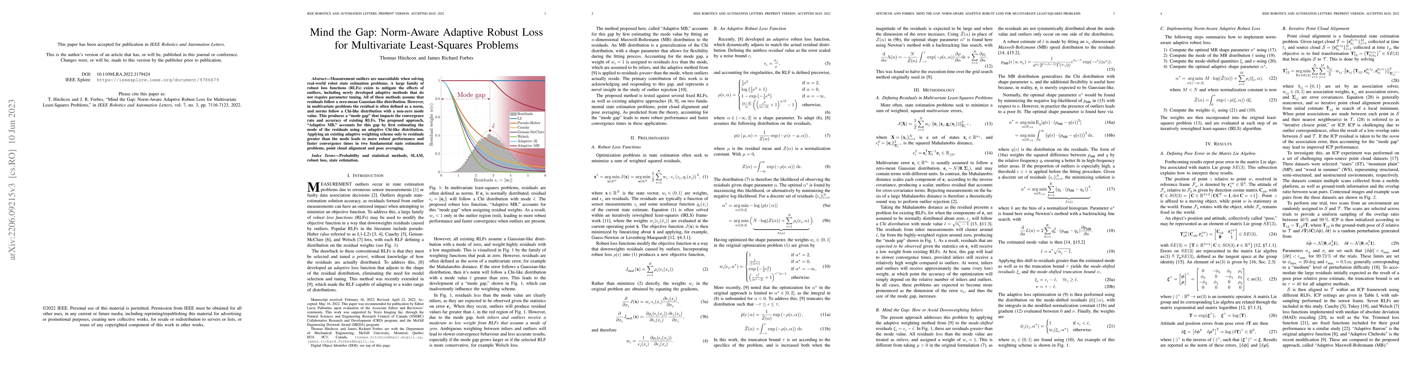
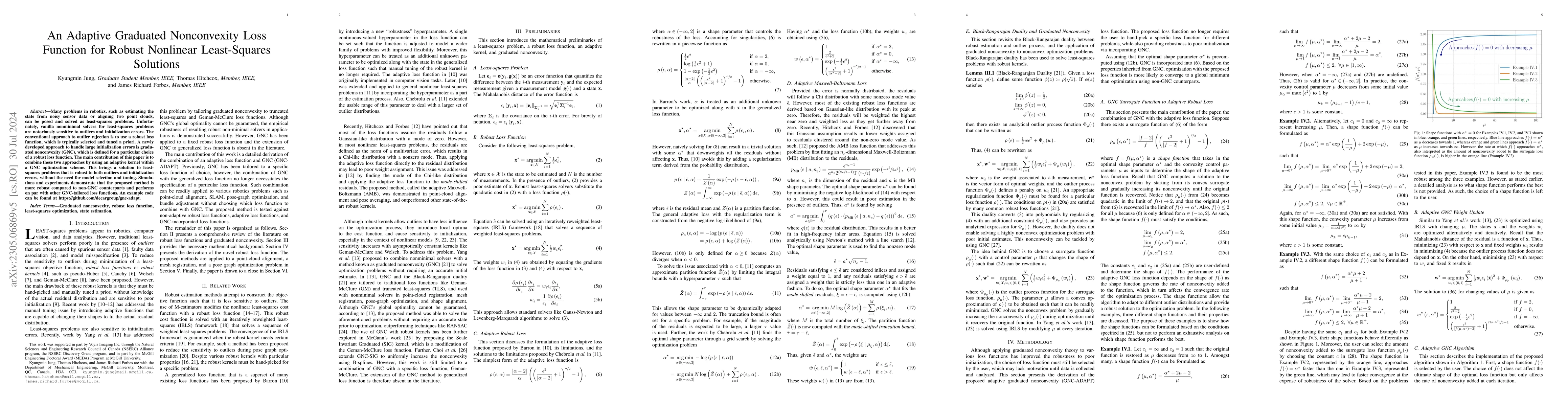
Measurement outliers are unavoidable when solving real-world robot state estimation problems. A large family of robust loss functions (RLFs) exists to mitigate the effects of outliers, including new...
Scan matching is a widely used technique in state estimation. Point-cloud alignment, one of the most popular methods for scan matching, is a weighted least-squares problem in which the weights are det...