2
arXiv Papers
1
Total Publications
Profile
Academic Profile
Metrics
Statistics
2
arXiv Papers
1
Total Publications
Network
Similar Authors
Publications
Papers on arXiv
arXiv
Exact: Exploring Space-Time Perceptive Clues for Weakly Supervised
Satellite Image Time Series Semantic Segmentation
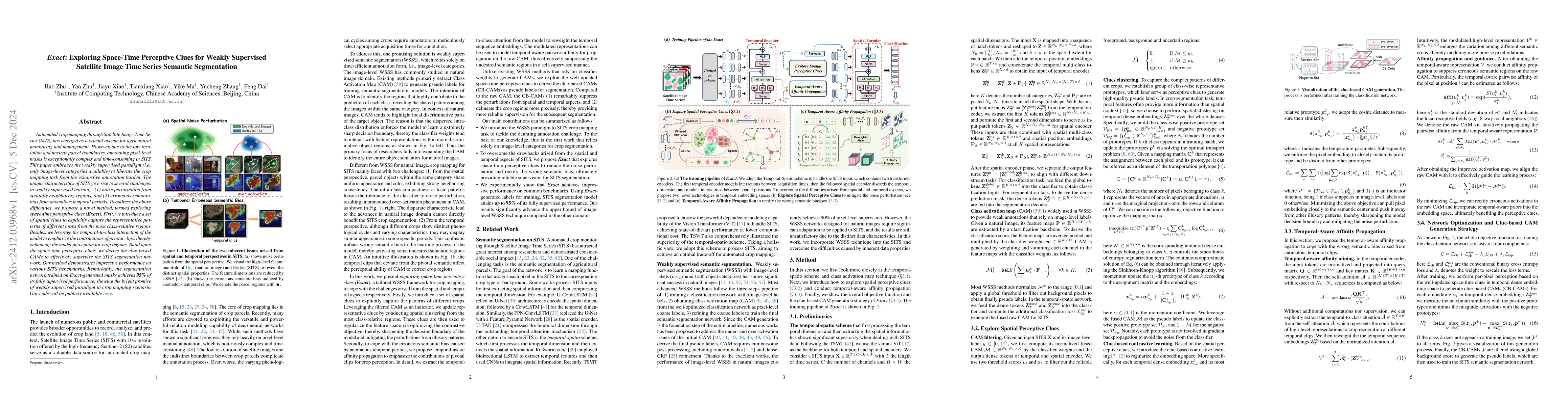
Automated crop mapping through Satellite Image Time Series (SITS) has emerged as a crucial avenue for agricultural monitoring and management. However, due to the low resolution and unclear parcel boun...
arXiv
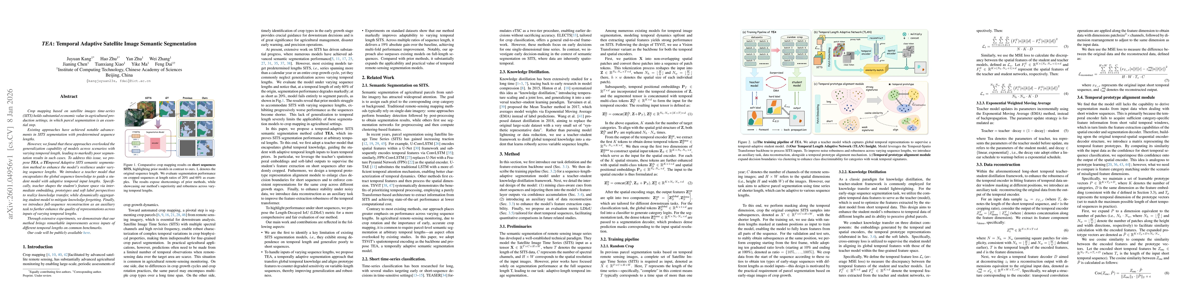
TEA: Temporal Adaptive Satellite Image Semantic Segmentation
Crop mapping based on satellite images time-series (SITS) holds substantial economic value in agricultural production settings, in which parcel segmentation is an essential step. Existing approaches h...