Academic Profile
Statistics
Similar Authors
Papers on arXiv
This paper introduces Mixed Effect Gradient Boosting (MEGB), which combines the strengths of Gradient Boosting with Mixed Effects models to address complex, hierarchical data structures often encoun...
Identifying and addressing poverty is challenging in administrative units with limited information on income distribution and well-being. To overcome this obstacle, small area estimation methods hav...
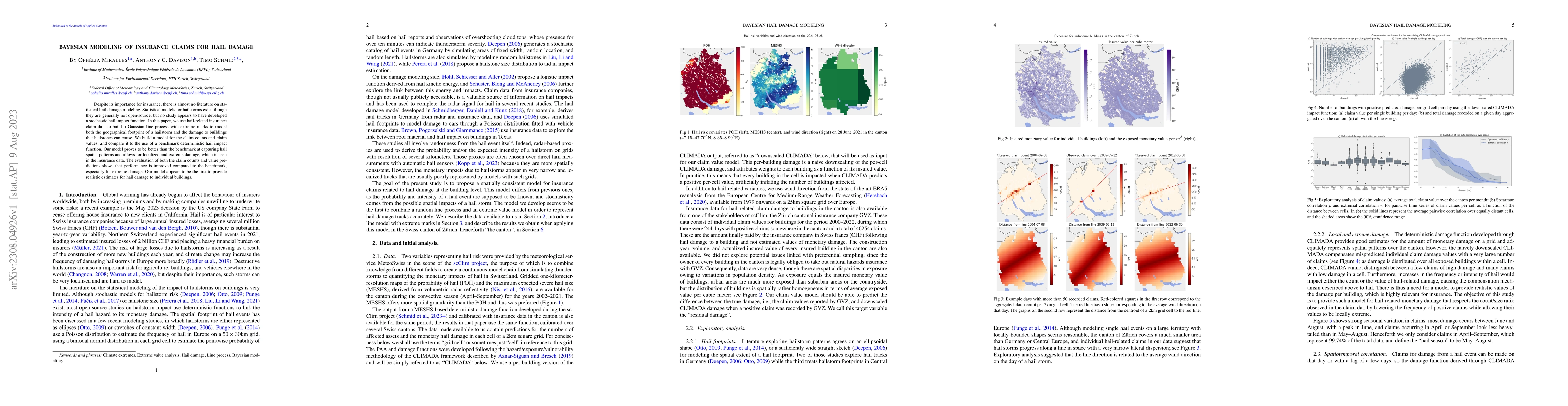
Despite its importance for insurance, there is almost no literature on statistical hail damage modeling. Statistical models for hailstorms exist, though they are generally not open-source, but no st...
This paper promotes the use of random forests as versatile tools for estimating spatially disaggregated indicators in the presence of small area-specific sample sizes. Small area estimators are pred...
Censuses are fundamental building blocks of most modern-day societies, yet collected every ten years at best. We propose an extension of the widely popular census updating technique Structure Preser...
M-quantile regression is a general form of quantile-like regression which usually utilises the Huber influence function and corresponding tuning constant. Estimation requires a nuisance scale parame...
This paper proposes small area estimation methods that utilize generalized tree-based machine learning techniques to improve the estimation of disaggregated means in small areas using discrete survey ...
Density estimation for geospatial data ideally relies on precise geocoordinates, typically defined by longitude and latitude. However, such detailed information is often unavailable due to confidentia...
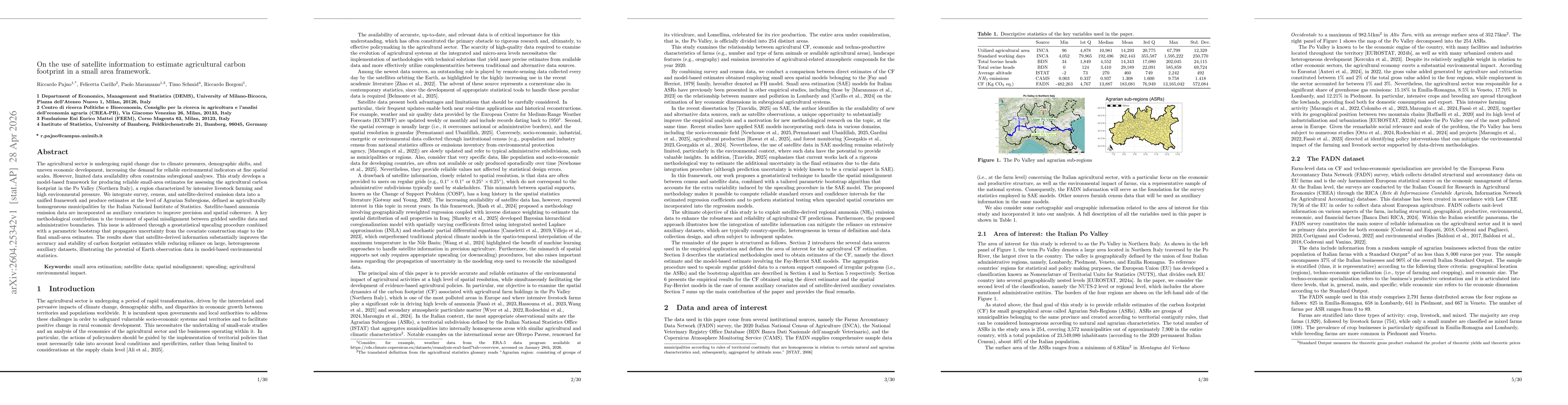
The agricultural sector is undergoing rapid change due to climate pressures, demographic shifts, and uneven economic development, increasing the demand for reliable environmental indicators at fine sp...