Academic Profile
Statistics
Similar Authors
Papers on arXiv
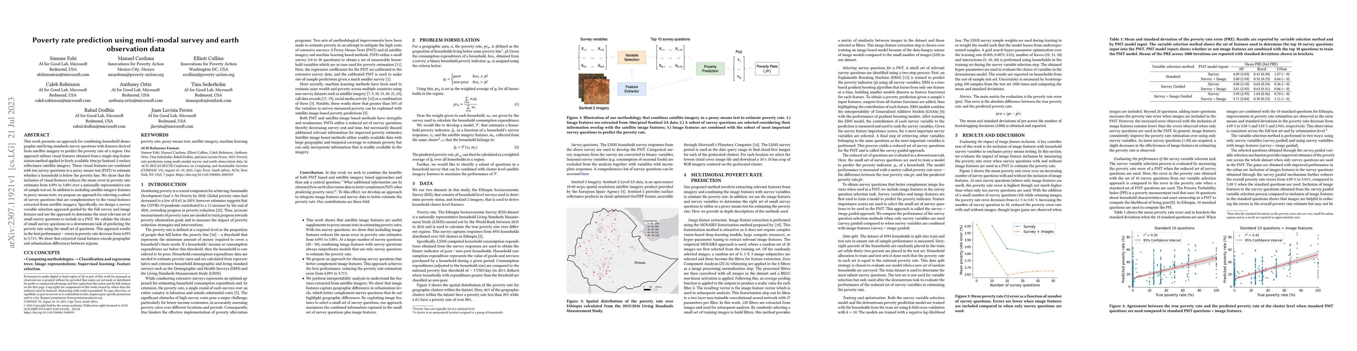
This work presents an approach for combining household demographic and living standards survey questions with features derived from satellite imagery to predict the poverty rate of a region. Our app...
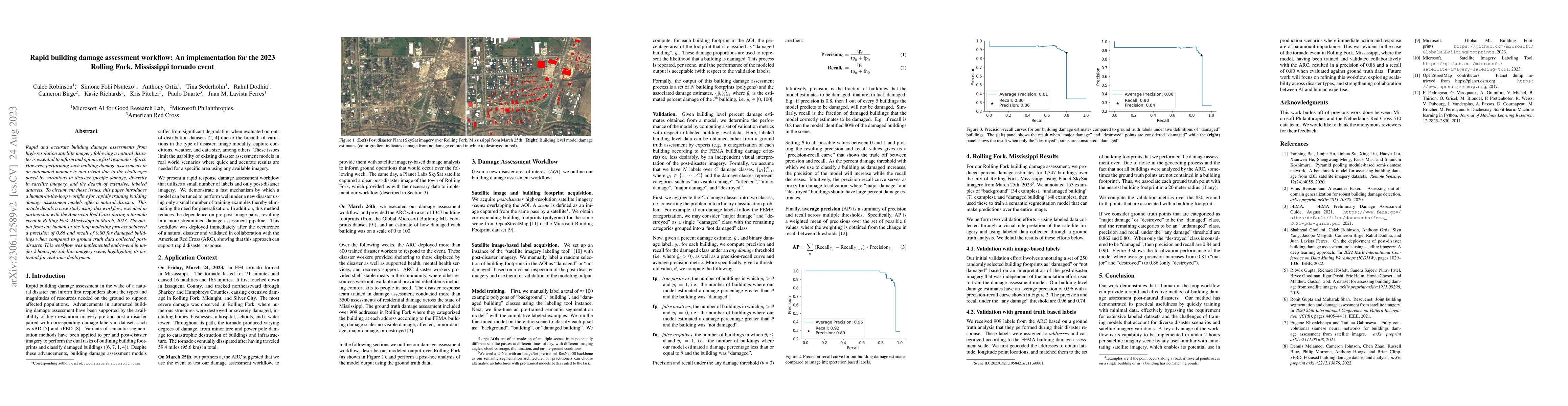
Rapid and accurate building damage assessments from high-resolution satellite imagery following a natural disaster is essential to inform and optimize first responder efforts. However, performing su...
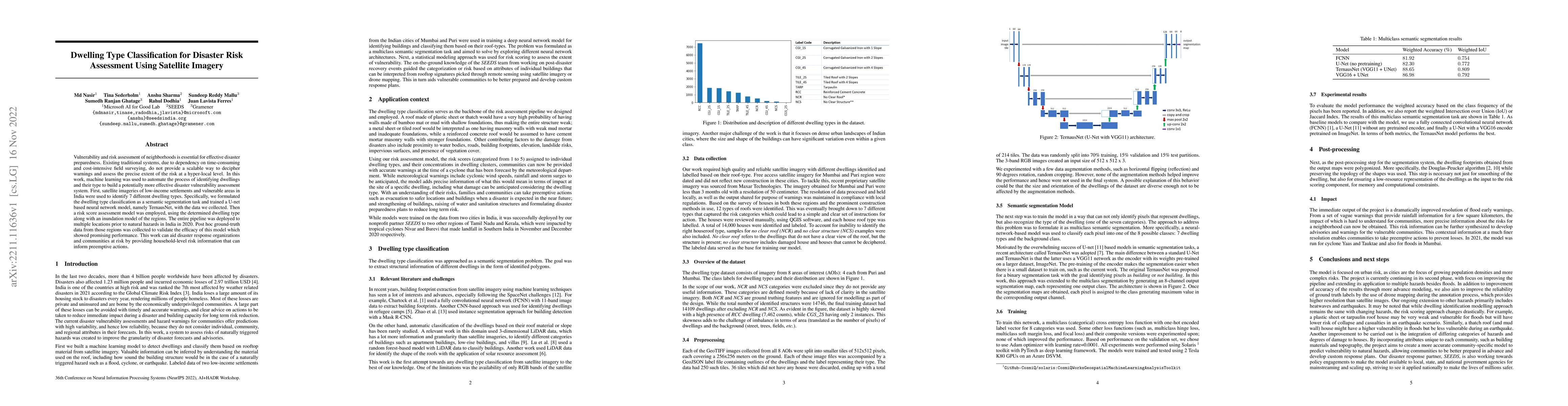
Vulnerability and risk assessment of neighborhoods is essential for effective disaster preparedness. Existing traditional systems, due to dependency on time-consuming and cost-intensive field survey...
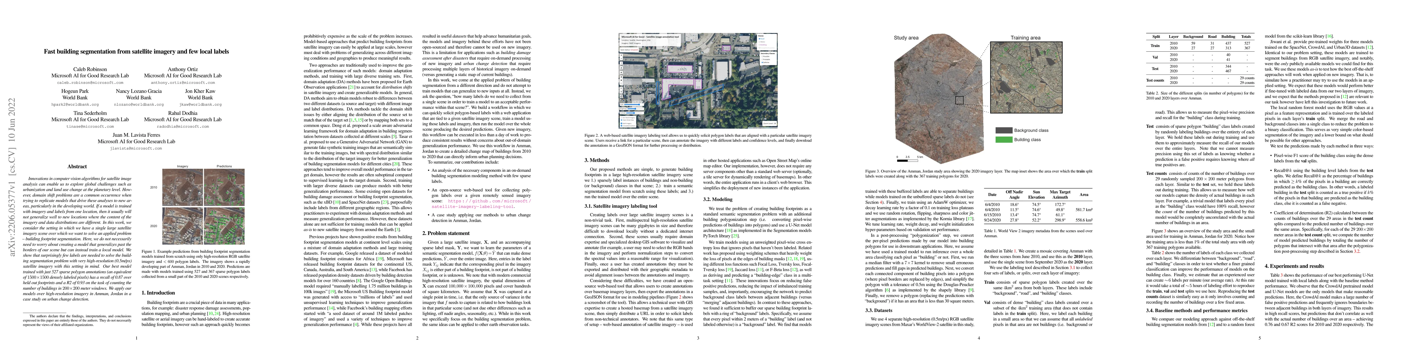
Innovations in computer vision algorithms for satellite image analysis can enable us to explore global challenges such as urbanization and land use change at the planetary level. However, domain shi...
Child trafficking in a serious problem around the world. Every year there are more than 4 million victims of child trafficking around the world, many of them for the purposes of child sexual exploit...