Academic Profile
Statistics
Similar Authors
Papers on arXiv
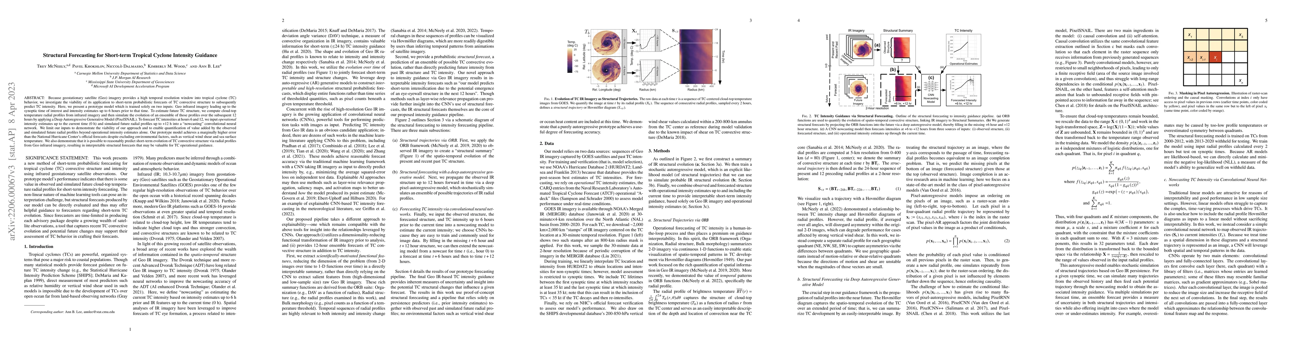
Because geostationary satellite (Geo) imagery provides a high temporal resolution window into tropical cyclone (TC) behavior, we investigate the viability of its application to short-term probabilis...
Our goal is to quantify whether, and if so how, spatio-temporal patterns in tropical cyclone (TC) satellite imagery signal an upcoming rapid intensity change event. To address this question, we prop...
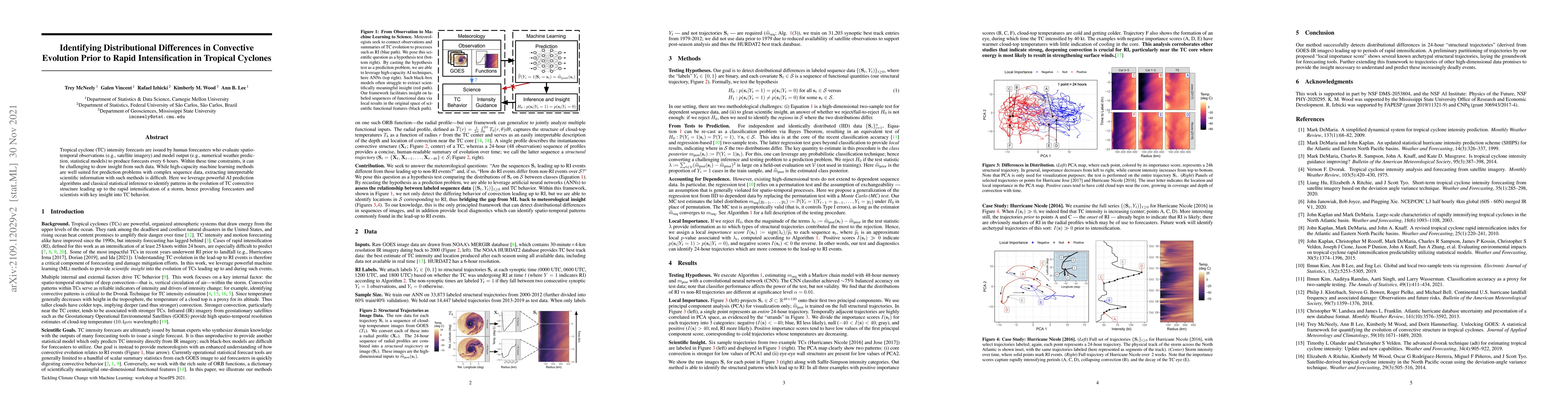
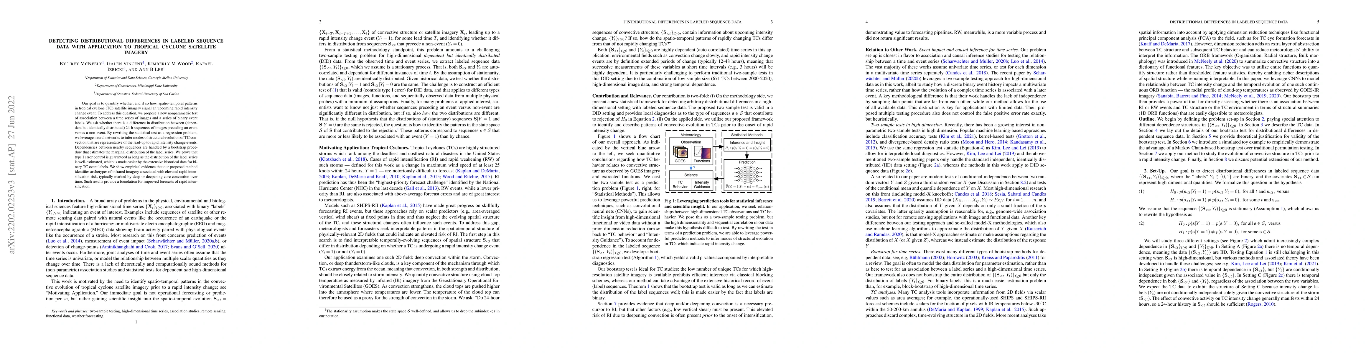
Tropical cyclone (TC) intensity forecasts are issued by human forecasters who evaluate spatio-temporal observations (e.g., satellite imagery) and model output (e.g., numerical weather prediction, st...