Academic Profile
Statistics
Similar Authors
Papers on arXiv
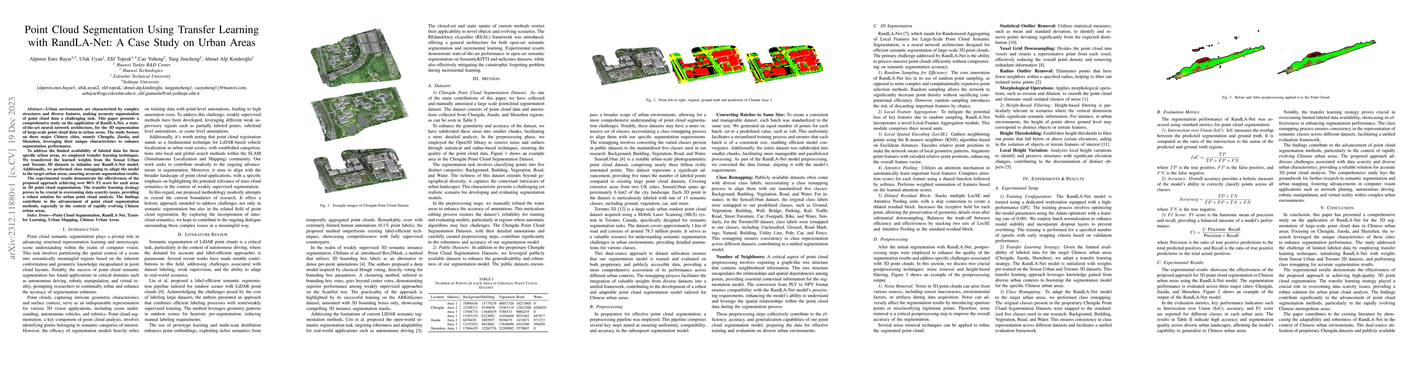
Urban environments are characterized by complex structures and diverse features, making accurate segmentation of point cloud data a challenging task. This paper presents a comprehensive study on the...
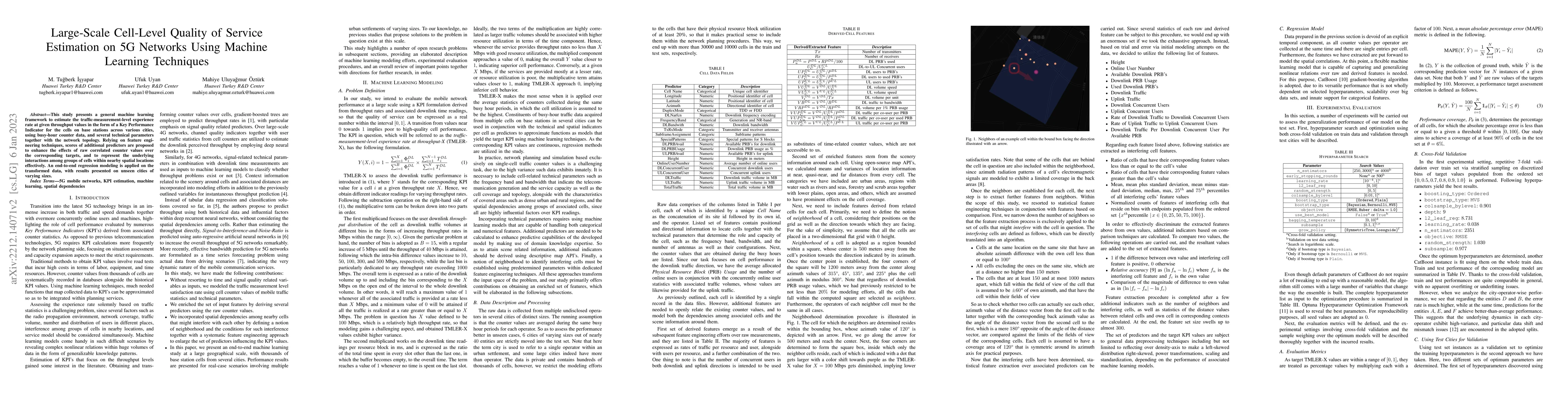
This study presents a general machine learning framework to estimate the traffic-measurement-level experience rate at given throughput values in the form of a Key Performance Indicator for the cells...
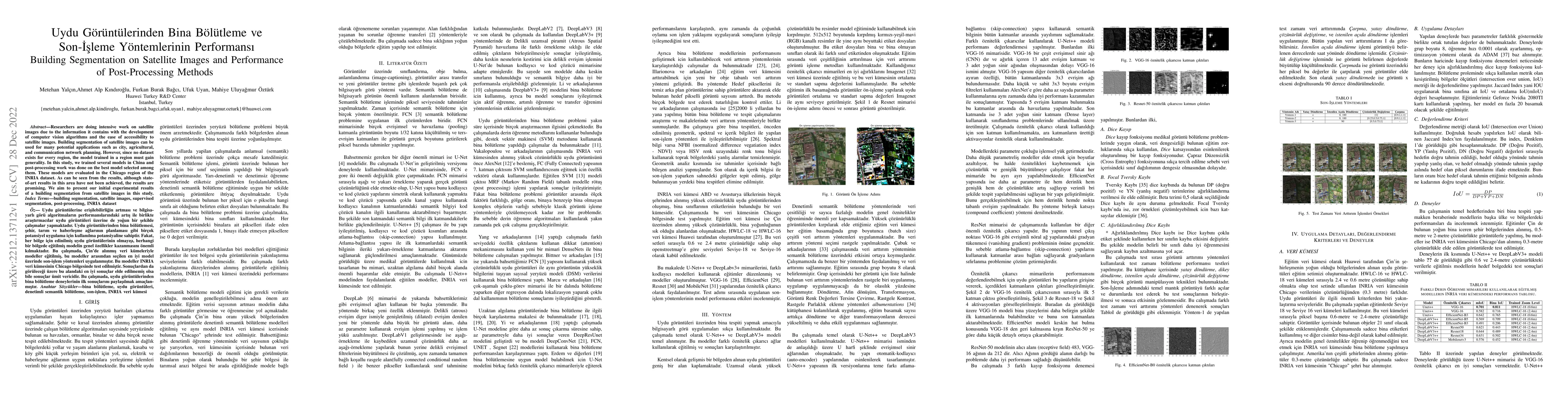
Researchers are doing intensive work on satellite images due to the information it contains with the development of computer vision algorithms and the ease of accessibility to satellite images. Buil...
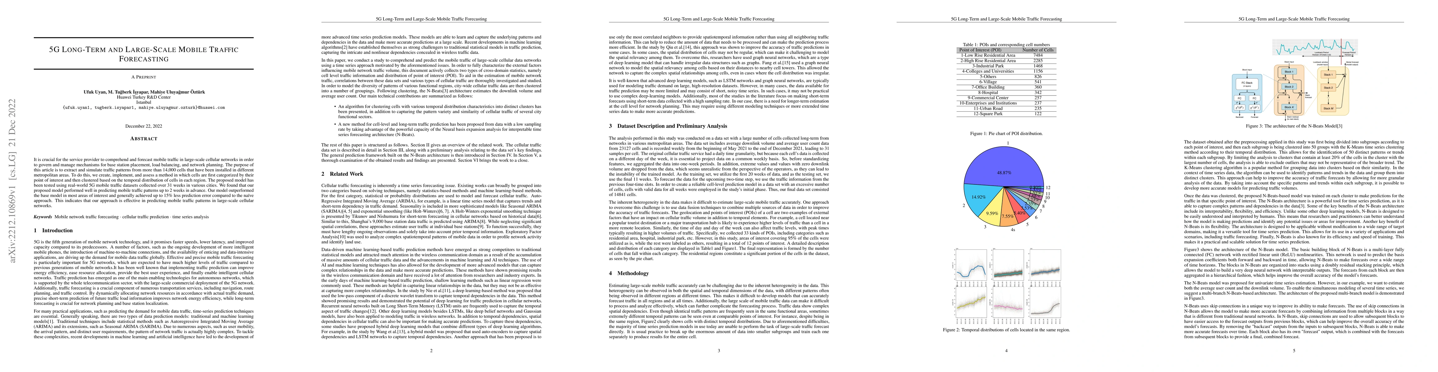
It is crucial for the service provider to comprehend and forecast mobile traffic in large-scale cellular networks in order to govern and manage mechanisms for base station placement, load balancing,...
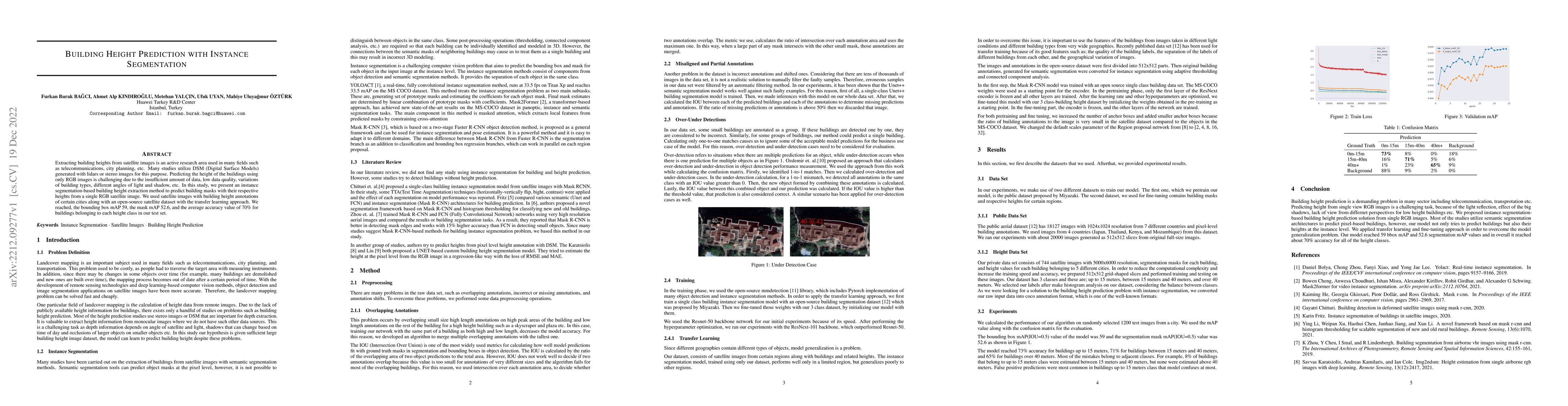
Extracting building heights from satellite images is an active research area used in many fields such as telecommunications, city planning, etc. Many studies utilize DSM (Digital Surface Models) gen...
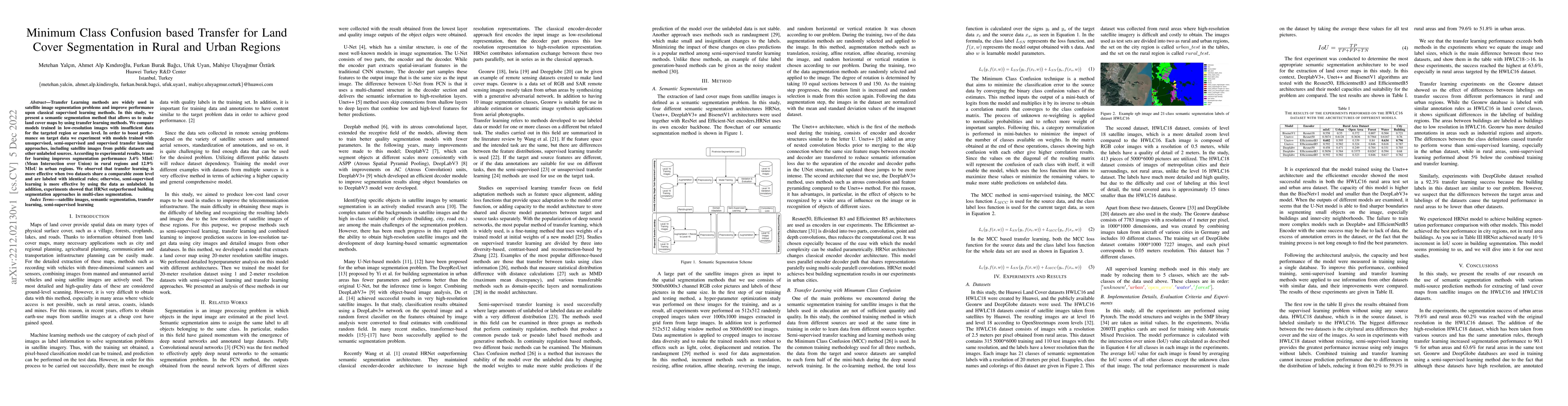
Transfer Learning methods are widely used in satellite image segmentation problems and improve performance upon classical supervised learning methods. In this study, we present a semantic segmentati...