Umut Altay

3 papers on arXiv

Statistics

arXiv Papers 3

Papers on arXiv

Thumbnail for GeoAdjust: Adjusting for Positional Uncertainty in Geostatistial
  Analysis of DHS Data

GeoAdjust: Adjusting for Positional Uncertainty in Geostatistial Analysis of DHS Data

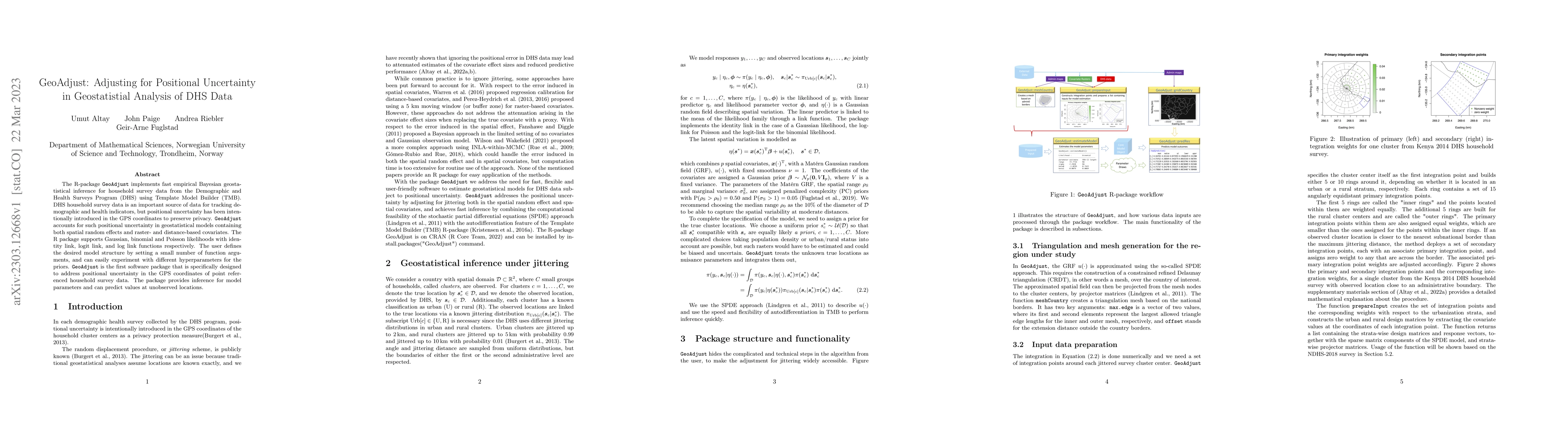
The R-package GeoAdjust https://github.com/umut-altay/GeoAdjust-package implements fast empirical Bayesian geostatistical inference for household survey data from the Demographic and Health Surveys ...

Thumbnail for Impact of Jittering on Raster- and Distance-based Geostatistical
  Analyses of DHS Data

Impact of Jittering on Raster- and Distance-based Geostatistical Analyses of DHS Data

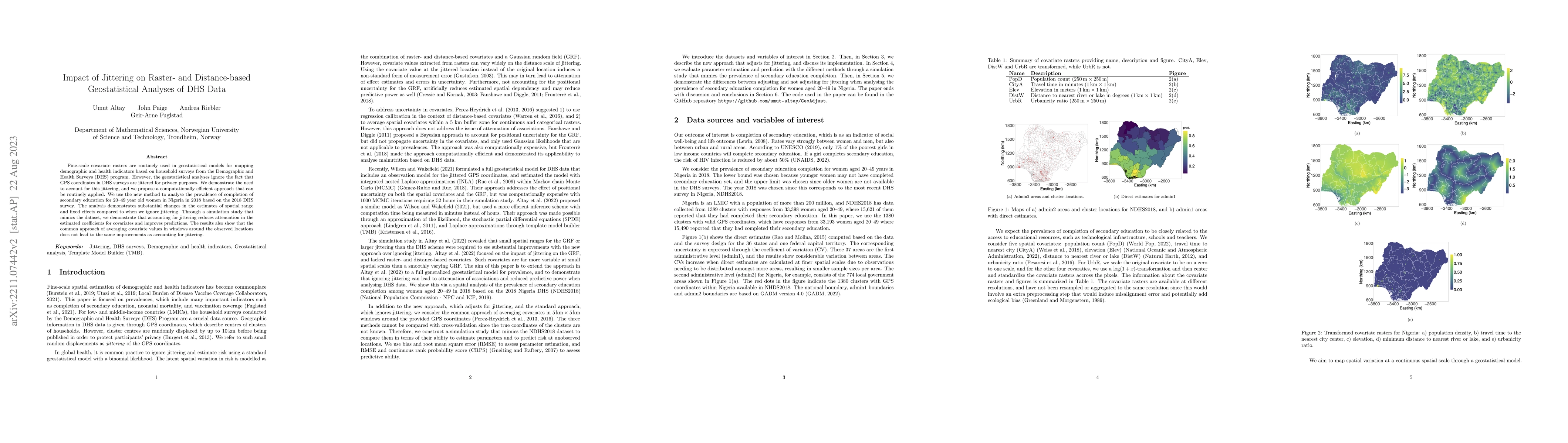
Fine-scale covariate rasters are routinely used in geostatistical models for mapping demographic and health indicators based on household surveys from the Demographic and Health Surveys (DHS) progra...

Thumbnail for Fast geostatistical inference under positional uncertainty: Analysing
  DHS household survey data

Fast geostatistical inference under positional uncertainty: Analysing DHS household survey data

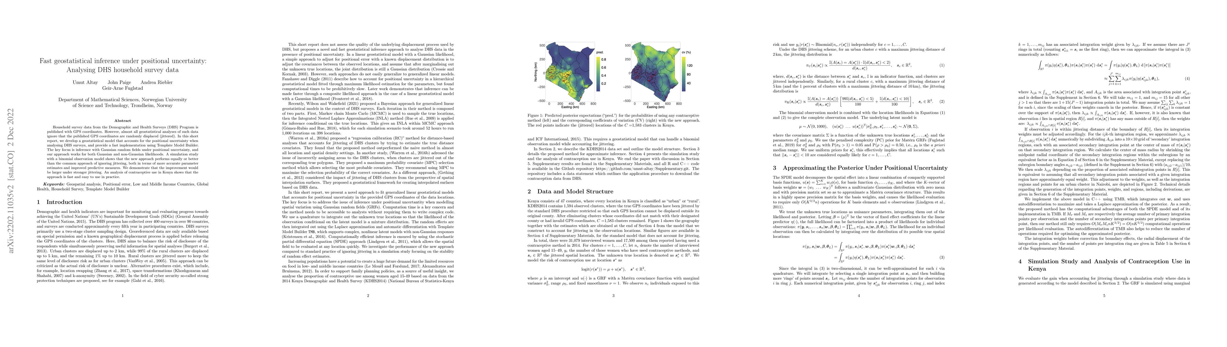
Household survey data from the Demographic and Health Surveys (DHS) Program is published with GPS coordinates. However, almost all geostatistical analyses of such data ignore that the published GPS ...

This website uses cookies to ensure you get the best experience. Learn more