Academic Profile
Statistics
Similar Authors
Papers on arXiv
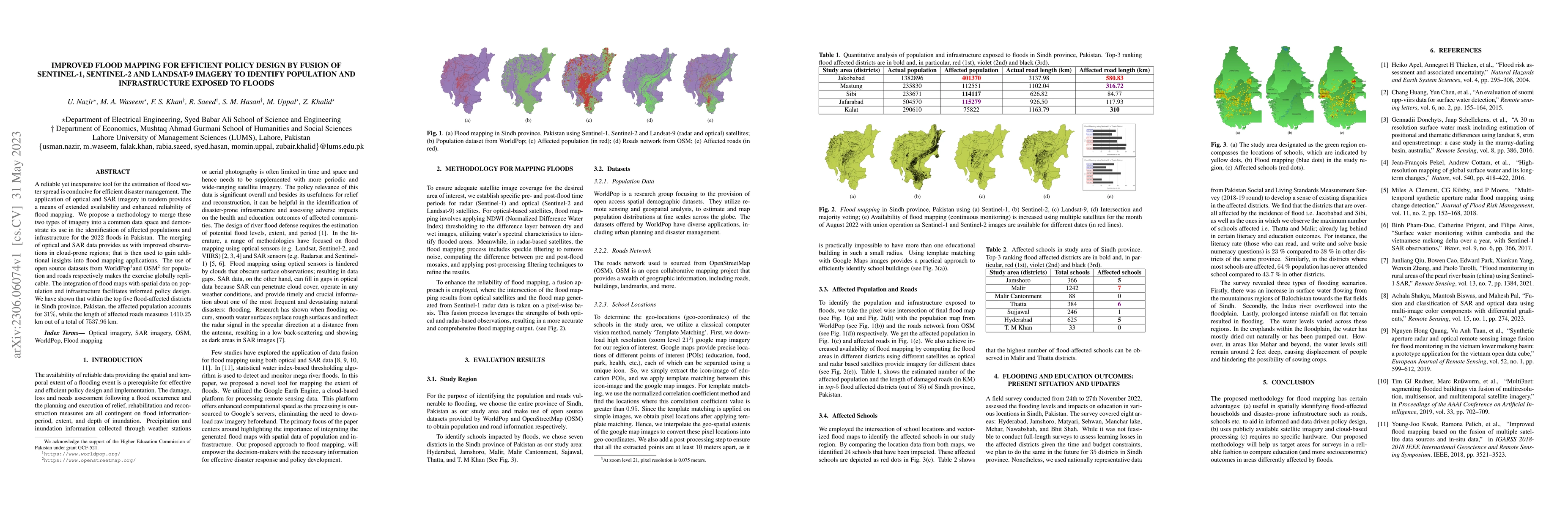
A reliable yet inexpensive tool for the estimation of flood water spread is conducive for efficient disaster management. The application of optical and SAR imagery in tandem provides a means of exte...
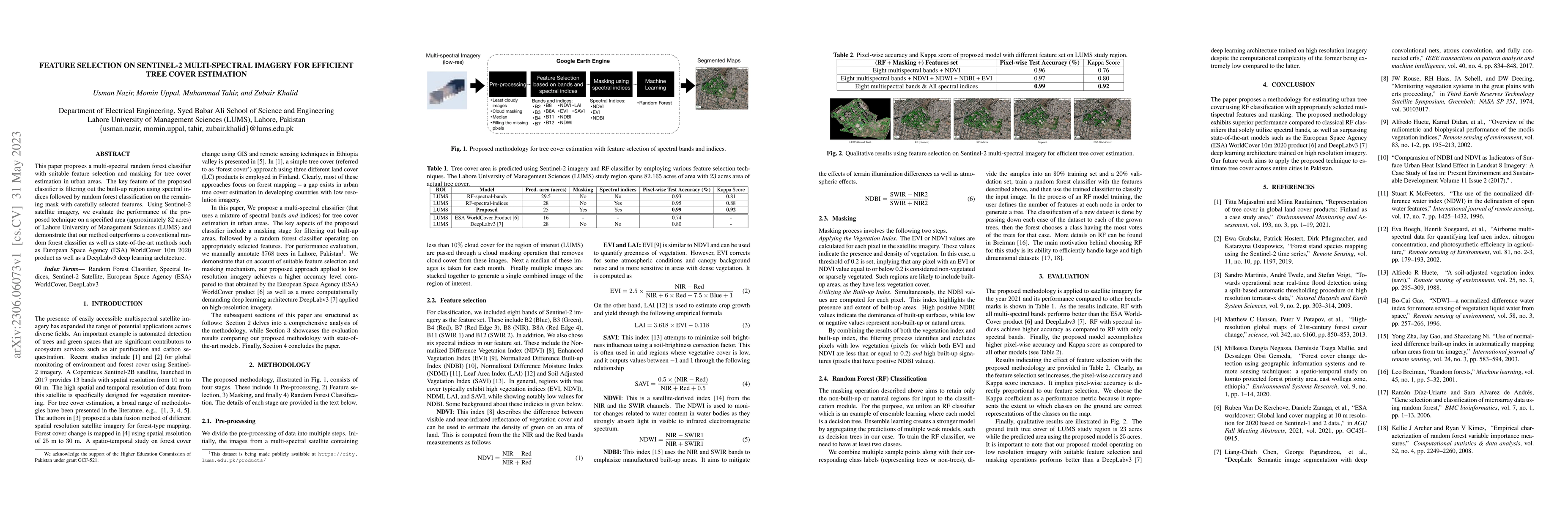
This paper proposes a multi-spectral random forest classifier with suitable feature selection and masking for tree cover estimation in urban areas. The key feature of the proposed classifier is filt...
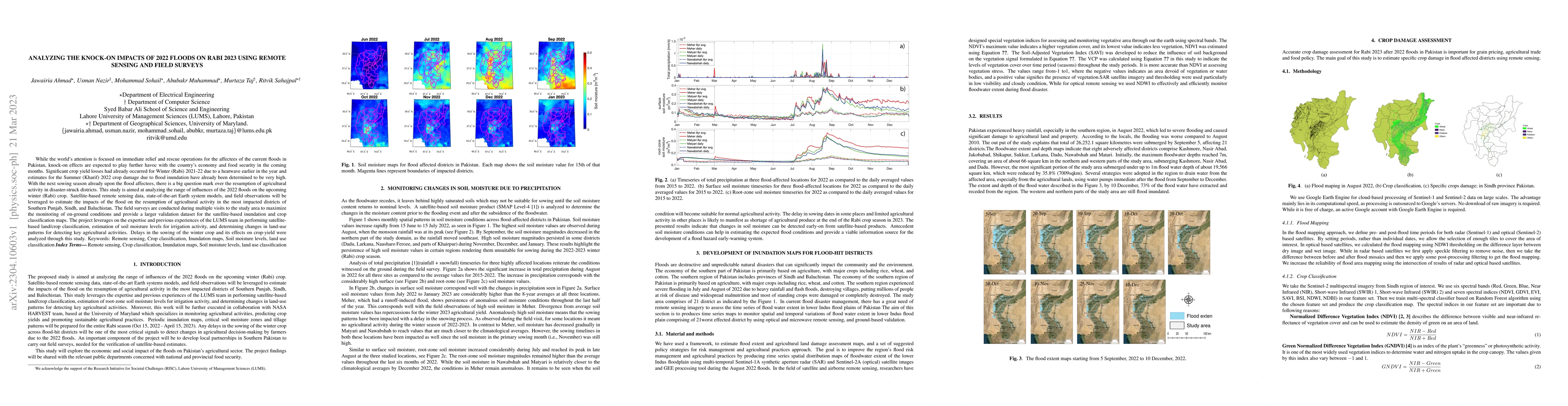
While the world's attention is focused on immediate relief and rescue operations for the affectees of the current floods in Pakistan, knock-on effects are expected to play further havoc with the cou...
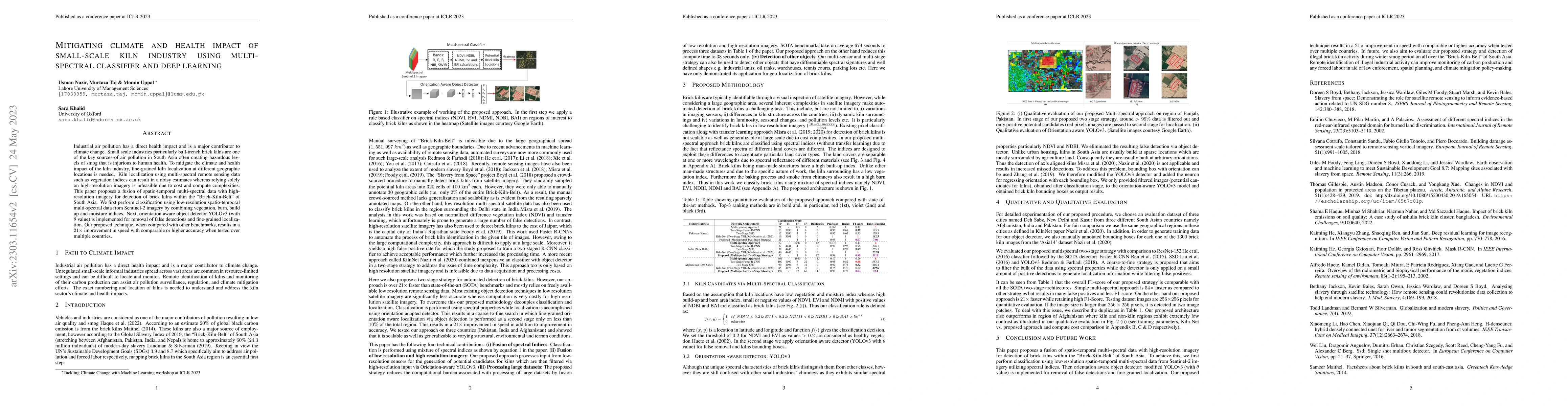
Industrial air pollution has a direct health impact and is a major contributor to climate change. Small scale industries particularly bull-trench brick kilns are one of the key sources of air pollut...
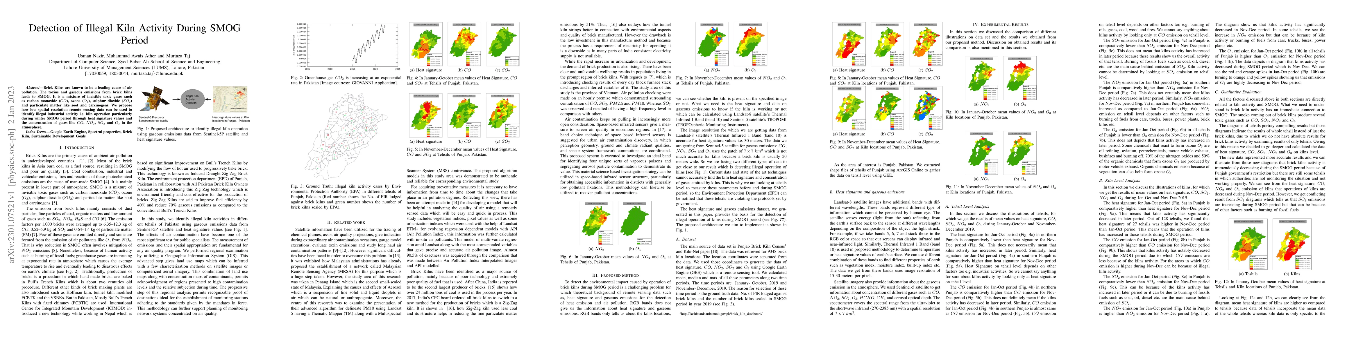
Brick Kilns are known to be a leading cause of air pollution. The toxins and gaseous emissions from brick kilns leads to SMOG. It is a mixture of invisible toxic gases such as carbon monoxide (CO), ...
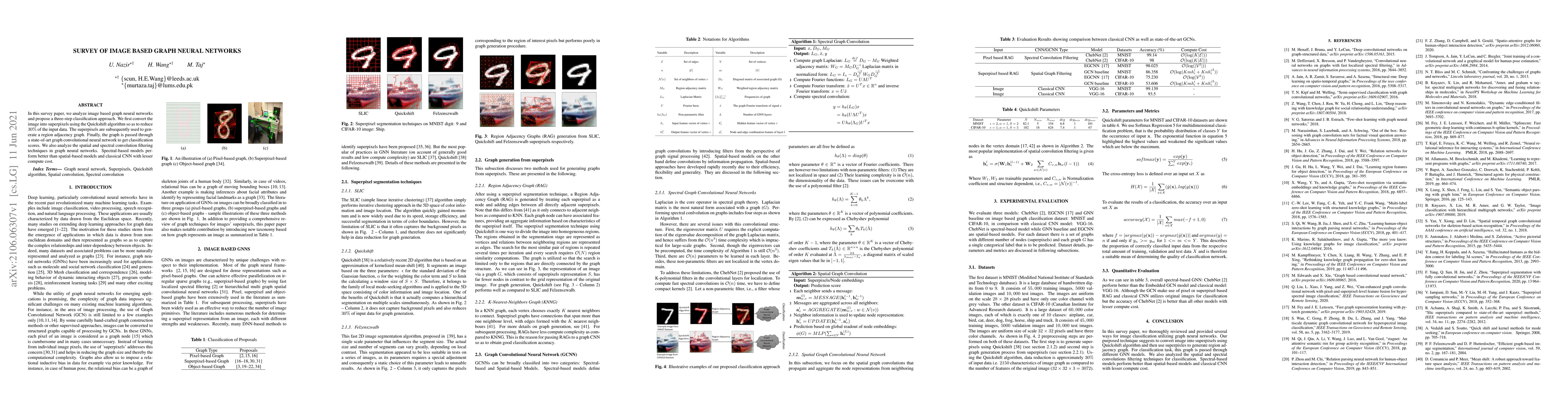
In this survey paper, we analyze image based graph neural networks and propose a three-step classification approach. We first convert the image into superpixels using the Quickshift algorithm so as ...
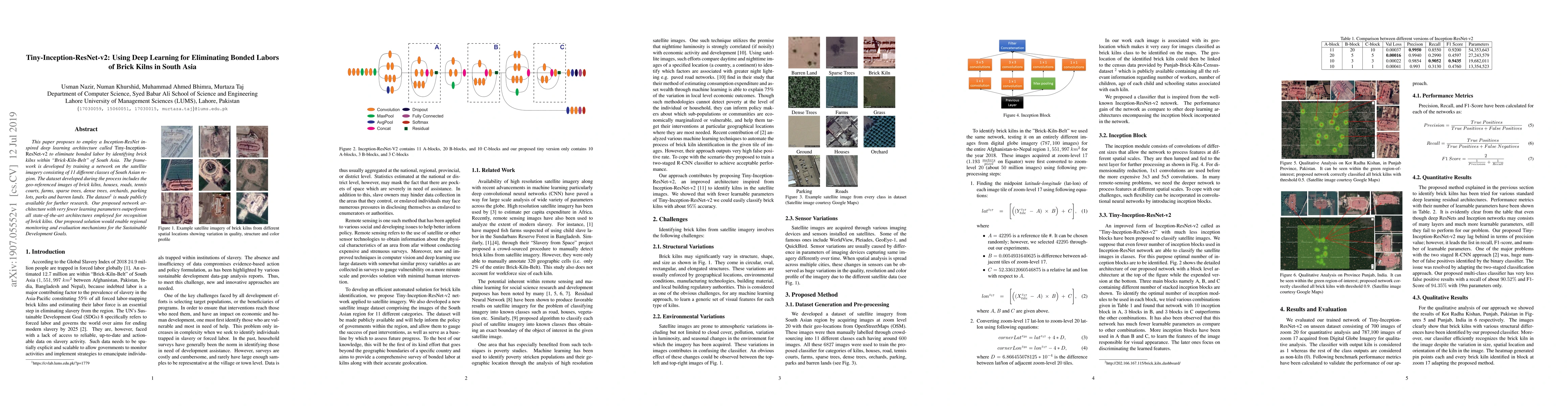
This paper proposes to employ a Inception-ResNet inspired deep learning architecture called Tiny-Inception-ResNet-v2 to eliminate bonded labor by identifying brick kilns within "Brick-Kiln-Belt" of ...
Localization of mobile nodes in a wireless sensor networks (WSNs) is an active area of research. In this paper, we present a novel RSSI based localization algorithm for 802.15.4 (ZigBee) based WSNs....
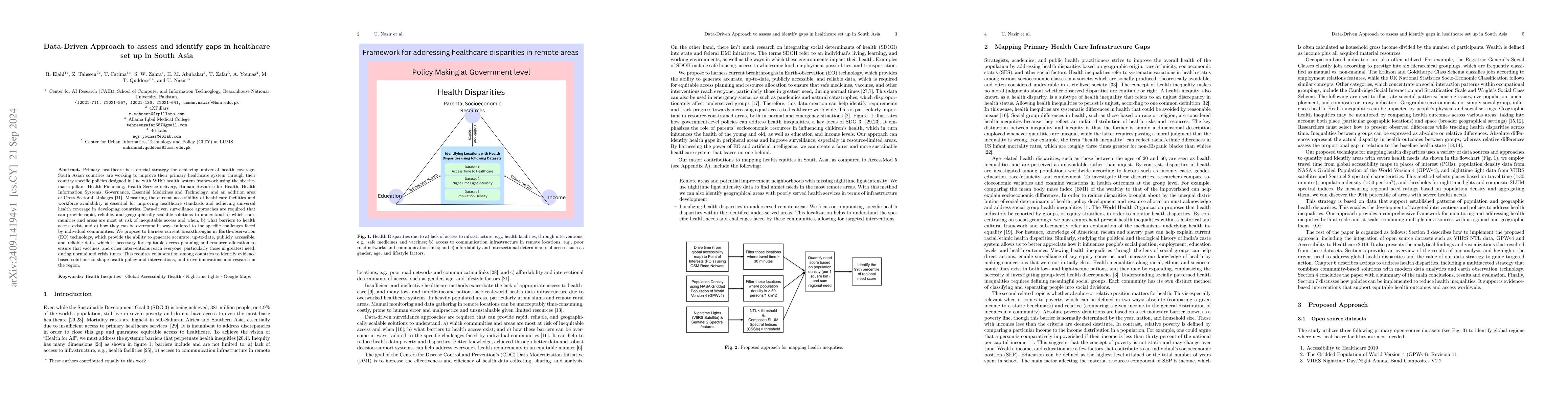
Primary healthcare is a crucial strategy for achieving universal health coverage. South Asian countries are working to improve their primary healthcare system through their country specific policies d...
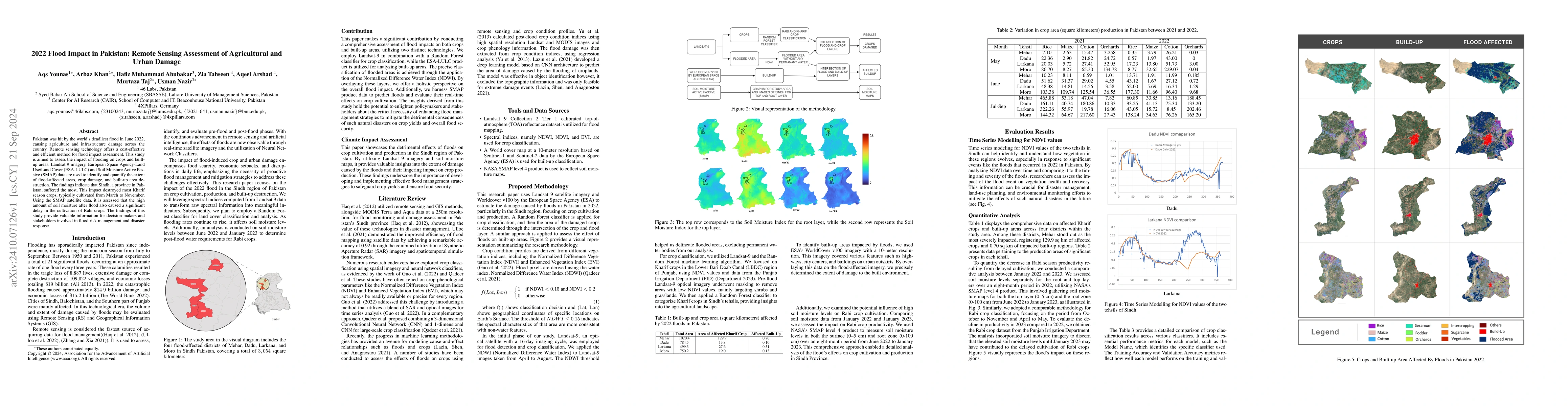
Pakistan was hit by the world's deadliest flood in June 2022, causing agriculture and infrastructure damage across the country. Remote sensing technology offers a cost-effective and efficient method f...
Brick kilns are a major source of air pollution and forced labor in South Asia, yet large-scale monitoring remains limited by sparse and outdated ground data. We study brick kiln detection at scale us...
Malaria, childhood acute respiratory infection, and child undernutrition together account for over two million deaths annually in children under five, with the burden concentrated in low and middle-in...
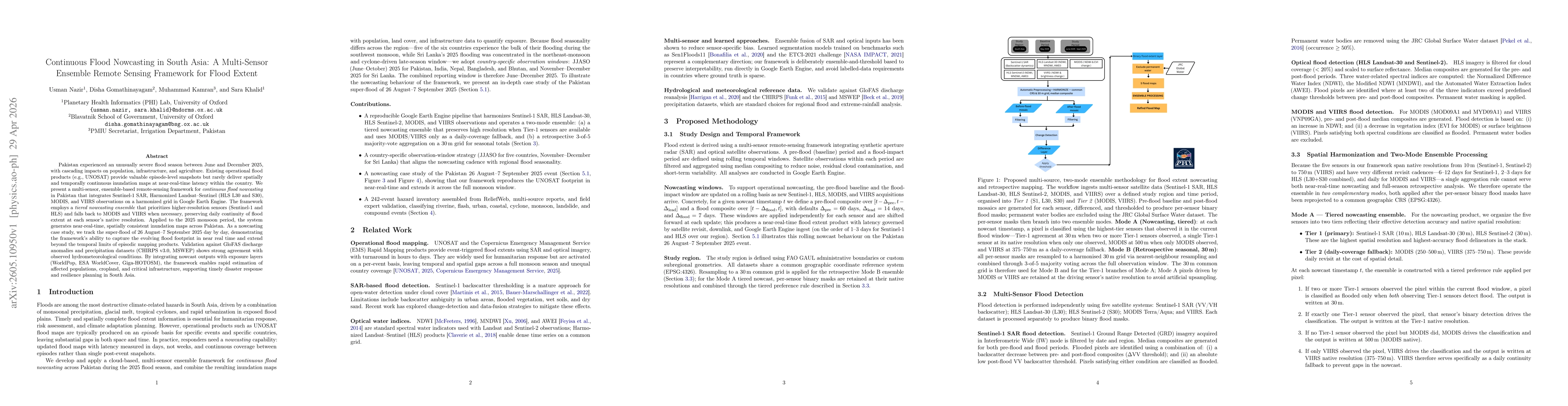
Pakistan experienced an unusually severe flood season between June and December 2025, with cascading impacts on population, infrastructure, and agriculture. Existing operational flood products (e.g., ...