ArxivLens
U
Researcher

Uwe Soergel

5 papers on arXiv

5 arXiv Papers
5 Total Publications
Profile

Academic Profile

Name U. Soergel
Total Papers 5
Scholar Profile View on Semantic Scholar
Metrics

Statistics

5 arXiv Papers
5 Total Publications
Publications

Papers on arXiv

Thumbnail for SLAM for Indoor Mapping of Wide Area Construction Environments
arXiv
SLAM for Indoor Mapping of Wide Area Construction Environments

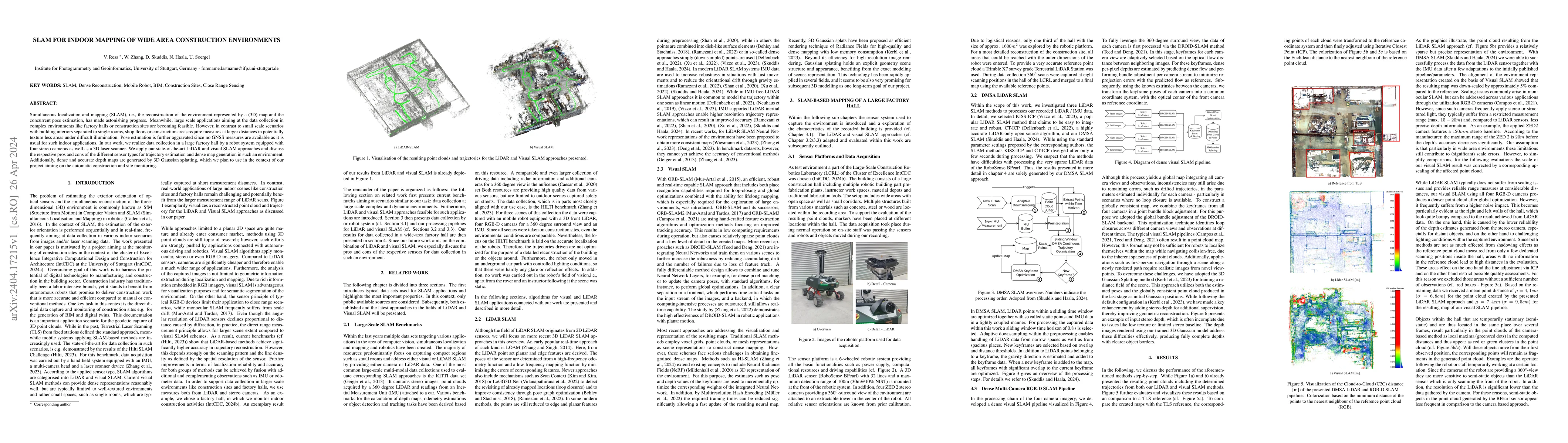
Simultaneous localization and mapping (SLAM), i.e., the reconstruction of the environment represented by a (3D) map and the concurrent pose estimation, has made astonishing progress. Meanwhile, larg...

Thumbnail for Efficient and Accurate Tree Detection from 3D Point Clouds through Paid
  Crowdsourcing
arXiv
Efficient and Accurate Tree Detection from 3D Point Clouds through Paid Crowdsourcing

Accurate tree detection is of growing importance in applications such as urban planning, forest inventory, and environmental monitoring. In this article, we present an approach to creating tree maps...

Thumbnail for 3D Gaussian Splatting aided Localization for Large and Complex
  Indoor-Environments
arXiv
3D Gaussian Splatting aided Localization for Large and Complex Indoor-Environments

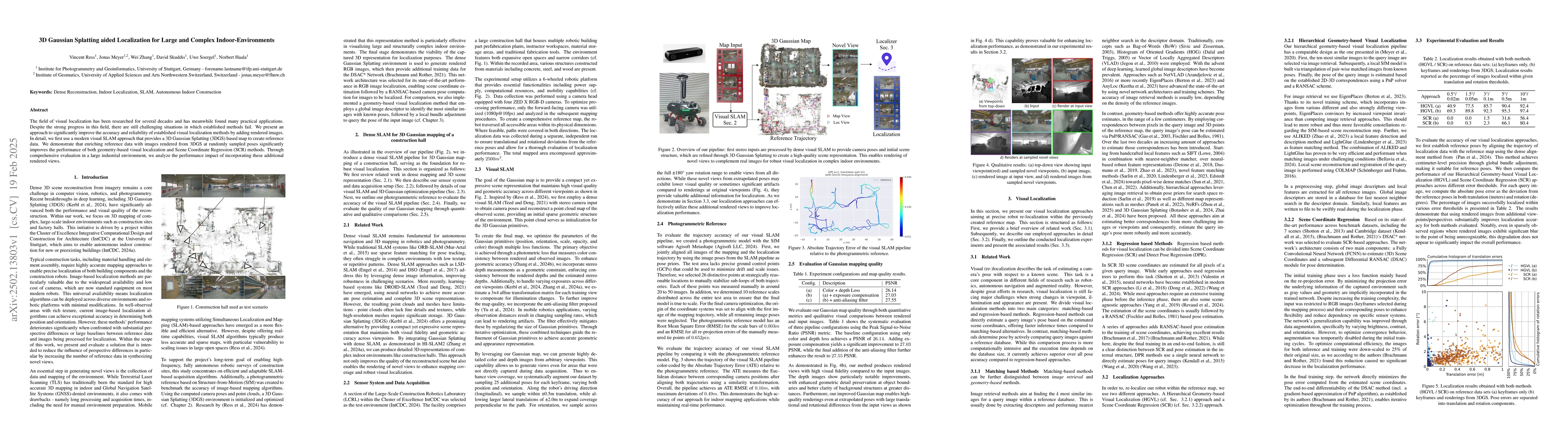
The field of visual localization has been researched for several decades and has meanwhile found many practical applications. Despite the strong progress in this field, there are still challenging sit...

Thumbnail for Unsupervised Domain Adaptation for 3D LiDAR Semantic Segmentation Using
  Contrastive Learning and Multi-Model Pseudo Labeling
arXiv
Unsupervised Domain Adaptation for 3D LiDAR Semantic Segmentation Using Contrastive Learning and Multi-Model Pseudo Labeling

Addressing performance degradation in 3D LiDAR semantic segmentation due to domain shifts (e.g., sensor type, geographical location) is crucial for autonomous systems, yet manual annotation of target ...

Thumbnail for An RTK-SLAM Dataset for Absolute Accuracy Evaluation in GNSS-Degraded Environments
arXiv
An RTK-SLAM Dataset for Absolute Accuracy Evaluation in GNSS-Degraded Environments

RTK-SLAM systems integrate simultaneous localization and mapping (SLAM) with real-time kinematic (RTK) GNSS positioning, promising both relative consistency and globally referenced coordinates for eff...

This website uses cookies to ensure you get the best experience. Learn more