Vinay Ravindra

6 papers on arXiv

Academic Profile

Name: V. Ravindra
Total Papers: 42

Statistics

arXiv Papers 6
Total Publications 42

Papers on arXiv

Thumbnail for Agile Satellite Planning for Multi-Payload Observations for Earth
  Science

Agile Satellite Planning for Multi-Payload Observations for Earth Science

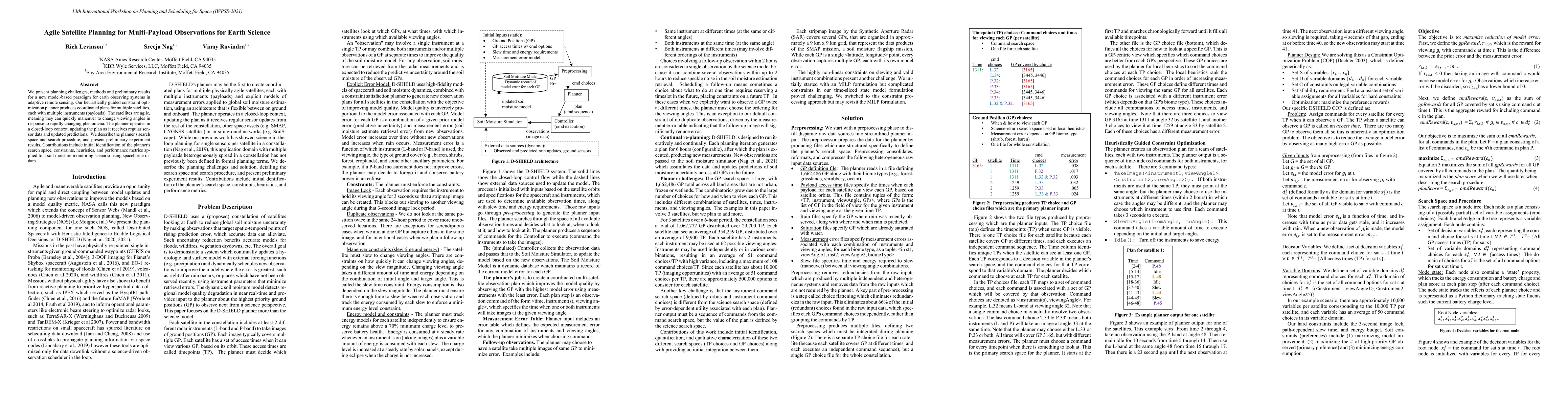
We present planning challenges, methods and preliminary results for a new model-based paradigm for earth observing systems in adaptive remote sensing. Our heuristically guided constraint optimizatio...

Thumbnail for Attitude Trajectory Optimization for Agile Satellites in Autonomous
  Remote Sensing Constellation

Attitude Trajectory Optimization for Agile Satellites in Autonomous Remote Sensing Constellation

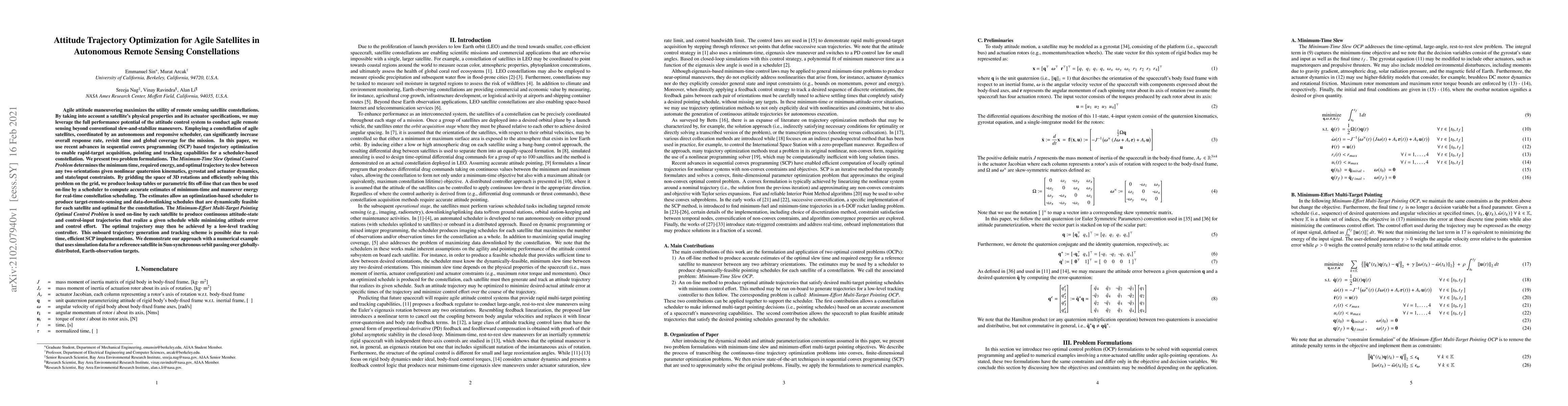
Agile attitude maneuvering maximizes the utility of remote sensing satellite constellations. By taking into account a satellite's physical properties and its actuator specifications, we may leverage...

Thumbnail for Planning a Reference Constellation for Radiometric Cross-Calibration of
  Commercial Earth Observing Sensors

Planning a Reference Constellation for Radiometric Cross-Calibration of Commercial Earth Observing Sensors

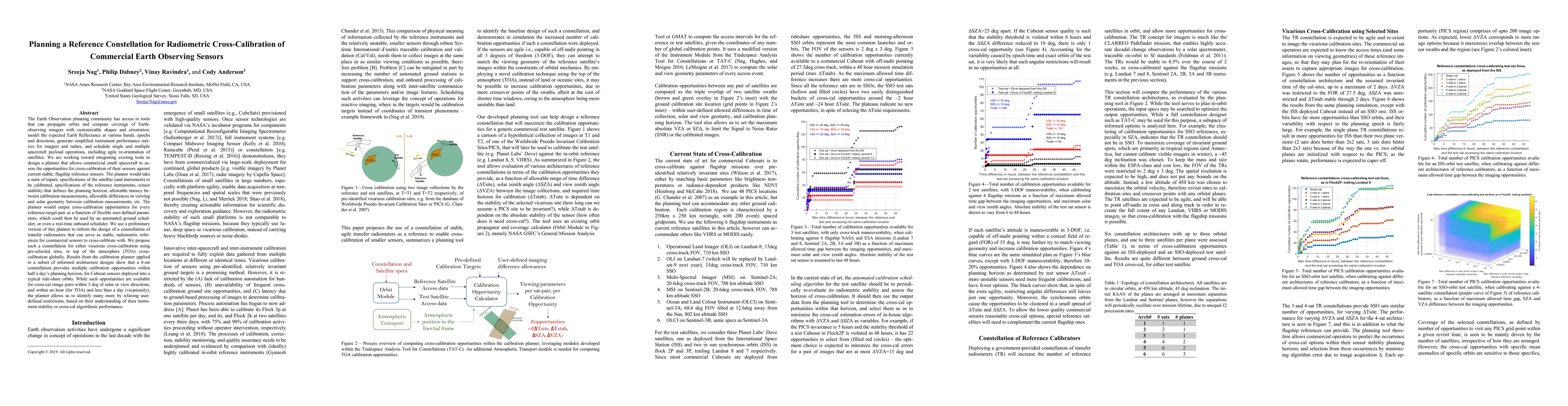
The Earth Observation planning community has access to tools that can propagate orbits and compute coverage of Earth observing imagers with customizable shapes and orientation, model the expected Ea...

Thumbnail for Autonomous Scheduling of Agile Spacecraft Constellations with Delay
  Tolerant Networking for Reactive Imaging

Autonomous Scheduling of Agile Spacecraft Constellations with Delay Tolerant Networking for Reactive Imaging

Small spacecraft now have precise attitude control systems available commercially, allowing them to slew in 3 degrees of freedom, and capture images within short notice. When combined with appropria...

Thumbnail for Agile, Autonomous Spacecraft Constellations with Disruption Tolerant
  Networking to Monitor Precipitation and Urban Floods

Agile, Autonomous Spacecraft Constellations with Disruption Tolerant Networking to Monitor Precipitation and Urban Floods

Fully re-orientable small spacecraft are now supported by commercial technologies, allowing them to point their instruments in any direction and capture images, with short notice. When combined with i...

Thumbnail for Optimal Planning and Machine Learning for Responsive Tracking and
  Enhanced Forecasting of Wildfires using a Spacecraft Constellation

Optimal Planning and Machine Learning for Responsive Tracking and Enhanced Forecasting of Wildfires using a Spacecraft Constellation

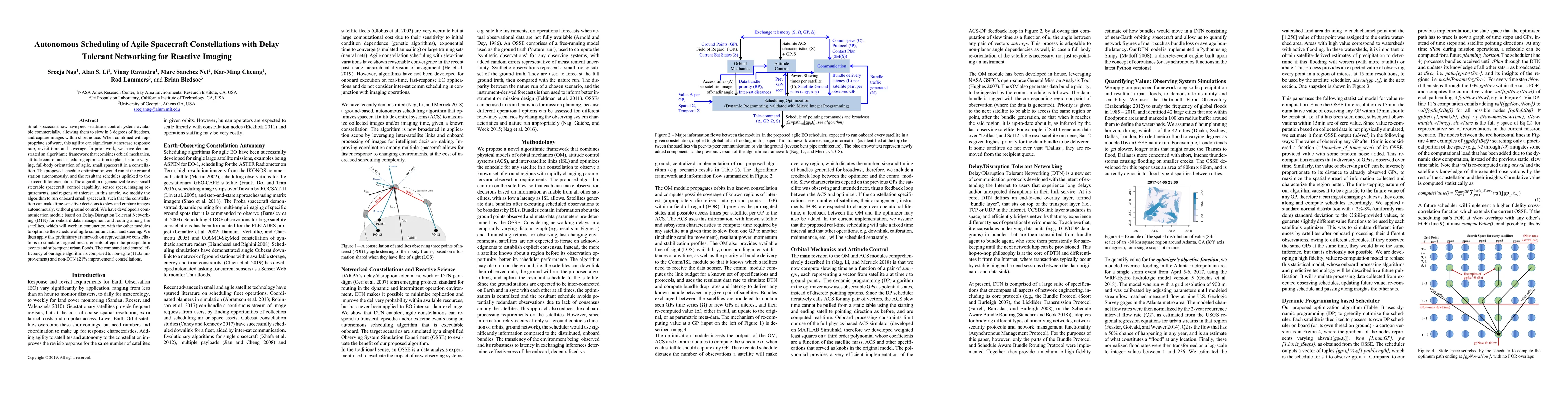
We propose a novel concept of operations using optimal planning methods and machine learning (ML) to collect spaceborne data that is unprecedented for monitoring wildfires, process it to create new or...

This website uses cookies to ensure you get the best experience. Learn more