Academic Profile
Statistics
Similar Authors
Papers on arXiv
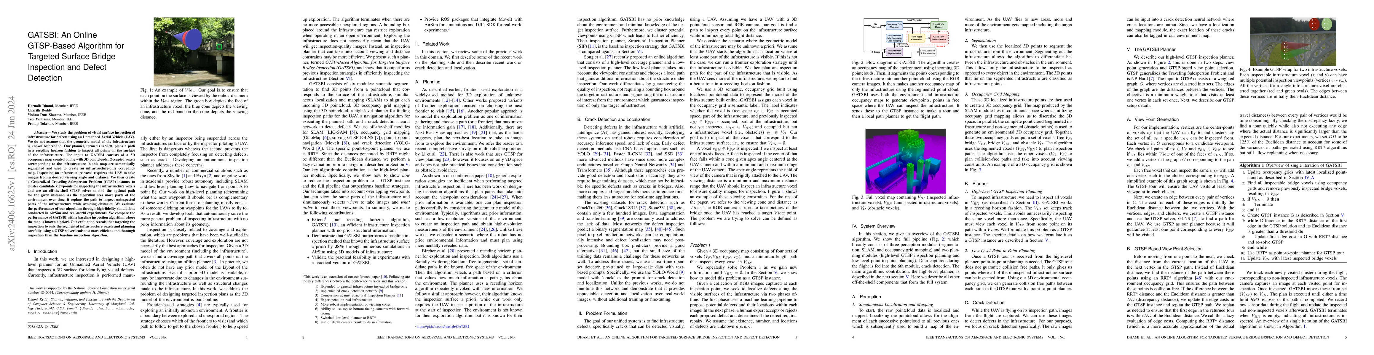
We study the problem of visual surface inspection of infrastructure for defects using an Unmanned Aerial Vehicle (UAV). We do not assume that the geometric model of the infrastructure is known befor...
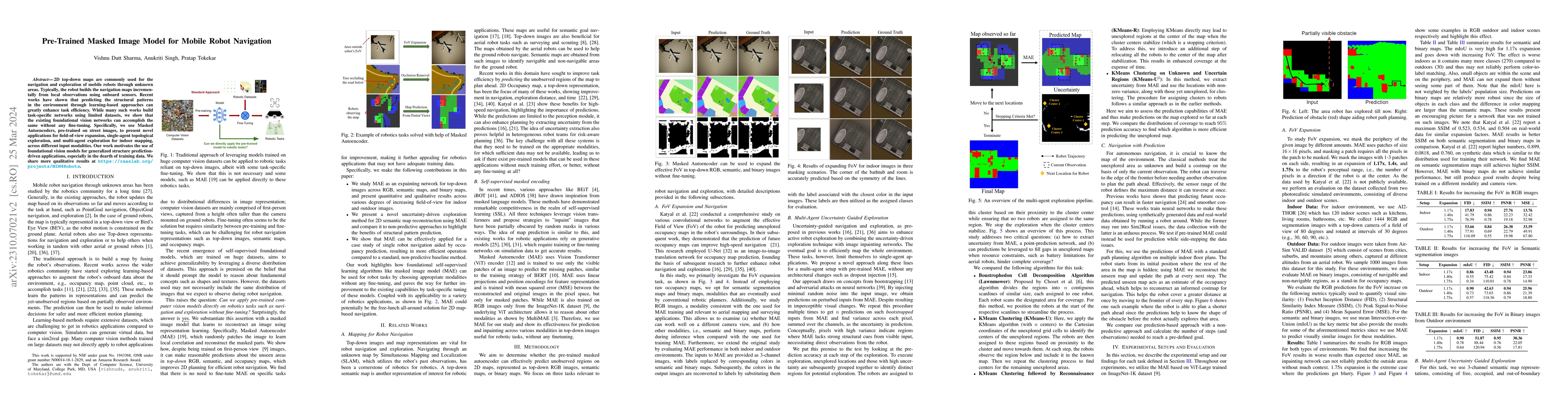
2D top-down maps are commonly used for the navigation and exploration of mobile robots through unknown areas. Typically, the robot builds the navigation maps incrementally from local observations us...
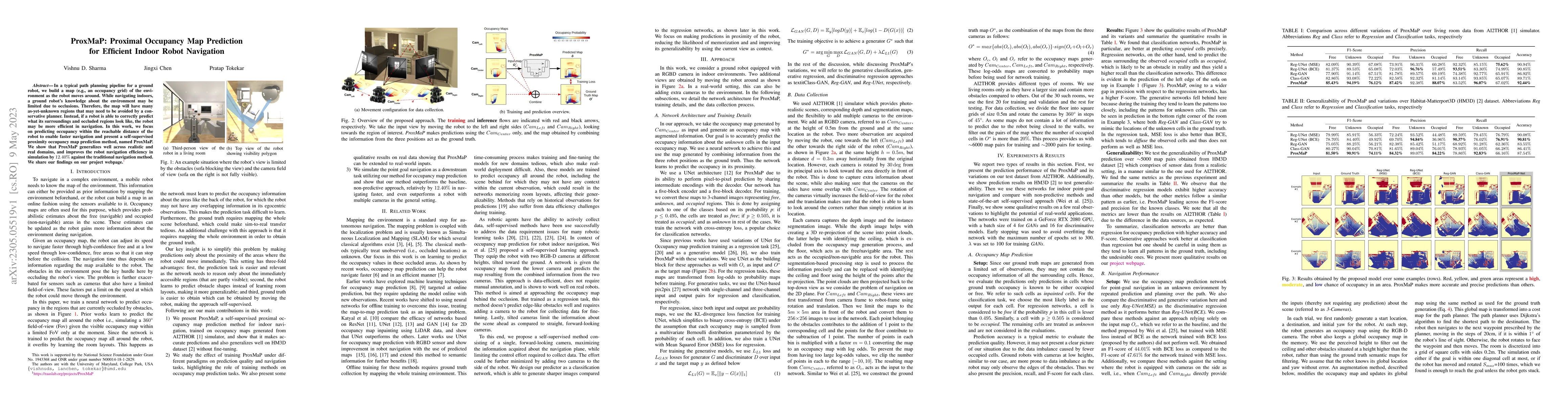
In a typical path planning pipeline for a ground robot, we build a map (e.g., an occupancy grid) of the environment as the robot moves around. While navigating indoors, a ground robot's knowledge ab...
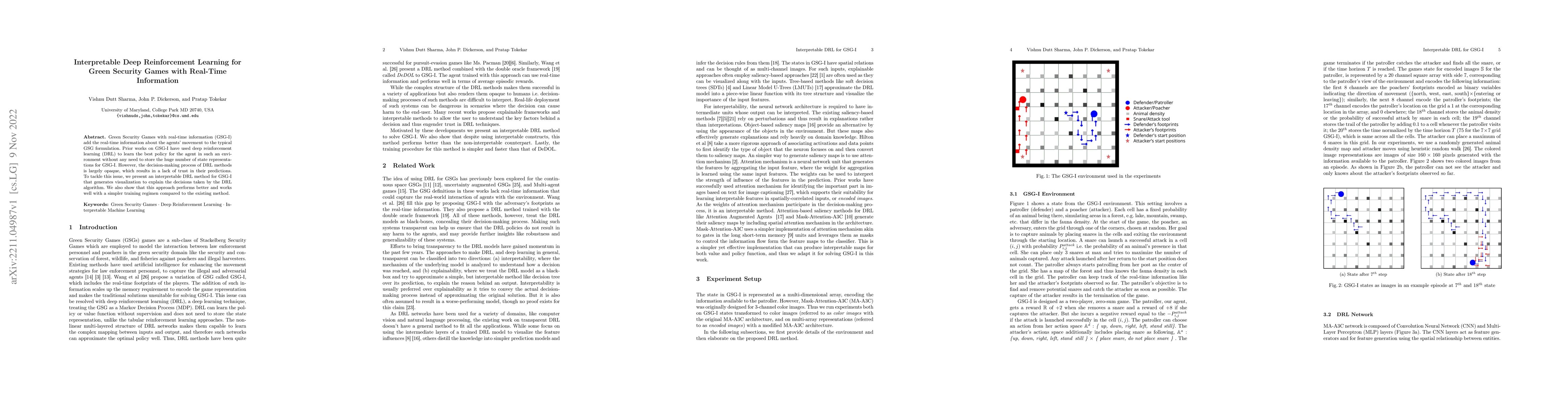
Green Security Games with real-time information (GSG-I) add the real-time information about the agents' movement to the typical GSG formulation. Prior works on GSG-I have used deep reinforcement lea...
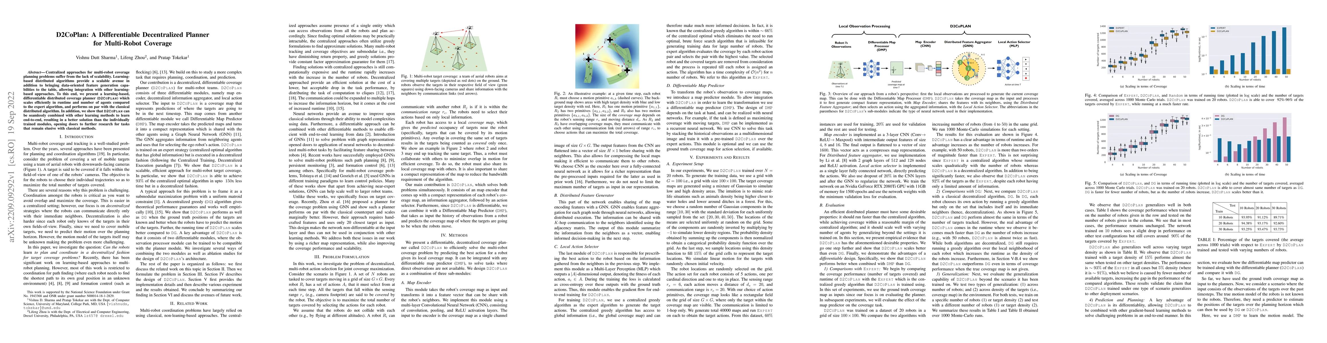
Centralized approaches for multi-robot coverage planning problems suffer from the lack of scalability. Learning-based distributed algorithms provide a scalable avenue in addition to bringing data-or...
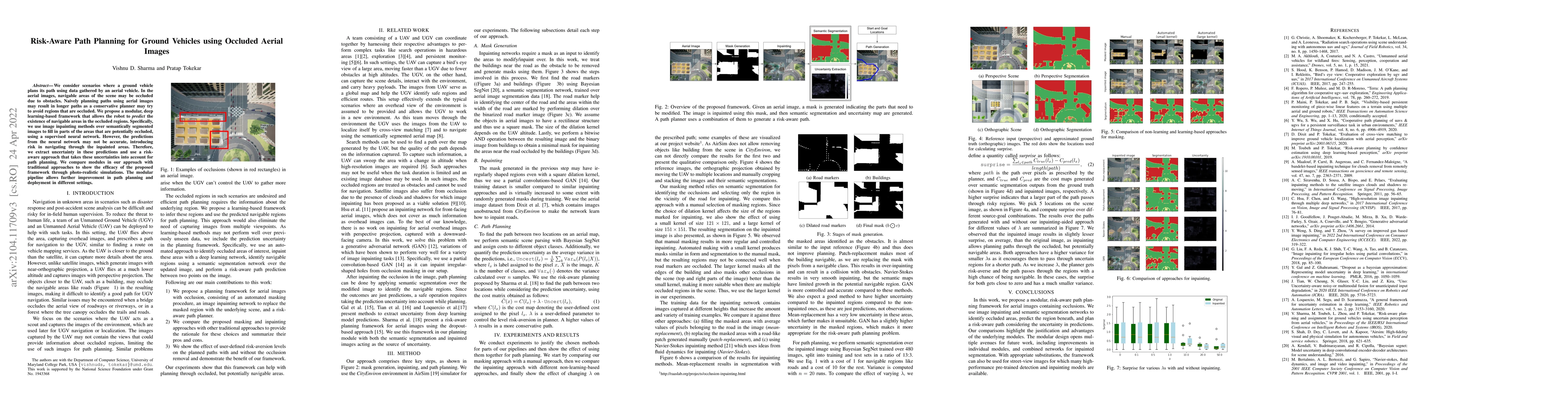
We consider scenarios where a ground vehicle plans its path using data gathered by an aerial vehicle. In the aerial images, navigable areas of the scene may be occluded due to obstacles. Naively pla...
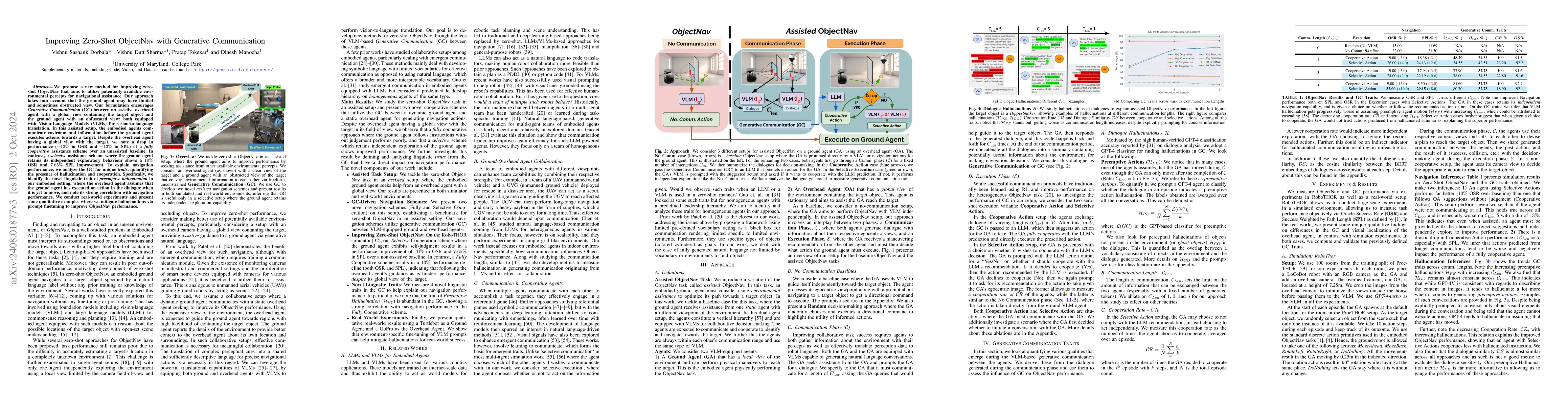
In Zero-Shot ObjectNav, an embodied ground agent is expected to navigate to a target object specified by a natural language label without any environment-specific fine-tuning. This is challenging, giv...
Mobile robots rely on maps to navigate through an environment. In the absence of any map, the robots must build the map online from partial observations as they move in the environment. Traditional me...