Academic Profile
Statistics
Similar Authors
Papers on arXiv
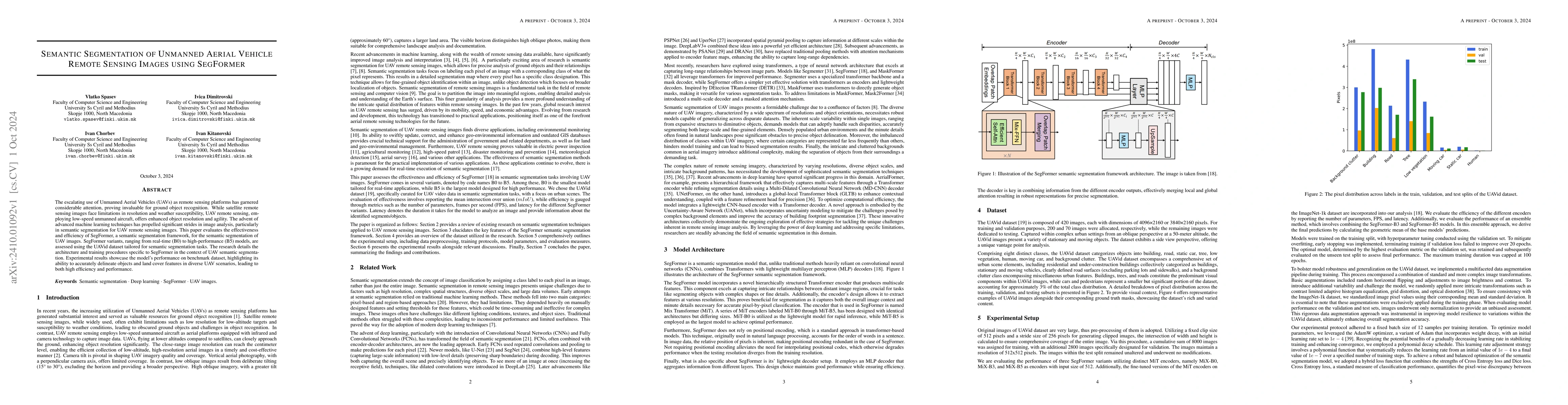
The escalating use of Unmanned Aerial Vehicles (UAVs) as remote sensing platforms has garnered considerable attention, proving invaluable for ground object recognition. While satellite remote sensing ...
Accurate semantic segmentation of remote sensing imagery is critical for various Earth observation applications, such as land cover mapping, urban planning, and environmental monitoring. However, indi...
Remote sensing applications increasingly rely on deep learning for scene classification. However, their performance is often constrained by the scarcity of labeled data and the high cost of annotation...