1
arXiv Papers
Profile
Academic Profile
Metrics
Statistics
1
arXiv Papers
Network
Similar Authors
Publications
Papers on arXiv
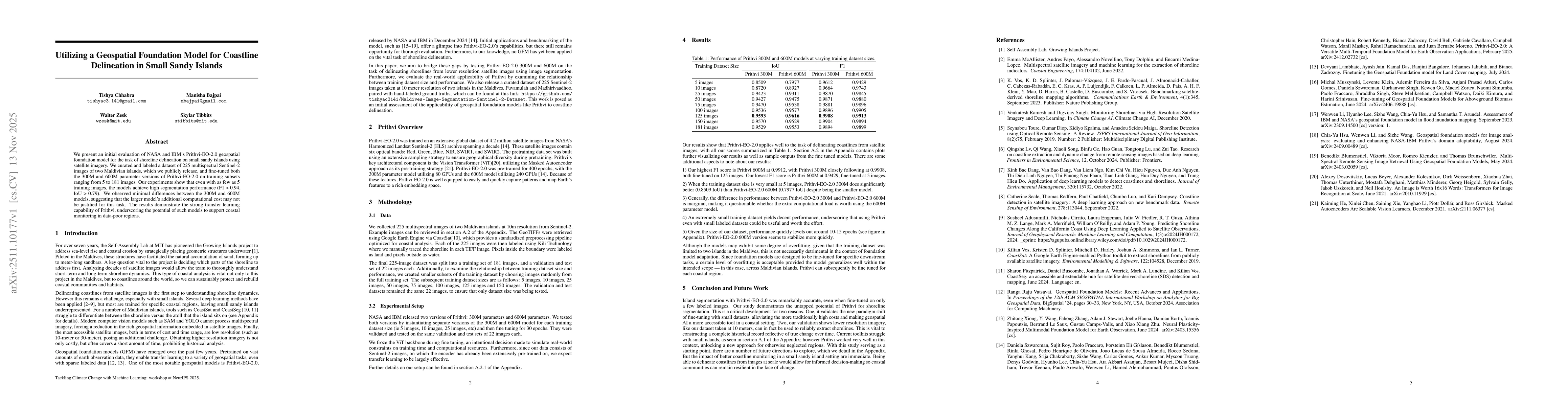
arXiv
Utilizing a Geospatial Foundation Model for Coastline Delineation in Small Sandy Islands
We present an initial evaluation of NASA and IBM's Prithvi-EO-2.0 geospatial foundation model on shoreline delineation of small sandy islands using satellite images. We curated and labeled a dataset o...