Academic Profile
Statistics
Similar Authors
Papers on arXiv
This work aims to produce landslide density estimates using Synthetic Aperture Radar (SAR) satellite imageries to prioritise emergency resources for rapid response. We use the United States Geologic...
Rapid assessment after a natural disaster is key for prioritizing emergency resources. In the case of landslides, rapid assessment involves determining the extent of the area affected and measuring ...
With climate change predicted to increase the likelihood of landslide events, there is a growing need for rapid landslide detection technologies that help inform emergency responses. Synthetic Apert...
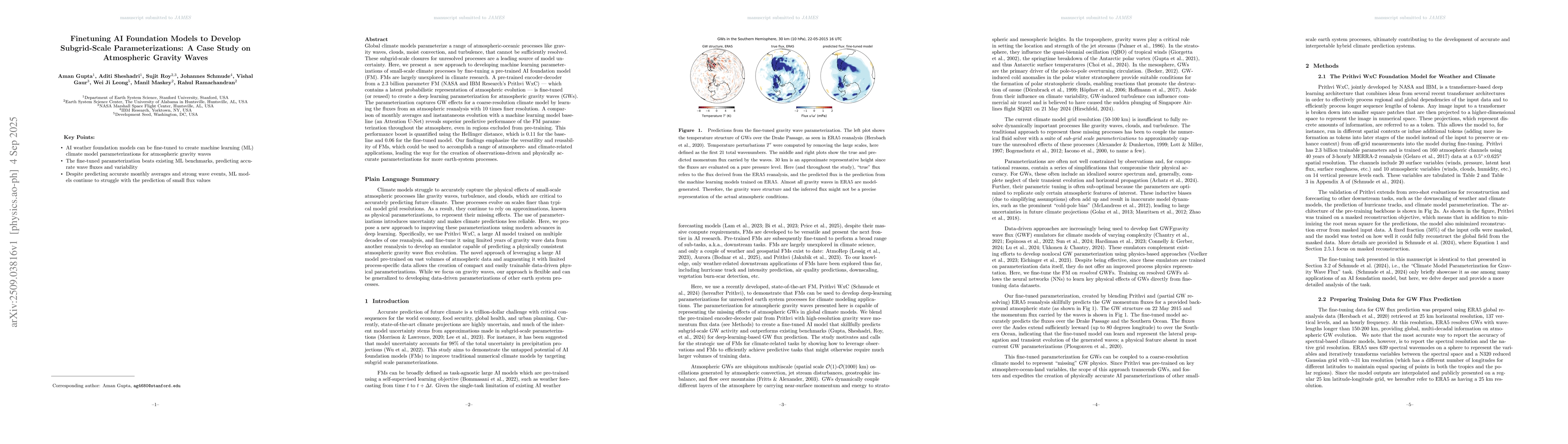
Global climate models parameterize a range of atmospheric-oceanic processes like gravity waves, clouds, moist convection, and turbulence that cannot be sufficiently resolved. These subgrid-scale closu...