Academic Profile
Statistics
Similar Authors
Papers on arXiv
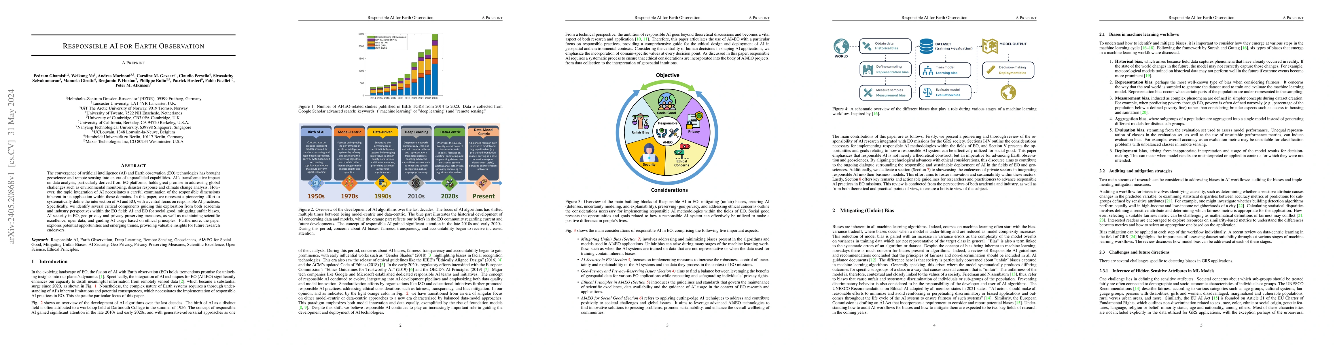
The convergence of artificial intelligence (AI) and Earth observation (EO) technologies has brought geoscience and remote sensing into an era of unparalleled capabilities. AI's transformative impact...
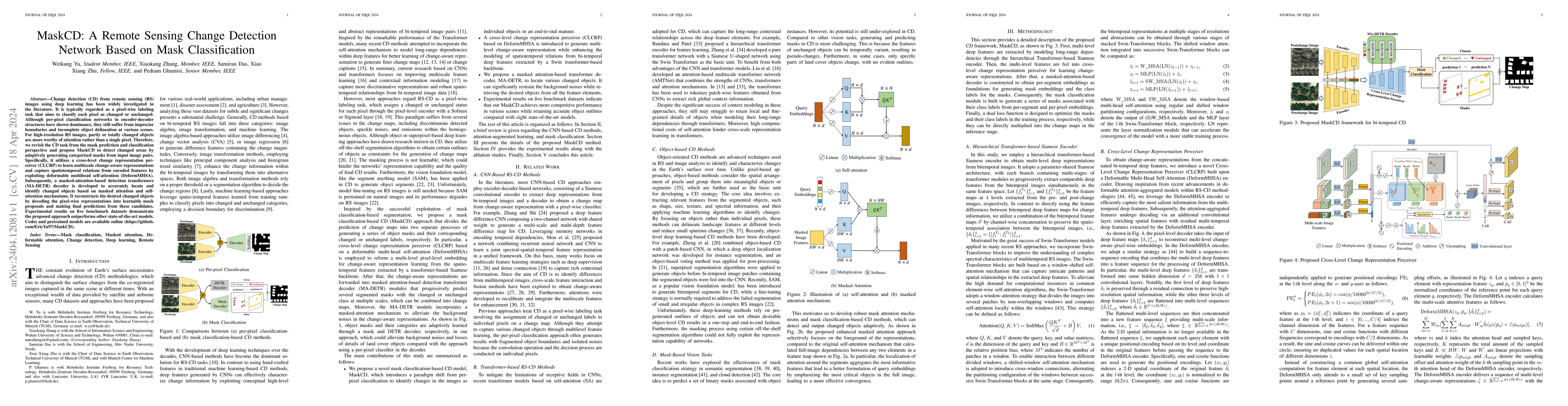
Change detection (CD) from remote sensing (RS) images using deep learning has been widely investigated in the literature. It is typically regarded as a pixel-wise labeling task that aims to classify...
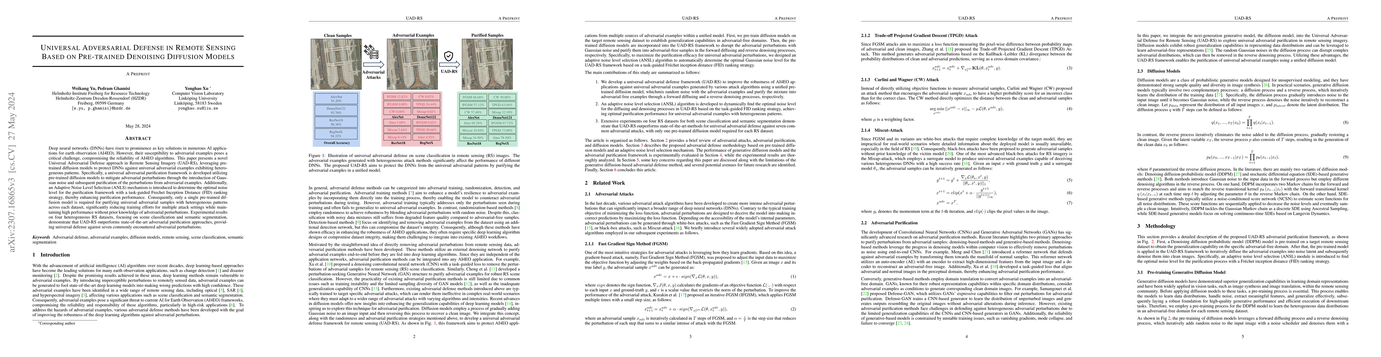
Deep neural networks (DNNs) have risen to prominence as key solutions in numerous AI applications for earth observation (AI4EO). However, their susceptibility to adversarial examples poses a critica...
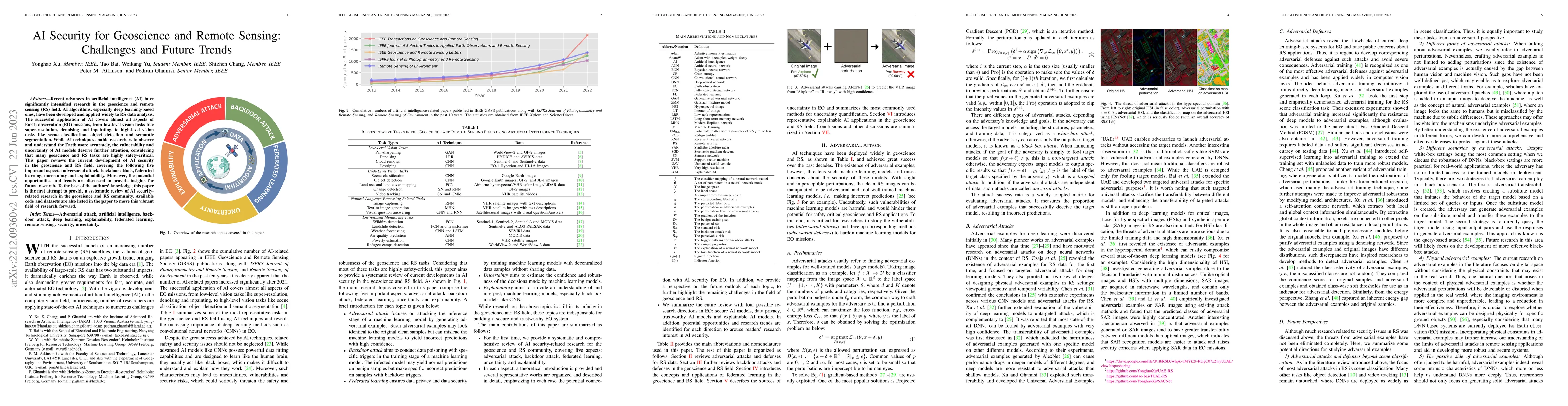
Recent advances in artificial intelligence (AI) have significantly intensified research in the geoscience and remote sensing (RS) field. AI algorithms, especially deep learning-based ones, have been...
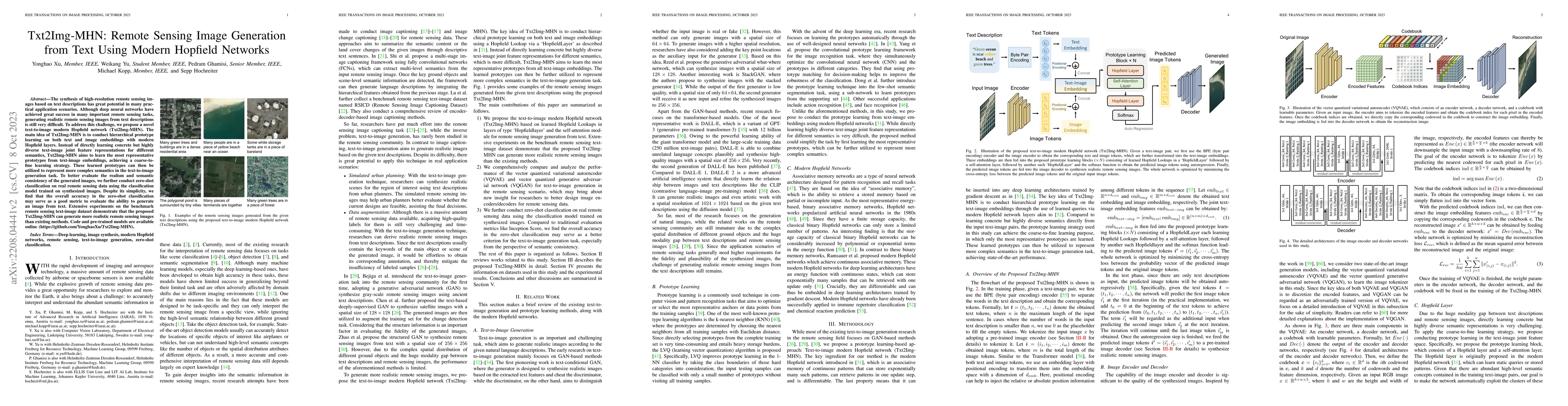
The synthesis of high-resolution remote sensing images based on text descriptions has great potential in many practical application scenarios. Although deep neural networks have achieved great succe...
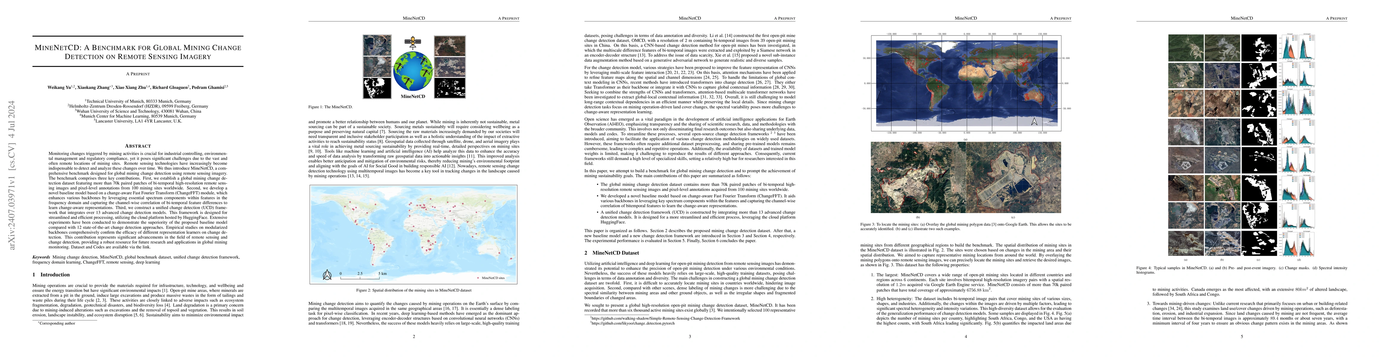
Monitoring changes triggered by mining activities is crucial for industrial controlling, environmental management and regulatory compliance, yet it poses significant challenges due to the vast and oft...
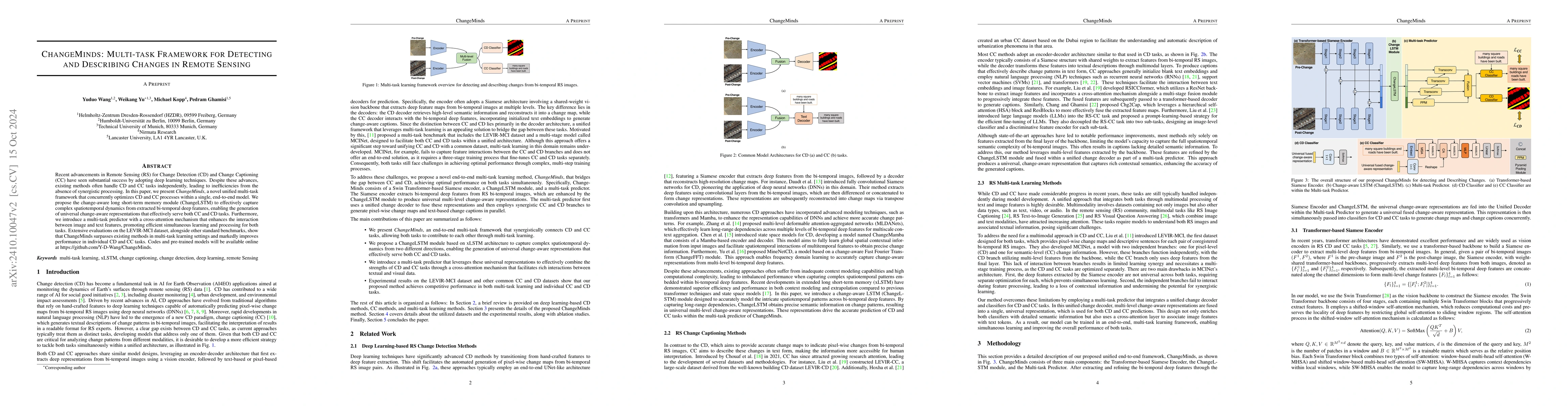
Recent advancements in Remote Sensing (RS) for Change Detection (CD) and Change Captioning (CC) have seen substantial success by adopting deep learning techniques. Despite these advances, existing met...
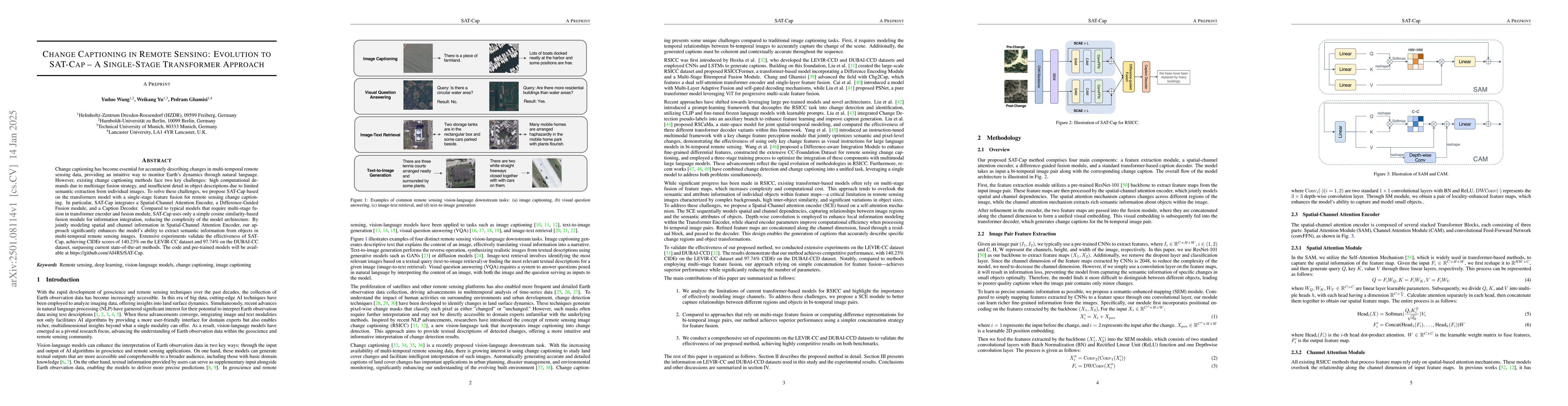
Change captioning has become essential for accurately describing changes in multi-temporal remote sensing data, providing an intuitive way to monitor Earth's dynamics through natural language. However...
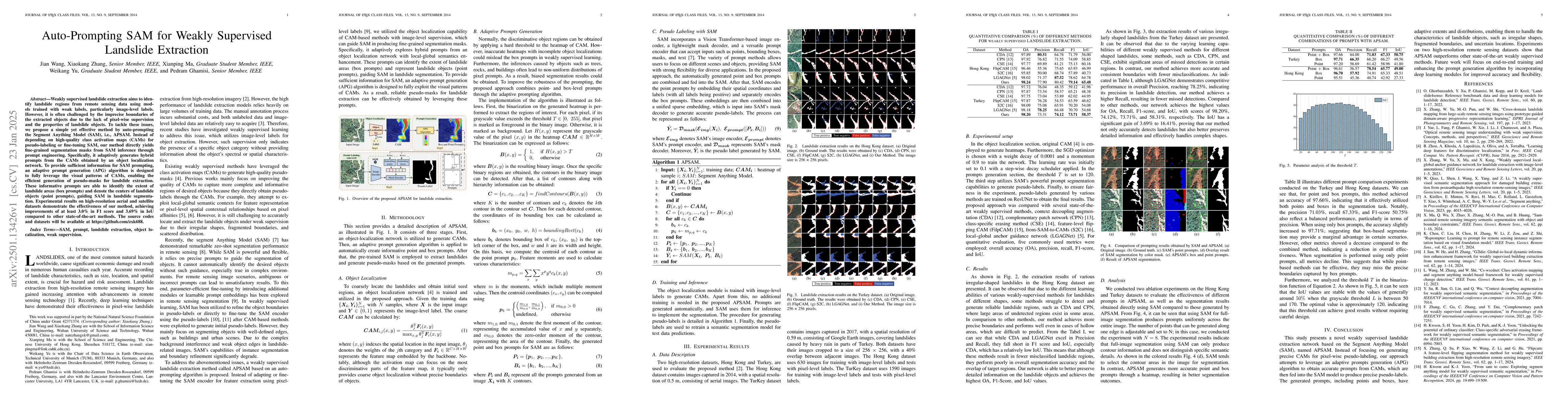
Weakly supervised landslide extraction aims to identify landslide regions from remote sensing data using models trained with weak labels, particularly image-level labels. However, it is often challeng...
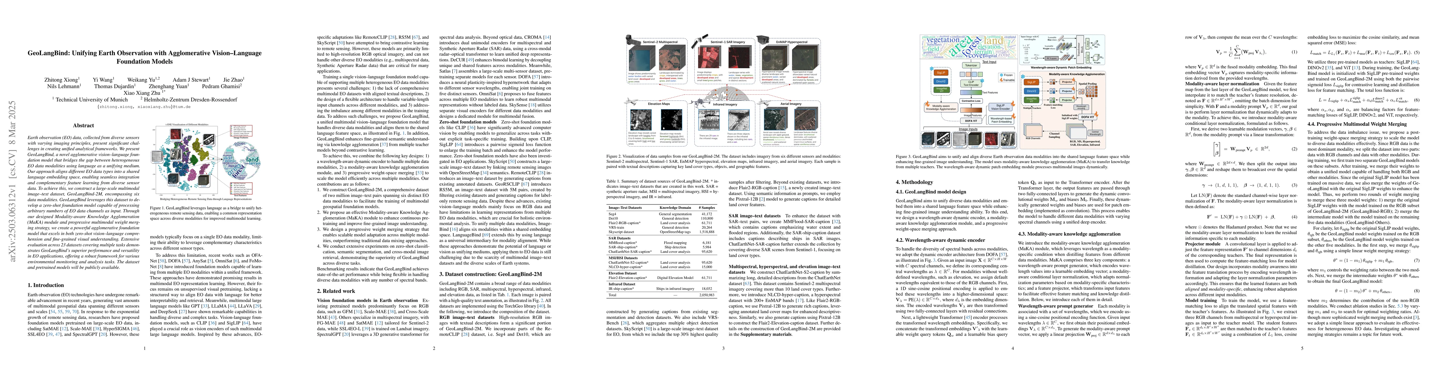
Earth observation (EO) data, collected from diverse sensors with varying imaging principles, present significant challenges in creating unified analytical frameworks. We present GeoLangBind, a novel a...
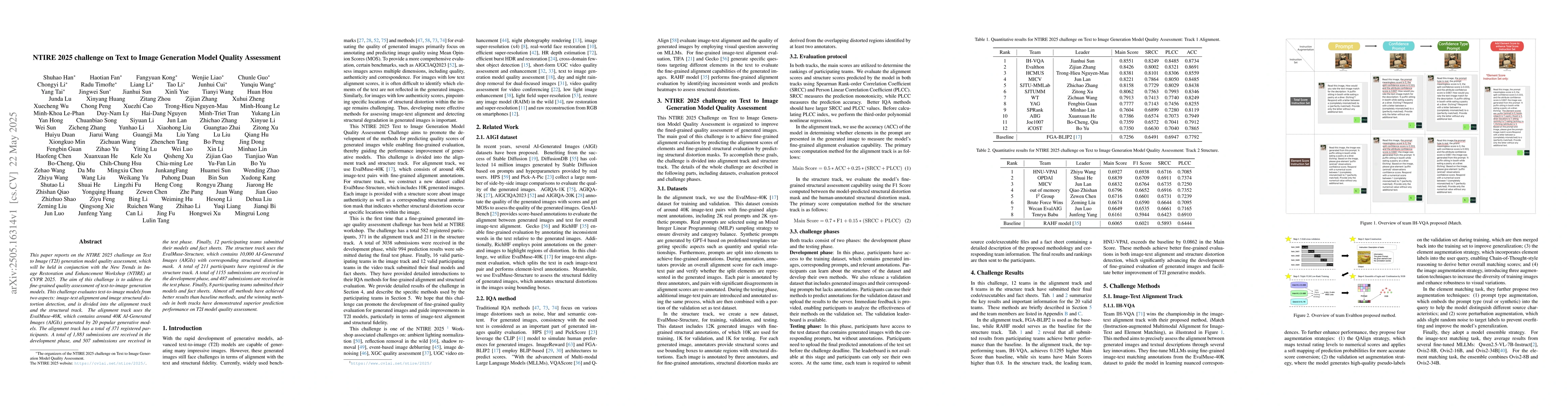
This paper reports on the NTIRE 2025 challenge on Text to Image (T2I) generation model quality assessment, which will be held in conjunction with the New Trends in Image Restoration and Enhancement Wo...
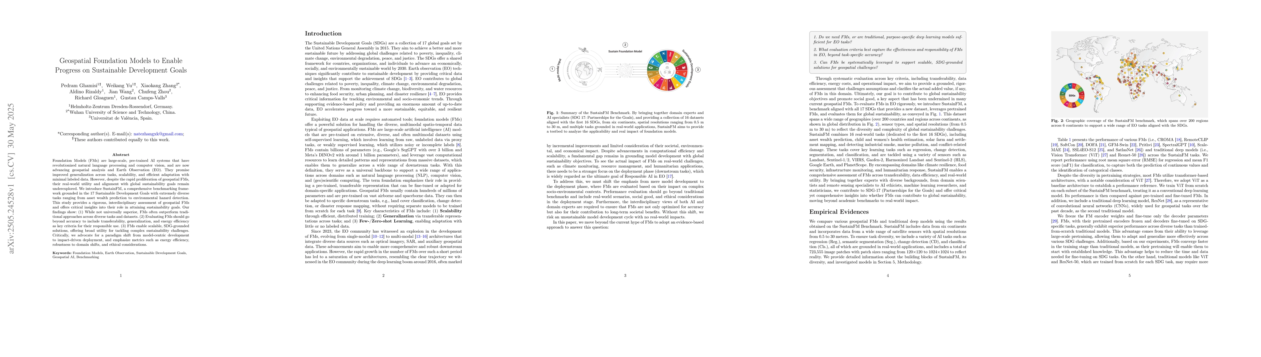
Foundation Models (FMs) are large-scale, pre-trained AI systems that have revolutionized natural language processing and computer vision, and are now advancing geospatial analysis and Earth Observatio...
Mining activities are essential for industrial and economic development, but remain a leading source of environmental degradation, contributing to deforestation, soil erosion, and water contamination....
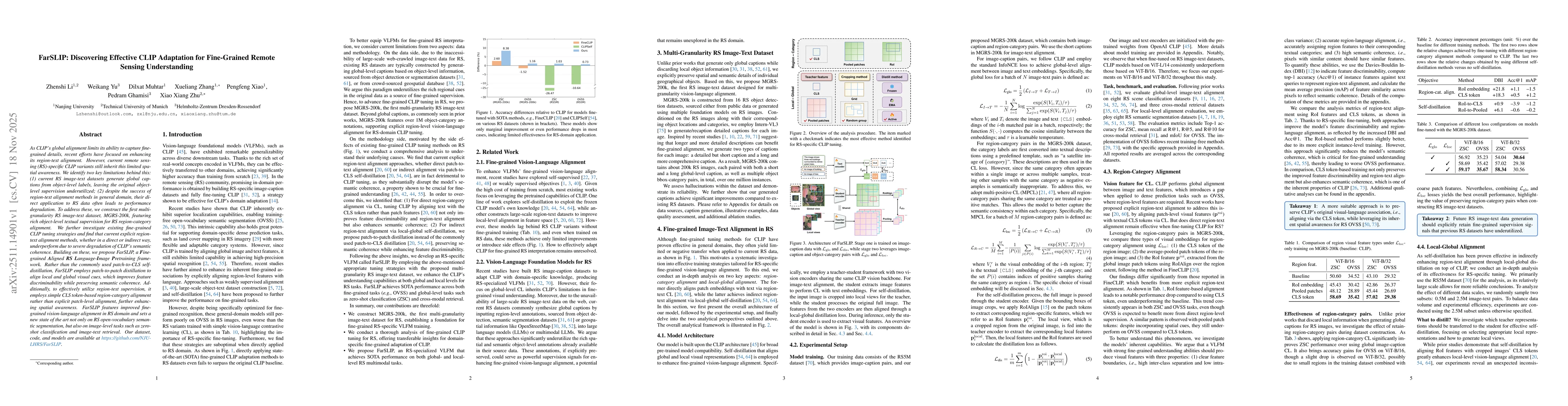
As CLIP's global alignment limits its ability to capture fine-grained details, recent efforts have focused on enhancing its region-text alignment. However, current remote sensing (RS)-specific CLIP va...
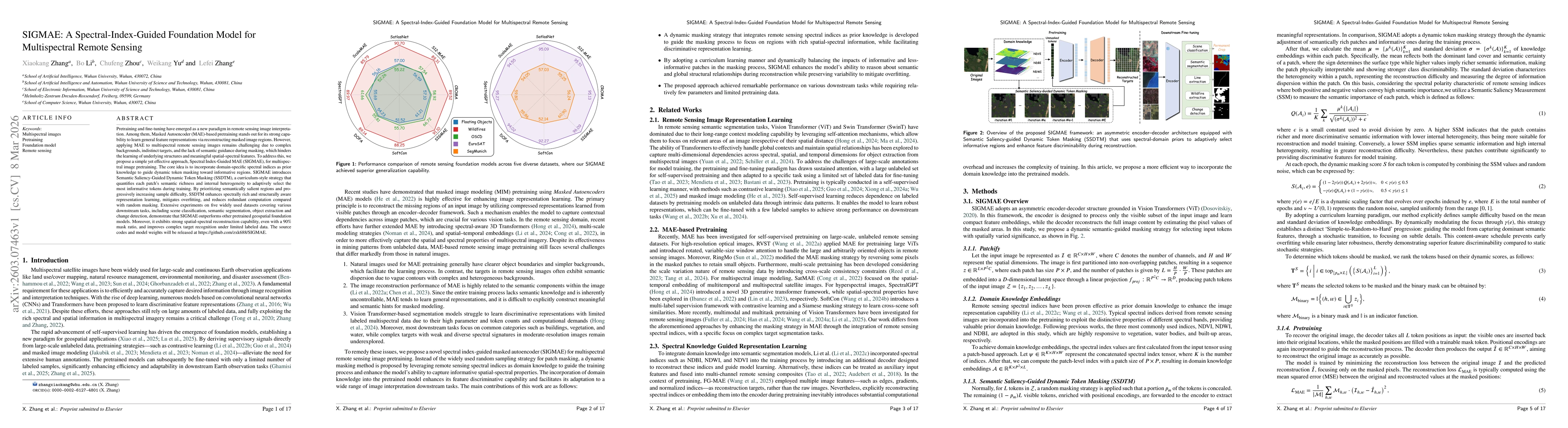
Pretraining and fine-tuning have emerged as a new paradigm in remote sensing image interpretation. Among them, Masked Autoencoder (MAE)-based pretraining stands out for its strong capability to learn ...