Weiwei Song
16 papers on arXiv
Academic Profile
Statistics
Similar Authors
Papers on arXiv
Forecasting the Future with Future Technologies: Advancements in Large Meteorological Models
The field of meteorological forecasting has undergone a significant transformation with the integration of large models, especially those employing deep learning techniques. This paper reviews the a...
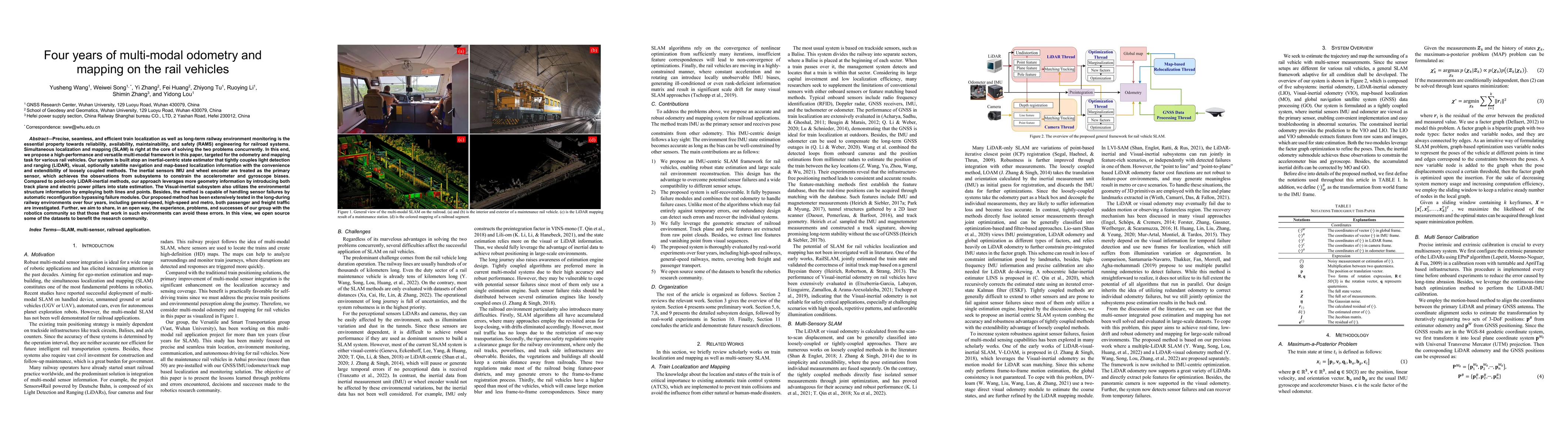
Four years of multi-modal odometry and mapping on the rail vehicles
Precise, seamless, and efficient train localization as well as long-term railway environment monitoring is the essential property towards reliability, availability, maintainability, and safety (RAMS...
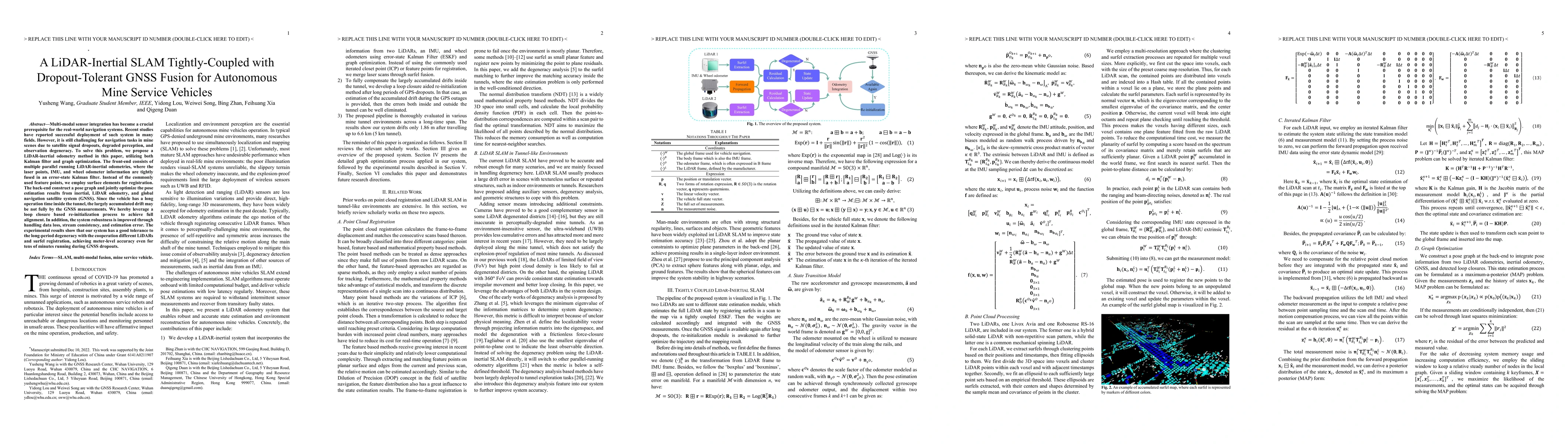
A LiDAR-Inertial SLAM Tightly-Coupled with Dropout-Tolerant GNSS Fusion for Autonomous Mine Service Vehicles
Multi-modal sensor integration has become a crucial prerequisite for the real-world navigation systems. Recent studies have reported successful deployment of such system in many fields. However, it ...
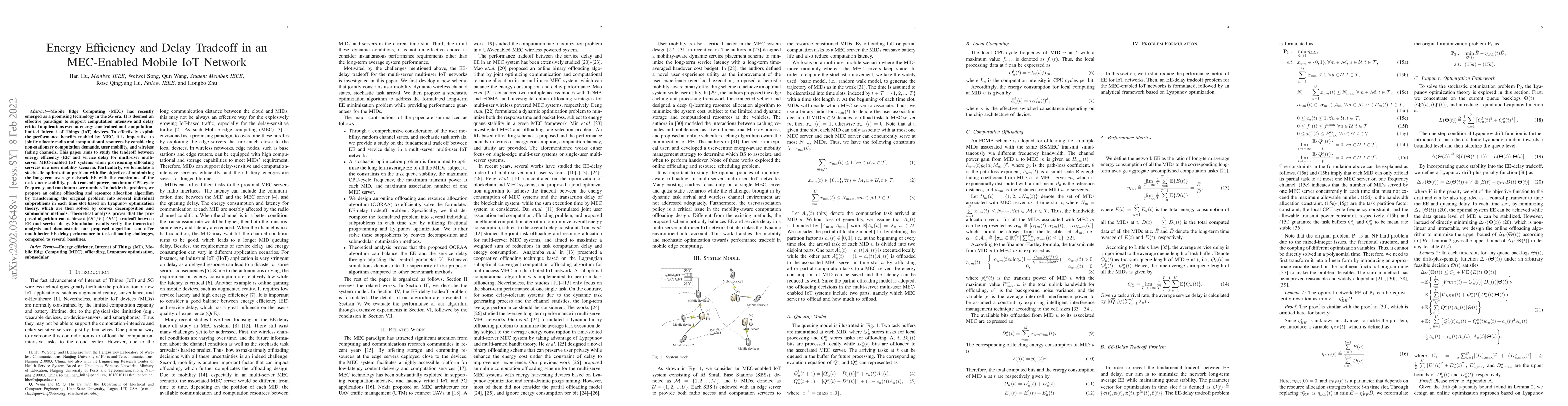
Energy Efficiency and Delay Tradeoff in an MEC-Enabled Mobile IoT Network
Mobile Edge Computing (MEC) has recently emerged as a promising technology in the 5G era. It is deemed an effective paradigm to support computation-intensive and delay critical applications even at ...
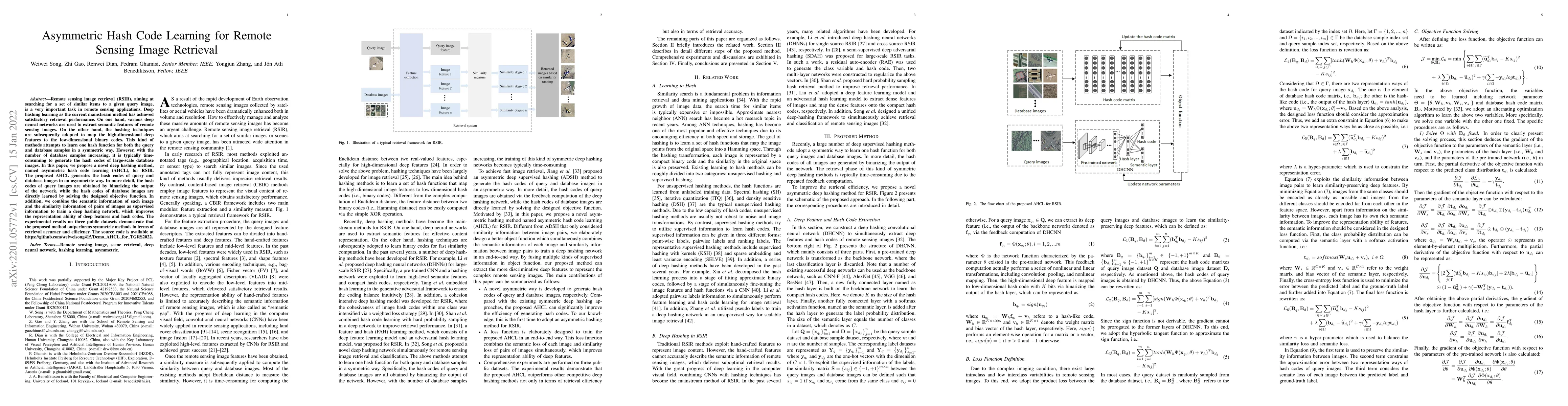
Asymmetric Hash Code Learning for Remote Sensing Image Retrieval
Remote sensing image retrieval (RSIR), aiming at searching for a set of similar items to a given query image, is a very important task in remote sensing applications. Deep hashing learning as the cu...
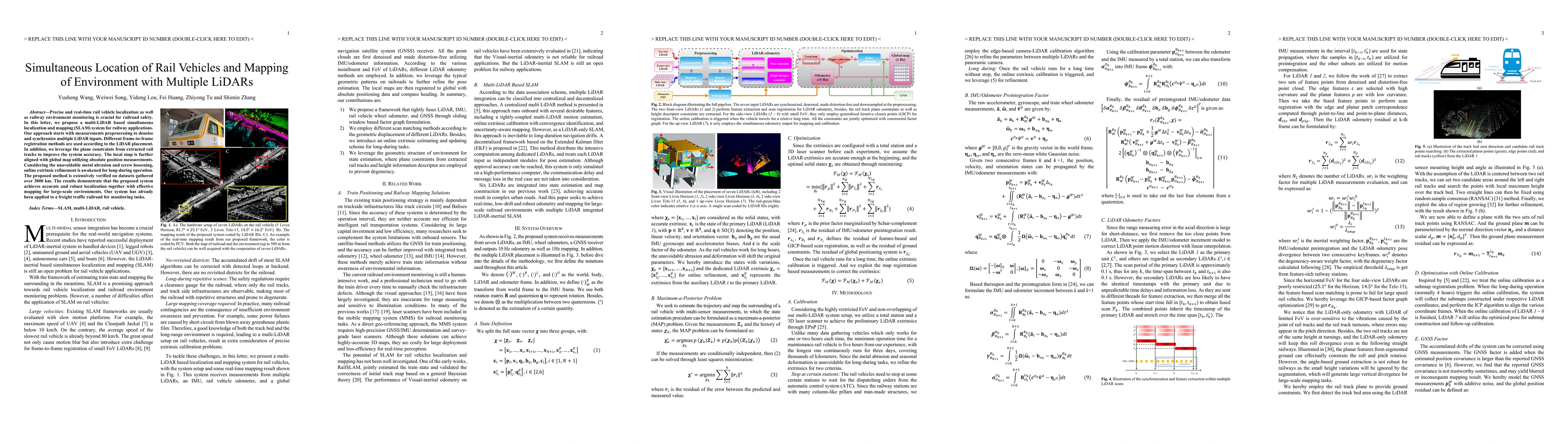
Simultaneous Location of Rail Vehicles and Mapping of Environment with Multiple LiDARs
Precise and real-time rail vehicle localization as well as railway environment monitoring is crucial for railroad safety. In this letter, we propose a multi-LiDAR based simultaneous localization and...
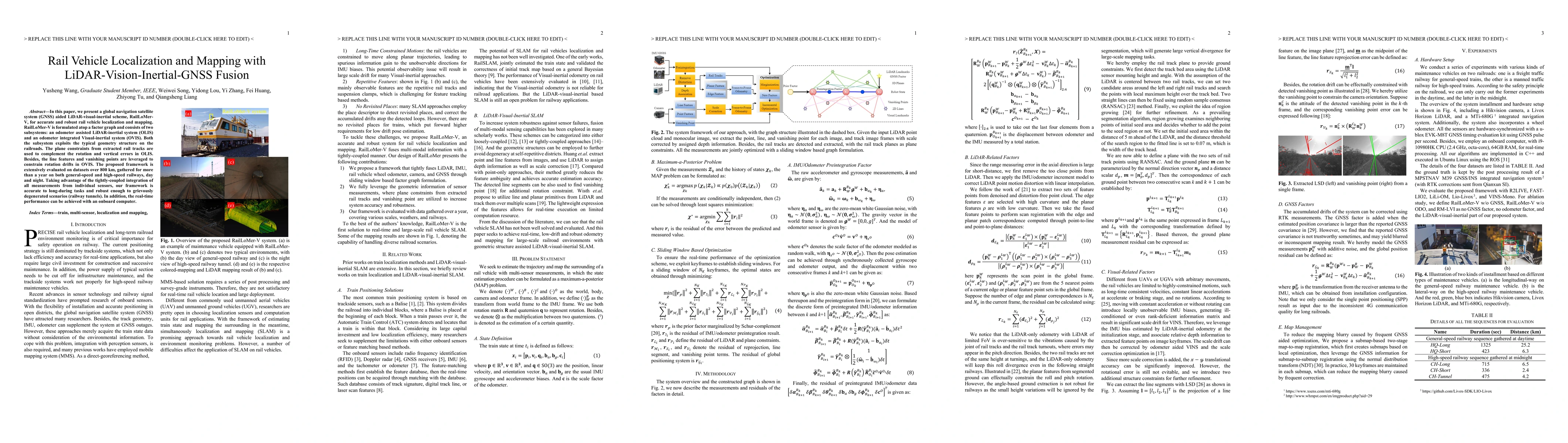
Rail Vehicle Localization and Mapping with LiDAR-Vision-Inertial-GNSS Fusion
In this paper, we present a global navigation satellite system (GNSS) aided LiDAR-visual-inertial scheme, RailLoMer-V, for accurate and robust rail vehicle localization and mapping. RailLoMer-V is f...
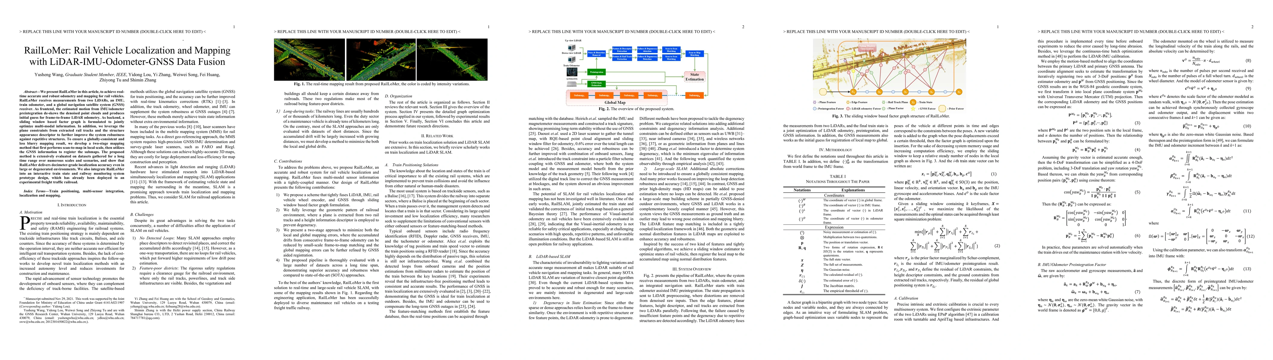
RailLoMer: Rail Vehicle Localization and Mapping with LiDAR-IMU-Odometer-GNSS Data Fusion
We present RailLoMer in this article, to achieve real-time accurate and robust odometry and mapping for rail vehicles. RailLoMer receives measurements from two LiDARs, an IMU, train odometer, and a ...
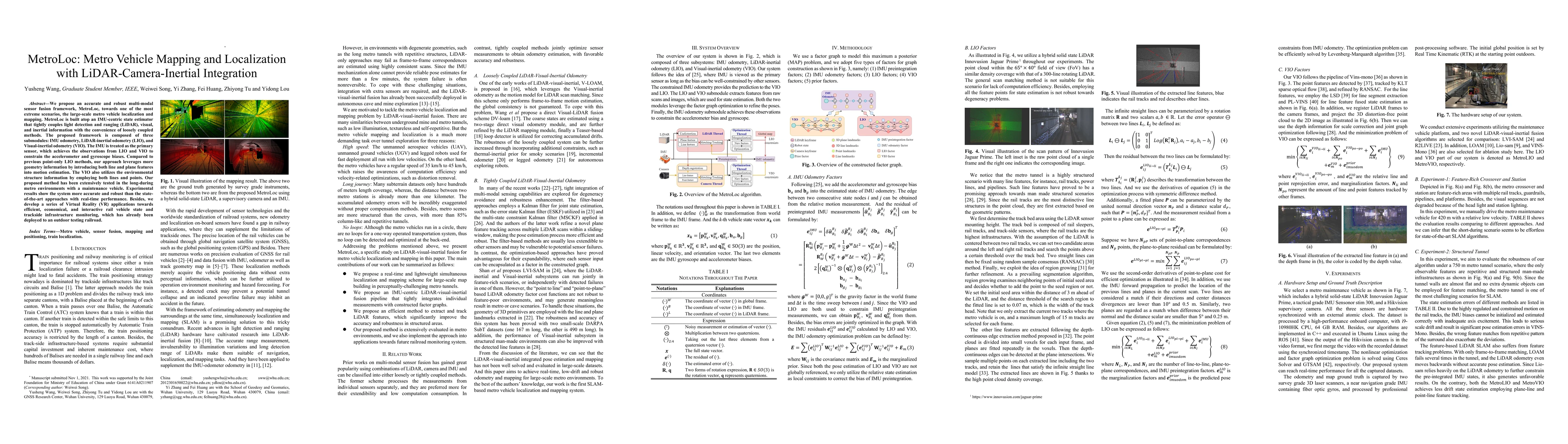
MetroLoc: Metro Vehicle Mapping and Localization with LiDAR-Camera-Inertial Integration
We propose an accurate and robust multi-modal sensor fusion framework, MetroLoc, towards one of the most extreme scenarios, the large-scale metro vehicle localization and mapping. MetroLoc is built ...
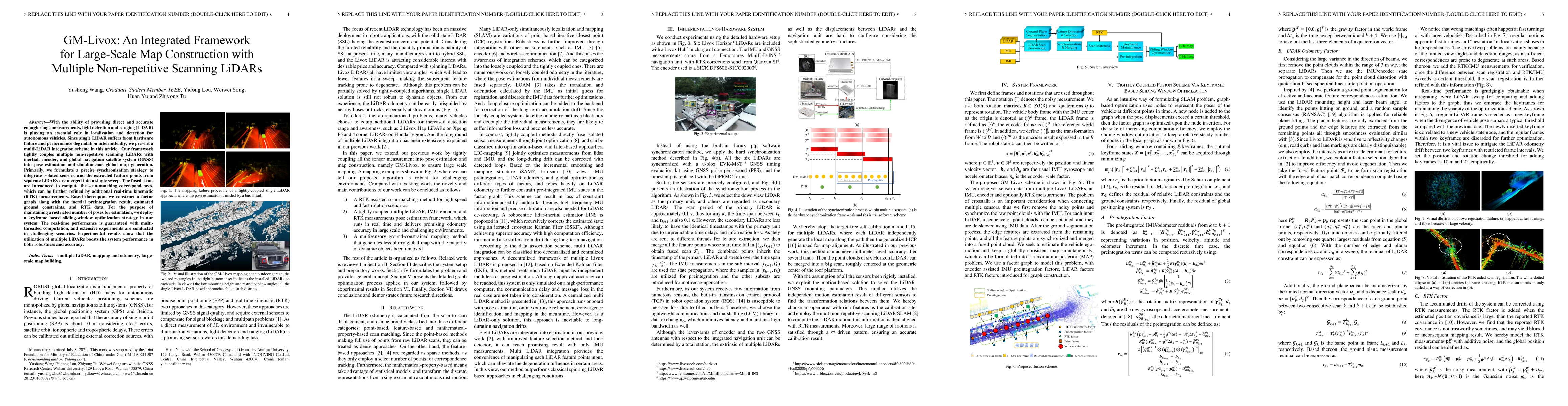
GM-Livox: An Integrated Framework for Large-Scale Map Construction with Multiple Non-repetitive Scanning LiDARs
With the ability of providing direct and accurate enough range measurements, light detection and ranging (LiDAR) is playing an essential role in localization and detection for autonomous vehicles. S...
Mobility-Aware Offloading and Resource Allocation in MEC-Enabled IoT Networks
Mobile edge computing (MEC)-enabled Internet of Things (IoT) networks have been deemed a promising paradigm to support massive energy-constrained and computation-limited IoT devices. IoT with mobili...
Deep Learning for Hyperspectral Image Classification: An Overview
Hyperspectral image (HSI) classification has become a hot topic in the field of remote sensing. In general, the complex characteristics of hyperspectral data make the accurate classification of such...
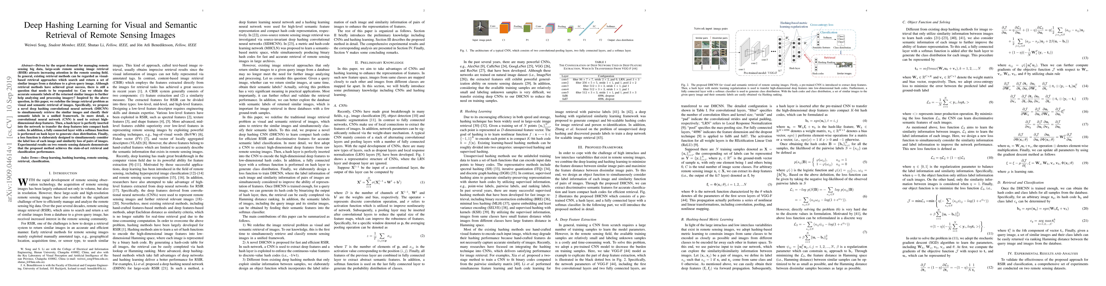
Deep Hashing Learning for Visual and Semantic Retrieval of Remote Sensing Images
Driven by the urgent demand for managing remote sensing big data, large-scale remote sensing image retrieval (RSIR) attracts increasing attention in the remote sensing field. In general, existing re...
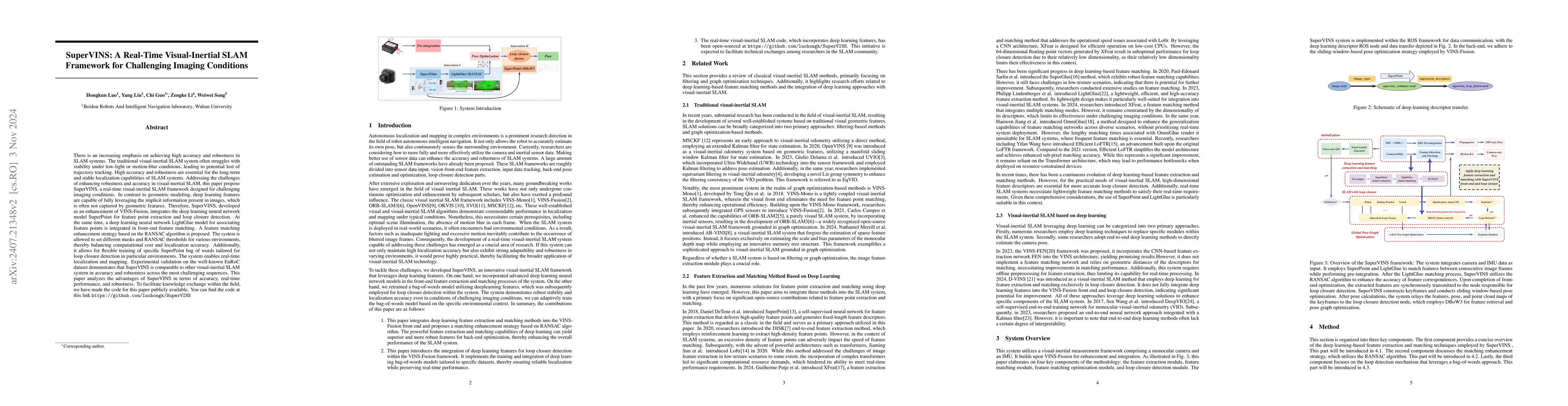
SuperVINS: A Real-Time Visual-Inertial SLAM Framework for Challenging Imaging Conditions
The traditional visual-inertial SLAM system often struggles with stability under low-light or motion-blur conditions, leading to potential lost of trajectory tracking. High accuracy and robustness are...
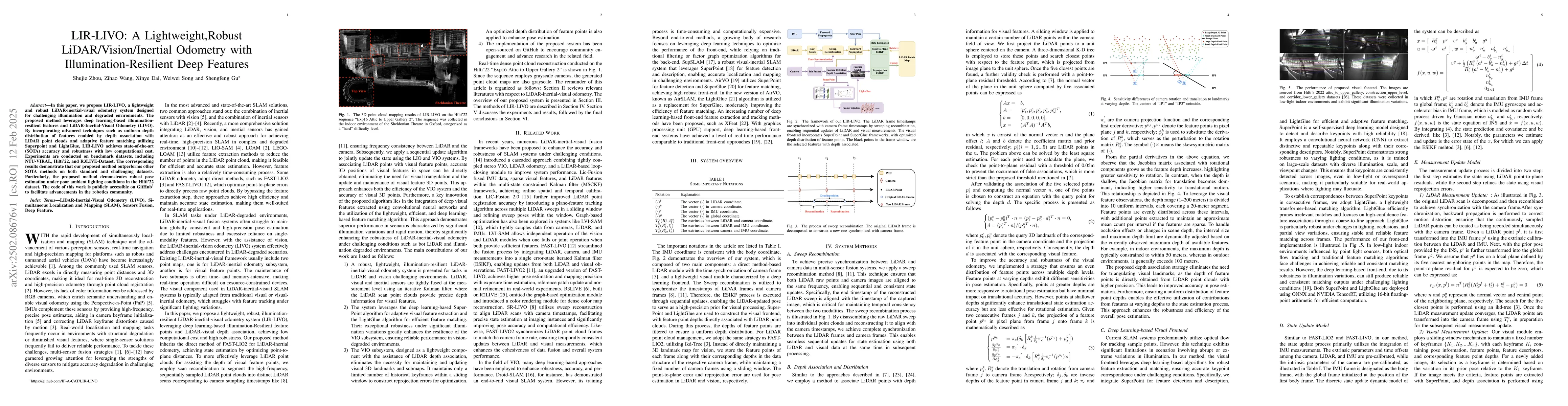
LIR-LIVO: A Lightweight,Robust LiDAR/Vision/Inertial Odometry with Illumination-Resilient Deep Features
In this paper, we propose LIR-LIVO, a lightweight and robust LiDAR-inertial-visual odometry system designed for challenging illumination and degraded environments. The proposed method leverages deep l...
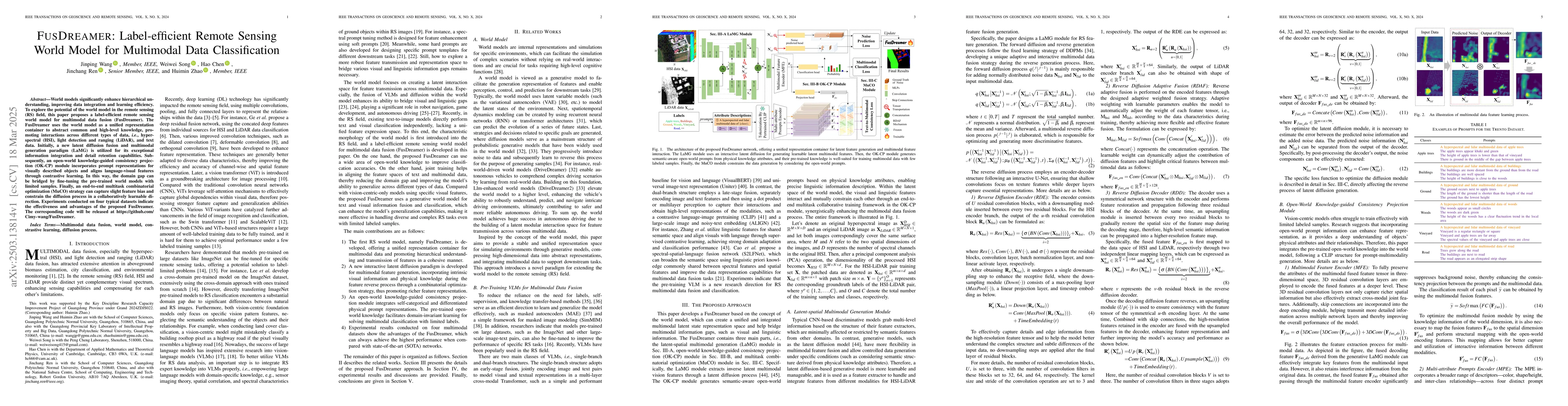
FusDreamer: Label-efficient Remote Sensing World Model for Multimodal Data Classification
World models significantly enhance hierarchical understanding, improving data integration and learning efficiency. To explore the potential of the world model in the remote sensing (RS) field, this pa...