Academic Profile
Statistics
Similar Authors
Papers on arXiv
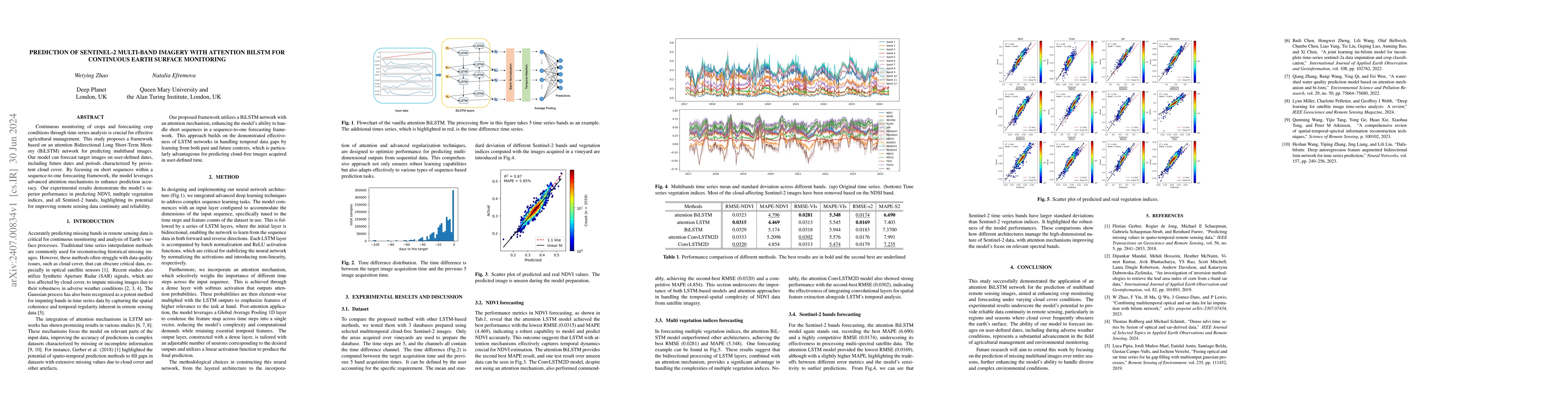
Continuous monitoring of crops and forecasting crop conditions through time series analysis is crucial for effective agricultural management. This study proposes a framework based on an attention Bi...
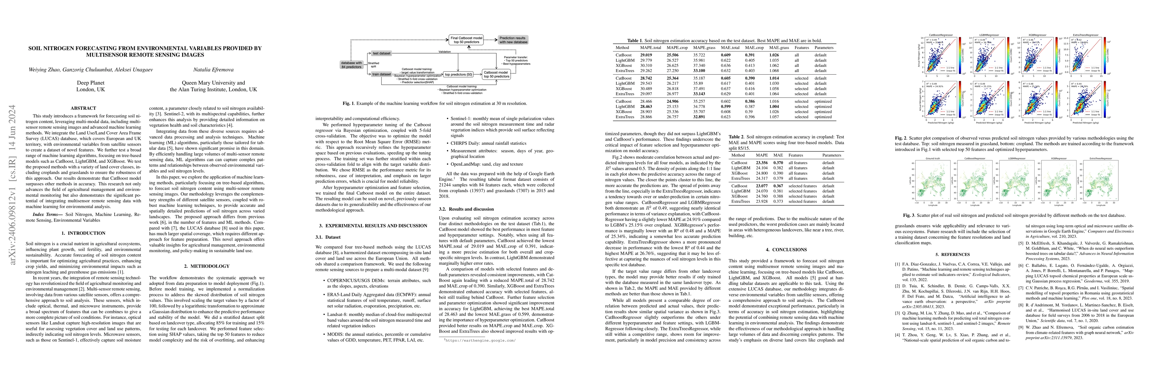
This study introduces a framework for forecasting soil nitrogen content, leveraging multi-modal data, including multi-sensor remote sensing images and advanced machine learning methods. We integrate...
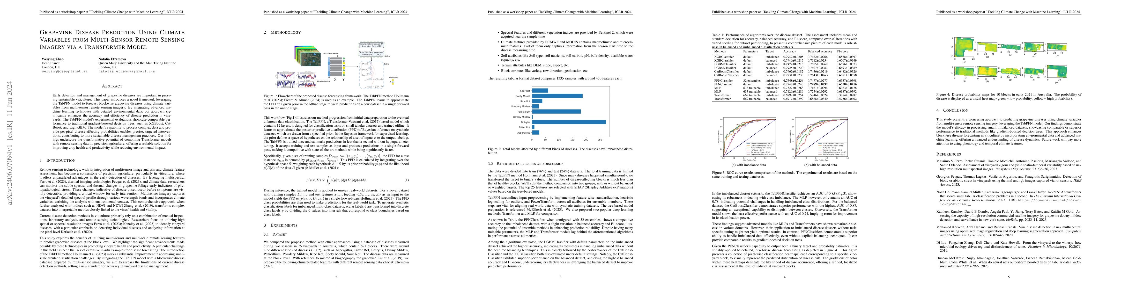
Early detection and management of grapevine diseases are important in pursuing sustainable viticulture. This paper introduces a novel framework leveraging the TabPFN model to forecast blockwise grap...
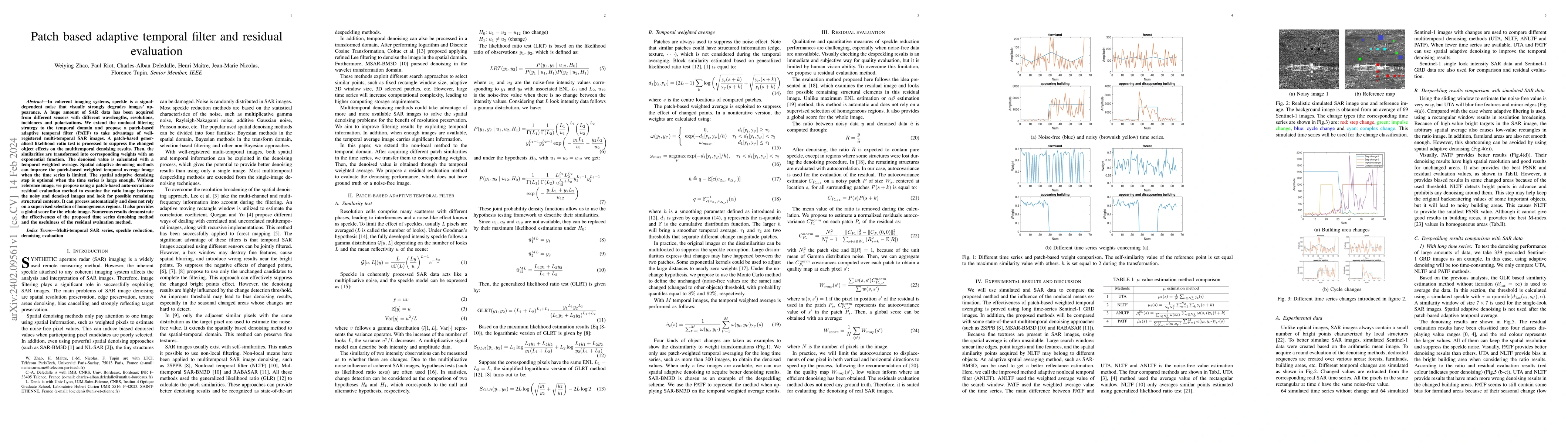
In coherent imaging systems, speckle is a signal-dependent noise that visually strongly degrades images' appearance. A huge amount of SAR data has been acquired from different sensors with different...
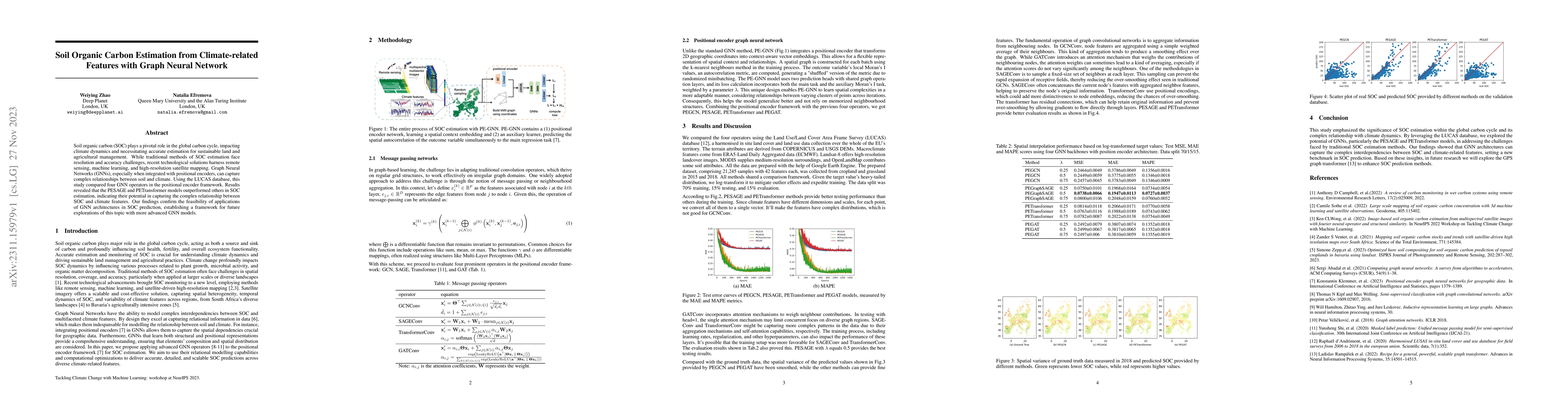
Soil organic carbon (SOC) plays a pivotal role in the global carbon cycle, impacting climate dynamics and necessitating accurate estimation for sustainable land and agricultural management. While tr...
Understanding the state of changed areas requires that precise information be given about the changes. Thus, detecting different kinds of changes is important for land surface monitoring. SAR sensor...
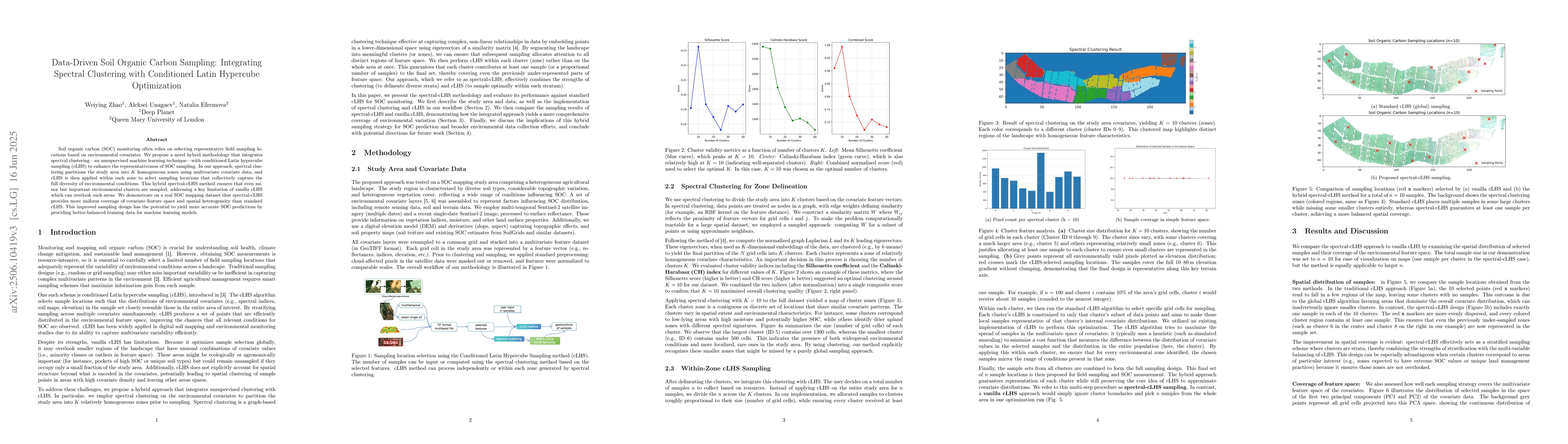
Soil organic carbon (SOC) monitoring often relies on selecting representative field sampling locations based on environmental covariates. We propose a novel hybrid methodology that integrates spectral...