Academic Profile
Statistics
Similar Authors
Papers on arXiv
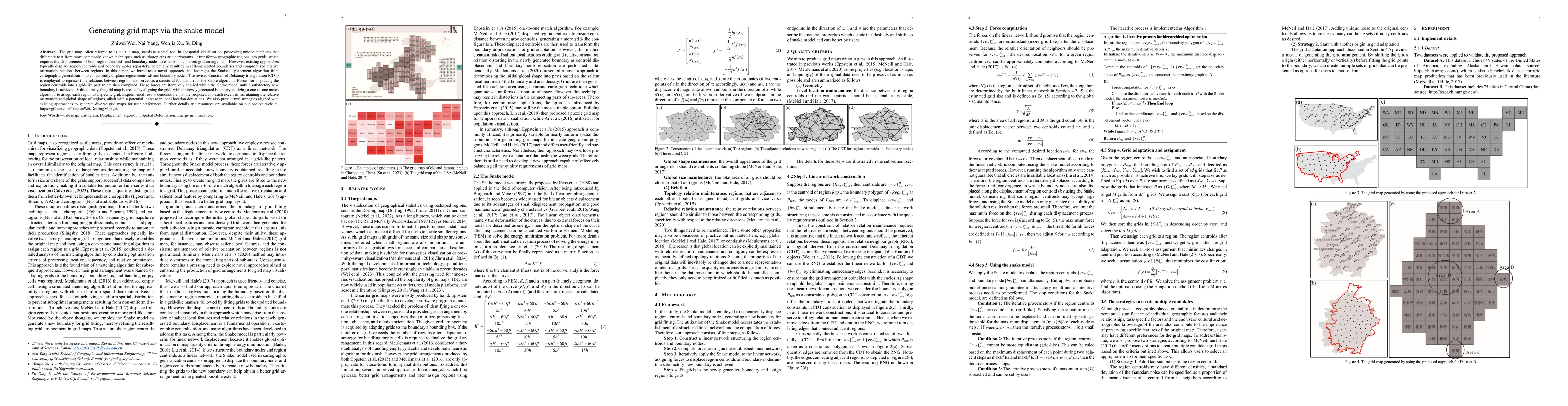
The grid map, often referred to as the tile map, stands as a vital tool in geospatial visualization, possessing unique attributes that differentiate it from more commonly known techniques such as ch...
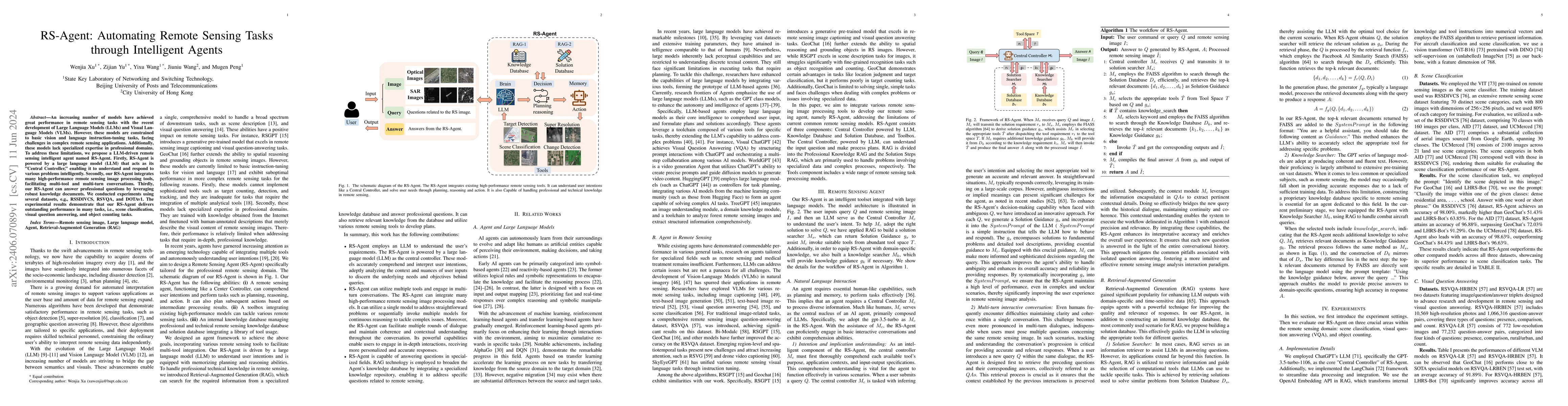
An increasing number of models have achieved great performance in remote sensing tasks with the recent development of Large Language Models (LLMs) and Visual Language Models (VLMs). However, these m...
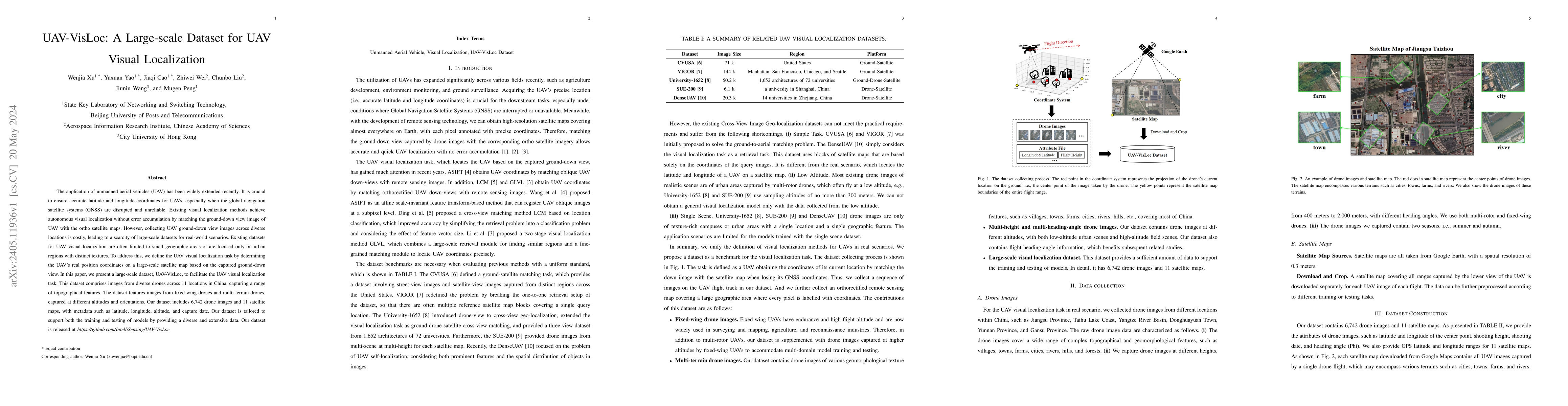
The application of unmanned aerial vehicles (UAV) has been widely extended recently. It is crucial to ensure accurate latitude and longitude coordinates for UAVs, especially when the global navigati...
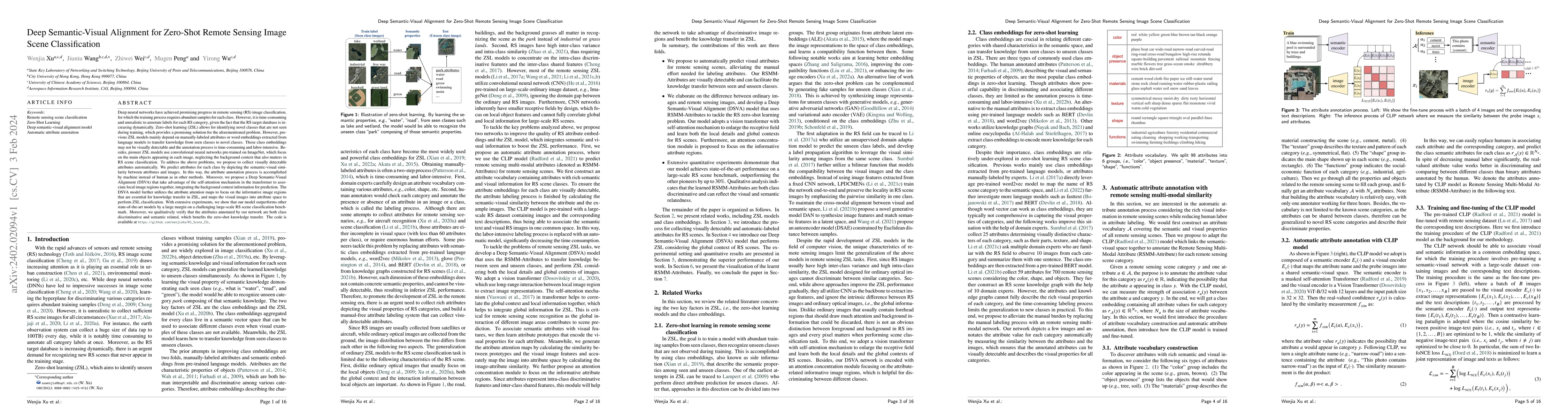
Deep neural networks have achieved promising progress in remote sensing (RS) image classification, for which the training process requires abundant samples for each class. However, it is time-consum...
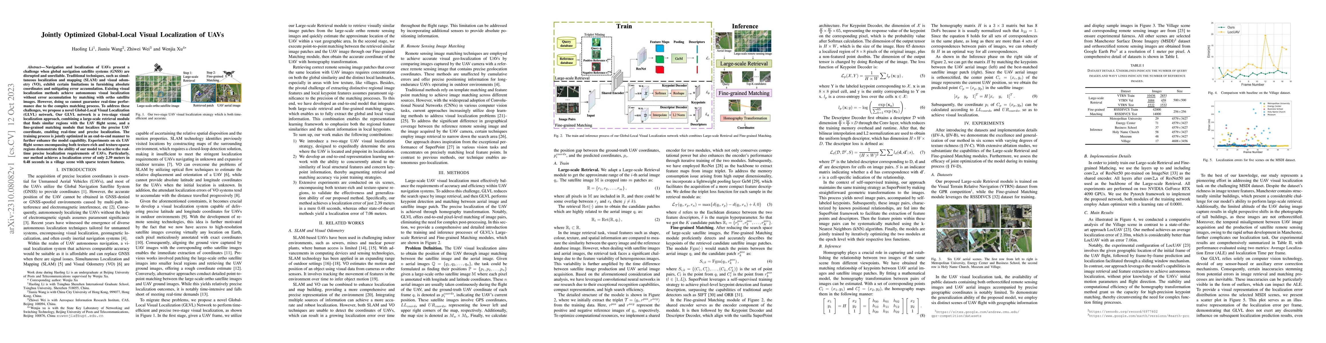
Navigation and localization of UAVs present a challenge when global navigation satellite systems (GNSS) are disrupted and unreliable. Traditional techniques, such as simultaneous localization and ma...
Multi-View Stereo~(MVS) is a fundamental problem in geometric computer vision which aims to reconstruct a scene using multi-view images with known camera parameters. However, the mainstream approach...
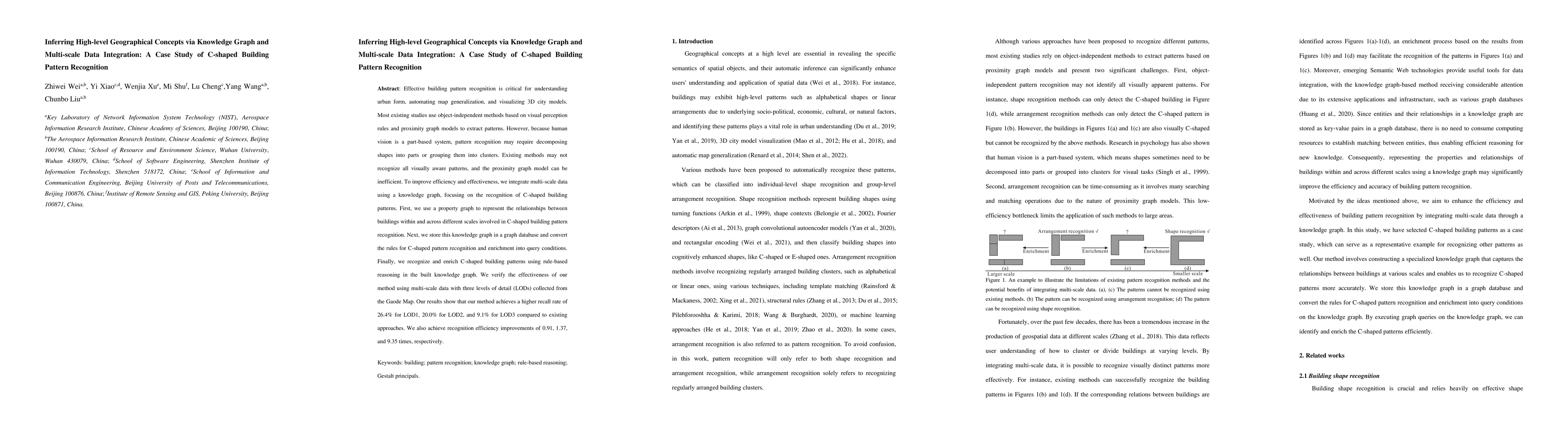
Effective building pattern recognition is critical for understanding urban form, automating map generalization, and visualizing 3D city models. Most existing studies use object-independent methods b...
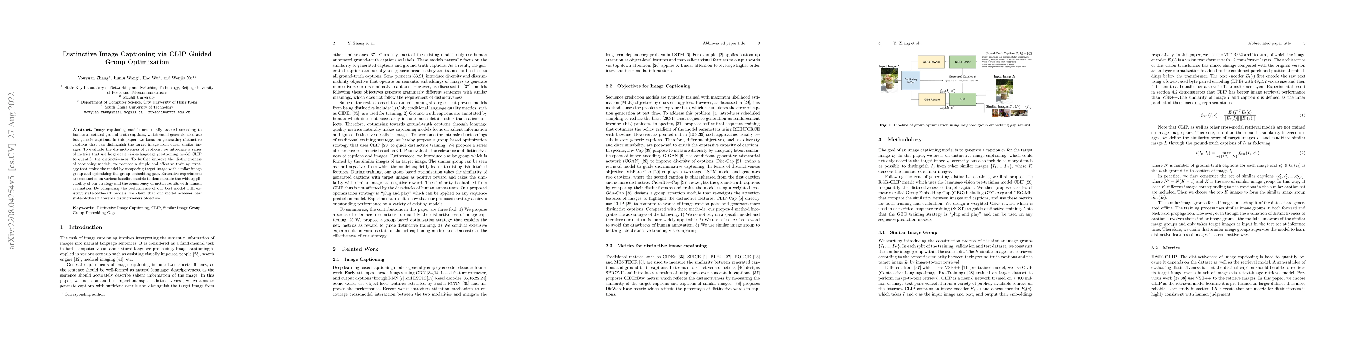
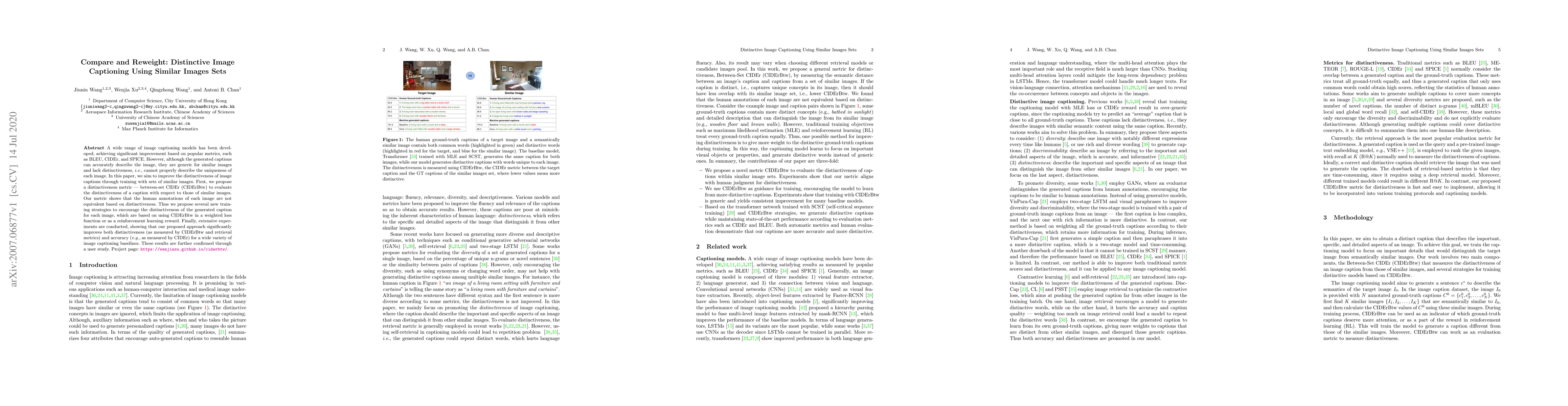
Image captioning models are usually trained according to human annotated ground-truth captions, which could generate accurate but generic captions. In this paper, we focus on generating distinctive ...
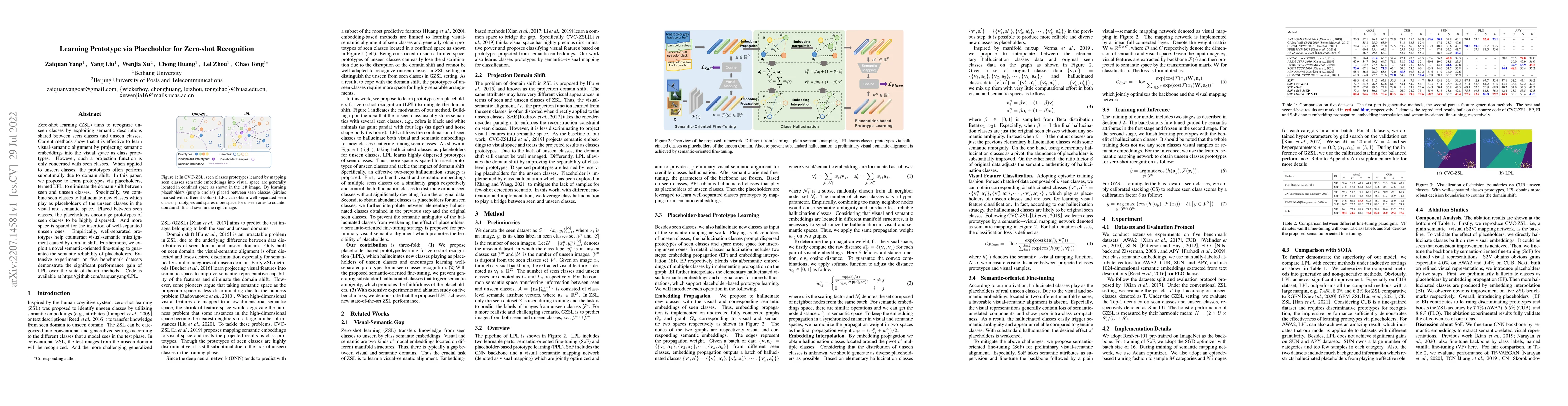
Zero-shot learning (ZSL) aims to recognize unseen classes by exploiting semantic descriptions shared between seen classes and unseen classes. Current methods show that it is effective to learn visua...
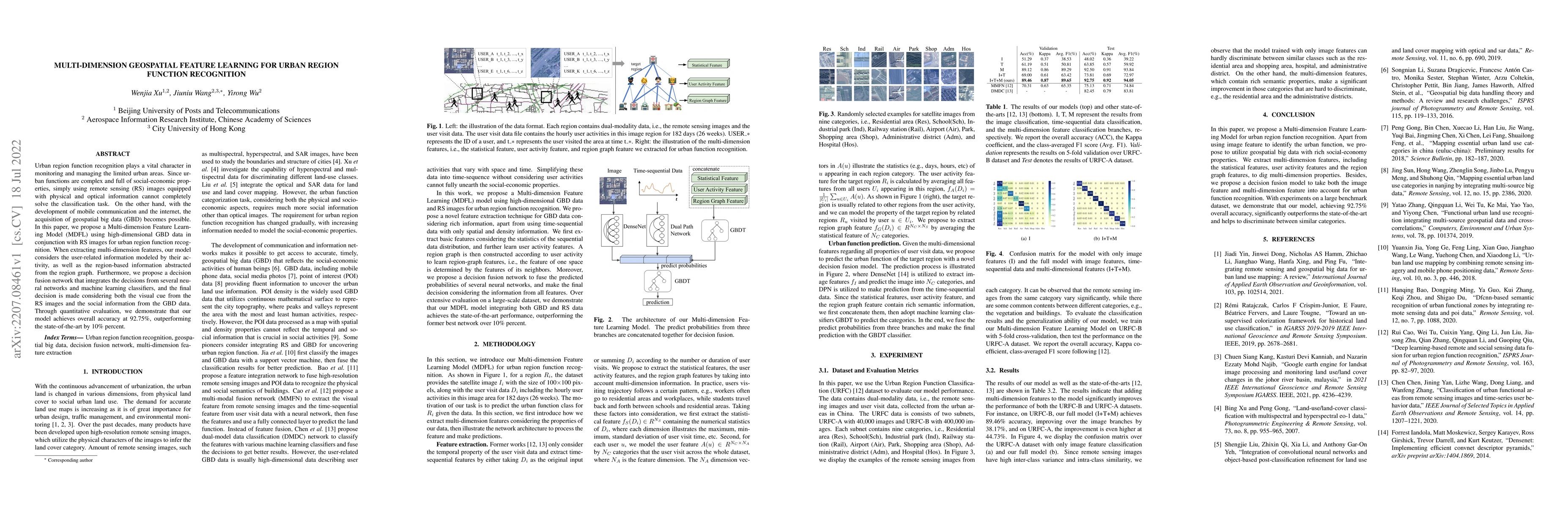
Urban region function recognition plays a vital character in monitoring and managing the limited urban areas. Since urban functions are complex and full of social-economic properties, simply using r...
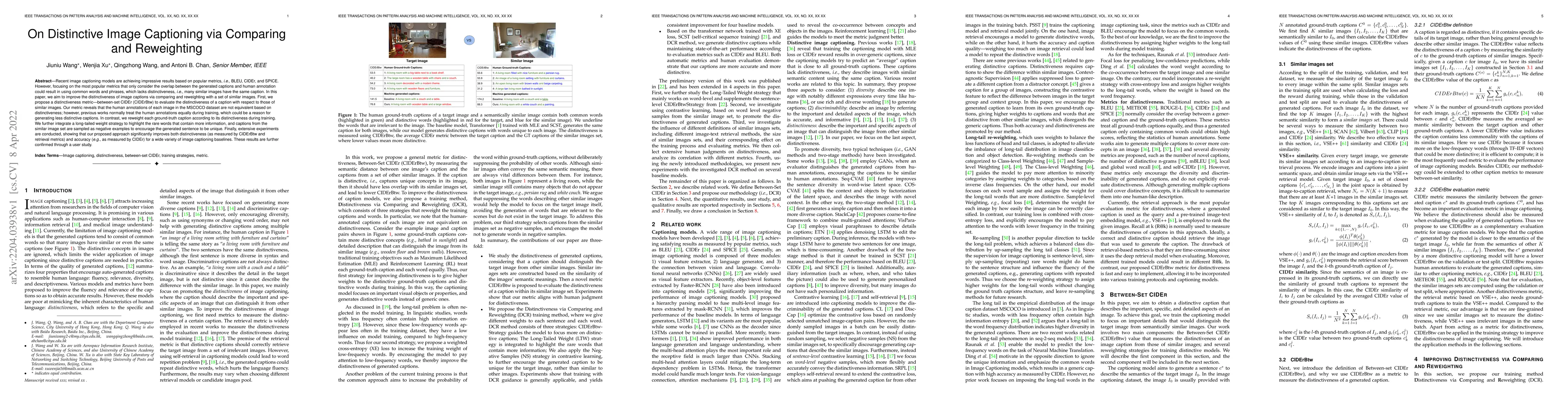
Recent image captioning models are achieving impressive results based on popular metrics, i.e., BLEU, CIDEr, and SPICE. However, focusing on the most popular metrics that only consider the overlap b...
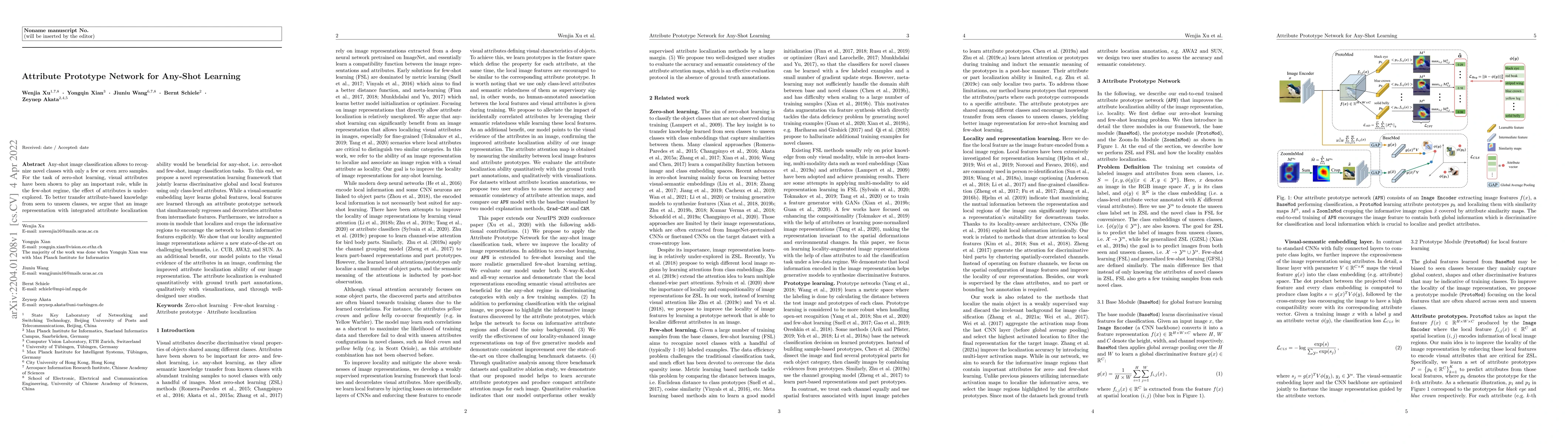
Any-shot image classification allows to recognize novel classes with only a few or even zero samples. For the task of zero-shot learning, visual attributes have been shown to play an important role,...
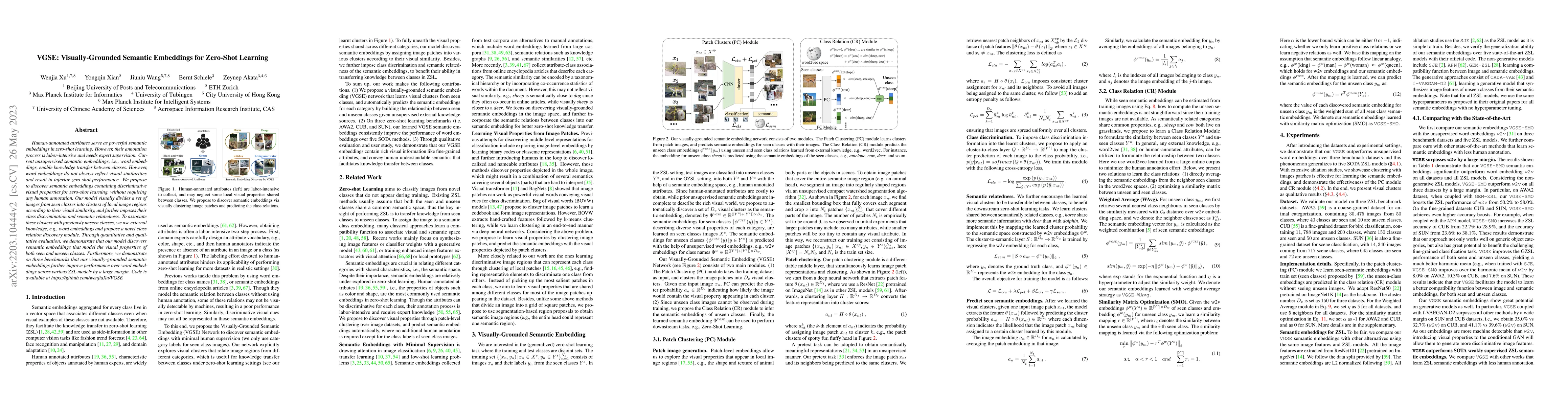
Human-annotated attributes serve as powerful semantic embeddings in zero-shot learning. However, their annotation process is labor-intensive and needs expert supervision. Current unsupervised semant...
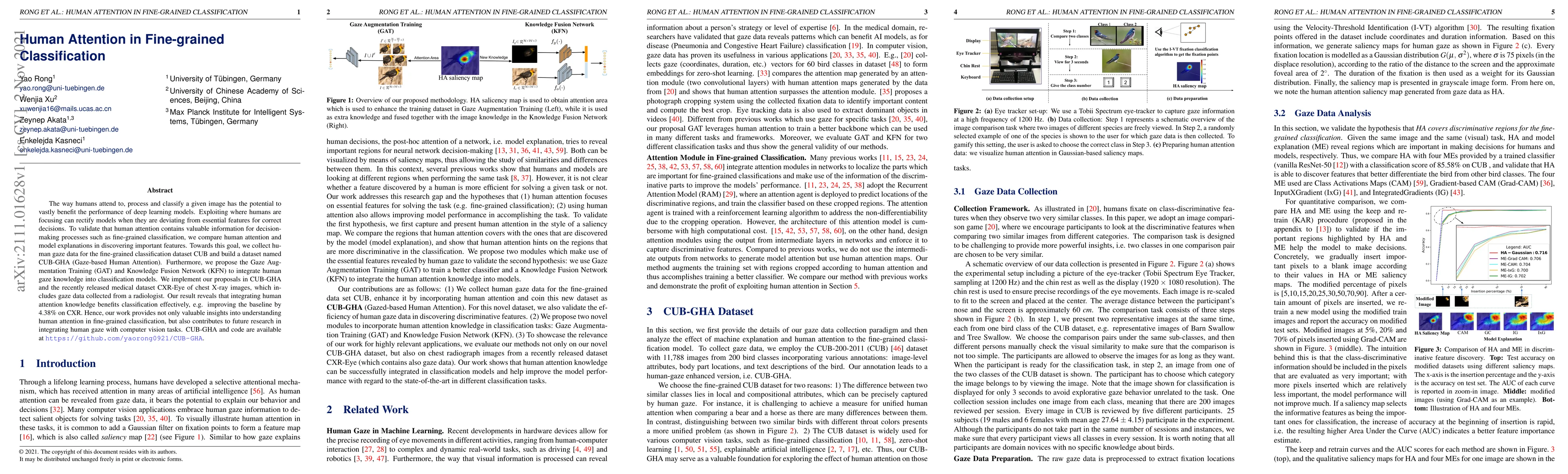
The way humans attend to, process and classify a given image has the potential to vastly benefit the performance of deep learning models. Exploiting where humans are focusing can rectify models when...
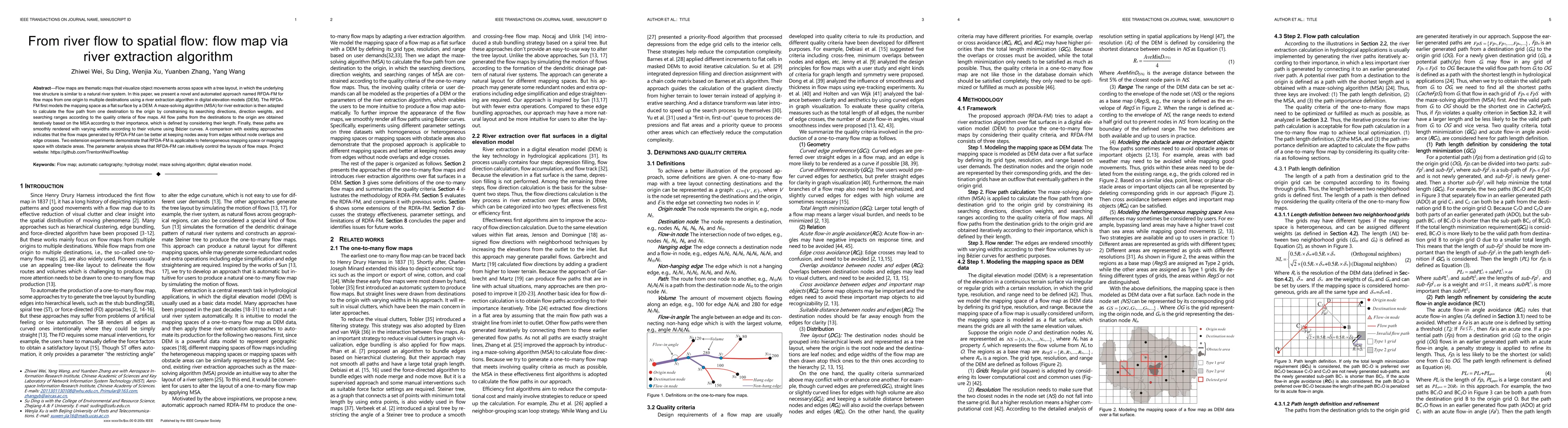
Flow maps are thematic maps that visualize object movements across space with a tree layout, in which the underlying tree structure is similar to a natural river system. In this paper, we present a ...
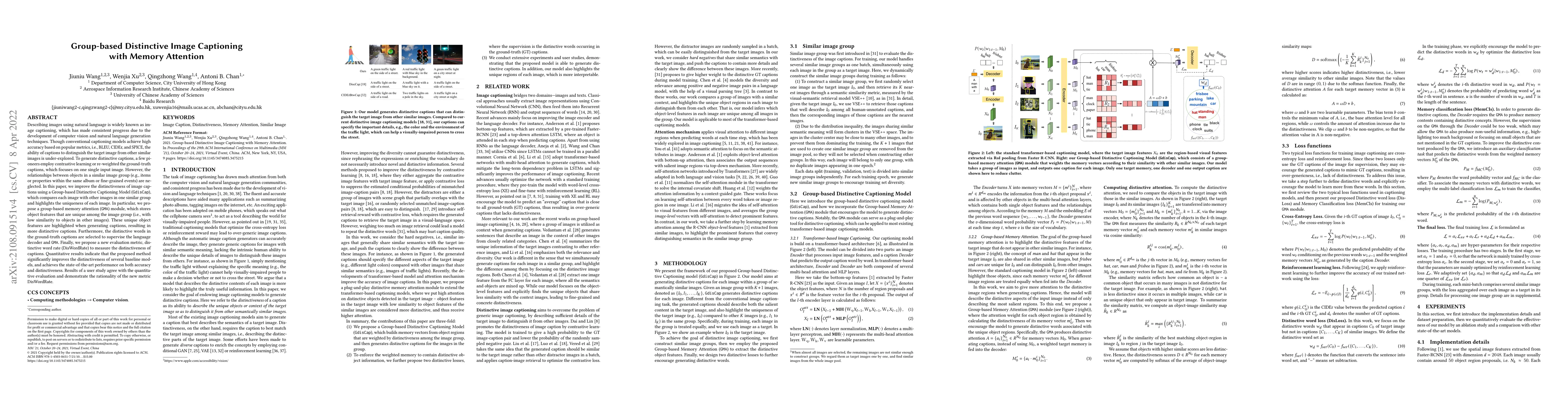
Describing images using natural language is widely known as image captioning, which has made consistent progress due to the development of computer vision and natural language generation techniques....
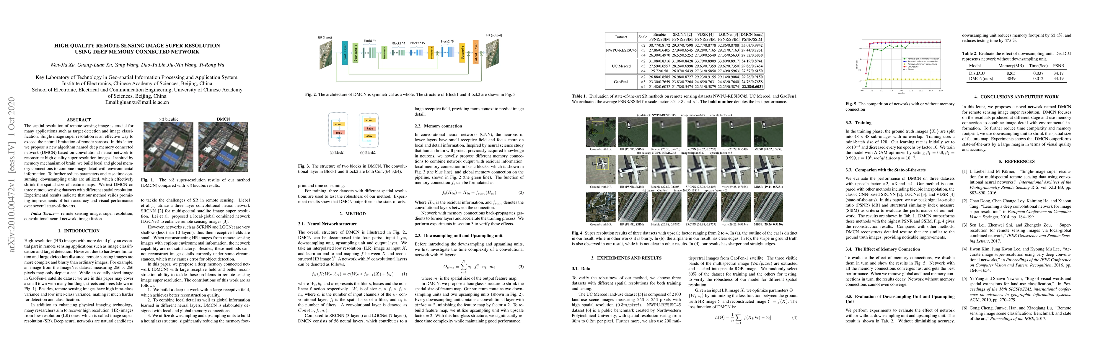
Single image super-resolution is an effective way to enhance the spatial resolution of remote sensing image, which is crucial for many applications such as target detection and image classification....
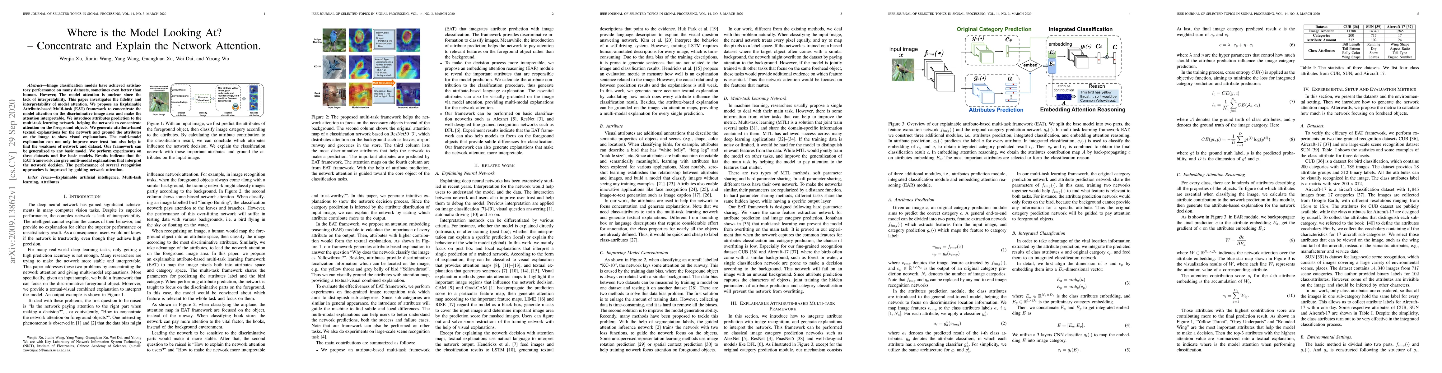
Image classification models have achieved satisfactory performance on many datasets, sometimes even better than human. However, The model attention is unclear since the lack of interpretability. Thi...
The question answering system can answer questions from various fields and forms with deep neural networks, but it still lacks effective ways when facing multiple evidences. We introduce a new model...
Named Entity Recognition (NER) is a challenging task that extracts named entities from unstructured text data, including news, articles, social comments, etc. The NER system has been studied for dec...
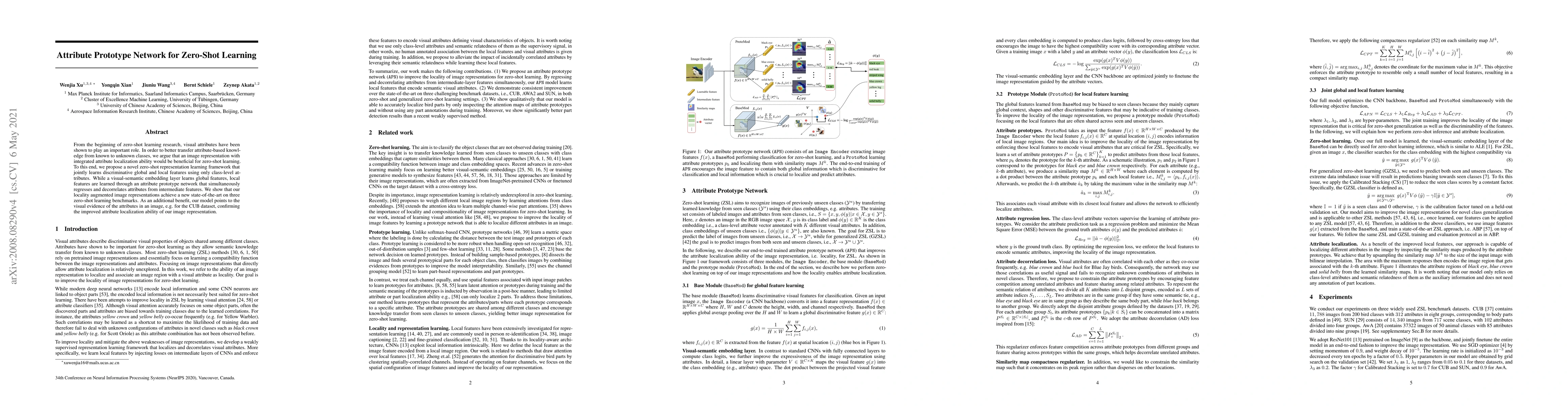
From the beginning of zero-shot learning research, visual attributes have been shown to play an important role. In order to better transfer attribute-based knowledge from known to unknown classes, w...
A wide range of image captioning models has been developed, achieving significant improvement based on popular metrics, such as BLEU, CIDEr, and SPICE. However, although the generated captions can a...
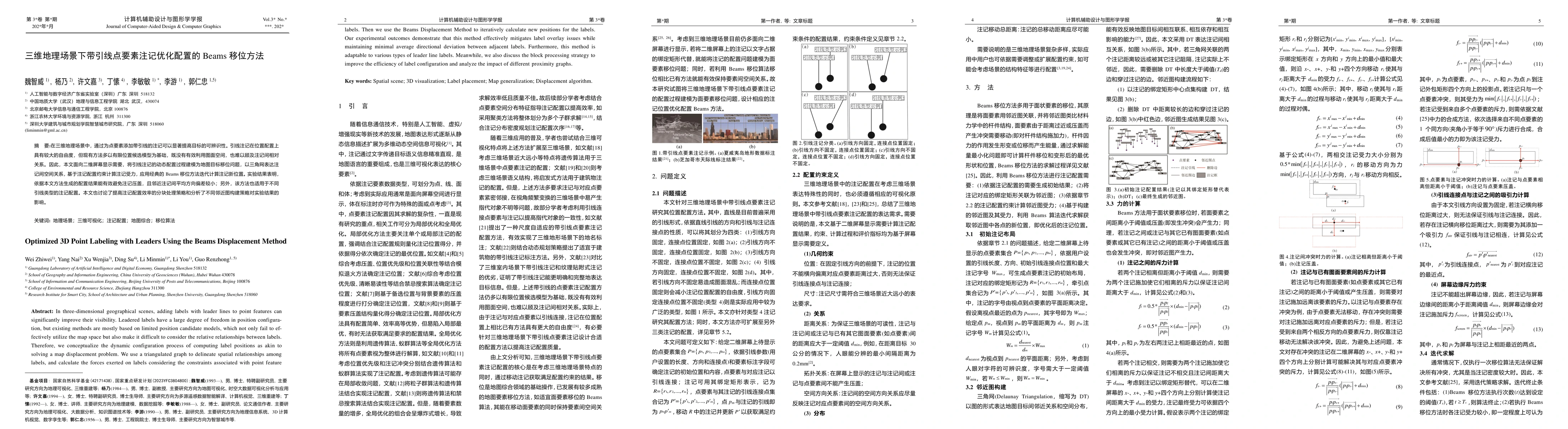
In three-dimensional geographical scenes, adding labels with leader lines to point features can significantly improve their visibility. Leadered labels have a large degree of freedom in position con-f...
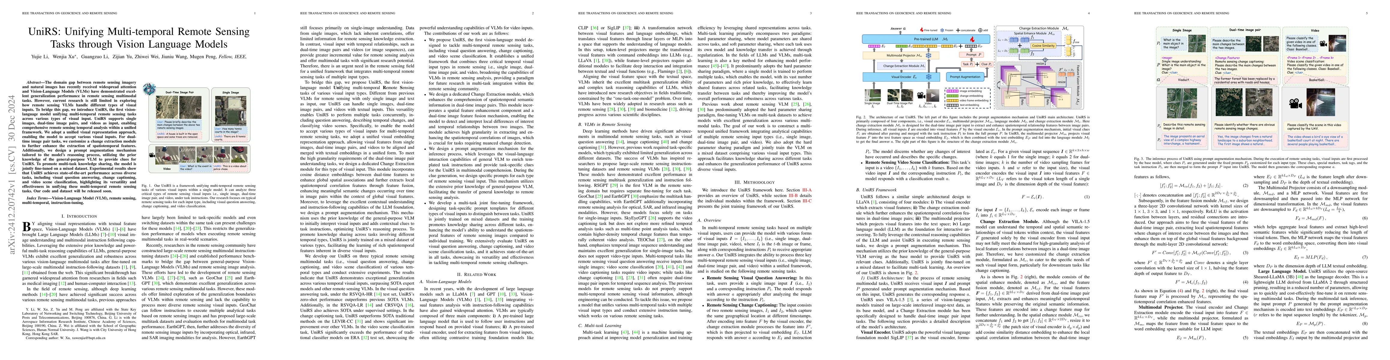
The domain gap between remote sensing imagery and natural images has recently received widespread attention and Vision-Language Models (VLMs) have demonstrated excellent generalization performance in ...
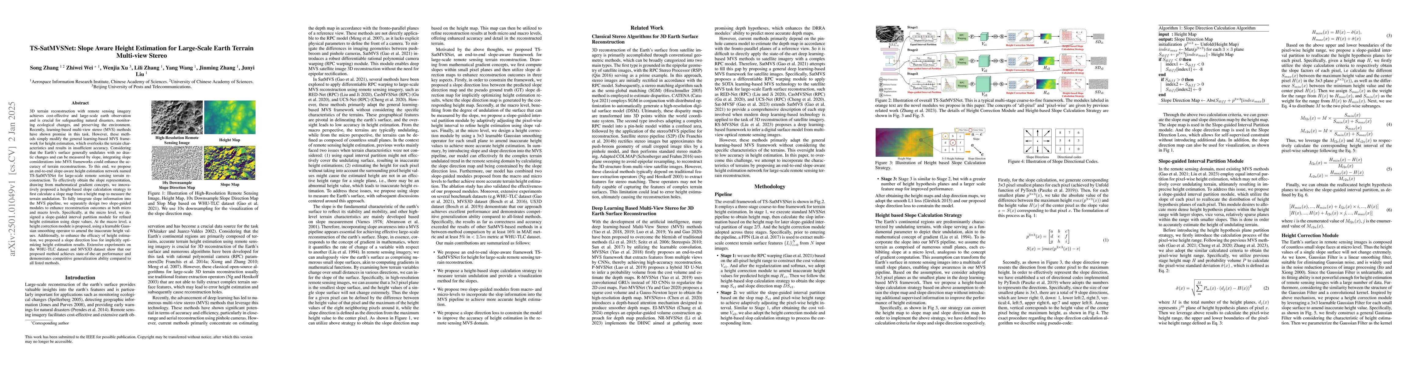
3D terrain reconstruction with remote sensing imagery achieves cost-effective and large-scale earth observation and is crucial for safeguarding natural disasters, monitoring ecological changes, and pr...
Recent advances in image captioning have focused on enhancing accuracy by substantially increasing the dataset and model size. While conventional captioning models exhibit high performance on establis...
While Multimodal Large Language Models (MLLMs) demonstrate impressive capabilities, their substantial computational and memory requirements pose significant barriers to practical deployment. Current p...
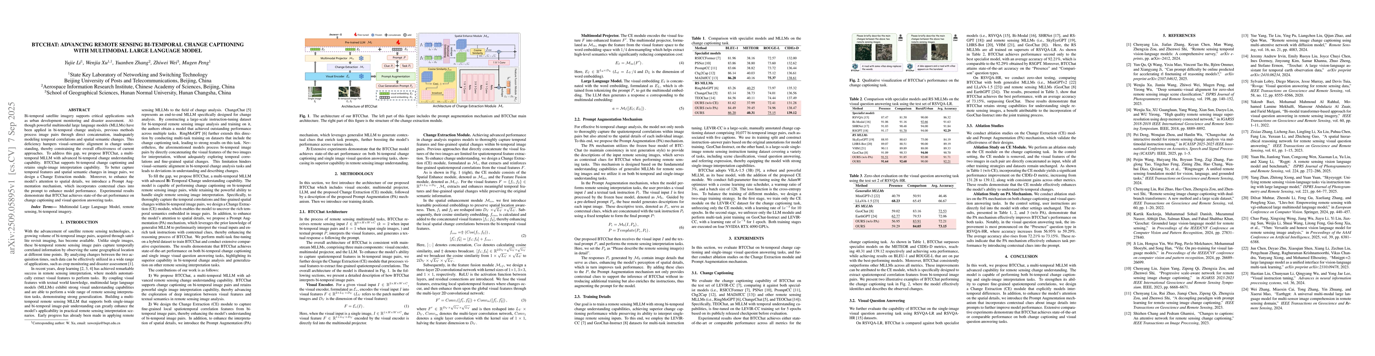
Bi-temporal satellite imagery supports critical applications such as urban development monitoring and disaster assessment. Although powerful multimodal large language models (MLLMs) have been applied ...
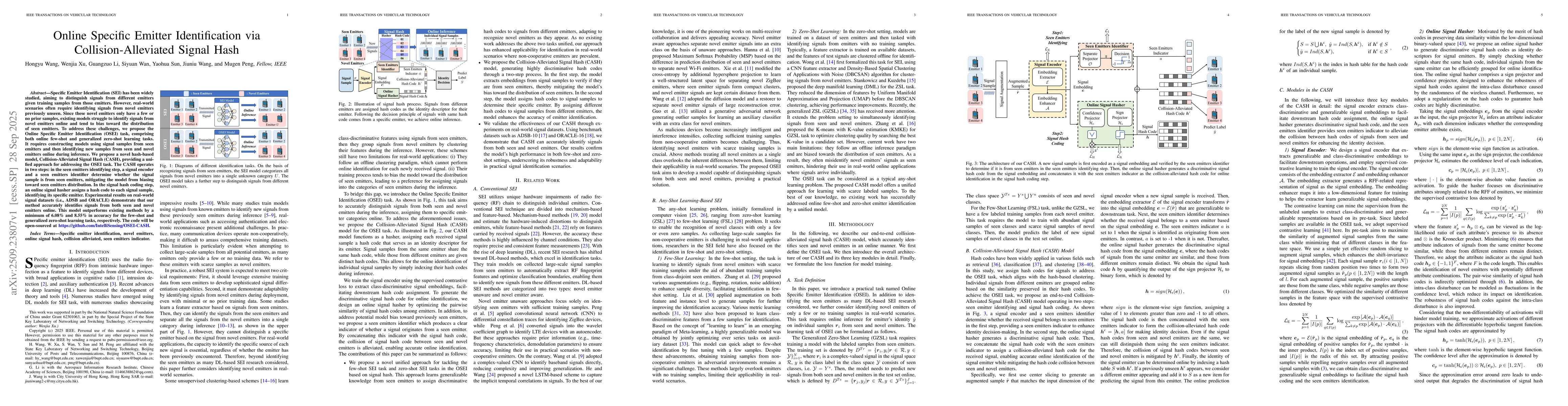
Specific Emitter Identification (SEI) has been widely studied, aiming to distinguish signals from different emitters given training samples from those emitters. However, real-world scenarios often req...
Map environments provide a fundamental medium for representing spatial structure. Understanding how foundation model (FM) agents understand and act in such environments is therefore critical for enabl...
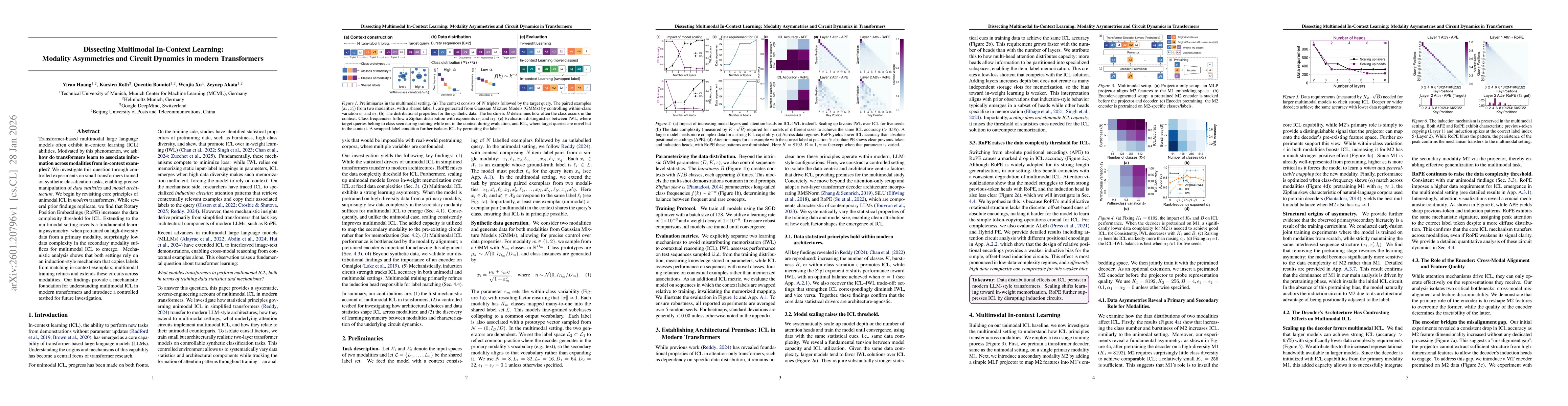
Transformer-based multimodal large language models often exhibit in-context learning (ICL) abilities. Motivated by this phenomenon, we ask: how do transformers learn to associate information across mo...
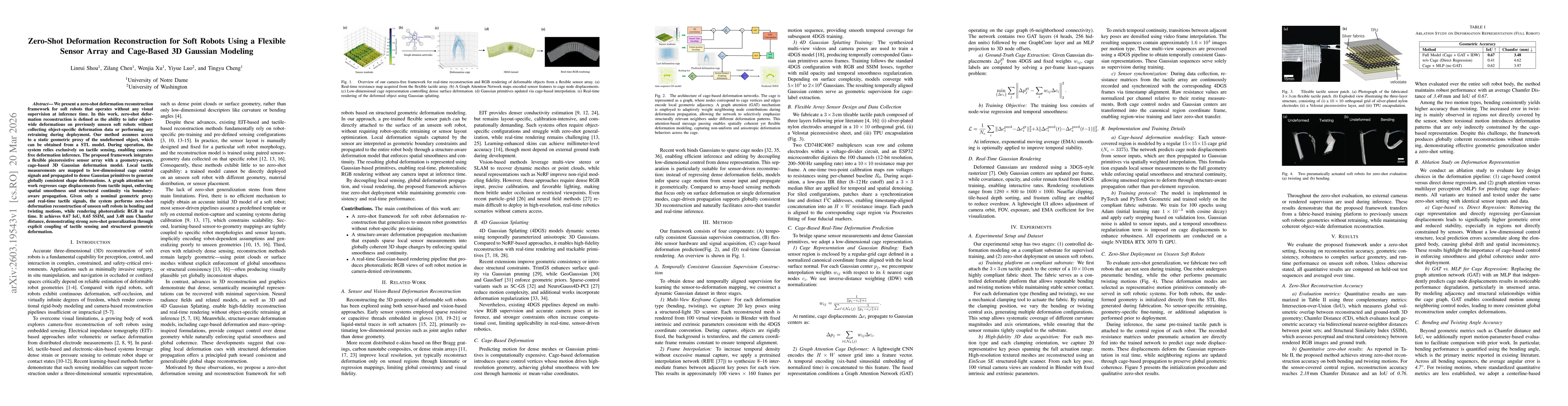
We present a zero-shot deformation reconstruction framework for soft robots that operates without any visual supervision at inference time. In this work, zero-shot deformation reconstruction is define...
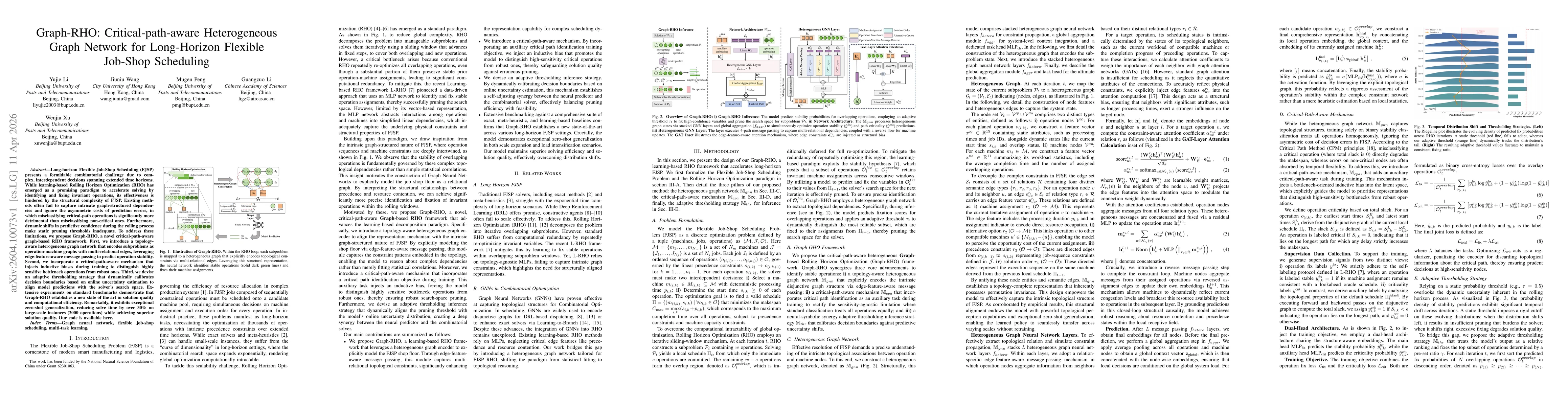
Long-horizon Flexible Job-Shop Scheduling~(FJSP) presents a formidable combinatorial challenge due to complex, interdependent decisions spanning extended time horizons. While learning-based Rolling Ho...
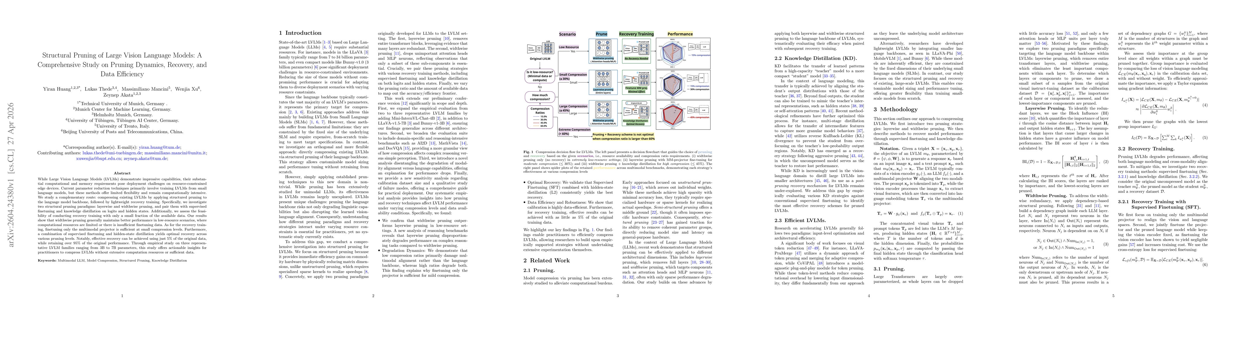
While Large Vision Language Models (LVLMs) demonstrate impressive capabilities, their substantial computational and memory requirements pose deployment challenges on resource-constrained edge devices....