ArxivLens
W
Researcher

Wentian Gan

6 papers on arXiv

6 arXiv Papers
3 Total Publications
Profile

Academic Profile

Name Wentian Gan
Total Papers 3
Scholar Profile View on Semantic Scholar
Metrics

Statistics

6 arXiv Papers
3 Total Publications
Publications

Papers on arXiv

Thumbnail for SfM on-the-fly: Get better 3D from What You Capture
arXiv
SfM on-the-fly: Get better 3D from What You Capture

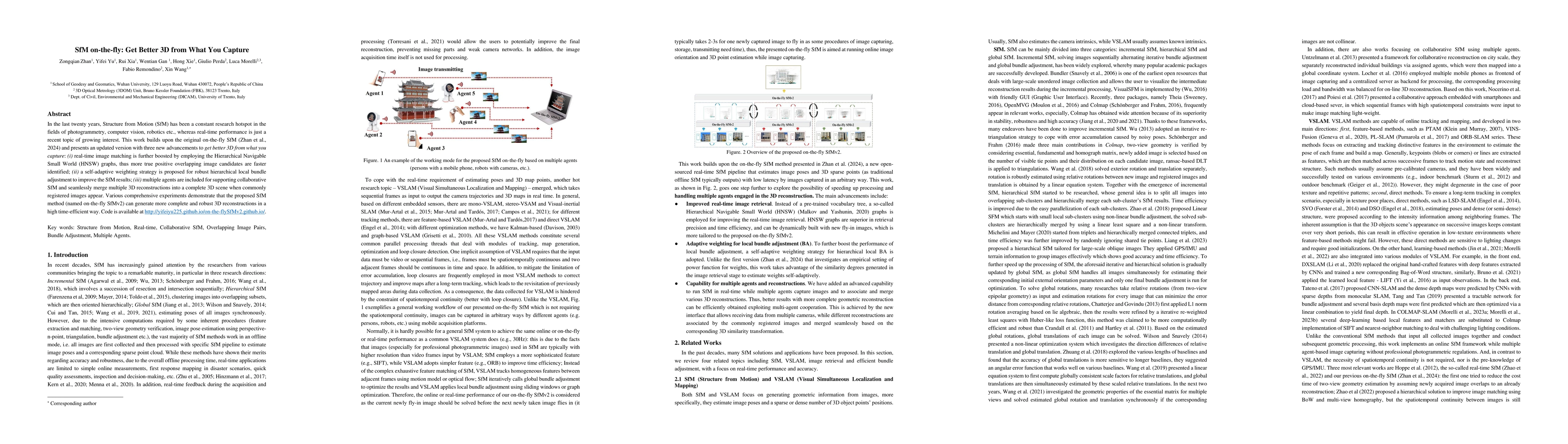
In the last twenty years, Structure from Motion (SfM) has been a constant research hotspot in the fields of photogrammetry, computer vision, robotics etc., whereas real-time performance is just a rece...

Thumbnail for Exploring the potential of collaborative UAV 3D mapping in Kenyan
  savanna for wildlife research
arXiv
Exploring the potential of collaborative UAV 3D mapping in Kenyan savanna for wildlife research

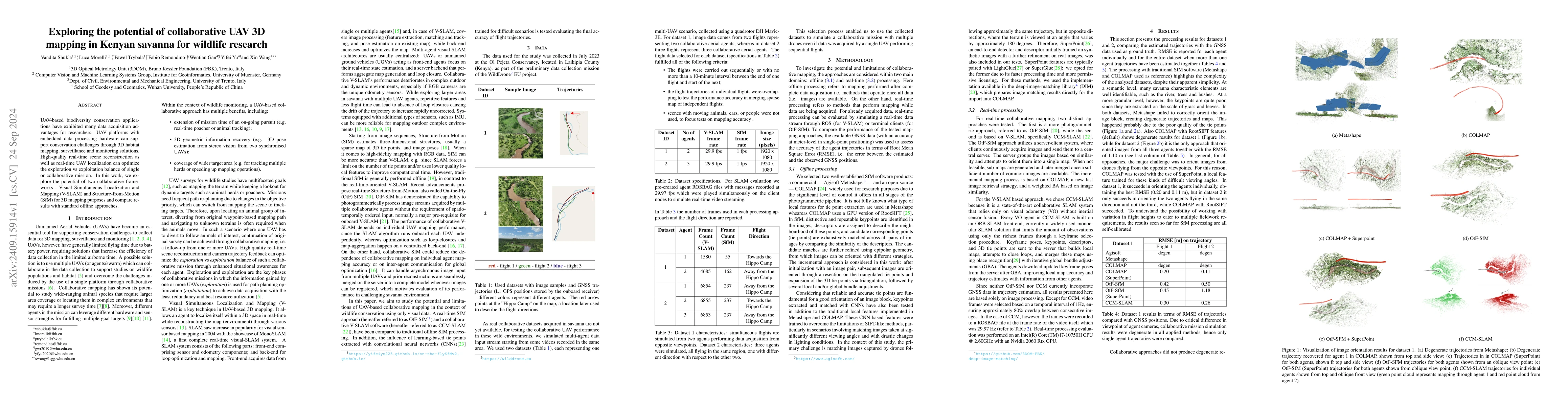
UAV-based biodiversity conservation applications have exhibited many data acquisition advantages for researchers. UAV platforms with embedded data processing hardware can support conservation challeng...

Thumbnail for Gaussian On-the-Fly Splatting: A Progressive Framework for Robust Near
  Real-Time 3DGS Optimization
arXiv
Gaussian On-the-Fly Splatting: A Progressive Framework for Robust Near Real-Time 3DGS Optimization

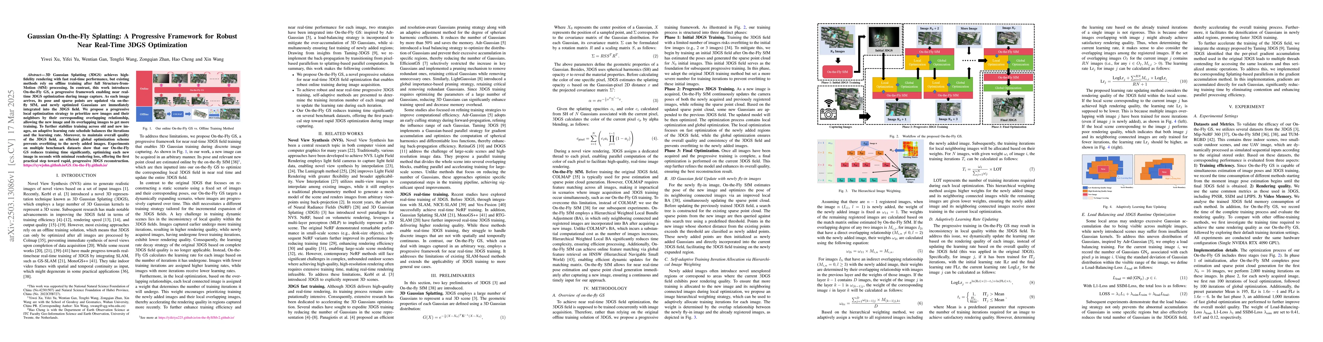
3D Gaussian Splatting (3DGS) achieves high-fidelity rendering with fast real-time performance, but existing methods rely on offline training after full Structure-from-Motion (SfM) processing. In contr...

Thumbnail for A-TDOM: Active TDOM via On-the-Fly 3DGS
arXiv
A-TDOM: Active TDOM via On-the-Fly 3DGS

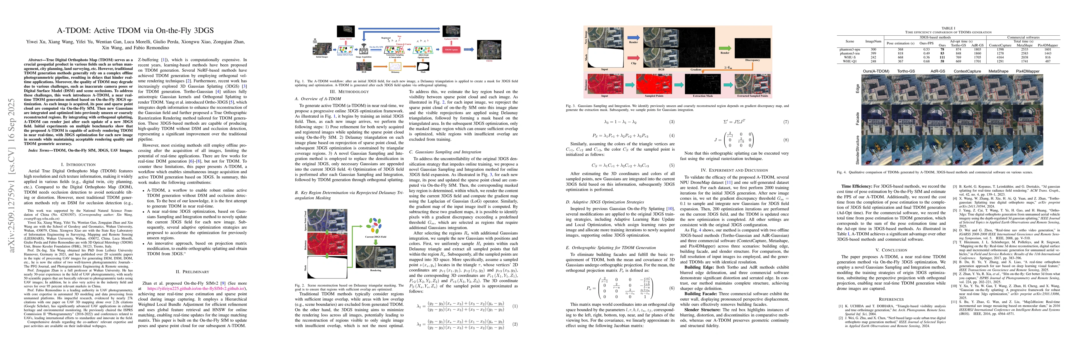
True Digital Orthophoto Map (TDOM) serves as a crucial geospatial product in various fields such as urban management, city planning, land surveying, etc. However, traditional TDOM generation methods g...

Thumbnail for SF-Recon: Simplification-Free Lightweight Building Reconstruction via 3D Gaussian Splatting
arXiv
SF-Recon: Simplification-Free Lightweight Building Reconstruction via 3D Gaussian Splatting

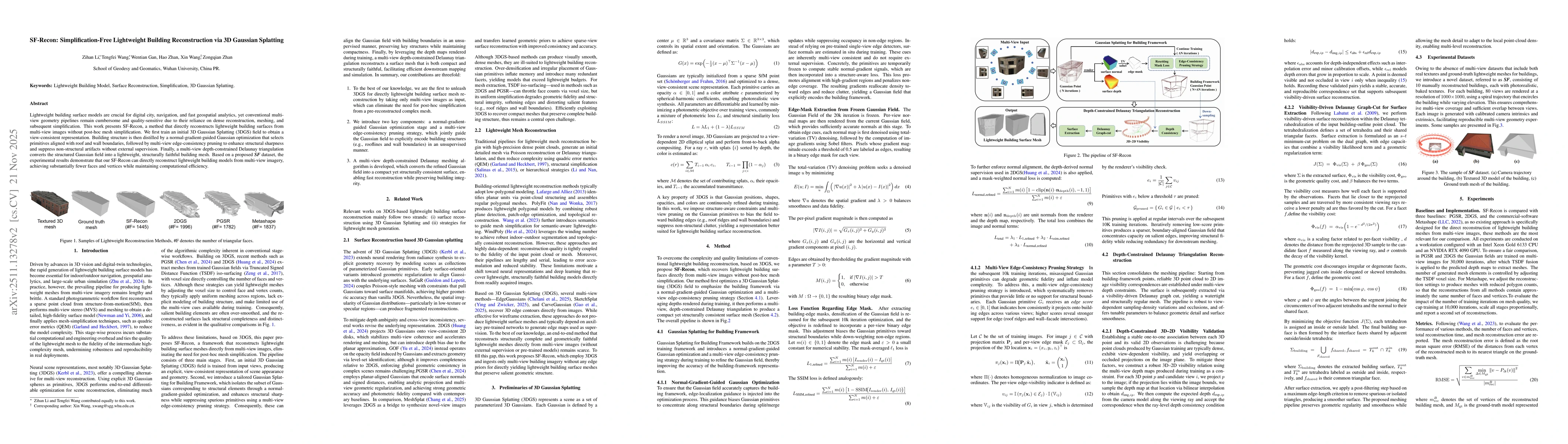
Lightweight building surface models are crucial for digital city, navigation, and fast geospatial analytics, yet conventional multi-view geometry pipelines remain cumbersome and quality-sensitive due ...

Thumbnail for On-the-fly Feedback SfM: Online Explore-and-Exploit UAV Photogrammetry with Incremental Mesh Quality-Aware Indicator and Predictive Path Planning
arXiv
On-the-fly Feedback SfM: Online Explore-and-Exploit UAV Photogrammetry with Incremental Mesh Quality-Aware Indicator and Predictive Path Planning

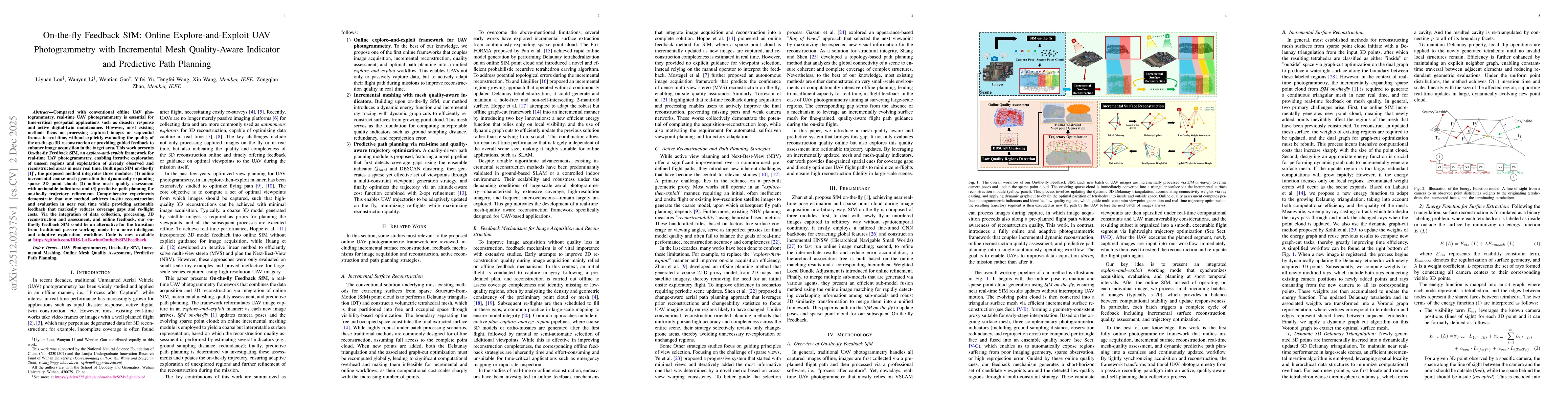
Compared with conventional offline UAV photogrammetry, real-time UAV photogrammetry is essential for time-critical geospatial applications such as disaster response and active digital-twin maintenance...

This website uses cookies to ensure you get the best experience. Learn more