Academic Profile
Statistics
Similar Authors
Papers on arXiv
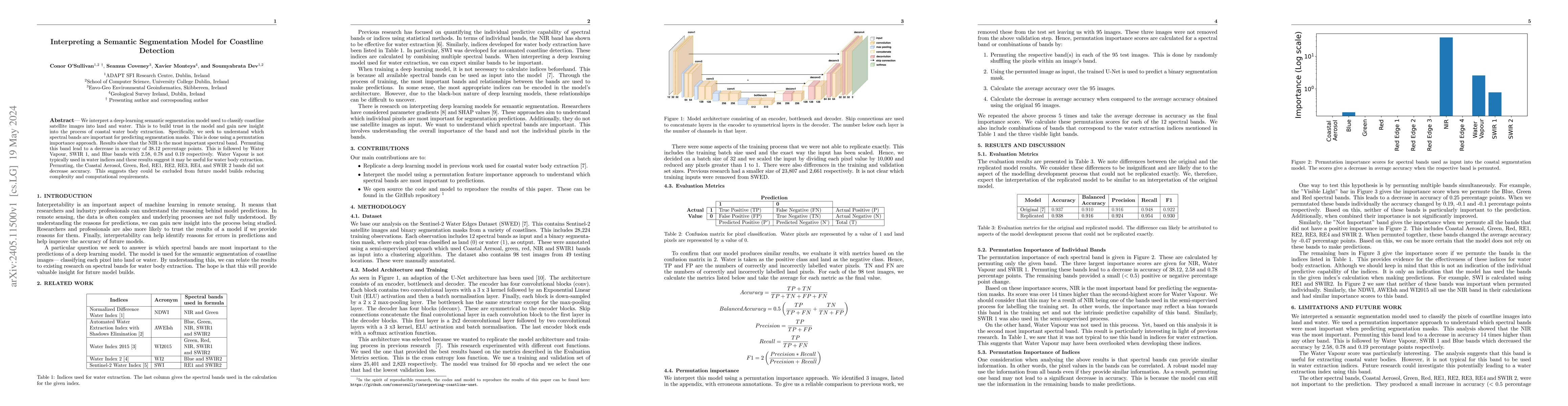
We interpret a deep-learning semantic segmentation model used to classify coastline satellite images into land and water. This is to build trust in the model and gain new insight into the process of...
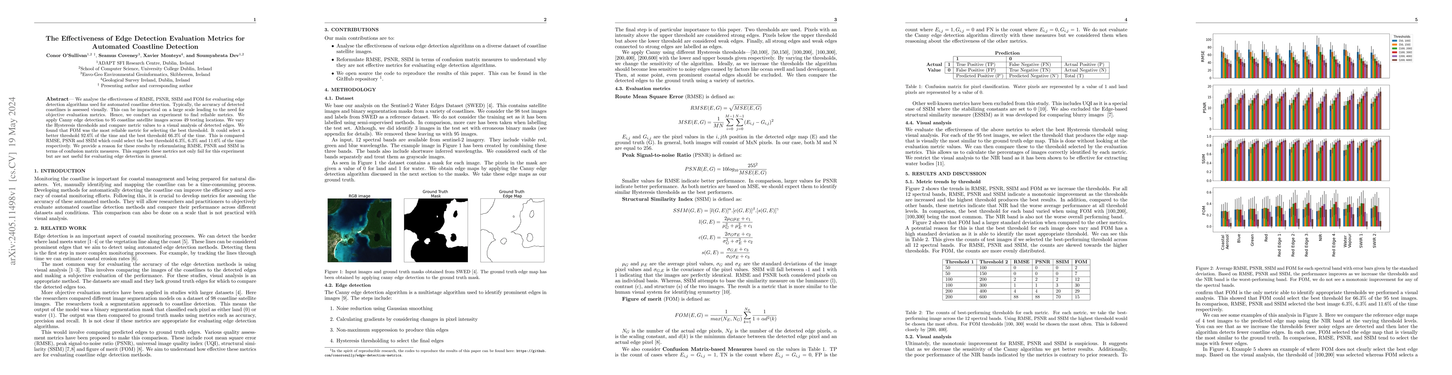
We analyse the effectiveness of RMSE, PSNR, SSIM and FOM for evaluating edge detection algorithms used for automated coastline detection. Typically, the accuracy of detected coastlines is assessed v...
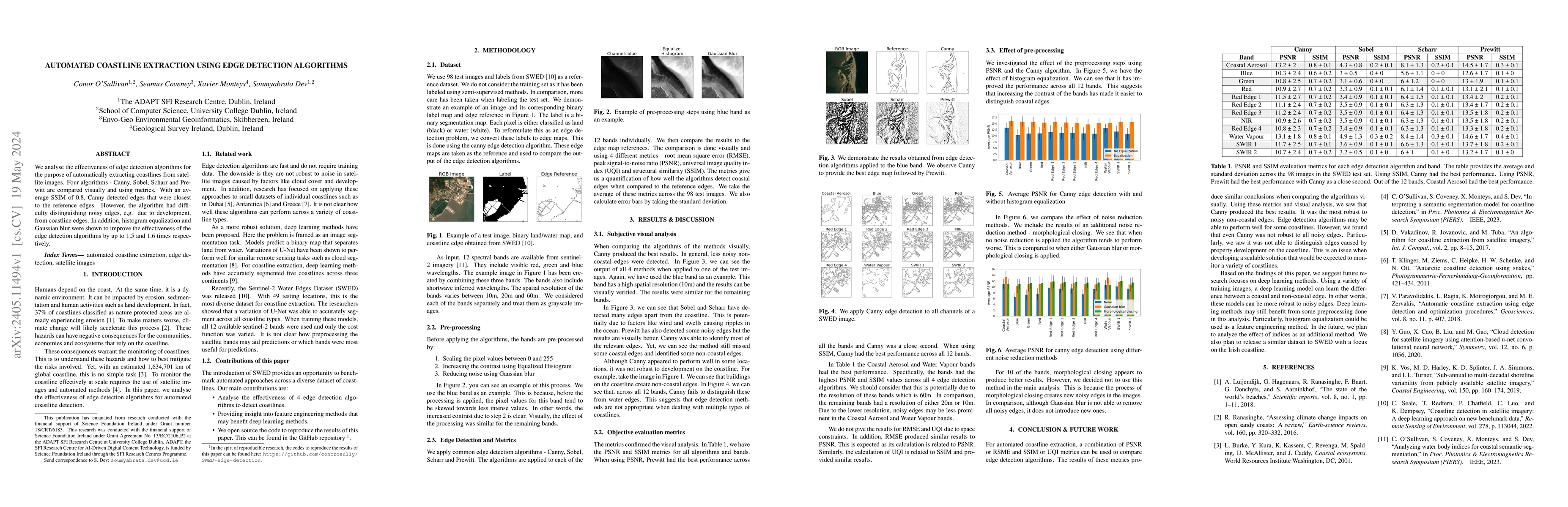
We analyse the effectiveness of edge detection algorithms for the purpose of automatically extracting coastlines from satellite images. Four algorithms - Canny, Sobel, Scharr and Prewitt are compare...
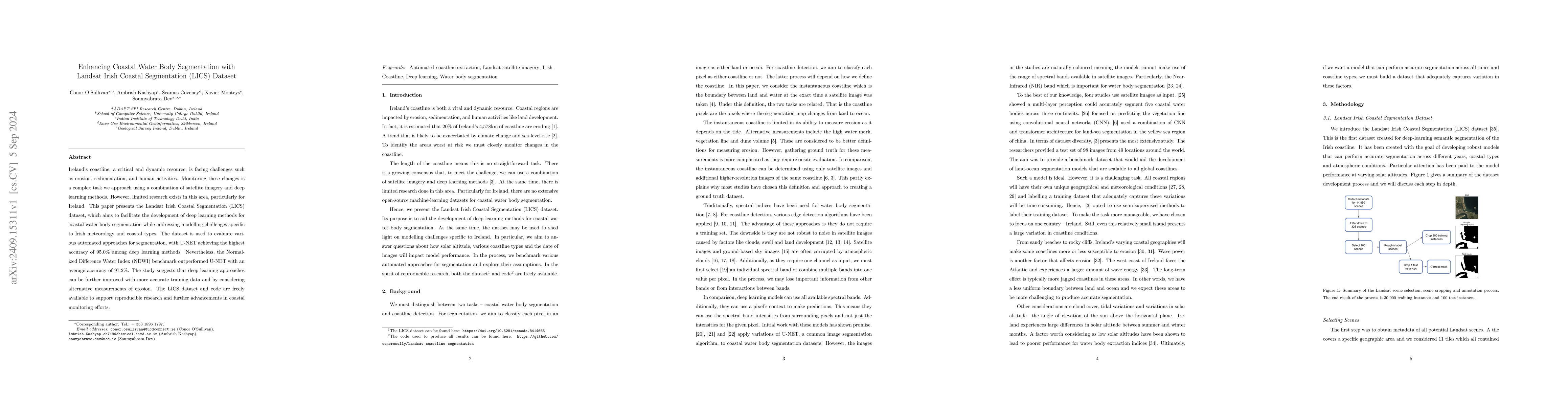
Ireland's coastline, a critical and dynamic resource, is facing challenges such as erosion, sedimentation, and human activities. Monitoring these changes is a complex task we approach using a combinat...