Academic Profile
Statistics
Similar Authors
Papers on arXiv
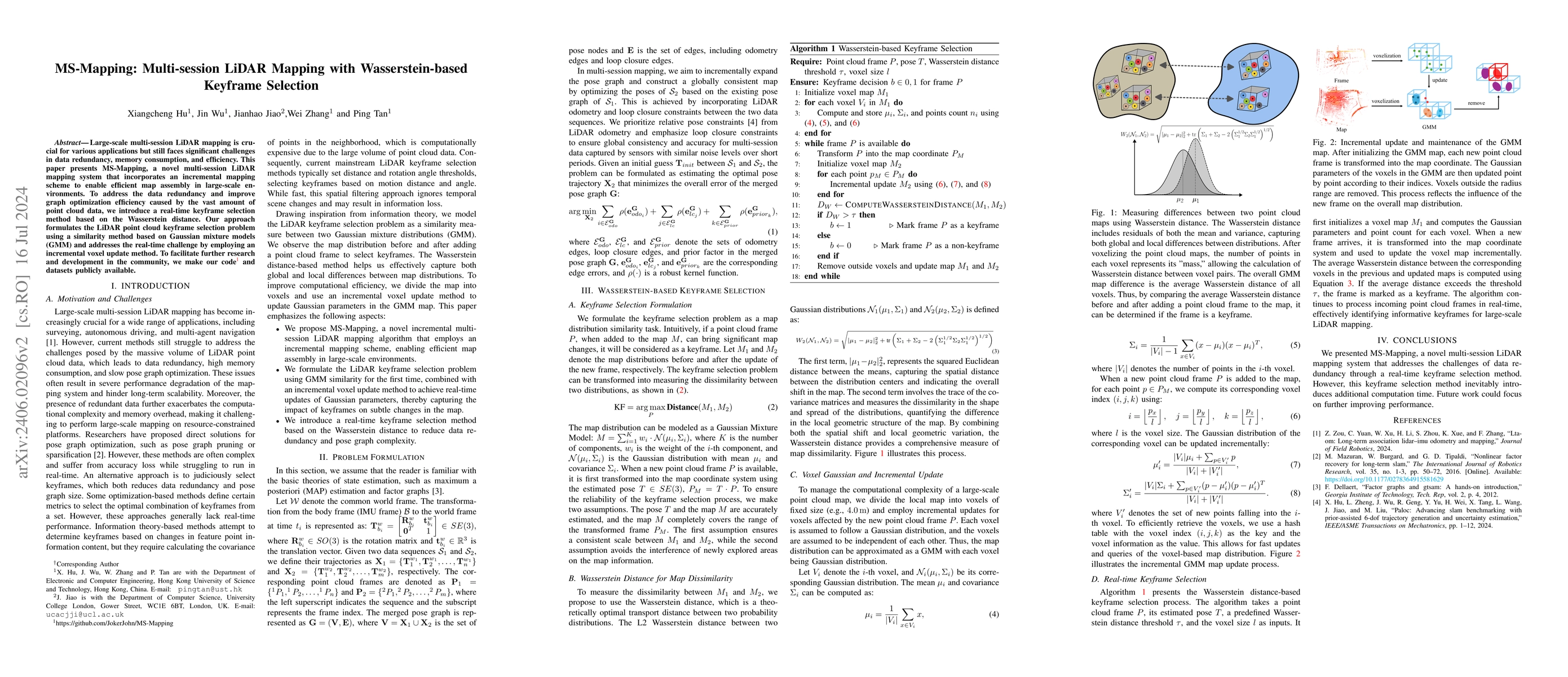
Large-scale multi-session LiDAR mapping plays a crucial role in various applications but faces significant challenges in data redundancy and pose graph scalability. This paper present MS-Mapping, a ...
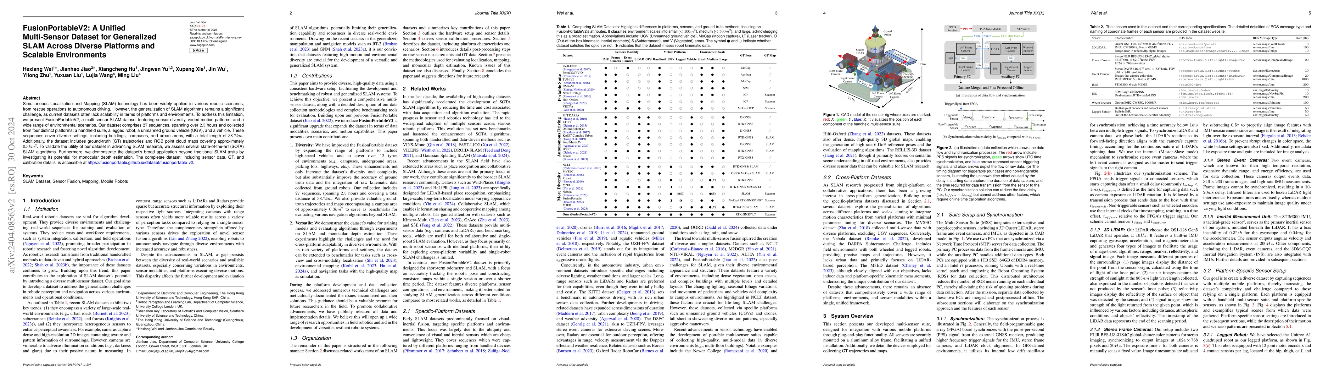
Simultaneous Localization and Mapping (SLAM) technology has been widely applied in various robotic scenarios, from rescue operations to autonomous driving. However, the generalization of SLAM algori...
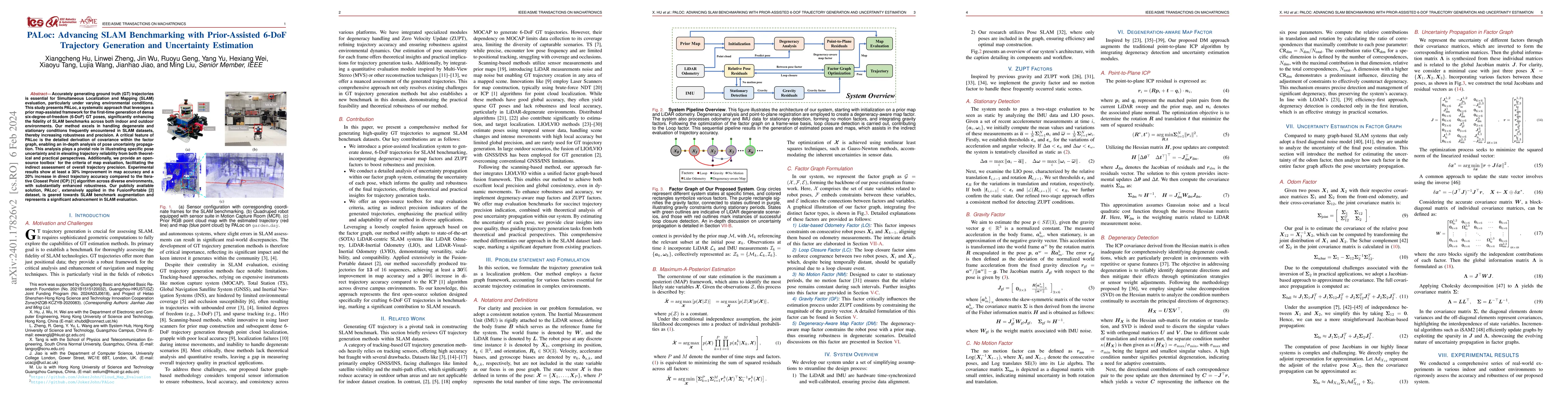
Accurately generating ground truth (GT) trajectories is essential for Simultaneous Localization and Mapping (SLAM) evaluation, particularly under varying environmental conditions. This study introdu...
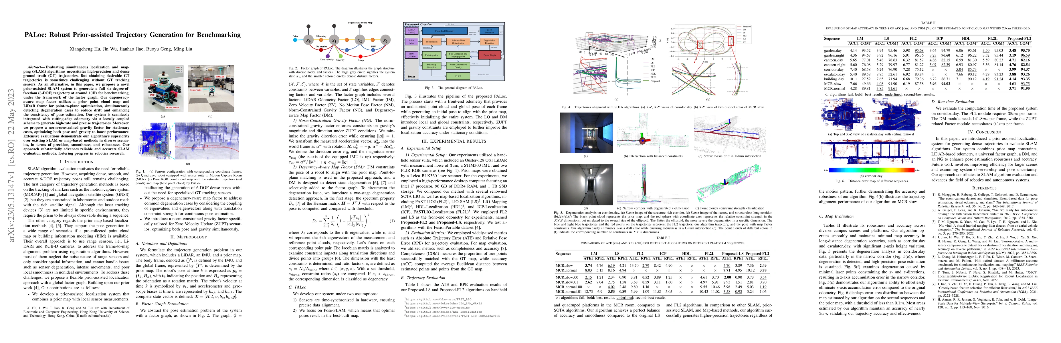
Evaluating simultaneous localization and mapping (SLAM) algorithms necessitates high-precision and dense ground truth (GT) trajectories. But obtaining desirable GT trajectories is sometimes challeng...
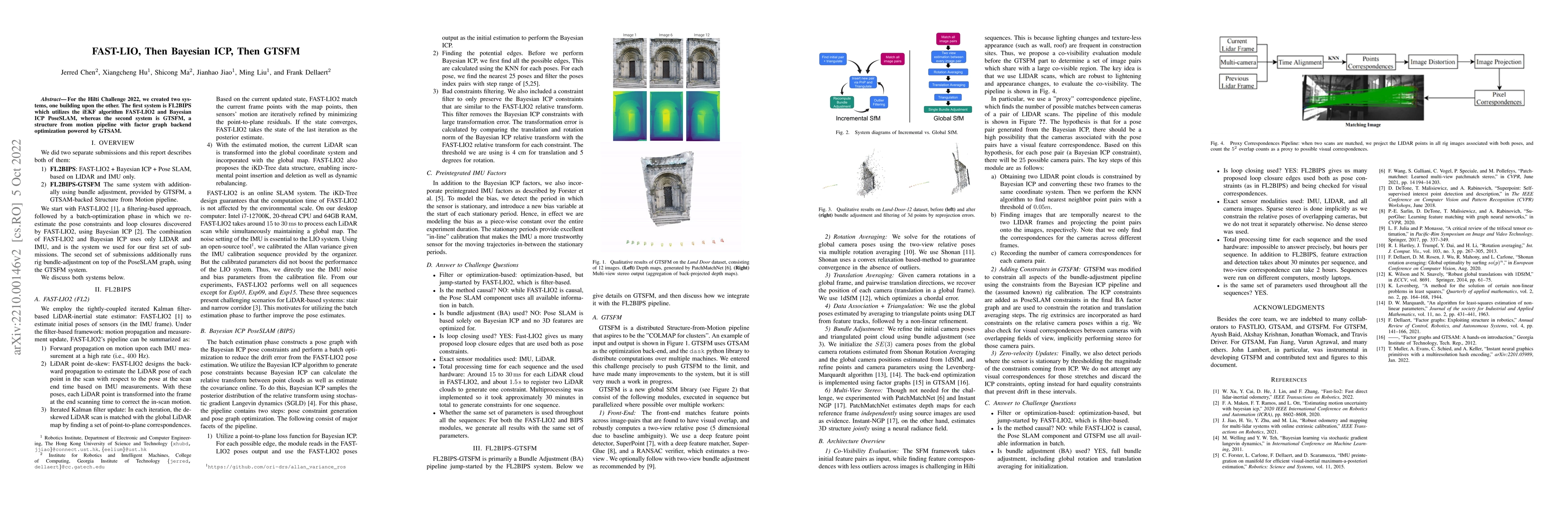
For the Hilti Challenge 2022, we created two systems, one building upon the other. The first system is FL2BIPS which utilizes the iEKF algorithm FAST-LIO2 and Bayesian ICP PoseSLAM, whereas the seco...
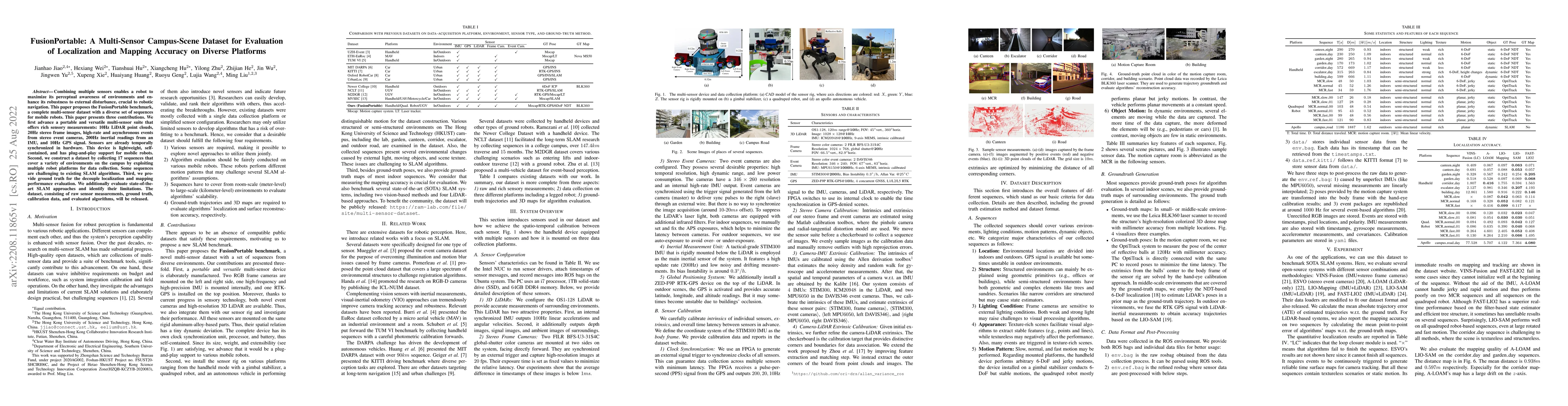
Combining multiple sensors enables a robot to maximize its perceptual awareness of environments and enhance its robustness to external disturbance, crucial to robotic navigation. This paper proposes...
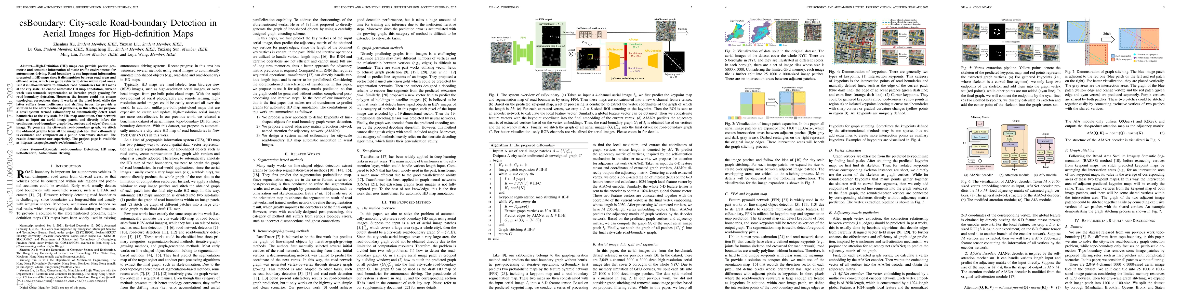
High-Definition (HD) maps can provide precise geometric and semantic information of static traffic environments for autonomous driving. Road-boundary is one of the most important information contain...
Multiview registration is used to estimate Rigid Body Transformations (RBTs) from multiple frames and reconstruct a scene with corresponding scans. Despite the success of pairwise registration and p...
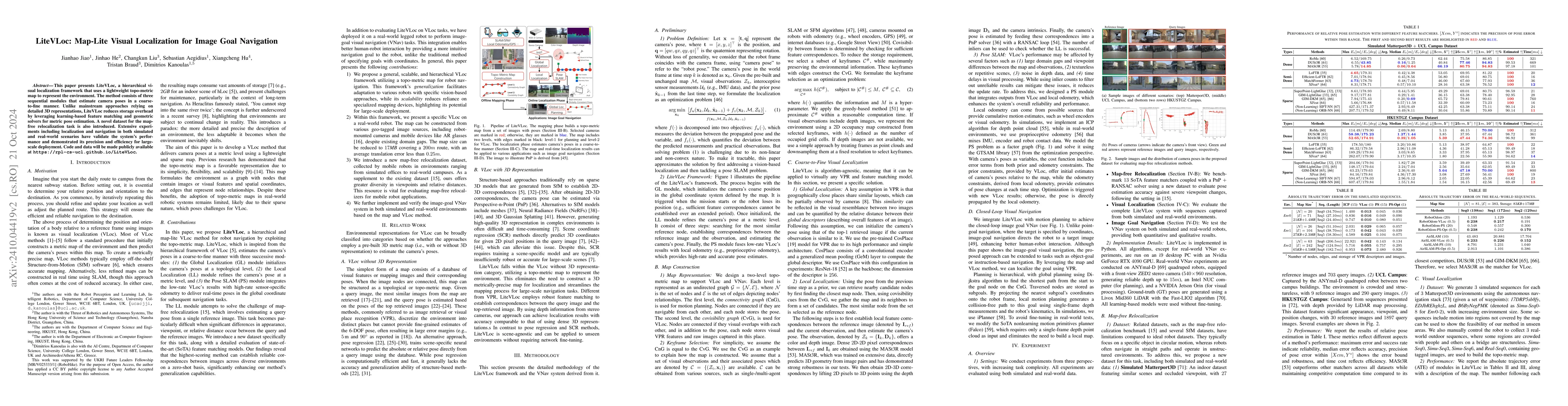
This paper presents LiteVLoc, a hierarchical visual localization framework that uses a lightweight topo-metric map to represent the environment. The method consists of three sequential modules that es...
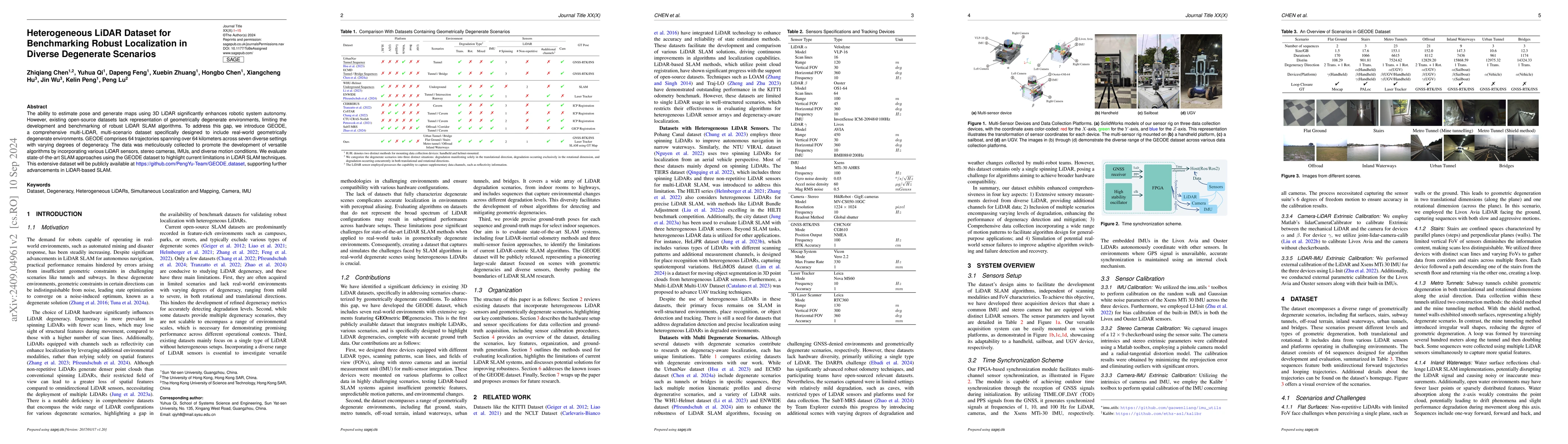
The ability to estimate pose and generate maps using 3D LiDAR significantly enhances robotic system autonomy. However, existing open-source datasets lack representation of geometrically degenerate env...
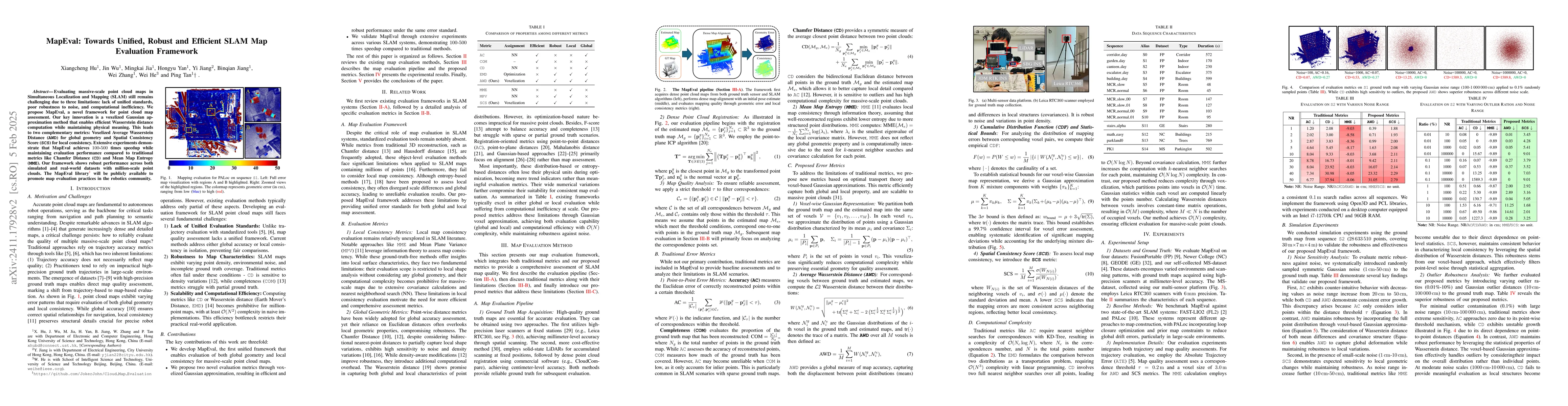
Evaluating massive-scale point cloud maps in Simultaneous Localization and Mapping (SLAM) remains challenging, primarily due to the absence of unified, robust and efficient evaluation frameworks. We p...
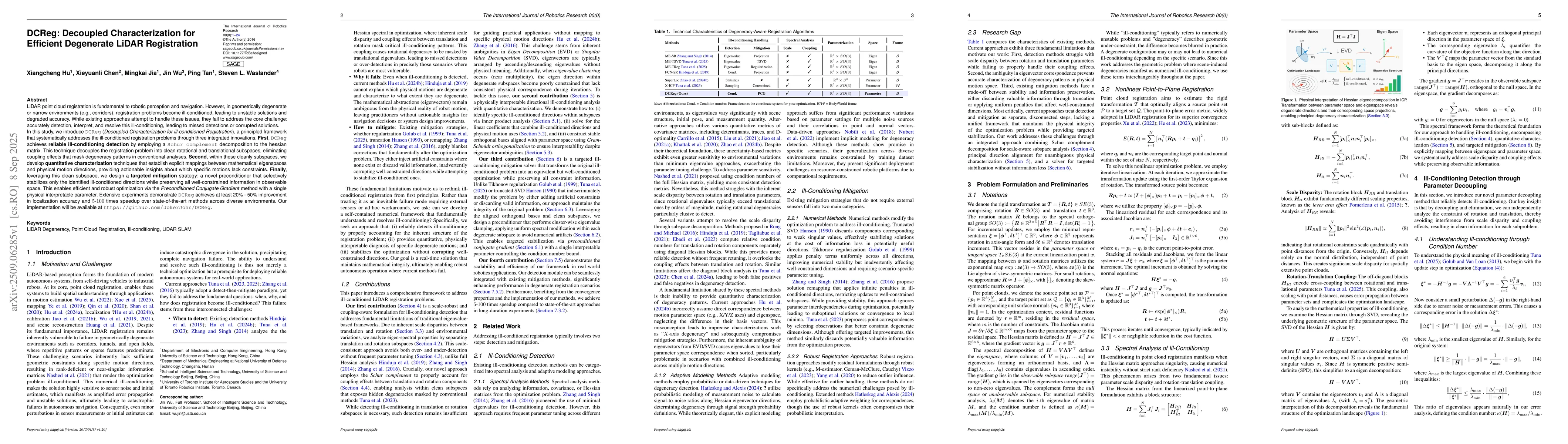
LiDAR point cloud registration is fundamental to robotic perception and navigation. However, in geometrically degenerate or narrow environments, registration problems become ill-conditioned, leading t...