ArxivLens
X
Researcher

Xianghong Zou

5 papers on arXiv

5 arXiv Papers
1 Total Publications
Profile

Academic Profile

Name Zou Xiang-hong
Total Papers 1
Scholar Profile View on Semantic Scholar
Metrics

Statistics

5 arXiv Papers
1 Total Publications
Publications

Papers on arXiv

Thumbnail for CoFiI2P: Coarse-to-Fine Correspondences for Image-to-Point Cloud
  Registration
arXiv
CoFiI2P: Coarse-to-Fine Correspondences for Image-to-Point Cloud Registration

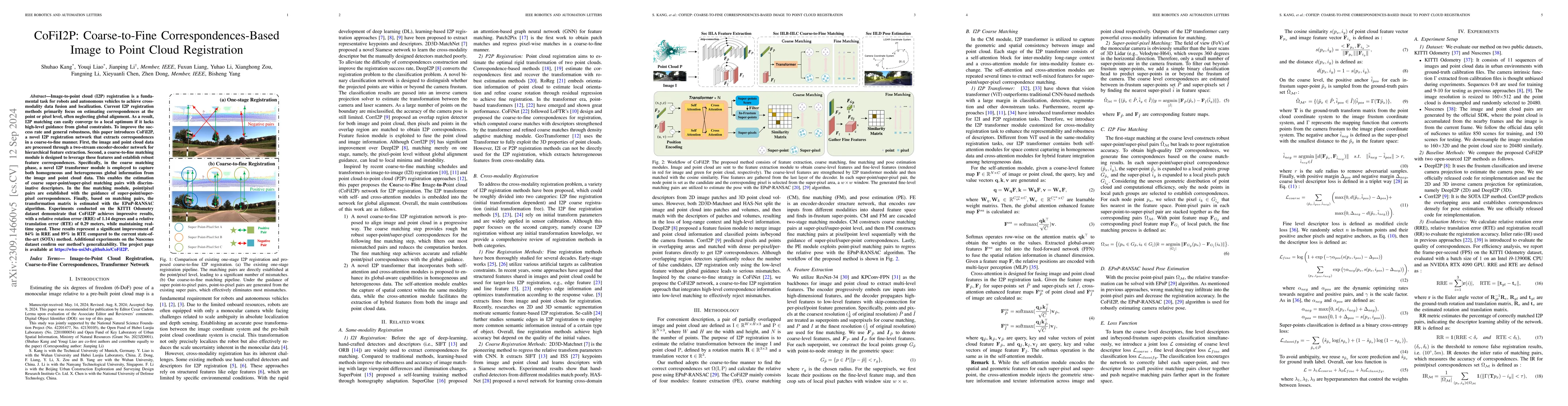
Image-to-point cloud (I2P) registration is a fundamental task for robots and autonomous vehicles to achieve cross-modality data fusion and localization. Existing I2P registration methods estimate co...

Thumbnail for Reliable-loc: Robust sequential LiDAR global localization in large-scale
  street scenes based on verifiable cues
arXiv
Reliable-loc: Robust sequential LiDAR global localization in large-scale street scenes based on verifiable cues

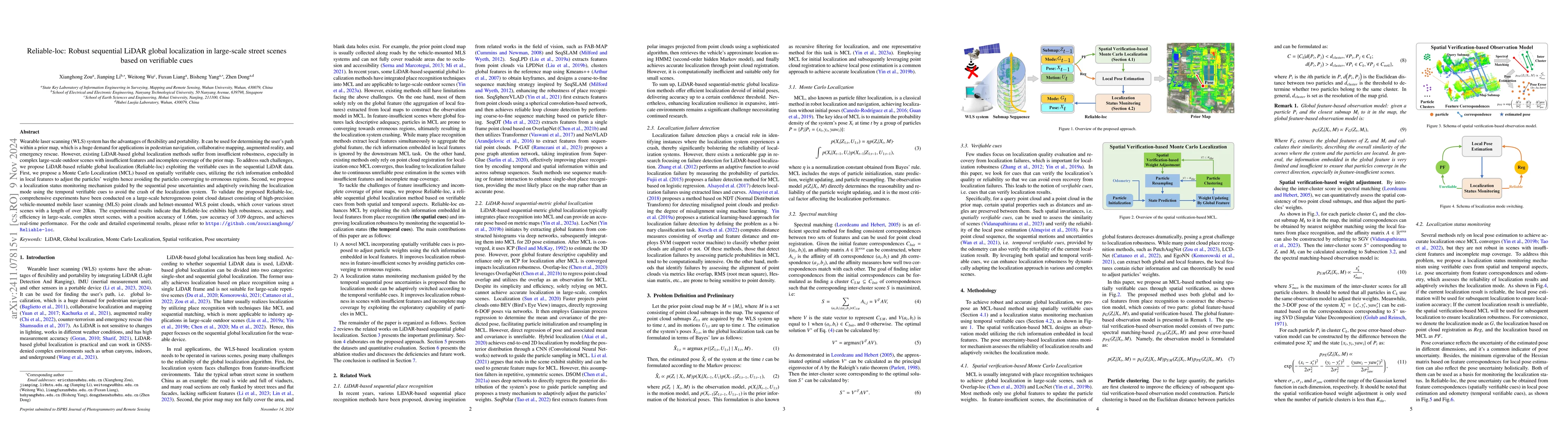
Wearable laser scanning (WLS) system has the advantages of flexibility and portability. It can be used for determining the user's path within a prior map, which is a huge demand for applications in pe...

Thumbnail for LifelongPR: Lifelong knowledge fusion for point cloud place recognition
  based on replay and prompt learning
arXiv
LifelongPR: Lifelong knowledge fusion for point cloud place recognition based on replay and prompt learning

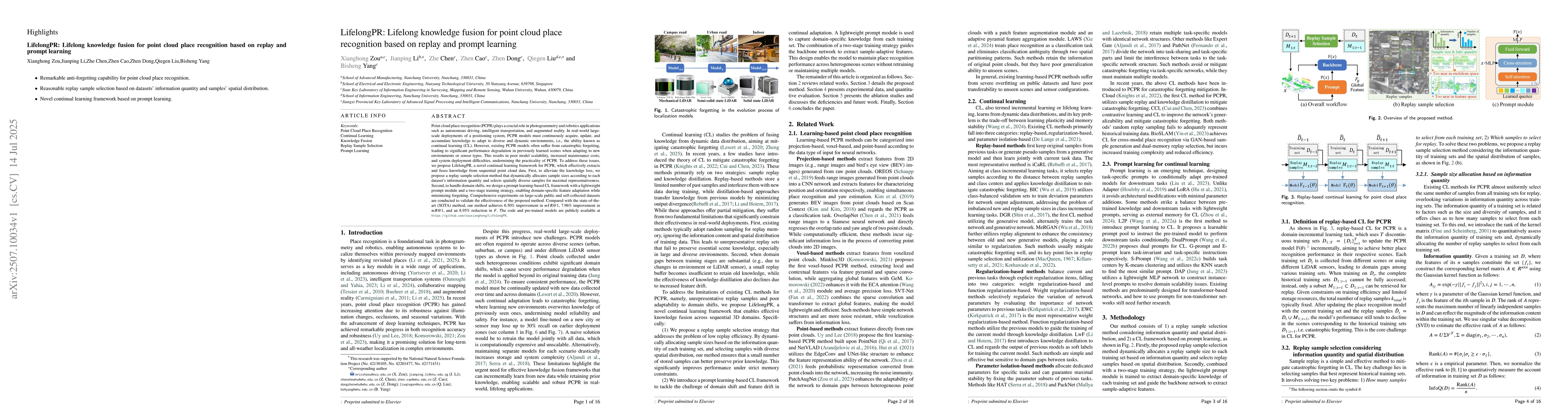
Point cloud place recognition (PCPR) plays a crucial role in photogrammetry and robotics applications such as autonomous driving, intelligent transportation, and augmented reality. In real-world large...

Thumbnail for WHU-PCPR: A cross-platform heterogeneous point cloud dataset for place recognition in complex urban scenes
arXiv
WHU-PCPR: A cross-platform heterogeneous point cloud dataset for place recognition in complex urban scenes

Point Cloud-based Place Recognition (PCPR) demonstrates considerable potential in applications such as autonomous driving, robot localization and navigation, and map update. In practical applications,...

Thumbnail for Aerial-ground LiDAR place recognition with patch-level self-supervised learning and expanded reciprocal re-ranking
arXiv
Aerial-ground LiDAR place recognition with patch-level self-supervised learning and expanded reciprocal re-ranking

LiDAR place recognition determines one's position on a prior point cloud map. The most studied ground-level LiDAR place recognition suffers from pre-visit requirements, incomplete coverage, and limite...

This website uses cookies to ensure you get the best experience. Learn more